| Public Land Hunting Areas in California | |
|
Author Dalton Tupen American River College Geography 350: Data Acquisition in GIS; Fall 2018 | |
|
Abstract Land ownership in relation to public land hunting in California has always interested me growing up and I used this project to go in and customize a map depicting the zones. | |
|
Introduction The primary issue that I aimed at resolving with this project is to create a map that showcased the public land hunting areas in California. Some data will need to be created by myself while other just needs to be found and altered a bit. | |
|
Background Growing up I have always been surrounded by the outdoors and throughout many years of hunting and fishing I have always been curious on how the zones and public versus private land areas worked and were layed out. Now I am finally able to get my own hands on the reasources and tools need to analyze this data. | |
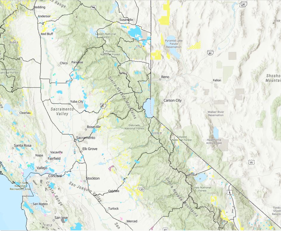
My first attempt at creating this map was very difficult and slow going due to the fact that the data containing the various land ownerships was so massive. My first job was to narrow down my search area as to cut down on the size of data being displayed. The map being shown to the right is a screenshot of my map before I was able to filter everything out. There is not much being shown because the program had difficulty displaying that much data and that more would begin to draw in as I zoomed in. |
|
|
Methods | |
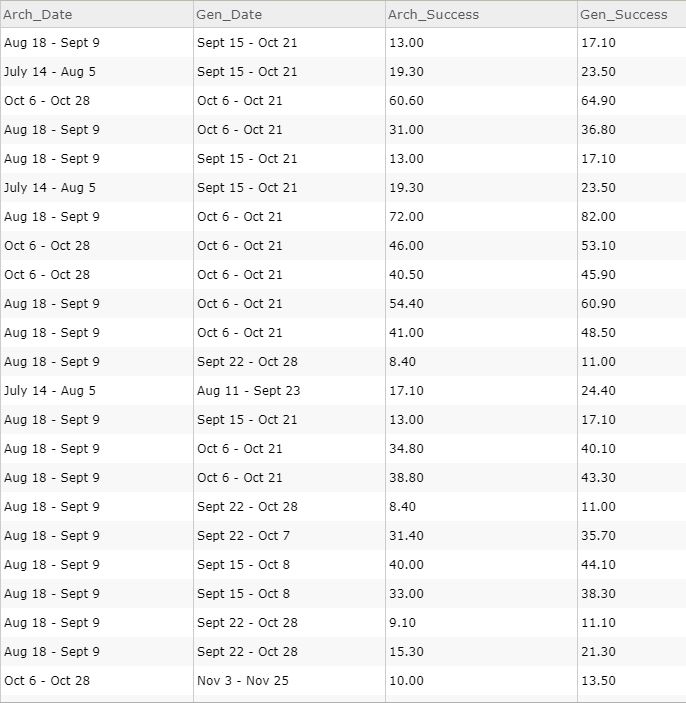
| The primary source of difficulty in this project was in the creation on the basic deer hunting zone layer. It was fairly easy to obtain from the California Department of Wildlife, but they did not have enough information for my purpose. I had to create a spreadsheet in Excel and populate it with the 2018 hunting season dates and the successfull harvest rates for 2017. Once the spreadsheet was complete I went into Arc Pro and joined the two tables together. After the hurdle of data creation was over it was mostly smooth sailing when contructing my application. My next issue was looking for the data on the land ownership in California. There are many mpas that had some of what I needed but none was in a downloadable format that could be imported and filter to my needs. After some digging I came across a very large file that crashed several times before I was able to limit what was being shown. My two land ownerships for public land was BLM and Forrest Service. |
|
|
|
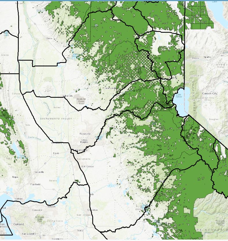
The photo to the left is showing the area that I selected as the focused area of my study. This is an area that I know fairly well which aided in determining which land ownershihp types are going to be open to the public. |
|
Figures and Maps | |
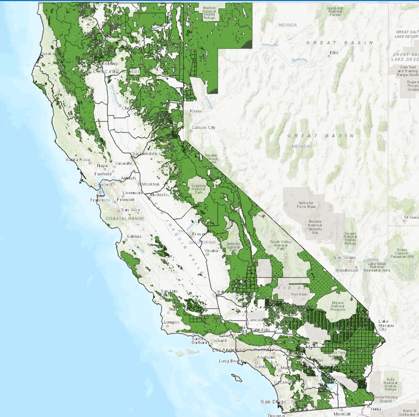 |
My final map takes a look back at the whole state and shows where the majority of BLM and Forrest Service is located. There is very little found in the central valley and along the coast, meanwhile the eastern edge of the state is almost entirely composed of BLM and Forrest Service land. |
|
Analysis There are no real numeric results as my goal for this project was to be more visually informative which I believe I accomplished. My main areas of difficulties were in editing the data and manually entering the extra data that I needed for the zones themselves. | |
|
Conclusions There is more data that I would like to add to this map, mainly in regards to the private land that is not open to hunting. | |
|
References California Deer Zone Boundries | |