Title
Author Information
Deanne De La Rosa
American River College, Geography 26: Data Acquisition in GIS; Spring 2002
Contact Information (5700 Mt. Pleasant Rd. Lincoln, CA 95648, (916)716-1454, ibespeedee@hotmail.com)
Abstract
Due to growing environmental concerns, especially in California, government agencies are requiring more responsibility from land owners and developers. Oak mitigation is becoming an intrinsic part of city and county environmental regulations. Developers are responsible for oak tree replacement and maintenance for a total of five years.
Introduction
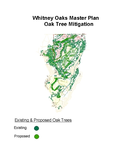
As land developments get larger and the logistics of maintaining thousands of trees becomes overwhelming, a solution must be found to gather and store data in a practical and efficient manner. In the case of Whitney Oaks, the oak tree mitigation requirements involve the planting and maintenance of over 3,500 oak trees. The developers asked their landscape architecture firm to develop a system that would allow them to monitor the trees as required. A combination of current software and technology such as GIS, AutoCAD, and Access were used to create maps and a database that will allow the developer to successfully meet the oak tree mitigation requirements.
Background
The Oak Mitigation Requirements were provided by the Planning Department, City of Rocklin, 3250 Rocklin Road, Rocklin, CA 95765. Contact Sherri Abbas at (916) 632-4020 for more information.
Autocad drawings were provided by Land Architecture, 720 Sunrise Road, Suite 206B, Roseville, CA 95661. Contact Deanne De La Rosa at (916) 786-2858 for more information.
Methods
After reviewing the requirements from the City of Rocklin, a survey form was created in Excel that would allow input of all of the desired attributes. It was decided that trees would be identified by a combination of the development unit that they resided in,the tree species, and the tree species number. This became the unique ID. The date of planting and the survey date needed to be recorded. The trees needed to be monitored for health condition, description of condition, and trunk size. Once the survey sheet was comleted, the next logical step was to evaluate the planting drawings which were drawn using AutoCAD Release 14. The unique id of each tree was marked on the corresponding tree graphic found on each plot sheet for use in the field. The next step involved evaluating the proper clothing and equipment for the site visit. The equipment to be used included a digital camera for pictures of the site, a measuring tape and a caliper to measure trunk diameter at breast height(DBH),the planting plot sheets to find approximate tree locations, and a Garmin 12XL handheld GPS unit to take the x,y locations of each indivual tree. After a site visit, which revealed that the site included steep topography and knee-high grasses, it was determined that sturdy boots and long pants would be required for the surveyor's safety.
Results
The field survey sheet included information on the Tree ID, WO Unit, Tree species, Planting date, Date of Inspection, Condition rating, Condition description, and Trunk diameter. Information was gathered on each individual tree. The survey information was then entered into an Access Database for future use. As each unit is planted, information will be periodically gathered and entered into the database creating an effective analysis tool for the maintenance crew.
Analysis
The project ran quite well considering it was a first attempt. Site conditions, such as steep topography and potential wildlife created a few small problems. There were a few issues that occurred when bringing the GPS points into ArcView 3.2. Otherwise, the project went very smoothly and was very successful. The information was gathered, cataloged, and recorded as intended.
Conclusion
As the data in this paper involves the very first development unit that has been planted with mitigation trees and cataloged, this project is still in its infancy. The groundwork has been done with the creation of a survey form, data collection techniques, cataloging methods, and the creation of an Access database. Careful preparation and planning occurred before the implementation of the first phase of the project. This will ensure that the remainder of the project will run smoothly and with only a few glitches that can be worked out along the way. The simplicity of the design will enable anyone to utilize the database information. Thus, allowing easy access for the developer, the contractor, or the maintenance company. Current technology has allowed for the creation of a simple oak mitigation planting and maintenance database that can be used by layman or technician alike.