Whitewater Guide to the Tuolumne River
Meral's Pool to Wards Ferry Bridge, California
Christopher Donohue
cdonohue@ix.netcom.com
American River College, Sacramento, CA
Geography 26: Data Acquisition in GIS, Spring 2002
Jump directly to Whitewater River Guide
Abstract
Spatial and attribute information was collected to create a whitewater guidebook to the Meral’s Pool to Wards Ferry Bridge section of
the Tuolumne River in California. Attribute data on rapids, campsites, geology, historical sites, roads, and other information
of interest to boaters was acquired from several sources: whitewater guidebooks, National Forest Service (NFS) materials, United
State Geologic Service (USGS) maps, history books, internet sites, and the author’s notes and photos. Spatial data was acquired
primarily through the use of a Garmin 12XL Global Positioning System (GPS) receiver to record river and road features. This was
particularly useful for defining spatial coordinates of features whose location were only approximately known, such as campsites,
rapids, and historical sites. The GPS waypoints were then imported into ArcView 3.2 Geographic Information System (GIS) and
overlaid onto United States Geological Survey (USGS) topographic maps in electronic form to produce a river map and shutle map.
Additional shapefiles from Environmental Systems Research Institute (ESRI) were added to create a location map. Accuracy checks of the GPS waypoints indicate that the
spatial accuracy is within the project objective of 250 feet for all but one of 33 points, allowing for the successful creation of the whitewater guide and its accompanying maps.
Introduction
The ‘T’, as the Tuolumne River is affectionately known, runs westwards from Yosemite’s high
alpine meadows near Tioga Pass down through the foothills and into the San Joaquin Valley,
where it flows into the San Joaquin River. In the middle elevations near the small town of
Groveland lies a popular class IV wilderness run, the Merals Pool to Wards Ferry Bridge section.
Due to summer releases from Hetch Hetchy dam and other smaller impoundments, the river is
usually boatable from March through August – well past when other Sierra rivers have dried up
in the blistering heat. Add to this incredible geology, scenery, campsites, and a variety of
rapids, and you have one of the West’s classic whitewater runs. Each year thousands float the
river on both commercial and private trips, their numbers limited only by the wilderness
permit system which helps retain the wilderness flavor.
This project will attempt to compile a Whitewater Guide to the Merals Pool to Wards Ferry
Bridge section of the Tuolumne, with the intent of providing a first time Tuolumne boater
with helpful information on major rapids, campsites, geology, historical sites, river access,
and a taste of the adventure to be had. The primary data collection effort will focus on
acquiring GPS waypoints of the major features, so their locations can be added visually to
topographic maps of the area. The resulting maps will be useful in helping orient boaters –
particularly since many of the river features are not currently mapped and their locations are
only approximately known.
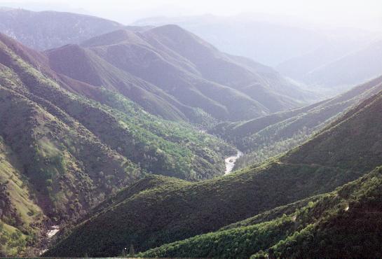
Methods
To compile this whitewater guide, several sources of boating information needed to be
located and integrated. Information requirements fell into two broad categories –
administrative data and spatial data. Administrative data included: permit requirements,
river flows, shuttle directions, camping spots, rapid difficulty, historical information,
and area geology. Spatial data requirements were primarily topographic and geologic maps
of the area, and point information depicting the spatial location of the administrative
information.
Administrative information was acquired by traditional data sources: whitewater guidebooks,
National Forest Service (NFS) materials, United State Geologic Service (USGS) maps,
history books, and internet sites. This information was supplemented by the authors
personal records and photos taken on two dozen river trips over the last 9 years.
Spatial information was primarily acquired by a GPS waypoints collection field effort.
The waypoints would be used to take the administrative information (attributes) and tie
them to the map. GPS acquisition included both features with well-defined locations
(found on existing maps) such as shuttle road intersections, and features with relatively
undefined spatial locations, such as the river rapids, campsites, and historical locations.
Additional spatial information acquired were a (paper) geologic map of the
area (Wagner et al, 1990), and digital copies of topographic maps from the both the
California Spatial Information Library (CaSIL, 2001) and the California Department of Fish
and Game (DFG, 2000).
Field GPS Collection:
GPS point collection formed the major data collection effort for the project. On April 12
and 13, 2002, GPS points were collected in and along the Tuolumne River using a Garmin 12XL
recreational-grade GPS unit. The Garmin 12XL Personal Navigator is a waterproof hand-held
unit with 12 channels and 15 meter (49 feet) horizontal positional accuracy. The unit was
set to collect data in Universal Transverse Mercator (UTM), North American Datum 1927
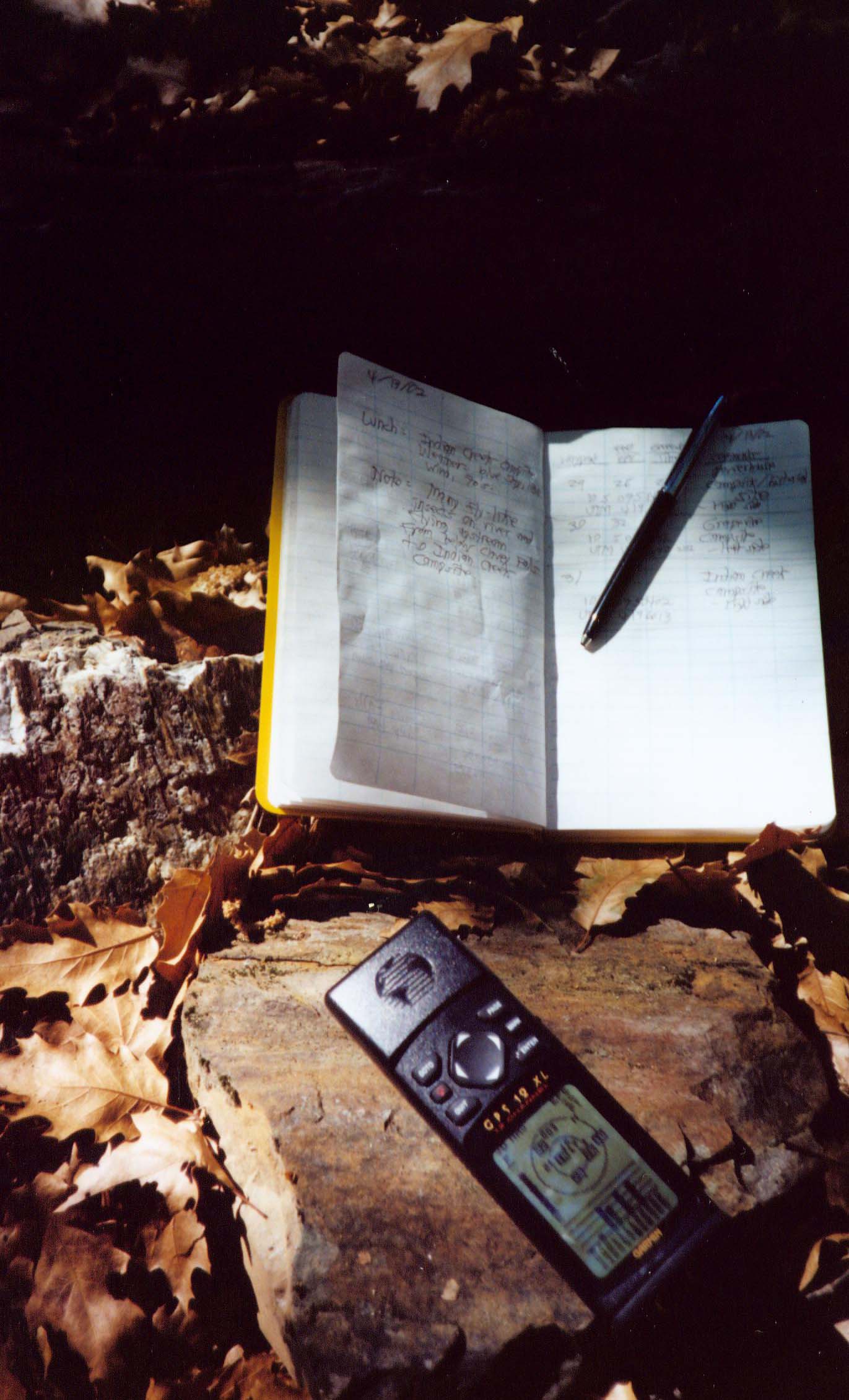
Continental United States (NAD27 CONUS). Waypoints were collected by ‘Averaging’ for 15-30
seconds before taking the final point. GPS waypoints were stored in the unit and transcribed
into a waterproof field book (“Rite in the Rain” brand), along with metadata such as the
waypoint number, location description, Estimated Precisional Error (EPE), Greenwich Time,
and additional comments.
Point collection on April 12 was primarily of the shuttle road intersections and important
non-river features, such as the Groveland Ranger Station and the La Casa Loma Cafe meeting
point. Collection was straight-forward and went well, with the only limitations being trees
limiting reception at a few sites, causing increased EPE values.
April 13 was devoted to point collection while kayaking the Tuolumne River, and locations
such as rapids, historical sites, and campsites were obtained. For rapids, points were
collected at the top of the rapid – typically while sitting in an eddy along the river bank.
Additional metadata in the form of “Side of River” – denoting whether the waypoint was
collected on “river right” (right side facing downstream) or “river left” (left side facing
downstream) was recorded besides the above listed information so as to aid in later analysis.
Overall, the data collection went well, but several minor difficulties arose. At the first
two rapids, I forgot to transcribe the EPE into the field notebook (unfortunately it’s not
stored by the GPS unit), causing two data gaps. In general, GPS point collection on the river
was made more difficult than expected by the elevated river flows due to spring runoff, which
caused most of the eddies to move somewhat. I chose to reduce the ‘averaging’ time to 10-15
seconds to minimize positional errors caused by the boat slowly drifting in the eddy. Also,
at one point – the rapid “Thread the Needle” (waypoint 035), reception was so poor that I
could not get a satellite fix. I ended up having to move downstream 20’ to another eddy
before the GPS unit was able to acquire enough signals for a fix (and then the EPE was a
whopping 84’!).
GPS to GIS:
Following GPS collection, the waypoints were downloaded from the Garmin GPS to an IBM
compatible PC for processing and eventual integration with digital topographic maps in a
Geographic Information System (GIS). Waypoint downloading was accomplished by connecting
the computer to the Garmin GPS unit with a cable and using the Waypoints+ program
(DFG maphost, 2002) to import the data directly from the GPS unit. Once in Waypoints+, the
projection and datum were set to UTM and NAD 27 respectively, the output set to decimal
degrees, and the file saved as a comma delimited text file. Next, the comma delimited file
was brought into ArcView 3.2 GIS (ESRI, 2002) via the AV Garmin extension (DFG maphost, 2002),
which creates a shapefile directly from a comma delimited text file. AV Garmin was set to
reproject the text file into NAD 27, Albers Equal Area Continental United States (CONUS) so
it would match the projection used for the digital topographic maps. The resulting GPS
waypoint shapefile was saved for use in creating the main river map and shuttle map.
Map Creation:
Digital topographic maps were brought into ArcView to provide the major informational
background for the various maps. 1:24,000 scale Digital topographic maps in Digital Raster
Graphic (DRG) form were obtained the California Spatial Information Library (CaSIL, 2001) and a
1:250000 scale from the California Department of Fish and Game (USGS, 2000).
The main river map was produced by overlaying the GPS waypoints onto 1:250000 scale topo
map (USGS, 2000) in ArcView 3.2. The resulting shapefiles were then brought into ArcView 8.1
for editing, with the resulting map saved as a jpeg format file.
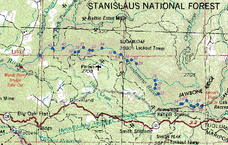
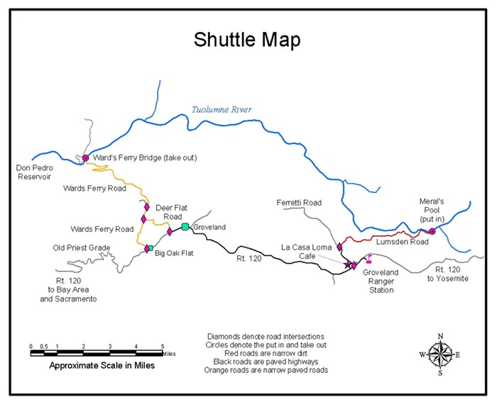
The shuttle map was created in ArcView 8.1 by pulling in the 1:250000 (USGS, 2000) scale topo
map and overlaying the GPS waypoints, then digitizing the roads and river off the resulting
map. The GPS points were converted to graphics and non-shuttle points removed. The final
shuttle map was saved as a jpeg file.
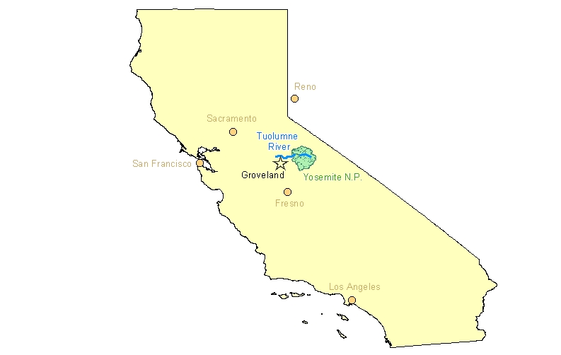
The California location map was constructed in ArcView 8.1 by pulling in several shapefiles
from the ESRI media disks : the State shapefile (ESRI, 2002a), the CA Rivers, CA Roads
shapefile, and the Road Network layer (ESRI, 2002b). Several queries were run to limit
the output to the major locational features. The final shuttle map was then saved as a
jpeg file.
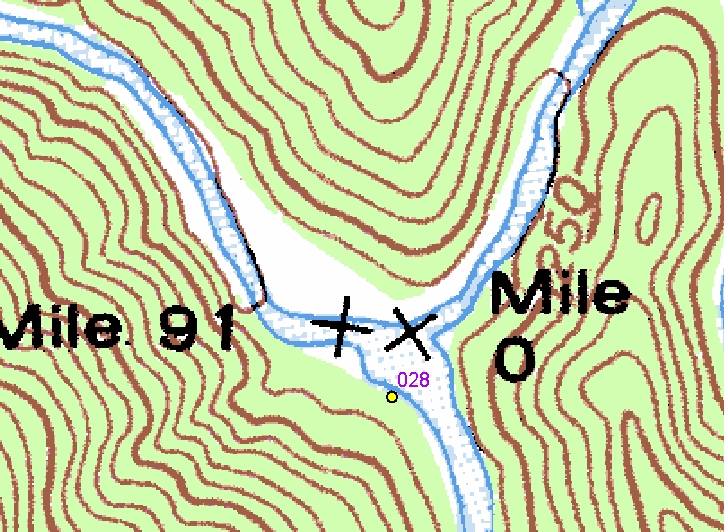
Several area-specific maps were created for accuracy checks of the GPS points (see GIS
accuracy and Suitability below). The GPS points were overlaid onto 1:24,000 scale topo
maps (CaSIL, 2001) in ArcView 8.1, and then the measure tool was used to determine the
distance the waypoints were from their true location.
Analysis
Overall, the project went well, though I did encounter some unexpected difficulties.
The process of converting the GPS waypoints to a GIS shapefile proved to be elusive and I
was only able to finish the process with major help from the instructor. I had hoped to be
able to do the process in ArcView 8.1, as I own a copy, but was unable to get the GPS
waypoints to overlay the topographic map – in ArcView 8.1 they kept coming out to the
Northeast of their true locations by several miles. “Tried and True” ArcView 3.2 proved to
be the tedious but workable solution.
As for GPS waypoint collection, I did come up with a few potential improvements for this
process. First, I would suggest using a raft instead of a kayak as a vehicle of choice,
primarily due to the greater stability and ease of taking waypoints from a raft. With a
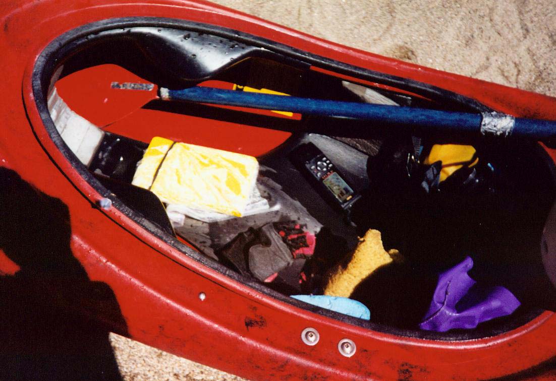
kayak, each stop to collect a waypoint meant undoing the sprayskirt, digging out the GPS
unit and notebook, taking a reading and recording metadata, and then stowing the unit and
notebook, and re-securing the sprayskirt. A raft would be much easier in this regard. Another
potential improvement would be to collect waypoints in the summer instead of spring, as the
increased daylight would allow more time for stops, and the summer flows are much lower than
the spring runoff I encountered, making for calmer eddies to measure from.
GPS Accuracy and Suitability:
Following import of the GPS data to ArcView, several checks were undertaken to determine if the
collected waypoints would be suitable for use in creating maps of the area and its features.
The overall accuracy goal was to acquire a point location within 250’ of the feature. The
advertised accuracy of the Garmin 12XL is 15 meters (49 feet), so this seemed reasonable
despite the potential for limited constellation visibility in the Tuolumne’s deep river canyon.
Estimated Precisional Error Check:
The first accuracy check performed was an evaluation of the Estimated Positional Error (EPE).
This is a relative measure of accuracy calculated by manufacturer (using a proprietary
process), and is continuously updated and displayed when the GPS unit is on. The EPE reading
was recorded for all points except Waypoints 18 and 19, where it was below 60’ but not
recorded in the field notebook. For the 33 points with EPE’s recorded, the results are
summarized below.
EPE SUMMARY|
|
Number of Waypoints taken |
EPE Range (feet) |
Average EPE (feet) |
|
Shuttle |
10 |
12 - 69 |
23.7 |
|
River |
23 (25)* |
14.9 - 84 |
38 |
* EPE recorded for 23 out of 25 river waypoints taken.
As you can see, the average EPE is well within the 250’ accuracy objective.
Known Point Check:
A rough accuracy check of the GPS points was made by comparing the
resulting (overlaid) GPS locations in the GPS shapefile to known points on a 1:24000 USGS
digital raster graphic (DRG) topographic map (CaSIL, 2001). Using the measurement tool, an
approximate distance of the offset was determined for each of the known points. Eight
Waypoints of road intersections had enough distinction on the topographic map to allow this
comparison. The average offset for these points was approximately 56’. These same points
had an average EPE of 18’, resulting in an average apparent real world error of 3.1 times
the reported EPE. If this error holds true, the average shuttle road point is off by 73.5’,
the average river point by 118’, and the most extreme EPE (waypoint 035, 84’) may actually
be 260’ feet off. However, the use of this comparison is limited at best, as the error
factor varied considerably by waypoint, from 1.68 to 9 times the EPE, and none of the known
point checks were among the river waypoints, which were taken under different conditions
(less view of the sky).
Point Reproducibility Check:
On successive days a waypoint was taken for the same location on
Wards Ferry Bridge (Waypoints 007 and 043). When projected onto the 1:24000 topographic map,
the two points turned out 25’ apart, which is probably a reflection of the limitations of the
recreational GPS and the restricted satellite configuration visible while down in the river
canyon.
Visual Check:
A visual check was performed for the points that lacked a distinct topographic
map location to determine if the resulting GPS point made sense. This process was used to
check all the river points – which are primarily unknowns - and some of the road points –
primarily where the roads had been changed and the topographic map was obviously out of date.
The points were checked against whether they lined up with the proper feature (river or
road) and whether they topologically matched features they were known to be spatially related
to. For example, the recorded metadata for Waypoint 028 (Clavey Falls) and its GPS placement
on the topo map - upstream of Clavey Falls on river left -was compared to its location in
regards to other features on the topo map – i.e, the GPS placement should fall directly across
from where the Clavey River joins the Tuolumne. The points were checked to see if they made
sense visually - in this case the GPS derived point at Clavey Falls was right where expected.
Accuracy Summary:
Based on the recorded EPE, all the GPS points met the 250’ accuracy criteria. However, one
point (Waypoint 035, “Thread the Needle”) would be outside the criteria if the known accuracy
check error factor of 3.1 times the EPE (84’) was applied to it. This was not surprising,
given that this location was the only spot on the river where satellite coverage was
insufficient to get an immediate fix. Whether the difficulty in acquiring a fix was
due to a permanent ‘dead’ area or a periodic signal loss is hard to say.
Conclusion
GPS point collection allowed for successful location of features for use in the
Tuolumne River Whitewater Guide. This included features both known spatially, such as roads,
and features not currently on maps, such as rapid locations. With the GPS information, river
information could be tied to a map, providing the reader with a better feel for the Tuolumne
River environs and its potential whitewater experience.
References
Digital Data Sources:
California Digital Raster Graphics page, California Spatial Information Library (CaSIL), 2001.
Accessed Digital Raster Graphics files (topo maps) for the Tuolumne River, March 2002.
Files: o37120h1-tr-alb.tar.gz (Duckwall Mtn, CA), o37120h2-tr-alb.tar.gz (Tuolumne, CA),
o37120h3-tr-alb.tar.gz (Standard, CA), o37120h4-tr-alb.tar.gz (Sonora, CA),
o37120g1-tr-alb.tar.gz (Jawbone Ridge, CA), o37120g2-tr-alb.tar.gz (Groveland, CA),
and o37120g3-tr-alb.tar.gz (Mocasin, CA). Untrimmed files of the same names were also
imported for use in checking map names and legend information.
http://drg.caldata.ucdavis.edu/
USGS scanned topographic map, 2000. 1:250,000 scanned topographic map (drg250r4.tif and
associated files) found on the San Joaquin Region Dataset CD compiled by the California
Department of Fish and Game (DFG), Information Technology Branch, Release date March 2000.
Geology:
Wagner, D.L., E.J. Bortugno and R. D. McJunkin, 1990. Geologic Map of the San Francisco –
San Jose Quadrangle. Map No. 5A(Geology). Sheet 1 of 5. California Department of
Conservation, Division of Mines and Geology.
GPS:
Garmin. Maker of the Garmin 12XL Personal Navigator.
www.garmin.com
Historical:
Heckensdorn and Wilson, 1856. Miners and Business Men’s Directory for the Year.
Columbia, CA.
Stoddart, Thomas Robertson, 1963. Annals of Tuolumne County. Edited by Carlo M. De Ferrari.
USA: Tuolumne County Historical Society.
Tuolumne County Historical Society, 1973. A History of Tuolumne County, California
. USA: Tuolumne County Historical Society.
Software:
California Department of Fish and Game, Information Technology Branch Maphost (DFG maphost),
2002. Providers of AVGarmin extension and Waypoints+ software for use in downloading
Garmin GPS waypoints to ArcView GIS.
http://maphost.dfg.ca.gov/
Environmental Systems Research Inc (ESRI), 2002. Makers of ArcView 3.2 and ArcView 8.1
Geographic Information Systems.
http://www.esri.com/
Environmental Systems Research Inc (ESRI), 2002a. Media Kit, disk #2 (included with
ArcView 8.1).
Environmental Systems Research Inc (ESRI), 2002b. Media Kit, disk #4 (included with
ArcView 8.1).
Whitewater Guides:
Cassady, Jim and Fryar Calhoun, 1990. California Whitewater; A Guide to the Rivers.
Second Revised Edition. Berkeley, CA: North Fork Press.
GORP web site. http://www.gorp.com/gorp/location/main.htm. Did a site search for
Tuolumne River. Accessed: April 18, 2002.
Holbek, Lars and Chuck Stanley, 1988. A Guide to the Best Whitewater in the State
of California. USA: Friends of the River Books.
Tuthill, Bill. California Creekin’ web site.
http://www.creekin.net/tuol-lum.htm.
Accessed 4/9/02.
Appendices
A. Descriptive Whitewater Guide to the Tuolumne River
B. GPS data (see after Guide)
Whitewater Guide to the Tuolumne River
Meral's Pool to Wards Ferry Bridge, California
Christopher Donohue
Copyright 2002
The ‘T’, as the Tuolumne River is affectionately known, runs westwards from Yosemite’s high alpine meadows near Tioga Pass down through the foothills and into the San Joaquin Valley, where it flows into the San Joaquin River. In the middle elevations near the small town of Groveland lies a popular class IV wilderness run, the Meral's Pool to Wards Ferry Bridge section. Due to summer releases from Hetch Hetchy dam and other smaller impoundments, the river is usually boatable from March through August – well past when other Sierra rivers have dried up in the blistering heat. Add to this incredible geology, scenery, campsites, and a variety of rapids, and you have one of the West’s classic whitewater runs. Each year several thousand float the river on both commercial and private trips, their numbers limited only by the wilderness permit system which helps retain the wilderness flavor.

Disclaimer:
Whitewater boating is an inherently risky sport – boat at your own risk. The descriptions of rapids herein are based on the author’s observations; however, be aware that the river environment is dynamic and changes do occur. Use common sense, and if in doubt, scout and/or portage.
The Run “In A Nutshell”:
Permits: Required from May 1 to September 30
Run length: 18 miles
Gradient: Average: 34 feet/mile, approximately 50 ft/mile in the first 5.4 miles down to Clavey Falls
Difficulty: 800-1500 cfs, Class IV-, with one IV-V (Clavey Falls).
1500 – 4000 cfs, Class IV, with one IV-V (Clavey Falls).
4000+ cfs, Class V.
Note: reported to get substantially harder at flows over 6000 cfs.
Shuttle Length: Total: 22 miles (1.5 hours each way)
Ward’s Ferry (take out) to Groveland – steep, narrow paved road: 7.5 miles
Groveland to Casa Loma – paved highway: 8 miles
Casa Loma to Meral’s Pool (put in) – steep bumpy dirt: 6 miles
Season: March – September, shorter in drought years, longer in good snow years. Dam releases moderate the flow and provide a long summer boating season compared to most Sierra rivers. Note that after July 4 there are typically no releases on Sundays (“Black Sundays”). Also note that early Spring runs may not be possible in some years, as the Forest Service locks the gate to Lumsden Road (put in road) until they have an opportunity to inspect and fix damage done to Lumsden Road over the winter – contact the Groveland Ranger station to find out if the gate is unlocked and the road open.
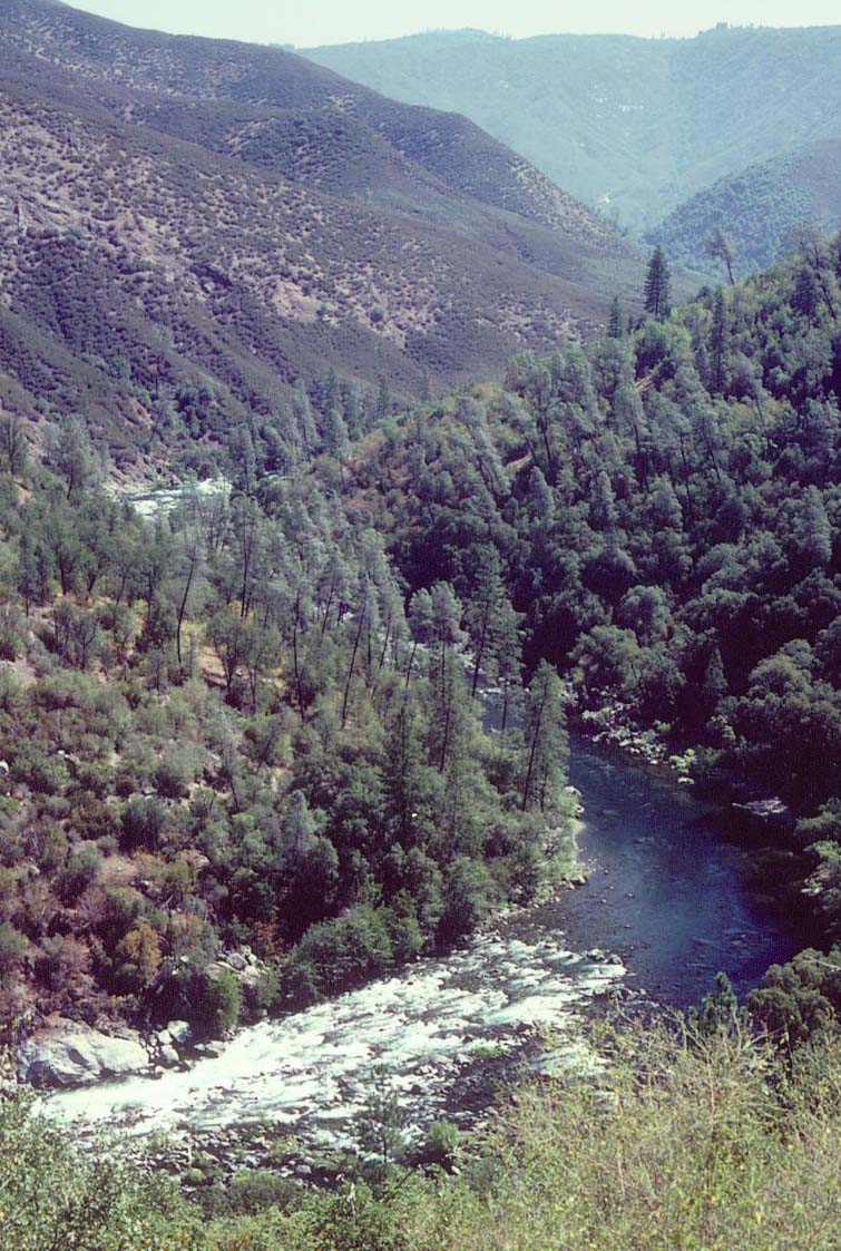
SUNDERLANDS CHUTE FROM LUMSDEN ROAD
River Flows:
Typical flows on the Tuolumne range from Summer flows (Low) of 900-1400 cfs to Medium flows of 2000-3000 cfs (much of springtime) to High flows of 3000+ cfs (big runoff years). Listed flows are based on the reading at Meral’s Pool. Note that while flows to Meral’s Pool are primarily controlled by dam release, several other streams and rivers feed the Tuolumne along the run, and it is not uncommon for the flow to quadruple between the put-in and the take out when the spring runoff is underway and the Clavey and North Forks are adding large volumes of water. Also, as we learned in the California power crunch of Spring 2001, flows can be subject to political and power needs – the river was turned off for several spring weekends in a row during the normal peak runoff.
Flow Information:
For most flow sites, look for “Flow at Meral’s Pool”. When checking flows, keep in mind that the Clavey River and the North Fork Tuolumne can quadruple the volume during spring runoff.
Gold Country Paddlers Flow Site
http://www.rivervilla.com/flows/index.html
Dream Flows
http://www.dreamflows.com/flows.html
The Groveland Ranger Station often has the scoop on upcoming flows and release schedules – particularly for the longer term outlook.
Groveland Ranger Station: (209) 962-7825
Commercial Boating:
The Tuolumne is boated by several commercial rafting firms, who offer trips from one day paddle-throughs to relaxing three day wine tasting adventures. If you raft, this can be a great option if you are new to boating or don’t want to deal with the permit issues, shuttle, and logistics. You can skip from here down to the Rapid Descriptions.
Stanislaus Nation Forest River Sports page – check left column on web page for commercial outfitters
http://www.r5.fs.fed.us/stanislaus/groveland/river.htm
All-Outdoors (Outfitter) Tuolumne page
http://www.tuolumne-river.com/
Permits:
The Tuolumne river has been part of the Wild and Scenic River System since 1984. Stanislaus National Forest oversees whitewater recreation on the Tuolumne and issues whitewater permits in an effort to maintain the wilderness character of the run. Whitewater permits are required to boat this run from May 1 to September 30. Permits are issued by the Stanislaus National Forest at the Groveland Ranger Station (located near La Casa Loma - see shuttle directions). They can be reserved in advance after January 1 by sending in a reservation request form. Trips are limited to 3 days maximum and overnight trips must comply with regulations on portable toilet requirements, allowable campsites, firepans, and other issues – contact the Groveland Ranger Station for details as these regulations change year to year.
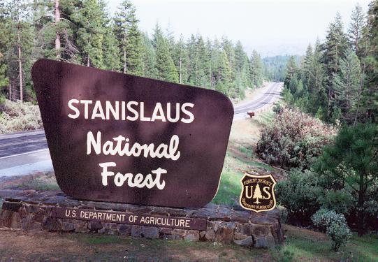
During weekdays, one can typically show up at the Ranger station in the morning and grab a permit without a reservation. However, on weekends and some summer Fridays, the permits will all be taken by advance reservation. Note that you still have a decent shot to grab a cancellation if your group is small (four or less) and you show up right when the Groveland Ranger station opens for the morning.
Be aware that if you have an advanced permit reservation and won’t be using it, you need to notify the Forest Service before the launch date and cancel it. Failing to do so will revoke any other permit reservations you have for the year and may get you blacklisted from future permits.
Groveland Ranger District, 24545 Highway 120, Groveland, CA 95321, (209) 962-7825
Stanislaus National Forest home page
http://www.r5.fs.fed.us/stanislaus/groveland/index.htm
Stanislaus National Forest whitewater permit information
http://www.r5.fs.fed.us/stanislaus/groveland/tcover.htm
Common Hazards:
Poison oak is commonly found throughout the area, both on and off the river. Learn to recognize its form so as to avoid contact and bring first aid supplies for treatment if allergic.
Rattlesnakes are occasionally encountered on the run. If you encounter one, don’t panic, just move away from them slowly. Let them be – they are uninterested in people and will usually move on once they no longer feel threatened.
Camping (off-river):
The Forest Service maintains several campsites in the area near the put-in and Casa Loma. “The Pines” campground (fee) has many amenities and can be found just beyond the Groveland Rangers Station. Less developed Forest Service campsites (free) exist along the Tuolumne River from Meral’s Pool upstream – “Lumsden”, “South Fork”, and “Lumsden Bridge” campgrounds. Refer to the Stanislaus National Forest Web site for more information. Boaters often camp at informal spots such as the Quarry (take either first or second left immediately after starting down Lumsden Road from Ferretti Road), or if you don’t mind traffic noise, in their vehicles on old Route 120 (dead end directly across Ferretti Road (East) from La Casa Loma).
Overnight trips / Camping on the river:
The Tuolumne makes a great overnight river run, whether camping out of your kayak or bringing the works with you in a raft. A couple of factors to keep in mind are the weather, permits, flows, and campsites.
For those unfamiliar with California weather, the winter and spring are typically cool and rainy, the summer and fall bone dry. The rainy season usually peters out by May – usually. Bring wet weather gear just in case. Daytime spring boating temperatures on the Tuolumne can be cold, but not usually below freezing. Summers are almost always bone dry and hot (90-100+ F), with the infrequent Sierra thunderstorm.
Permits are required from May 1 to September 31 – see the permits section. Fridays and Saturdays are popular launch days for overnight trips, so be aware that permits for these days are often all reserved in advance for the popular summer months. Inclusive with obtaining the permit are the regulations for overnight trips on firepans, portable toilets, campsites, etc. Be sure to read the permit regulations before getting to the river so you are aware of the constraints and can meet to criteria.
Flows can be a major issue. Springtime flows can often be high, increasing the rivers difficulty and shrinking the many low-lying river campsites. Conversely, lower summertime flows lead to more difficult travel for laden rafts as the rapids shallow out, and the first rapid – Rock Garden – can become a major epic to get a loaded raft past. Overnighting rafters tend to skip running the river when flows drop below 1300 cfs or so. Another low water issue is getting off the river on Sundays from July 4 onwards when they don’t turn on the river. On these “Black Sundays” travel is limited and several rapids are un-runnable. Most rafters plan on making it past Hells Kitchen (mile 12.9) on Saturday, where it’s possible to boat out on the low fish flow on Sunday. Another strategy is to put in on Friday for a two day trip (with water both days). Keep in mind that summer flow releases often don’t arrive at Meral’s Pool until noon and don’t make it to down to the North Fork until after 3PM, limiting your options if you want to be off the river earlier in the day.
Finally, on-river campsites are another issue. The Forest Service rotates campsite usage between commercial and private parties each year. Check with them to see how they divided out the campsites this year. Note that sites allocated to commercial parties can be used by private parties if the commercials don’t need them that night. Check with the commercial parties at the put in to see where they are going and you might be able to pick up a normally commercially-restricted site.
The Shuttle:
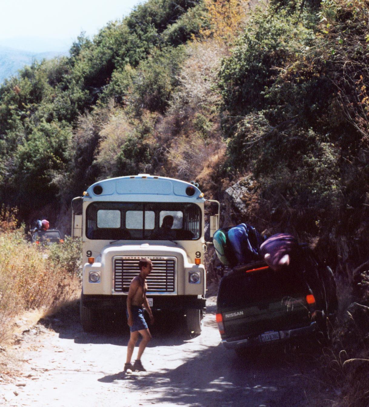
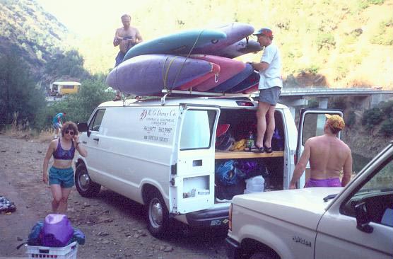
The Tuolumne shuttle can add another level of adventure to the trip beyond the wilderness river aspect. The road to the take out – Ward’s Ferry Road – is 7.5 miles of narrow, steep, and winding one-lane paved road with pullouts. On the other end, the last 5 miles to the put in are on Lumsden Road – a one-lane rutted steep dirt road with occasional pullouts. In between are 8 miles of regular highway, where one can rediscover what the upper gears are for.
The Lumsden Road part of the shuttle is best done with a high clearance vehicle. While one can usually squeak down with a normal car, it will take some punishment – take it real slow to avoid damage from the many ruts. The ruts grow as the season progresses, slowly making the road impassible to normal vehicles until the Forest Service gets around to regrading it. Also, look out for wildlife and other vehicles on the narrow shuttle roads – visibility is poor, turnouts few, and crashes a real possibility. Take it slow to avoid a head-on collision.
Commercial Shuttles: A commercial company is available to do shuttles, should one desire. As of Spring 2002, Tuolumne River Shuttles will ferry a vehicle from Meral’s Pool to Wards Ferry Bridge for $95, with somewhat lower prices for half shuttles (put-in to Casa Loma or Casa Loma to take out). Contact them at: (209) 962-4662 for details. Note that reservations are usually required in advance. They maintain a key dropoff box inside the La Casa Loma Café (see shuttle directions below).
Another shuttle possibility for those with time, but not the money, is to meet at Casa Loma early (7:30AM) and hook up with boaters who are running Cherry Creek – the class V run above this run – and hand off a copy of your car key to them. Then drive down to the put in and boat on down the river. The Cherry Creekers will drive your vehicle back up Lumsden Road when they finish their run and drop it off at Casa Loma, saving you the bone jarring drive up and down Lumsden Road again.

Directions to the take out (Ward’s Ferry Bridge):
Take Rt. 120 from I-5 near Tracy/Manteca out of the Central Valley Eastwards towards Yosemite Continue until the tiny town of Big Oak Flat, which lies near the end of a long uphill grade (just before the town of Groveland). In Big Oak Flat, turn left onto Ward’s Ferry Road and start your way down to Ward’s Ferry Bridge. Keep heading downhill at the various junctures as the road slowly shrinks to one lane. Eventually you’ll reach Ward’s Ferry Bridge over the river/reservoir. Most people park on the North Side (far side) off the pavement. Be cautious leaving vehicles here overnight, as their have been cases of vandalism.
If approaching from Yosemite on Rt. 120, pass through Groveland and turn right onto Deer Flat Road on the outskirts of town. Follow it down to Wards Ferry Road and turn right. Continue down Wards Ferry Road as it narrows until you reach Ward’s Ferry Bridge over the reservoir.
Ward’s Ferry Bridge to put in (Meral’s Pool), with stops at Groveland Ranger Station and La Casa Loma, 22 miles:
Retrace your way back up Ward’s Ferry Road towards Big Oak Flat / Groveland. After the road widens into two lanes, keep an eye out for Deer Flat Road entering on the left. Turn left and continue until it T’s into Route 120 on the outskirts of Groveland – the largest town in the area. Turn left onto Route 120, pass through Groveland, and continue East for approximately 8 miles. When the road opens up into a large meadow, keep an eye peeled for Ferretti Road on the left. If you need to pick up your river permit, continue on past Ferretti Road another 500 feet East and turn right into the Groveland Ranger Station access road. With permit in hand, head back to Route 120, turn left (West), then turn right onto Ferretti Road. An immediate left turn brings one to La Casa Loma (“Casa Loma”) , a café that serves as a meeting point for boaters of all types. The commercial shuttle company has a key dropoff here – see commercial shuttle section.
La Casa Loma Café (209) 962-0689
To head to the put-in from Casa Loma, head back to Ferretti Road and turn left. Wind up and over a hill, then around some curves, until you intersect Lumsden Road – a dirt road entering from the right (about a mile). Turn right onto Lumsden Road, cross the cattle guard, and prepare to get bounced. The drive down to the river is about 5 miles and you’ll soon get to know every rock intimately. Stay on the main road – don’t take the smaller turnoffs at the beginning (they lead to potential camping). The road starts out mellow and deteriorates quickly, with the crux about halfway down. Keep an eye peeled for uphill traffic so you can find a convenient pullout to pass. When you reach the river level and see a rapid to your left (Rock Garden) Meral’s Pool is just ahead. Park in or near the small upriver 3-4 car parking “lot” – the cobblestone lined downriver parking area is for the commercial outfits. Next to the parking area you’ll see a bulletin board and a trail down to the river. Lumsden Campground lies a few hundred feet further down the road and has outhouses for those wishing to lighten their load.
LUMSDEN ROAD
The run:
A whitewater run on the Tuolumne at normal summer flows can be characterized by four distinct sections. First, there is a busy 5.4 miles featuring many class IV rapids, from the put in at Meral’s Pool to Clavey Falls. Then the river mellows for several miles past nice campites and the Powerhouse historical site, before the adrenaline cranks up again at class IV Gray’s Grindstone (mile 9.5). Following Gray’s, there is a stretch of mixed class III and IV drops, and long pools that continues until Hells Kitchen (mile 12.9) - usually the last class IV drop (unless Pinball is exposed by the reservoir). From Hells Kitchen to the take out (mile 18), the rapids are generally easy and the pools long, with several good campsites.
Note on Running the Rapids:
The rapids on the Tuolumne come in many flavors, but many are laid out the same way – a rock garden start funneling down into a steep chute blocked by a rock (hole at higher flows). Luckily, the rapids are fairly forgiving and almost all drops are separated by pools. Note that at medium and higher flows the pools disappear. At summer flows, most drops can be boat scouted from the pool/eddy at the top. If in doubt, follow the rule of thumb for the ‘T’ - ‘start center, go left’.
MAJOR RIVER FEATURES

BLUE AND RED DOTS REPRESENT GPS WAYPOINT LOCATIONS OF MAJOR RIVER FEATURES
Rapid and River Feature Descriptions – listed by GPS waypoint number in bold (if measured), rapid name, rating in parenthesis, and river miles from Meral’s Pool. Descriptions are based on summer flows, with higher flow changes noted if known. GPS Waypoint numbers correspond to the Major River Features Map (see above) and river GPS points begin at 18 (1-17 were road waypoints and are not listed here). Note that not all rapids are listed here - only the major and distinctive drops. Plenty of unlisted class III and easier drops are available for you to discover.
Meral's Pool, mile 0 - the put in. Rinse yourself off from the dusty shuttle ride before dropping into Rock Garden immediately downstream.
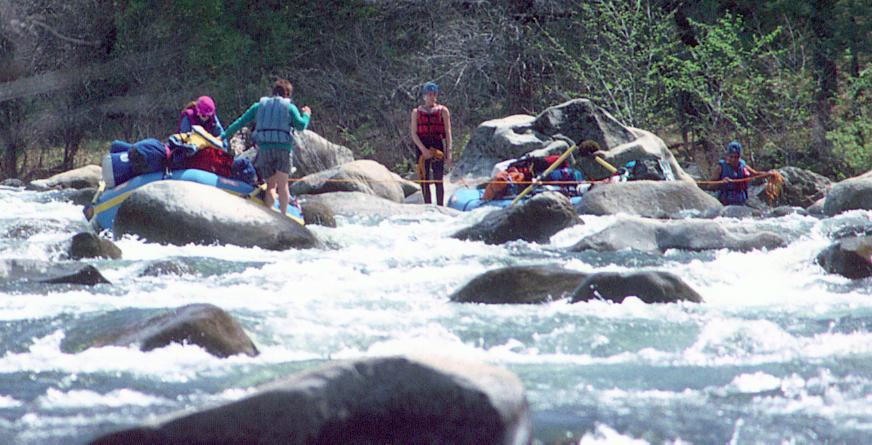
18 Rock Garden (IV) mile 0.1 – the name says it all. First rapid after Meral’s Pool and visible on the drive in. A long right turn with lots of small to medium sized boulders followed by small ledges at the bottom. Rock Garden can be very frustrating to rafters at lower (summer) flows, when a rocky “island” emerges. At these flows, rafts usually find the best route is to start down the right channel, then move/haul the raft to the left channel partway down. Look out for the several wrap rocks on the left and disappearing water on the right. At higher flows, large holes develop towards the bottom.
ROCK GARDEN AT SUMMER FLOWS
19 Nemesis (IV) mile 0.4 – an increasingly difficult lead in on a gradual left turn leads to the Nemesis rock – a large bedrock boulder in center right, with horizon lines on both sides. Both the far left and far right are mostly boulder sieves; instead run the horizon line just left of the Nemesis rock and down a short narrow chute. Follow the flow left when it opens up again for a wave-laden ride down to the bottom. At higher flows alternate routes open up on the inside of the turn.
20 Sunderland’s Chute (IV+) mile 0.8 – the biggest drop besides Clavey Falls. A Poison Oak laden scout is available over granite boulders on the right. A Classic Tuolumne drop – a rock garden start choking down to a steep chute with rocks and holes (big hole at higher flows) blocking the right side near the bottom. The river conspires to sweep one right – continue working leftwards after starting down. Avoid the temptation to start too far left or you’ll run out of water partway down. Note that at medium and higher flows the wave train runout merges into the next rapid, Hackamack’s Hole.
21 Hackamack’s Hole (IV, harder at higher flows) mile 1.0 – a short ledge and rock ridden rapid that becomes a river-wide hole around 3000 cfs and up.
22 Ram’s Head (IV) mile 1.5 – the river turns left, drops over a rocky ledge, and becomes a fast rocky chute followed by a right turn over ledge at the bottom (hole on left at higher flows). Beware of the several rocks hidden in the wave train while in the rocky chute.
23 Upper India (IV) mile 1.9 – the river drops down a left hand turn and over a ledge cut in bedrock. Rocks unexpectedly choke off the inside of the turn and a hole greets those on the outside of the turn. Note that this drop is immediately followed by Lower India (IV) and the short pool separating the rapids disappears at any but summer flows.
24 Lower India (IV) mile 2.1 – an easy rock garden start leads to a picket fence of boulders blocking the exit (this forms an almost river–wide hole at higher flows). Many ‘doors’ to choose, but tough to stop and choose once in the rapid. Good recovery pool after the drop.
Following Lower India, the river mellows to class II and occasional class III drops for the next two miles. This is probably due in least in part a the change in geology at this point from granitic rocks to the metasedimentary Calaveras Complex – a change not immediately obvious when boating.
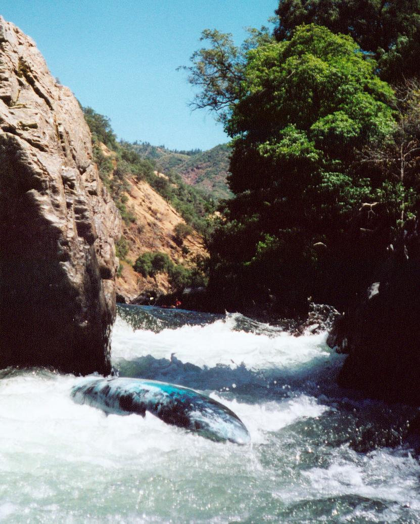
25 Stern (IV) mile 4.4 – a wall of boulders with a huge detached block emerging from river left announce Stern rapid. Run the turbulent chute between the block and the cliff on river left, or alternately try cutting right just in front of the block. A less technical center-right route over opens up at medium and higher flows.
OOOPS.... STERN RAPID
26 Evangelist (IV) mile 4.7 – on a right turn the river narrows down, dropping between boulders and over a series of ledges. Beware the hidden hole that covers the left and center just before the biggest ledge, or you may have an opportunity to discover religion. Several other holes form as the flow increases. At summer flows boaters either go right or far left of the hole, then immediately line up on the center chute for the biggest drop.
27 Bent Thole Pin (III) mile 5.0 - the river turns left through some waves, then drops steeply
over a 4+’ ledge cut into the bedrock. Run left, but beware the undercut boulder on far left near the bottom. Avoid running the center and right at low flows due to a shallow water landing.
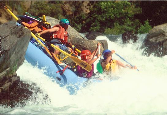
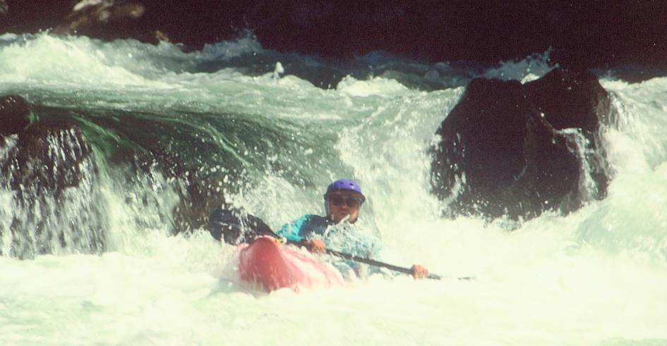
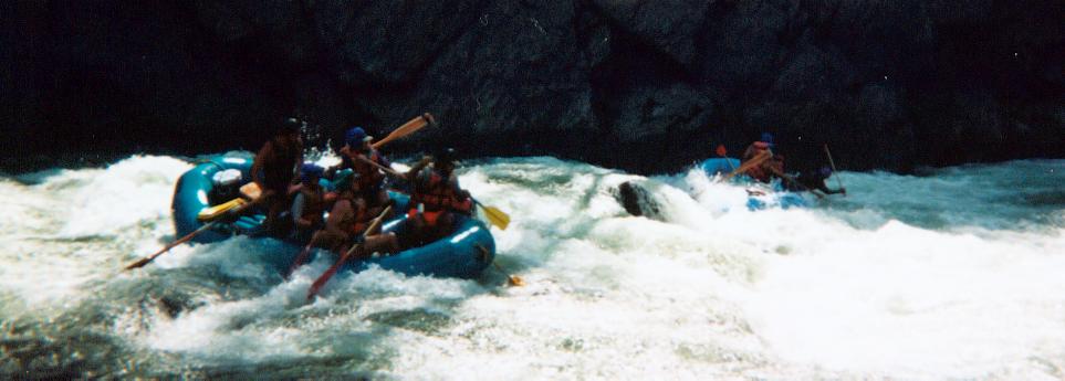
28 Clavey Falls (IV-V) mile 5.4 - The Clavey River enters from the right, marking your arrival at the biggest drop on the run. The river splits through a collection of rocks, down a sharp drop (the "falls"), churns into a cliff on the left, and then rushes over several busy ledges. The boulder studded falls near the top is the most impressive part, but beware boat-eating Clavey Hole a hundred feet downriver, which occupies the left and center of the river below a ledge. Rafts typically run the falls in the right channel, while kayakers usually opt for the more technical left channel. After the big drop, fight your way rightwards to avoid Clavey Hole, then immediately work left of the big instream boulder ("Alligator Rock") for the next big ledge. Avoiding the Hole can be quite a challenge at certain flows (approximately 2500-3000cfs), when the current sweeps strongly left along the cliff. At higher flows Clavey Hole becomes more a big crashing wave than a hole, but can still be problematic.
Scout the right side of the whole rapid, and if running the left channel, boat across and scout the left side too. Keep an eye out for both the prolific poison oak and the occasional rattlesnake amongst the vegetation on the left. Consider setting rescuers in the short pool after Alligator Rock to round up swimmers and lost gear before the class III-IV drop just around the corner downstream. For those who want to skip running Clavey Falls, there is a relatively easy portage over the gravel bar on the right.
RIVER RIGHT RUN AT CLAVEY FALLS
RIVER LEFT RUN AT CLAVEY FALLS
CLAVEY HOLE - ON LINE AND OFF LINE
A large campsite can be found on both sides of the river at Clavey Falls – above the Clavey River on the right and just above the drop on the left. One site is usually set reserved for commercial rafters – check with the Groveland Ranger Station to find out which one it is this year. During the summer, the Clavey River provides a great side hike to warm swimming pools and a natural water slide.
Many large quartz dikes appear in the bedrock around the Falls and up along the Clavey River. Keep an eye peeled for the infrequent light colored orbicular granite cobble – these uncommon rocks look like a collection of bull’s-eyes fused together.
Following Clavey Falls, a Class III-IV drop (just around the corner) provides one more jolt of excitement. Most boaters run it left of center.
Soon afterwards, a trail on river left soon leaves the river and heads up to Ferretti Road near Groveland.
On the river, the drops soon ease, the gradient flattens out for several miles, and several large campsites can be found. Summertime boaters sometimes refer to the stretch from Clavey’s to Gray’s Grindstone as “The Pond”.
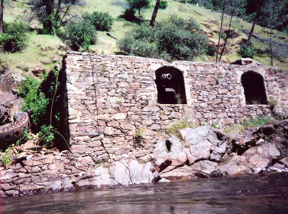
29 Powerhouse mile 7.5 – An old powerhouse sits next a large sandy beach (large campsite) on river right. In past years water was diverted from the Tuolumne upstream and dropped down the hillside behind the structure to generate electricity for the local mines around the turn of the century. In 1928 a fire destroyed most of the structure, followed by a flood in 1937 which ruined the powerhouse, and it was never repaired. In 1905, a road was built from Groveland to the Powerhouse, crossing the river on a cable bridge. Remnants of the stone bridge abutments can be seen in the river just upstream of the Powerhouse. The roads masonry supports can still be seen on river left as it follows the river to Indian Creek, where it then rises out of the canyon.
THE POWERHOUSE
30 Grapevine Campsite mile 8 – large campsite on river left just past Grapevine Creek – a small stream which enters on the right.
31 Indian Creek Campsite mile 8.4 – large campsite on river right. An old road leads out of the canyon via Indian Creek on river left.
FLOATING
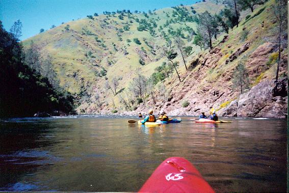
32 Campsite mile 9.0 (Wheelbarrow or Baseline?) – small campsite on river left. Crystalline and Dolomite blocks occasionally appear in the river from this point on. Look for the pockmarked light colored rocks in the riverbed.
33 Grays Grindstone (IV) mile 9.5 – after a long stretch with few rapids, a rocky-strewn hillside on the left announces Grays as the river makes a shallow right turn and drops over a horizon line. This 2000 foot-long rapid features three parts: a steep chute, followed by a boulder garden, and then finishing with ledges. The initial chute jets one past boulders into a sea of waves and holes, followed by a 3’ ledge drop into a hole. Warning – an almost river-wide hole hidden in a wave-train develops here around 3000 cfs and up – stay far left at these higher flows. Next comes the long boulder garden, where the river mellows but keeps one busy dodging boulders (holes at higher flows). Near the end of the rapid, the river steepens once again and plunges over several rocky ledges, with many good lines. A good recovery pool follows.
LEDGE/HOLE AFTER INITIAL CHUTE - GRAYS GRINDSTONE
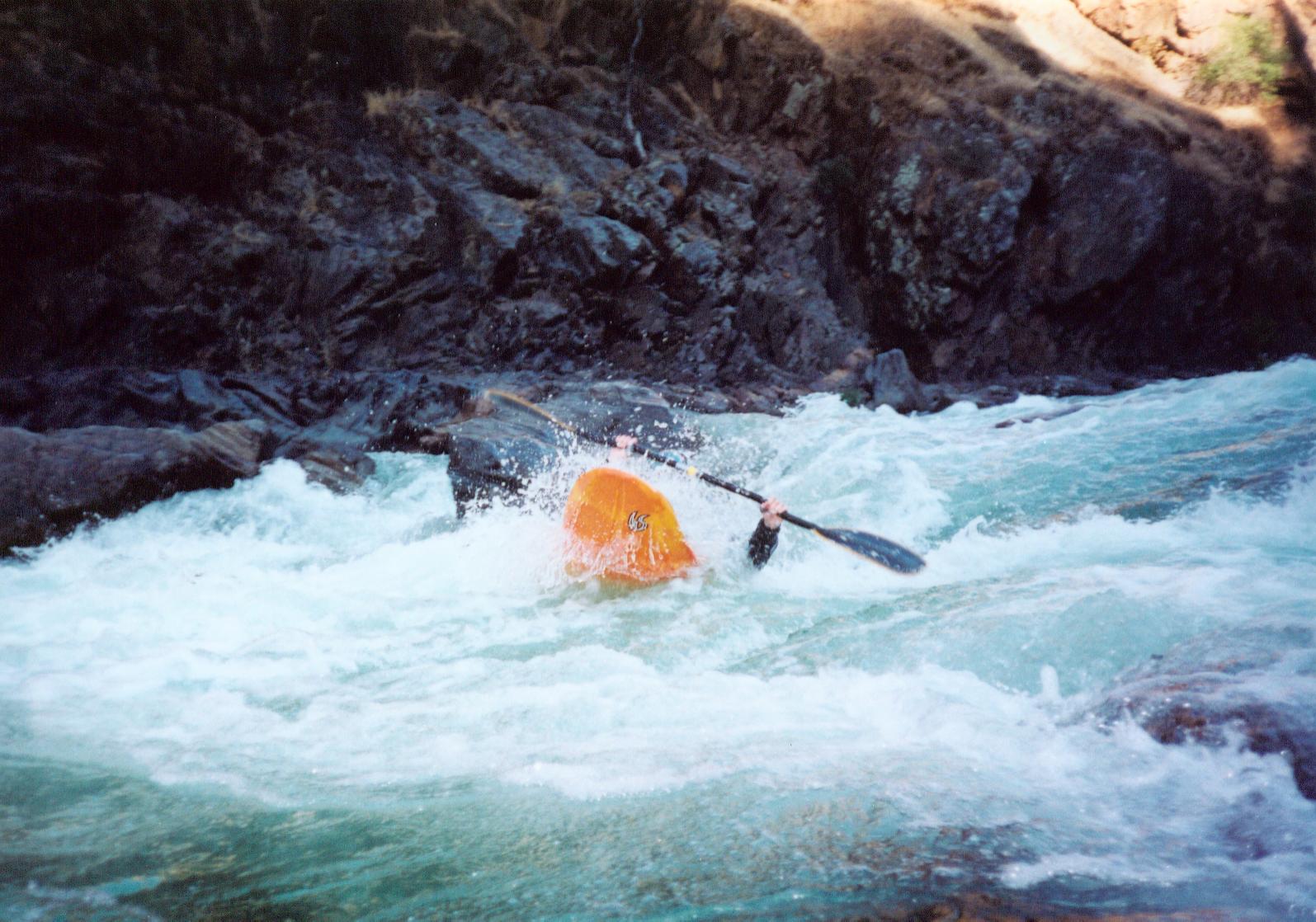
34 Rinse Away (III) mile 10.5 – the river plunges down a chute cut in bedrock and makes a sharp left turn over a ledge, often producing a hole on the outside of the turn.
RINSE AWAY
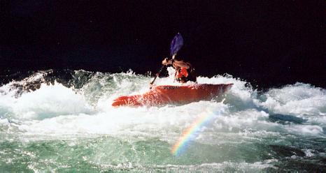
35 Thread the Needle (IV or II) mile 11.0 –Two house-sized boulders block the river here below a gravelly lead-in. Either thread between them (IV), move left of them, or take the easy way out and drop down the channel to the left of the blocks (II).
THREADING THE NEEDLE
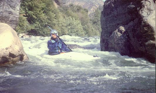
36 Driftwood Paradise Campsite mile 11.3 – a small campsite lies on river left. Note also the crystalline limestone and dolomite blocks in the riverbed, and the concentration of large quartz dikes in the exposed bedrock.
37 Steamboat (III) approx mile 11.8 – the river turns left and starts down a long rocky lead-in, terminating 1000 feet later in Steamboat hole, which spans most of the river. The hole starts washing out above 3000 cfs, often turning into a good set of play waves. Stay far left to avoid the hole, but beware the whirlpool eddy and its sometimes-turbulent eddy line.
38 Cabin (IV) mile 12.6 – while the river valley continues straight, the bedrock forces the river to carve rightwards into a hillside before being deflected back left. After a rocky start, the river zips past a central boulder perched on a ledge (hole at higher flows). Most boaters’ work to stay left of the boulder.
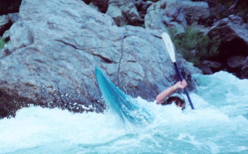
29 Hells Kitchen (IV) mile 12.9 – the river turns sharply right amongst bare bedrock riverbanks and plunges down an easy open rocky drop, then through a wall of van-sized boulders. The crux lies amongst the boulders, as the river drops through several ledges and holes. Stay in the main central channel and avoid the temptation to go far right or far left, as several rock strainers are present there. Note that the floods of 1996-1997 moved the boulders around a bit, straightening the main channel and increasing visibility.
LEDGES AMONGST THE BOULDERS - HELL'S KITCHEN
Sand and exposed polished bedrock form a large campsite (Big Creek Campsite) on river left just upstream of Hells Kitchen. A nice side hike up the slot canyon of Big Creek (river left) is reminiscent of Grand Canyon side hikes. Downstream from the campsite, an old quartz mine lies just up the slope from Hells Kitchen rapid on river left.
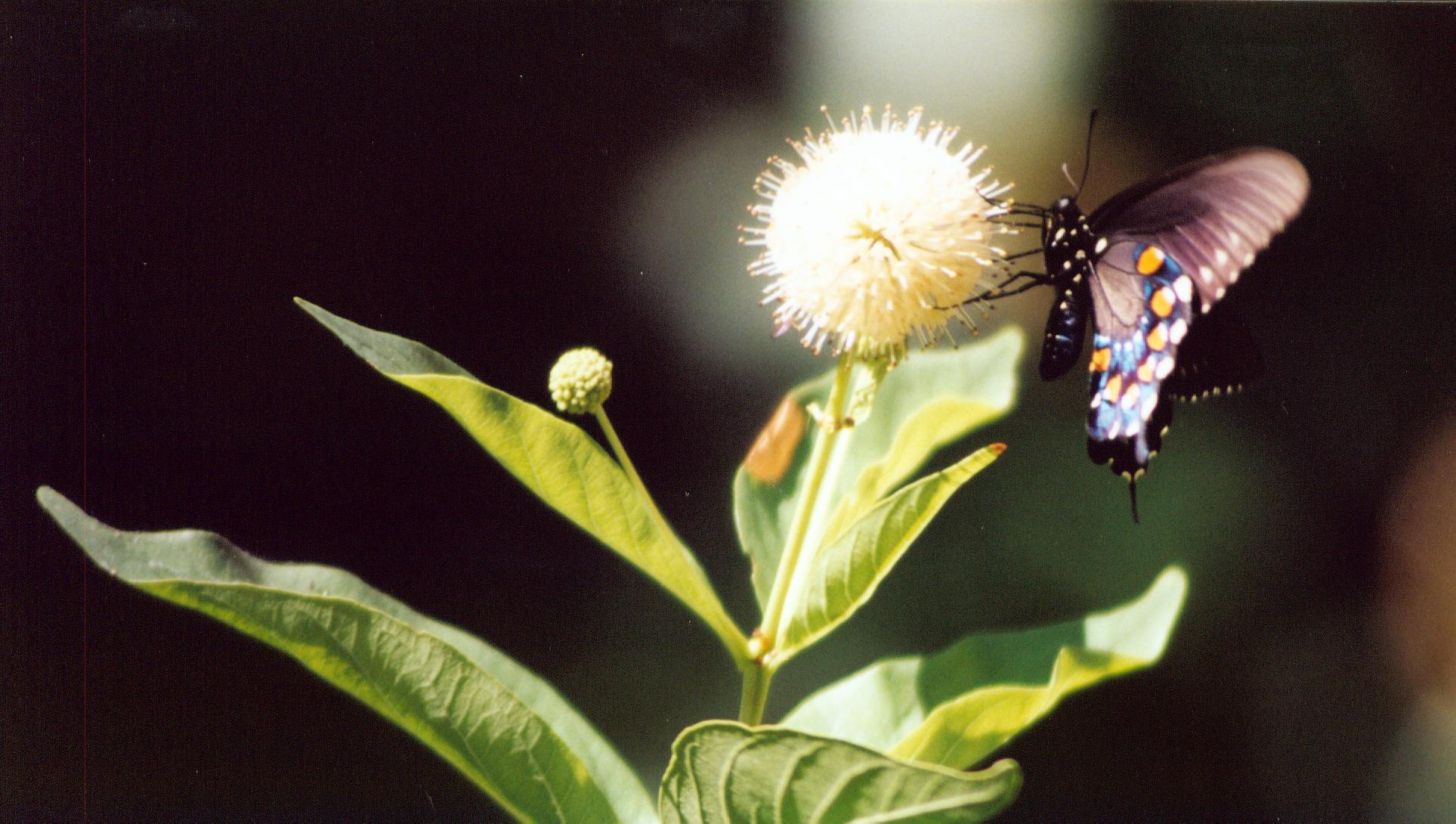
BUTTERFLY ON BIG CREEK
40 Mohegan campsite mile 14.3 – A large campsite on river right sits above the dike-laced bedrock. An old suspension bridge used to span the river just downstream and serve the quartz mines on both banks besides local traffic. A trail leads out of the canyon via the old road on river left.
In this part of the Sierra’s, gold is often associated with concentrations of quartz veins running through bedrock. Miners first descended upon the Tuolumne in the 1850’s and tapped into the many quartz vein concentrations present along the river. Over the years, they did find some gold, but hardrock quartz mining along the river never yielded the great concentrations of gold found in similar formations in the nearby Coulterville, Jamestown, and Sonora mining districts. The other popular form of gold extraction in the Sierra's – placer mining – turned out to be even less profitable.
41 North Fork mile 15.1 – a popular side hike and camping area, with a small campsite upstream of the confluence and a larger one just downstream. Check with the Groveland Ranger Station to determine which sites are reserved for commercial boaters, as they are rotated each year. Note that during low summer flows one can raft from here to the take out on Sunday fish flows during “Black Sundays”, making it a popular location to camp for rafters. A popular side hike/wade leads up the North Fork about a mile to enjoy the warm swimming pools. Look out for poison oak and occasional rattlesnake.
42 High water mark mile 16.3 – after a long straightaway, the river makes a right hand turn and plunges down a class III drop into a cliff wall on the right. When Don Pedro Reservoir is full, this rapid is covered and a two-mile paddle out on the reservoir begins here instead.
Pinball (IV?) mile 17.5 (not marked on map) - a victim of the reservoir, Pinball only shows during a series of low water years, when the river has an opportunity to erode the sand and silt that is deposited when the reservoir is full. When Pinball shows, navigate between large boulders guarding the entrance and immediately line up for a steep drop over a ledge and then down a rocky chute. A few strokes later and you are in sight of the take out.
Wards Ferry Bridge mile 18 – the take out. Most boaters elect to use the trail up to the old bridge abutments on the right side (North side), and then take the old road to the top. Commercial trips often employ cranes to lift their rafts straight up to the bridge.
WARDS FERRY BRIDGE TAKE OUT
River Links
Conservation:
American Whitewater Association (AWA)
http://www.americanwhitewater.org/
Central Sierra Watershed Coalition
http://www.cswc.org/tuolumne.htm
Friends of the River (FOR)
http://www.friendsoftheriver.org/index.html
Tuolumne River Trust
http://www.amrivers.org/groups/tuolumnerivertrust95354.htm
Whitewater Guides:
Cassady, Jim and Fryar Calhoun, 1990. California Whitewater; A Guide to the Rivers. Second Revised Edition. Berkeley, CA: North Fork Press.
GORP web site.
http://www.gorp.com/gorp/location/main.htm Then do a search for Tuolumne River.
Holbek, Lars and Chuck Stanley, 1988. A Guide to the Best Whitewater in the State of California. USA: Friends of the River Books.
Bill Tuthills California Creekin’ web site.
http://www.creekin.net/
Appendix - GPS Waypoint data table
These points have been included for those who wish to program their GPS unit for use on the river. Keep in mind that the waypoints were taken with a Garmin 12XL recreational grade GPS unit with a manufacturers claimed accuracy of 15 meters (49 feet). Given the limited satellite visibility in the Tuolumne River canyon, the accuracy is probably much less. Accuracy checks of the GPS data imply that it is accurate to within 250 feet of the indicaited location; however, use common sense and don't place sole reliance on GPS waypoints while on the river for your navigation and identification of hazards.
Also, note that GPS waypoints of rapids were taken at the top of the rapid, and the crux move may be quite a distance downstream. GPS waypoints of campsites and historical features that were not also rapids were taken at the feature, while GPS waypoints of combination features were taken at the top of the rapid.
Waypoints were originally taken in Universal Transverse Mercator (UTM), North American Datum 1927
Continental United States (NAD27 CONUS)
| Waypoint_ID |
Latitude (decimal degrees) |
Longitude (decimal degrees) |
Date & Time (UTC) Collected |
EPE (feet) |
Side of River |
Feature Name |
Feature Type(s) |
| 18 |
37.83634452 |
-120.0535601 |
4/13/2002 19:41 |
48 |
R |
Rock Garden |
Rapid |
| 19 |
37.83824897 |
-120.0586562 |
4/13/2002 19:50 |
Not Recorded |
R |
Nemesis |
Rapid |
| 20 |
37.83579207 |
-120.0642243 |
4/13/2002 19:58 |
Not recorded |
R |
Sunderland's Chute |
Rapid |
| 21 |
37.83694546 |
-120.0674482 |
4/13/2002 20:05 |
32 |
R |
Hackamack's Hole |
Rapid |
| 22 |
37.84203644 |
-120.0733757 |
4/13/2002 20:17 |
20 |
R |
Ram's Head |
Rapid |
| 23 |
37.83872658 |
-120.078976 |
4/13/2002 20:26 |
24 |
R |
Upper India |
Rapid |
| 24 |
37.83864077 |
-120.081567 |
4/13/2002 20:29 |
20 |
R |
Lower India |
Rapid |
| 25 |
37.84948272 |
-120.1111401 |
4/13/2002 21:06 |
46 |
L |
Stern |
Rapid |
| 26 |
37.85512087 |
-120.1158713 |
4/13/2002 21:14 |
78 |
R |
Evangelist |
Rapid |
| 27 |
37.85923008 |
-120.1144926 |
4/13/2002 21:21 |
59 |
L |
Bent Thole Pin |
Rapid |
| 28 |
37.86348415 |
-120.1156888 |
4/13/2002 21:28 |
29 |
L |
Clavey Falls |
Rapid, Campsite,Geology |
| 29 |
37.88098879 |
-120.1406324 |
4/13/2002 22:05 |
26 |
R |
Powerhouse |
Historical, Campsite |
| 30 |
37.88502832 |
-120.1469569 |
4/13/2002 22:12 |
32 |
L |
Grapevine |
Campsite |
| 31 |
37.88445973 |
-120.1527825 |
4/13/2002 22:21 |
15 |
R |
Indian Creek |
Campsite |
| 32 |
37.89090259 |
-120.1612258 |
4/13/2002 23:27 |
42 |
L |
Campsite |
Campsite |
| 33 |
37.89297337 |
-120.1692668 |
4/13/2002 23:31 |
54 |
R |
Gray's Grindstone |
Rapid |
| 34 |
37.89748507 |
-120.1864217 |
4/14/2002 0:00 |
46 |
R |
Rinse Away |
Rapid |
| 35 |
37.89508724 |
-120.1991458 |
4/14/2002 0:11 |
84 |
L |
Thread The Needle |
Rapid |
| 36 |
37.89511409 |
-120.2030295 |
4/14/2002 0:14 |
56 |
L |
Campsite |
Campsite |
| 37 |
37.89805928 |
-120.2109525 |
4/14/2002 0:19 |
42 |
R |
Steamboat |
Rapid |
| 38 |
37.89376236 |
-120.2177705 |
4/14/2002 0:40 |
20 |
L |
Cabin |
Rapid |
| 39 |
37.89296308 |
-120.2222283 |
4/14/2002 0:44 |
22 |
L |
Hell's Kitchen |
Rapid, Campsite |
| 40 |
37.8973514 |
-120.2381869 |
4/14/2002 1:00 |
42 |
L |
Mohegan |
Historical, Geology |
| 41 |
37.89692235 |
-120.2524988 |
4/14/2002 1:09 |
14.9 |
R |
North Fork |
Campsite |
| 42 |
37.88964284 |
-120.2688653 |
4/14/2002 1:21 |
21 |
L |
High Water Mark |
Rapid |
UTC=Universal Time Coordinate, i.e. Greenwich Time
EPE = Estimated Precisional Error
Side of River: R=River Right, L= River Left (i.e. direction facing downstream)


