Title
New Developments
Author Information
Cierra Lewandowski
cgulstar@yahoo.com
American River College, Geography 26: Data Acquisition in GIS; Spring 2002
Introduction
Sacramento is becoming more and more developed each year. With all of the new homes, there is an increased demand for consumer resources; for example groceries, gasoline, and dinning. Sometimes the grocery store (the resource) is not built for years after the development is finished. This is where the problem comes in, when the demand is not met. Especially when since everything is becoming a lot more geared toward convenience and or easy access. Driving more than five miles to the nearest grocery store or quick mart is not convenient, in other words the demand needs to be met. GIS can be used to demonstrate to developers that there is a need/demand for a grocery store.
Background
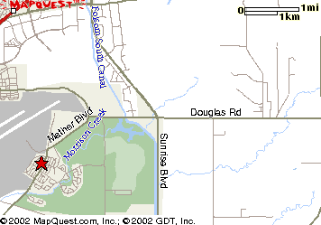
I have experienced this inconvenience first hand. Approximately one year ago I moved into a new housing development on what use to be know as Mather Air Force Base (MAFB) and now is known as just Mather. Now that the base is open to the public there are only a few facilities that are still in operation, for example the gymnasium, church, and the airport. There are also two schools that are also still in operation, and before the builder was able to build they had to agree pay for the school to be upgraded/remodeled for children that moved into the new development would have a nearby place for the children to go to school. Which in long run could also benefit the builder because that would be a feature in selling the home to someone with young children. In other word so they would not run into the problem we are having now with the grocery stores.
Methods
Choose a geographic area for the project. I chose a ten-mile radius around Mather (naturally the area in which I live), in turn would include all of the grocery stores within ten miles from my home. Stores that were included were two Ralph’s (one on Sunrise Bl and one on Bradshaw), Raleys (Folsom Bl), Safeway (Folsom Bl), and my personal favorite Bel Air (Sunrise Bl).
Spatial Data --
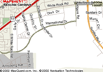
I collect GPS marks with my hand held GPS (Global Positioning System) unit, for all of the grocery stores within the 10 miles. This was not as easy as thought it would be, I had a little problem with reception to the GPS unit. I had to try three or four times before I actually got the mark into the GPS unit. After successfully marking each store I downloaded the marks on to the computer, then plotted them a digital map you can see below.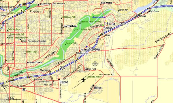
Other avenues of data collection--
Internet Data-
I looked at several different websites on the Internet, ranging from population projections to similar projects that others have done, and all the way to sacog linking me to the Regional Housing Needs Plan (RHNP). I feel was unable to really use all of the information that is available on the web because unfortunately I am not very familiar with using the Internet for research purposes.Verbal Data-
I contacted Barbara who worked at the Rancho Cordova Chamber of Commerce who had good information. She informed me that most of the time there is set standard for number of homes or potential customers in order for a grocery store to be built and the number of homes that presently out at Mather is not enough. Barbara also informed me that there are plans to develop a large portion of Mather and the area nearby. Currently they are new homes going in at the end of Zinfandel Rd and in the future the will be new homes going in on the other side of Sunrise Bl and Douglas Bl.
Results
At this present time there are not enough homes or prospective customers at this point for the grocery store (resource) to be built, just yet. There are going to be many different phases to developing Mather and the surrounding areas. The development that I live in the first phase and have to wait for the rest to develop to get all of the conveniences that you want and recourses that you need.Life is not always convenient and you have to be patient.
Conclusion
The area is divided into different phases (# depended on size of area). Unfortunately when you or the development I live in is part of the first phase you have to be patient and wait for everything to develop and all of the phases to finish. In due time you will have all of the resources that are needed and in a convenient distance.
References
www.nber.org; www.sacog.org/; http://mapping.usgs.gov; www.mapquest.com ESRI, 1997 Getting to Know ArcView GIS. Redlands, California: Environmental Systems Research Institute, Inc.