GIS AND VITICULTURE
Todd Raugewitz
American River
College, Geography 26: Data Acquisition in GIS; Spring
2002
Abstract
Geographic Information Systems (GIS) have
become the backbone of precision farming. The combination of technologies
including GIS, Global Positioning Systems (GPS), and imagery, allows a grower to
track information relating to crops and map the location of features that affect
crop productivity. The ability of a GIS to integrate information from many
sources makes it appropriate for use in vineyard management. The purpose of this
project was to research how GIS is currently being used in vineyard management
and apply this knowledge hands on to meet the needs of a local
viticulturist.
Willow Point Vineyard: A Case Study in GIS
Implementation
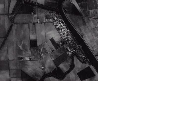
Willow Point Vineyard is located near the town of
Clarksburg twenty miles south of downtown Sacramento along the Sacramento River.
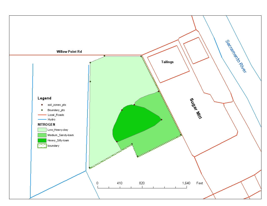
The vineyard is comprised of fifty-five acres of fertile river bottomland.
Within its boundaries are three distinct soil types. The needs of the grower
were to geo-reference the vineyard along with the soil zones and apply this to
future nitrogen applications. Like so many other vineyards, Willow Point was
converting to Precision Agriculture.
Background: Precision
Agriculture
Farm fields are seldom homogeneous in terms of soil
characteristics. Correctly identifying these areas of variability and precisely
locating them so people or machinery can pinpoint them easily is the first stage
of precision farming. This allows growers to treat a zone within a field as a
separate target rather than the whole field on an average basis. Inputs such as
tillage, soil amendments, foliar applications, or fertilizers are then applied
only where needed. The results are increased efficiency, reduced costs, and
improved production. (Gordon, 1997)
Methods: Building the
GIS
Gathering the Data
Fieldwork was conducted under
the supervision of the grower to ensure accuracy. Data was collected using GPS
(Garmin eTrex Summit and 12XL) and stored in the form of Waypoints. These
geo-referenced points would be used to correctly identify spatial features
within the vineyard. Two features include the vineyard itself, including
boundaries and identifying each of the three distinct soil zones. The waypoints
themselves would have limited meaning until placed upon associated layers. Once
completed the first maps could be produced.
Creating Sample
Maps
The first maps were created using Delorme Topo USA version 2.0
1997. These simple maps were used in the field to take notes while gathering
waypoints. The second mapping process would involve correct placement of the GPS
data into a true GIS. The points were extracted using Waypoint Plus software and
placed into its own layer and could be viewed using Esri Arc View 3.2. Other
layers were collected from California Fish and Game data. These shapefile layers
included roads and hydrology. Images were also found through MS Terraserver.
Interpreting Results
Sample Maps were taken back into the
field for testing accuratecy of data. Once corrected all information was brought
before the grower for further analysis. The grower was able to correctly label
soil zones based upon past soil lab results. This new information was brought
back into the GIS utilizing Esri Arc GIS software. Soil zones were digitized
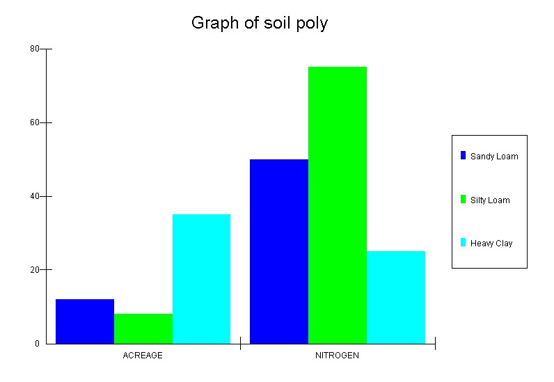
into polygons and attributes were assigned. Attributes included soil type,
nitrogen needs, and size in acreage. Once completed final maps could be produced
and implementation could begin.
Results: Implementation
Analysis: Successes and
Difficulties
Successful completion of the Willow Point Vineyard GIS
was based on accuracy of final data and by meeting the grower's needs through
use of appropriate technology. All difficulties were overcome by utilizing
multiple GIS software systems as compared to dependency on just one format. Such
difficulties included recalculation of initial errors in GPS points and point
conversion using Waypoints Plus software.
Conclusion
With
a GIS of the vineyard the grower can now make the transition to precision
agriculture. Accurate coordinates allow the viticulturist to treat each soil
zone individually and precisely. Within the near future the vineyard plans to
purchase a Variable Rate Spreader. Complete with its own computer and GPS on
board this spreader loaded with information from the GIS will automatically
apply the right amounts of nitrogen fertilizer for each identified zone
throughout the vineyard. The GIS completed in this project will serve as a basis
upon which future applications can be added tailored around the needs of Willow
Point Vineyard.
References
Gordon, A. Donald; 1997
Vineyard and Winery Management: A Case Study in GIS Implementation: ESRI User
Conference
Hill, Veeder; The Hess Collection Winery: Vineyard Viticulture
Map
ESRI Agriculture Services:
http://www.esri.com/mapmuseum/mapbook_gallery/volume16/agriculture3.html
GIS
Solutions for Farm and Vineyard Management Using Precision Farming Technology
http://www.vestra.com/documents/services/farmvine.htm