| Title Open Pit Aggregate Mining in Southern Sacramento County |
|
Author Wesley Turner wes_turner@hotmail.com American River College, Geography 26: Data Acquisition in GIS; Call for Papers; Spring 2002. |
|
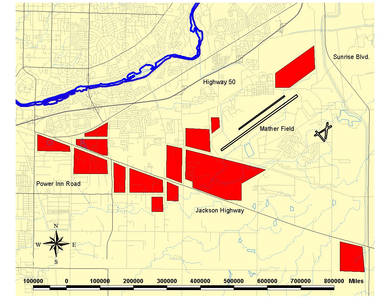
Abstract The purpose of this paper is to quantify the geographic extent of open-pit agreggate mining in southern Sacramento County. To this end, data was collected on-site using a Garmin 12X GPS unit, then imported into ArcView to produce a map. The map itself was the main point of this excersize; when informed of the drawbacks of this kind of mining, and shown to what extent it has been allowed to occur, I believe that most people would agree that is a problem that needs to be adressed. |
|
Introduction Southern Sacramento county is an area of alluvial sedimentation which has been deposited over the past several million years. Sediments eroded from the Sierra Nevada mountain range have been transported to the area by the American River, which in the course of its natural flooding has deposited gravel and sand to a depth of several hundreds of feet. These minerals are highly prized by the construction industry to produce concrete; since the deposits lie at the surface, the normal method of extraction is open-pit mining. Believing this activity to be largely inimical, because it is taking place in a growth sensitive area, and because a lack of viable alternatives for the future uses of the areas after mining has been completed, I set out to make a map of ts geographical extent, using GPS and GIS technology. |
|
Background The main problem with open-pit aggregate mining is that after extractive operations have ceased, there are very limited options for the future use that these deep (up to 100’) and extensive (up to three square miles) areas can be put to. This is because here is no drainage out of the pit, unless pumps are installed (and who will pay for that?). Naturally, without drainage outlets, these areas become inundated during the rainy season. In one of the exhausted pits a wetlands area has already begun to form. While the idea of dedicating these areas as wetlands habitat is suprficially attractive, it would not be wise. In a natural wetlands, water flows through the system, flushing out impurities; in these pits water merely collects, thereby acting as a sump and concentrating pollutants and other toxic materials. |
|
Results
I was at first surprised when I made my initial survey, because the extent of the mining was greater than I had expected. When displayed on the map, it becomes immediatly apparent just how much land has been affected. |
|
 |
|
Analysis
The only problem of consequence I encountered on this project came as a surprise; even with brand new batteries in the GPS unit, after only 90 minutes use on a very hot afternoon, I started getting “low battery power” messages!
|
|
Conclusions
There are so many problems associated with the future uses for exhausted open-pit mines that it should never have been allowed to occur in such close proximity to a growing urban area. That being said, some wise use must be found for these pits, because
they will be there essentially forever. |
|
References
Sacramento County General Plan. Ch35, Art.4, Secs 235-41 through -61. |
|