Map of Control Points in the Sacramento Region. Notice the distribution near major transportation routes.

JS0271: A beautiful control point in a biege-like pink color paint job. The National Geodetic Survey can make $250 dollars here!

JS0271: A long shot of this painted beauty in old Folsom CA!

JS0270: Uncovered!

JS0270: Notice the density of the Moss.

JS0270: On top of a rock where my GPS fell from, buried by moss!.

JS0813: This control point is 95 years young! It was monumented in 1908.

JS0813: Found in a graveyard near a catholic church.

JS4815: It's blue cause it is along a "Blue Ravine."

JS4815

JT2363: This control point is a landmark. The silo pictured is the control point.

JT2363: Down on the farm, do as the farmers do!

JT0245: Located on a culvert.

JT0245: Evidence that this point was recently used, but it was not recovered online. Notice the faded pink survey flag.

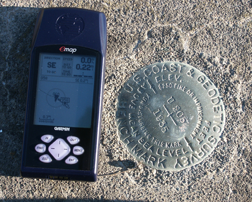
JT0245: A wonderful shot of the disk and my personal GPS (complete with extremely outdated software).

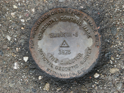
JS4112: This is such a groovy disk that it has two reference marks!


JS4112: Swanson's Reference Marks

A swarm of Red-Winged Blackbirds that I encounted near JT0245.

A culvert that I discovered while on a failed attempt to find a control point

A control point was near this gas line marker, but I could not find it.

Many control points are along transportation lines.

Railroad tracks on a small bridge

Many control points might now be on private property.

Plant growth can hide control points.

Old railroads are a great place for a stroll.

A swarm of Red-Winged Blackbirds that I encountered near JT0245.

Schellville, California