Title
EXERCISING AND GPS
Author Information
Lindanne Campbell
American River College, Geography 26: Data Acquisition in GIS; Spring 2003
Contact Information: keykeepr@pacbell.net
Abstract
The project evolved into a struggle with non-integrated technologies. Recreational use of GPS will increase as this technology becomes easier to use and more accessible.
Introduction
Context: A friend of mine bought his GPS for use during trips, but started using it to measure his daily walks. He was attempting to increase his distance each week. I also wanted to learn to use his GPS, so I could use it perhaps for future GIS projects
Problem: How can one collect and analyze the GPS data to use to evaluate exercise routines?
Approach: I had him collect tracks during his morning and evening walks for two weeks. Then I will collect data on my bike rides and walks. Since the GPS measures moving and standing time it will be interesting to see how these two types of exercise compare. I will also note whether the dog accompanied me as she sometimes makes the pace slower or faster. I will also try to find some information on calories burned during each kind of exercise. I can plot the routes on aerial photos from the Terra server. I can check the accuracy of the GPS instrument by observing whether the tracks plot on streets and trails and not thru houses. The ultimate goal is to get myself into a regular routine of exercise and reward myself for meeting a set goal each week.
Background
I searched the internet for GPS software that had trial downloads.
These are the sites that I used or searched.
Easy GPS
Expert GPS
Garmin
Methods
Technology and time got the best of me. I tried to download some preliminary tracks and found that the Waypoints software worked fine for waypoints but not for tracks. According to their documentation my device was not supported.
I looked for other downloads and finally was successful using EasyGPS.com to download the tracks onto a PC. Then I also downloaded the Expert GPS because it said it would enable me to view the tracks on top of topo maps or aerial photos.
I had already been that warned none of the numeric/statistical data would download with the tracks. If I really wanted to analyze this, I would have to collect it by hand.
Results
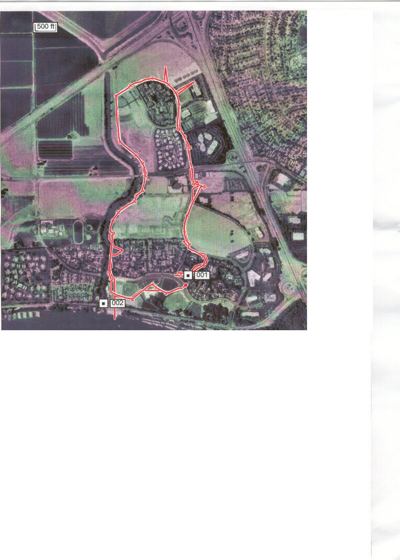
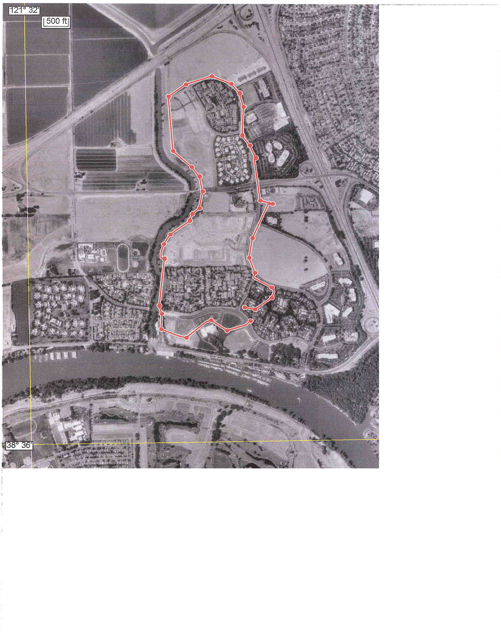
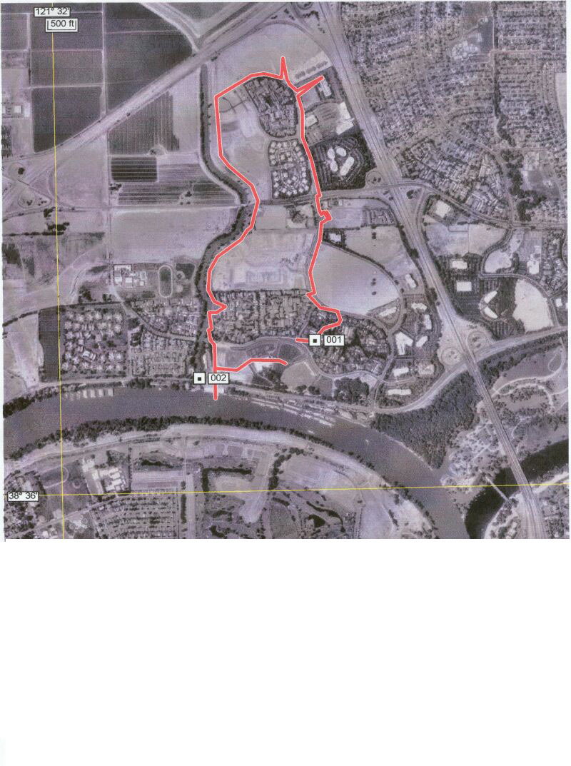
Working through the software became quite a challenge. I had originally downloaded some aerial photos from ------that I want to use with my tracks. I found that the trick is to use their aerials and topo and a high speed connection. I was still a little confused about the two tracks overlapping when I only highlighted one. I was thinking that it seemed to display all the tracks in the file. So I tried copying the files and then deleting all but one track. Voila! A much neater single track. Then I tried the "Simplify Route" command. It removed the points made the track smoother looking on the map. Finally I found a way to display one track at a time but have multiple tracks on the screen for my presentation and paper. The next snarl I encountered was that the software does not allow you to export to a jpg file. It saves as a tpg file which is a proprietory format from Topographix and cannot be displayed in other image software to my knowledge. I tried to save it as a shapefile because it was one of the options, but it requires an extension that costs $39.95 on top of the price of the ExpertGPS. So I had to use the print function on the file menu, then scan the picture and save it as a jpg.
Figures and maps
Analysis
Once the software was conquered, I enjoyed collecting new tracks and displaying them on the aerials or the topos. It also has a quick map format that shows the track in relation to some latitude and longitude lines. I was not able to do my original project of evaluating walking habits.
Conclusion
The Expert GPS software is a good product for recreational users of GPS. Its limited functions and odd formats would not do well in the GIS world unless you purchased the shapefile extension. The basic software costs $59.95 and the package including the GIS/Shapefile extension is $99.95
References
None
Appendices
None