Results
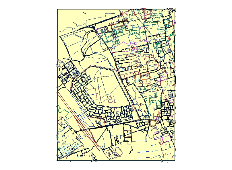
example of a dgn file from LA GIS
Title
LAND AFFAIRS DIVISION IN SAUDI OIL CO. (ARAMCO)
Author Information
Abdullah Al-Ateeq
American River College, Geography 26: Data Acquisition in GIS; Fall 2004
Saudiincali@yahoo.com
Abstract
In this web site I'm sharing with you my experience with Land Affairs Division
of Saudi Aramco Oil Co.; launching a project for GIS and enhancing the operation
of the division with the latest technology means.
Introduction
Land Affairs Division is committed to manage, safeguard Saudi Aramco's existing
reservation lands and to be proactive in procuring the land surface rights
required for new company operations areas, utilizing Geographic Information
Systems (GIS) and other leading edge technologies.
Land Affairs mission remains as important today, as it was 70 years ago. In recent Geographic Information Systems, Global Positioning Systems and other technologies have become key elements in accomplishing our mission.
The vision of the division is to ensure that Saudi Aramco enjoys unimpeded access to the surface rights required for its operations, to be recognized throughout the company as the single most reliable source for accurate land uses data and as an essential provider of value-driven services.
Background
Before the implementation of the GIS technology , The material that was used to
maintain the operations are the basic cartographic tools, hand drawn sketches,
arielphotoes, and GPS "for field inspection observations". Due to the paper work
involved extracting information and obtaining records became a big hassle for
the division. It was time to call for the technology to lift the division up and
accelerate the operation. Several companies were invited to show their
solutions and provide ideas, and after a deep revision of the companies offers
the project for launching GIS in the company was granted to Bentley Co. and
their software solutions MGE and Microstation.
Methods
A project team was created to accomplish the mission, each were given
responsibility and the division was divided into three units "I will key touch
on each unit with its responsibility afterwards".
MGE along with Microstation and Oracle dBase were loaded on all the division PC's; maps were digitized from the papers to the PC'S as dgn files "file types that MGE and Microstation uses same as shape file that are used in ESRI software" using special digitizing tools. Case files for Land Uses were migrated from storage drawers to the dBase and linked to each parcel it represents in the GIS maps using unique ID's for easy use and information revision.
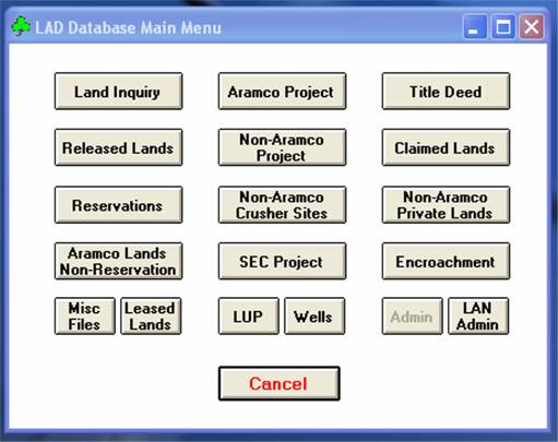
The parcels were organized in the system according to their uses. Land Affairs deals with several types of lands, they are categorized as follows: Reservations, Title deed lands, Land Inquiries, Land Releases, Wells, Encroachments, Land Claims, Land Purchases, and Easements. Each category was given a different symbology, weight and color; according to its importance.
The division's responsibilities were divided among three units
-Eastern Province Surface Rights Unit, Western & Central Surface Rights Unit: both units provide the same services which are:
Reservations: A core responsibility of both units is the reservation of lands for company operations. A common misunderstanding related to reservations is that Saudi Aramco owns the land held within the reservations, when in fact reservation lands are Government lands.
Title Deed Requests, Land Inquiries and Land Release: Requests for land come to the company through the Ministry of Petroleum as either a title deed request or a land inquiry. Land Affairs receives over 1,200 of these cases annually depicts and analyzes each one for impact on company reservations and facilities. Usually if conflict exists the request is rejected outright. If no conflict exists opinions are solicited from relevant company organizations and compiled into corporate position that is articulated to the Ministry of Petroleum. Once Land Inquiry is approved, Land Affairs process the official release from Saudi Aramco Reservations.
Encroachments: encroachments, or unauthorized land use, have the potential to cause serious damage to company land and facilities. Monitoring Saudi Aramco's 150 reservations, right-of-ways and deed lands totaling more than 78,000 sq. for encroachments is particularly challenging.
Land claims: the majority of land claims originate as title deed requests tat are rejected be the company and progress to claim status when the applicant petitions the courts. Claims can also originate as encroachments, or as happens quite often, as a result of implementation of Saudi Aramco project.
Land Purchases: The need to purchase land for the development of the company's oil and gas infrastructure has become a more common occurrence in recent years. The growth in the amount of private land ownership over the last two decades makes it increasingly difficult to develop large-scale projects without impacting privately owned land.
Committees: Participates in different level Government Committees.
Easements: Negotiations with Government Departments to utilize their land at no cost.
-Geographic and Technical Services Unit: the heart of Land Affairs, it handles the following services
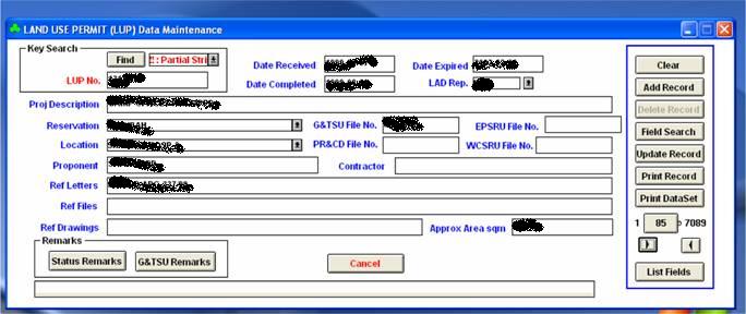
Land Use Permits&Wells: The unit analyzes over 700 Land Use Permits (LUPs) received from different department parties in the company and about 300 proposed well locations received from Producing Organization annually to ensure that proposed LUPs and wells do not conflict with lands not under the company's jurisdiction.
Pre-project Planning: Requests from proponent organizations for pre-project planning are regularly received. The unit evaluates major project land requirements and based on land status research we provide the proponent with route and site selection.
Mapping Supports&Research for Land Status&Special project drawings: one of the unit's primary core functions is to provide Land Affairs with accurate and informative color-coded land use maps for analysis of land and project requests. Also bilingual aerial image/ maps are produced for review by Management, The Ministry of Petroleum and other Government entities.
Geographic Information System: Land Affairs is responsible for documenting and recording company lands utilizing Geographic Information System (GIS) technology and publishing non-restricted data to the corporation.
Geographic Research&Technical Services: A variety of technical services are also provided, including; deed analysis and boundary evaluation, consultation on issues requiring land surveying; Global Positioning Systems support and aerial image research.
Results
example of a dgn file from LA GIS
Analysis
Through the implementation of Geographic Information system (GIS) technology
Land Affairs Division has evolved into the resource center of the organization.
The GIS, so far efficiently organized and injected intelligence into over 25,000
land parcels and projects, bringing a wealth of land use and project information
to the desktop of the division's land professionals. Several other company
organizations now rely Land Affairs GIS data and universally recognized
throughout Saudi Aramco as the widely single most reliable and comprehensive
source for accurate land use information.
Conclusion
We in Land Affairs feel very proud of our accomplishments. In our business, we
are aware that there are many limitations and challenges surrounding us.
However, we are committed to fulfill our mission
References
www.intergraph.com
www.saudiaramco.com
Appendices
LA : Land Affairs
GIS: Geographic Information System