| Title GPS, GPS Photo Link, and Sacramento Green Map | |
|
Author Amanda Blosser American River College, Geography 360: Data Acquisition in GIS; Fall 2004 Contact Information (2690 San Fernando Way, 320-4838) | |
|
Abstract This paper explores the use of GPS and GPS Photo Link for the use of data collection for the Sacramento Green Map. Previous maps have used traditional data collection methods and employed a traditional low tech solution for map output. This paper proposed to use GPS Photo Link as an alternative for data collection to output files that are compatible with ArcGIS software. Based on the initial data collection, the process provides satisfactory results in terms of accuracy and ease of data collection. | |
|
Introduction In 2002, a volunteer driven group launched Sacramento’s first Green Map project. The group published the first map of the Sacramento Green Map in 2004 and since has continued to expand on initial data collection. Part of the global Green Map System (GMS), the Sacramento Green Map is one of many Green Maps that seeks to chart places where nature and the designed world interconnect, using the Green Map Icons to symbolize the different kinds of ecologically and culturally significant sites, including the toxic hot spots. GMS is a locally adaptable framework that produces both printed and digital Green Maps to identify, promote, and link eco and social resources (for more info on Green Map see http://www.greenmap.org or http://www.greenatlas.org). Each map merges the ancient art of map making and new media in creating a fresh perspective that helps hometown residents discover great ways to get involved with the urban environment, and guides tourists (especially virtual ones) to special places and successful greening initiatives they can experience, and then replicate back home. With a growing concern for healthy, sustainable communities, Green Map participants wanted to encourage healthy community spaces, safe products, and environmentally conscious practices, as well as recognize local organizations and companies that are already taking action to promote a sustainable high quality of living. Green Map System can be a compliment to GIS and several of the other participants are using GIS software to create their Green Maps, but many groups opt for a more low-tech and more accessible cartographic solution. Because the first Sacramento Green Map was sponsored by volunteer groups that had little experience with GIS, the first map was a paper map with each site placed in a database. Since the publication of the first map, several businesses have expressed interest in supporting the future Sacramento Green Map efforts and would like to incorporate the data set into their GIS system. This project purpose is two-fold: to assess the ease which GPS coupled with GPS Photo-link would allow for easy data collection of previous Green Map sites and whether the process of data collection was easy enough to allow for the development of a methodology for volunteer data collection using recreational grade GPS units. The ultimate outcome is to help Sacramento Green Map transition from a more traditional map making process to a more sophisticated GIS model like several Green Maps have done (see Portland Green Map). | |
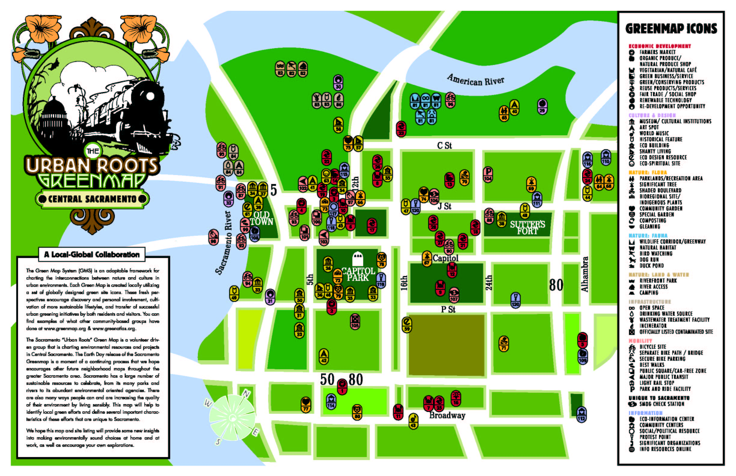 Sacramento Green Map 2004 |
|
|
Background As mentioned above, the first Sacramento Green Map opted for a low-tech or traditional cartographic solution for production of the map. Original submission of Sacramento Green Map sites ranged from a scribbled note with site information to elaborate AutoCAD drawings of a collection of sites from partner organizations. When putting the 2004 Green Map together, the largest and most time consuming task was to collate all of the data in a consistent and useable format. Most of the information collected for each site included simple tabular data and varied in completeness. On the occasion, spatial data such as a latitude and longitude was given for a site. For the next publication, partner organization would like to provide GPS points and tabular information in a database format. Groups often organize a day-long event where they go out and collect sites by walking or biking around the pre-determined area. However before they can submit data, a methodology and data standards need to be developed to ensure consistent data collection and to shorten the time of data processing. With this in mind, I began to search for other groups training methodology and for simple tutorial about GPS Photo-link. Internet searches and the help for GPS Photo-link provided simple how-to instruction for coupling GPS and digital photography (Cusick, Joel 2003 and GPS Photo Link online help). | |
|
Methods To test whether the use of a recreational grade GPS coupled with the GPS Photo-link would be appropriate for data acquisition for this project, I decided to first try to collect GPS points and photograph each site. Steps I took include: 1. Selecting several sites from the published Sacramento Green Map site list for initial collection of GPS data. 2. Plotting an easy course for collection each of data (allowing for travel by bicycle). 3. Collection of data. 4. Downloading data and processing of data with GPS Photo-link. | |
|
Results Eleven GPS points were collected for this project included:1. P&M Tools 2. Old City Cemetary 3. Southside Community Garden 4. Site of the Sunday Farmer’s Market 5. Southside CoHousing Project 6. Solar Sculpture at the Crocker Art Musuem 7. Capital Park 8. Fragrance Garden at the State Library 9. Millennium Tree at Caesar Chavez Plaza 10. California EPA Building 11. Sacramento International Hostel | |
|
Figures and Maps Sample output files for the data collection are shown below | |
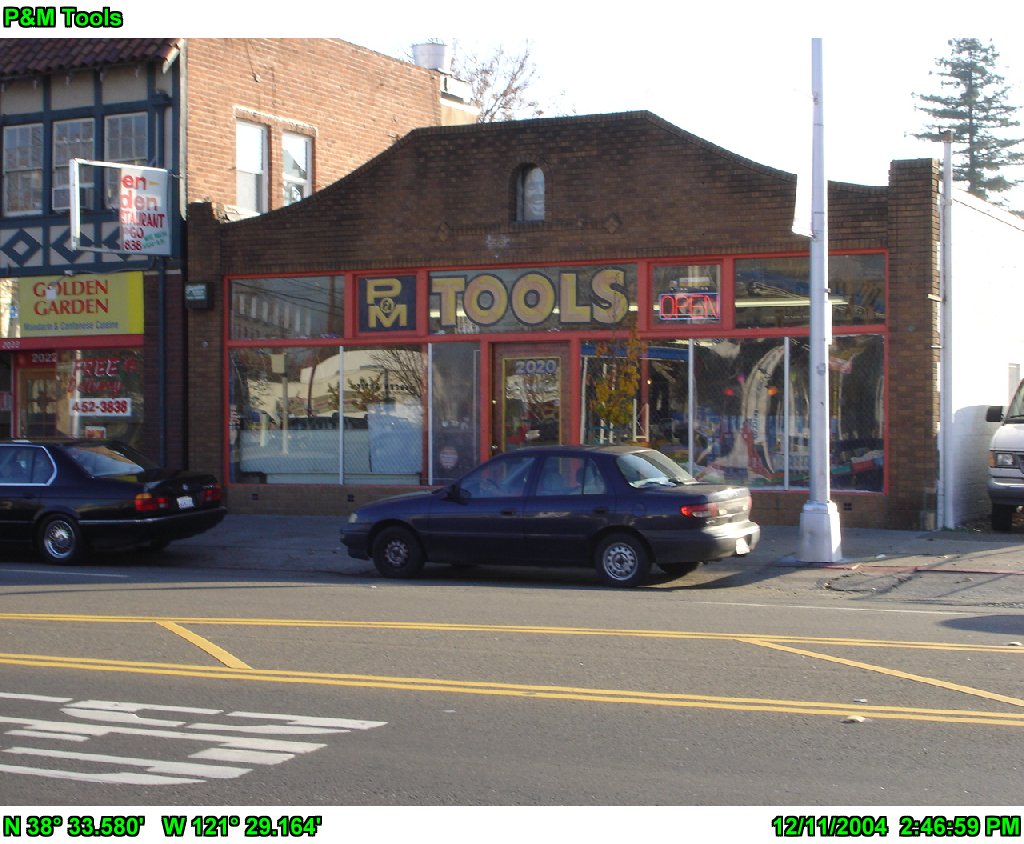 P&M Tools, the first data collection site |
|
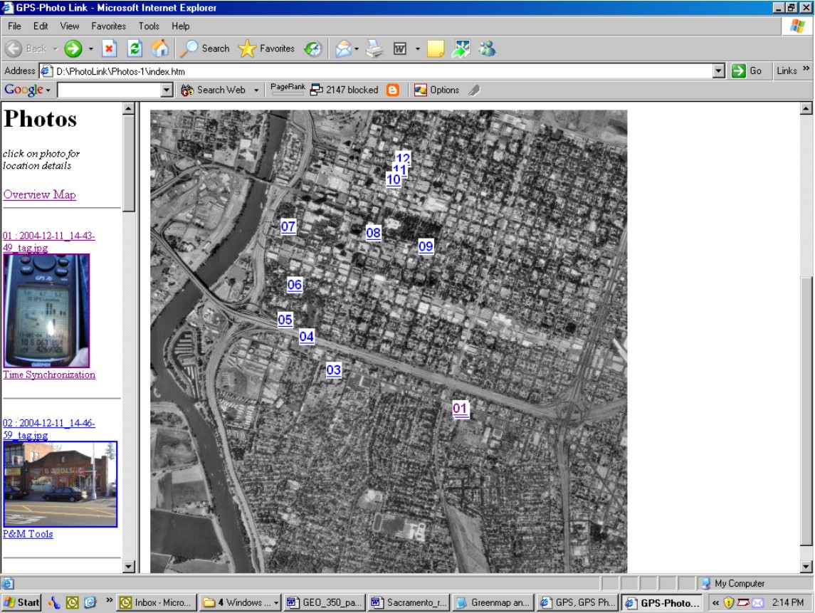 The overview map created by GPS Photo Link |
Analysis The collection of GPS data using my Garmin unit were satisfactory in terms of accuracy as well as ease of collection and processing. By comparing the location of each point against the location on the original map, it was easy to see that accuracy was indeed high enough for our purposes. In addition to high accuracy, the process of using GPS Photo-link was easy enough for me to process data and it appears that it would be easy enough to develop a standard for data collection. Once a methodology is developed to train volunteer groups, data collection could be simplified. However, there could be issues with submissions that are not evident and will not manifest themselves until processing of data from other groups begins. |
|
Conclusions Continued use of GPS Photo Link will provide greater familiarity with the software and will allow for better training of the other groups interested in using this technology. Once I am more familiar with the software then I can begin to compile a basic training manual for other groups to begin their GPS data collection. | |
|
References Cusick, Joel, 2003. What you need to hitch GPS and Digital Photos., Accessed online at http://165.83.48.21/rgr/rgr2.htm (NPS-wide Intranet). Garmin Corporation, 1997. Garmin GPS 76, Owner's Manual and Reference Guide,Kansas: Garmin Corporation | |
 | |