| Title Exploring the Effie Yeaw Nature Center Using GIS | |
|
Author Jake Petersen American River College, Geography 350: Data Acquisition in GIS; Fall 2004 Contact Information: jakepetersen@gmail.com | |
|
Abstract This paper is focosed on and area known as the Effie Yeaw Nature Center. It follows the process that I used to gater data, apply the data to my needs, and use the results to help me understand the layout of the land and trails in the Nature Center. | |
|
Introduction For many, getting outside and walking around is a great way of relaxing. Unfortunately walking around residential streets gets sort of boring. Luckily for me, not to far from where I live there is a nature center that is full of trails to walk on. The Effie Yeaw Nature Center has roughly five miles of trails to explore. While it isn't huge it at least provides a more relaxing surrounding. I want to take a look at this area of land and get a more complete feel for it using GIS and GPS. Doing this will allow me to preplan my rout to get the most distance without having to backtrack on any of the trails. | |
|
Background The Effie Yeaw Nature Center is a 77 acre wildlife preserve. Located within the American River Parkway. It was finished in 1976, and has been a great relaxing and educational resourse for sacramento residents ever since then. The trouble is that I was unable to find a quality map of the area, so I decided to create some maps of the area on my own. | |
Here is a map showing the location of the nature center, along with a photo of the area.
 |
|
|
Methods To begin my project I first started to collect my data. For this project I would need some aerial photos, Lidar information, and some GPS waypoints. Once I had all of that I began to process the data. That would be a three step process. | |
| First: I inserted my aerial photos into arcmap to be used as a background. |
|
| Second: I added the Lidar information into arcmap. Lidar means LIght Detection And Ranging. Basicaly a plane flys over an area and shoots a laser down at the ground. The plane then has receptors that can measure the amount of time that it takes for the light to bounce back. From that they can figure out how far away the ground was. When compared to the known altitude of the plane, the elevation of the ground can be figured out. From this information I created a hillshade for the area of interest. I also created contour lines, which will help me get a better feel for the area. |
|
 |
|
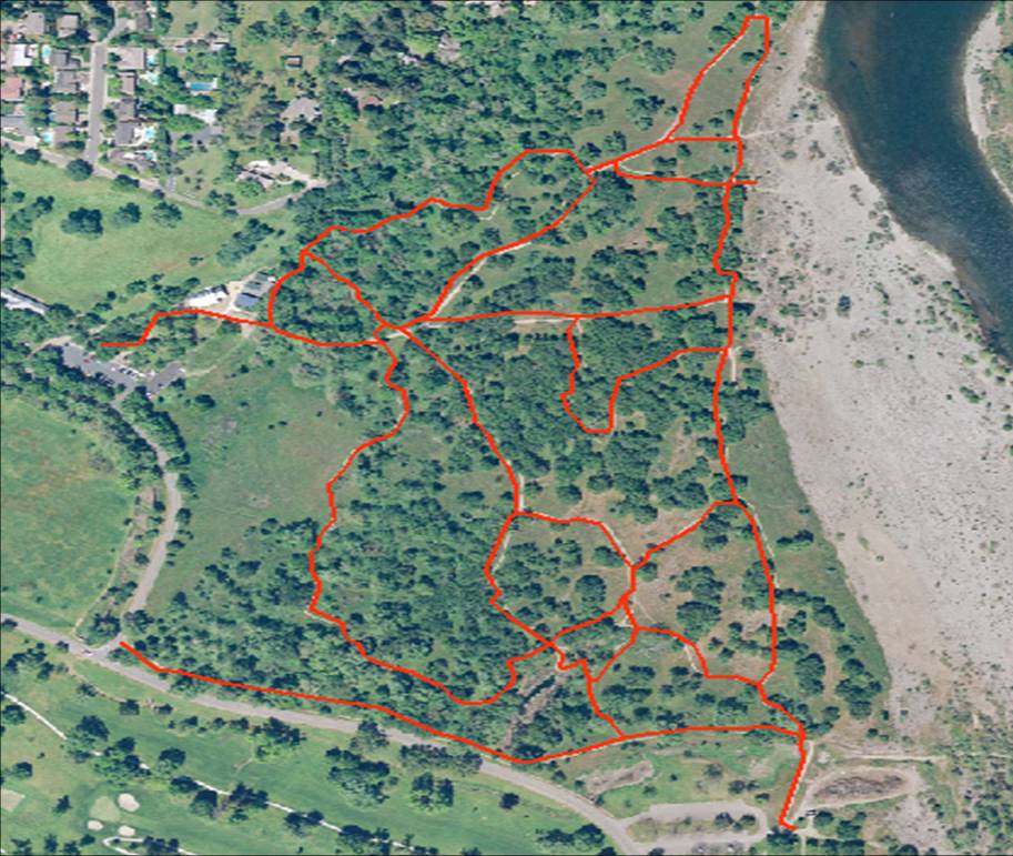
| Third: I took a GPS unit out to the area to make tracks of the trails in the Nature Center. This was the most complicated step. Once I got the GPS info from the GPS and into arcmap, I ran into a few problems. I had hoped to lay the GPS tracks over the trails that can be seen on the aerial photos. Doing this would enable me to be able to "see through the trees" on my map. Unfortunitaly this process didn't work out as well as I had hoped for. |
|
|
Results Overall things went very well for this pjoject. From the data I gathered, I was able to produce a large map that I could use to analize the Effie Yeaw Nature Center. This will help me in planing out a regular rout of travel based upon certain natural fetures. | |
|
Analysis Although the results were pretty good, I would have liked to have seen more from the data that I gathered. One of the main difficulties that I had was that the area in question was just to small. The GPS points were not as acurate as I needed them to be. I was trying to mark trails that were as thin as 18 inches and the accuracy of the GPS was only as good as about 10 feet. (It was also overcast on the day that I gathered my data) Even without the GPS data, my map will still provide a great deal of information for me to use. | |
|
Conclusions The next time that I undertake a project like this I either need to find a larger area to look at, or use a more advanced GPS. A 10 foot error from the GPS wouldn't be very noticable on a smaller scale map. The second option dosen't seem very likely, because as of now I don't have access to a GPS that has the accuracy I would need for a project like this. | |