Title
The Adventure of
Fault Lines in
Author
Geography 350: Data Acquisition in GIS, Fall 2004
Abstract
This project was to explore research and maps of fault lines in Auburn Dam site. Completed the creations of the coordinates from the GPS receiver where fault lines were found. Then, data stored into ArcGIS and created shapefile points on the aerial view of the site.
Introduction
Have you ever though why the Auburn Dam site has been abandoned? You probably have heard some of the reasons why constructors stopped building it. One of the reasons I had in mind for this project was earthquakes. While that thought came, I was thinking about what kind of earthquake? Fault lines came to thought. I decided to do some fun adventure in finding the fault lines. I went out to some of the libraries I could find. Map was found with features of fault lines over the Auburn Dam’s foundation. Brought my GPS receiver and started my adventure!!
Click here to enlarge view.
Background
I used to work for Bureau of Reclamation, the dam owner
throughout the
Methods
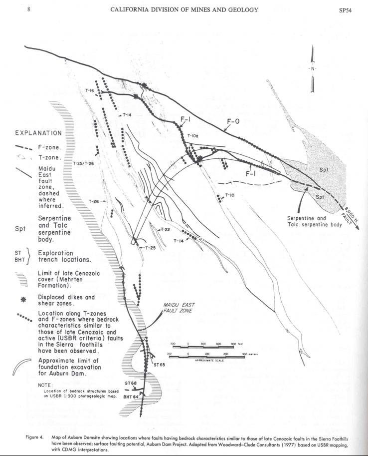
For a start of this project, I went online to find some ideas as to where to find the maps of the fault lines in the Auburn Dam site. Finally found the information I needed. I called the California Geographical Survey, seismic hazard mapping program library and spoke with Dale Stickney, the librarian geologist, to set an appointment for me to come over and get the publications. It was an interesting experience at the library where they keep records all through history. Dale found some records I needed and I paid some of the publications he provided. It was kind of expensive, but it is worth the work.
I spoke with my father who works
for the
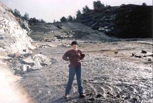
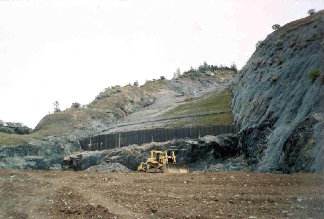
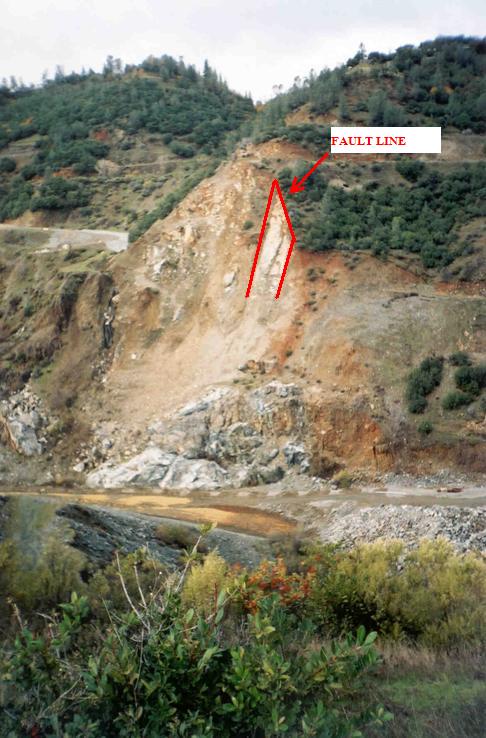
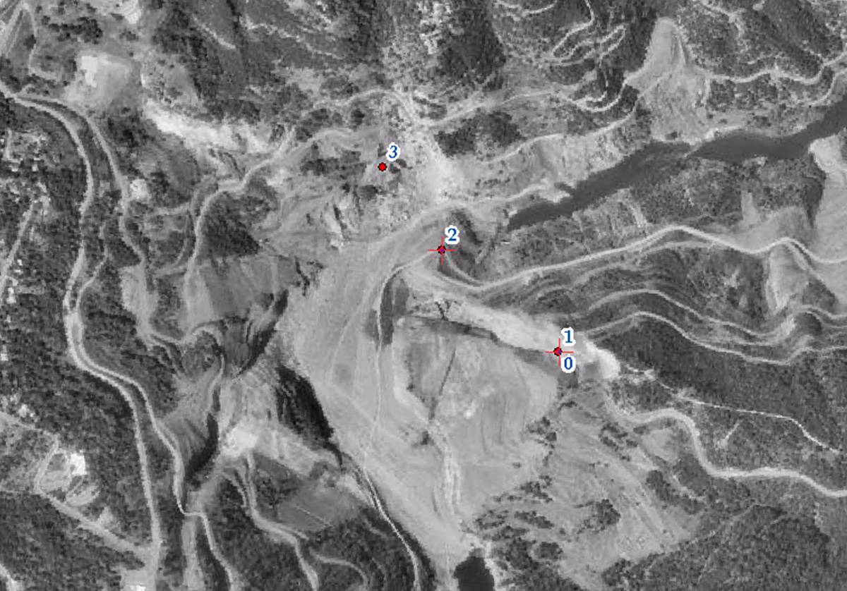
When the day came, we went out to the site and I had my bag and GPS receiver with me. The map, of course, was with me. Three of us walked to the east side of the dam foundation. It was somewhat steep. I took some pictures along the way. When we finally got to the top of the dam foundation, we found some rocks, serpentines, where those types are most likely effect of earthquakes. Serpentines are fragile and easy to slip rocks and they are considering fault lines. We found the fault lines and I started my GPS receiver with waypoints. I did four points along the way back down.
Click here to
enlarge view.
Click here
to enlarge view.
Results
At the end of the project, I had the data coordinates from GPS receiver transmitted through VB Garmin 2.7.100 program to convert it to shapefile points. When that was done and created, I downloaded a black and white aerial view of the Auburn Dam site and change the file to “.jpg” so that the ArcGIS program can read it or be able to “add” it. I finally added the point shapefile I made for fault lines and then adjusted the points in the right position.
Analysis
The results are awesome. I did have a hard time finding resources to match what I was looking for. For example, I couldn’t find maps that display the fault lines at the Auburn Dam site until I spoke with the librarian. Before I had decided to create coordinates of the fault lines on my own, I thought I could go out and search for the fault lines with the coordinates from research and insert it into the GPS receiver. Then just follow the waypoint along the way, but I was wrong. It turned out that the sources does not have the coordinates at the time. The other difficulties I also had with the project was having to bring the data from the GPS receiver into the VB Garmin 2.7.76 which was the old version and when I tried to open the shapefile that was created, nothing appeared in ArcMap.
Click here to
enlarge view.
Conclusion
For this project, I really did had a blast and wanted to do more adventures like this in the future. Next time I will make sure resources are available and that everything will be updated such as the version I had problem with above. The updated VB Garmin version is 2.7.100 instead of 2.7.76 which was pretty old. The shapefile, after the updates, did appear in the ArcMap which is great!
References
Bennett, John H. 1978. Foothills Fault System And The
Movement – Foothills Fault System. 175-182.
Dam site. Special Publication 54. 8.