Exploring Sacramento's Lost Lake and the Possibilities for Restoration
Author Information
Jim Miller
American River College, Geography 350: Data Acquisition in GIS; Fall 2005
jmiller@pe.com
Abstract
Until about a century ago, downtown Sacramento had a large body of water at its northwest corner. Known originally as Sutter Lake, it also was referred to as Sutter Slough, China Lake and, increasingly, China Slough. As its condition worsened, some people referred to it sarcastically as "Lake Como," after the scenic lake in northern Italy. My goal was to use GIS to analyze China Slough in relation to modern-day Sacramento. Such a study serves the historical record.
But this analysis also takes a forward-looking approach. With the region's burgeoning population, its shortage of recreational amenities, safety risks along the American and Sacramento rivers, as well as efforts to improve the appeal of Old Sacramento and Downtown Plaza, the study explores the question of whether it makes sense to restore the lake at or near its historical footprint.
Introduction
As the Gold Rush turned Sacramento from a sleepy outpost into a bustling crossroads, a day off from working at the waterfront or in the blacksmith's shop might have included spending time at Sutter Lake. Historical texts describe a lake where people fished or rowed boats. What happened to the lake? Should Sacramento bring it back?
Background
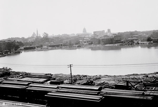
The slough originated from near the confluence of the Sacramento and American rivers, extending east roughly to 6th Street between G and I. The lake covered 50 acres and was more than 40 feet deep.
The lake's slow decline began in the middle part of the 1800s. In 1850 it exacerbated the disastrous flood that inundated Sacramento. Then in 1862, the Sacramento County Board of Supervisors gave the lake to the Southern Pacific Railroad, which wanted to build a new depot closer to downtown.
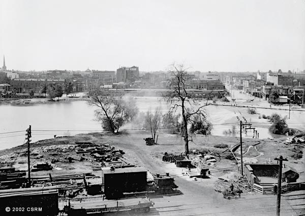
The railroad steadily filled in the lake. By 1869, 20 acres had been reclaimed at the lake's western end. In 1880, the railroad filled in the neck of the slough connecting to the river. The work allowed Second Street to connect to the depot.
Another 15 acres were gone by 1890. By 1900, the railroad had reclaimed the lake all the way to Third Street.
With its river water supply eliminated, the lake/slough increasingly turned into a stagnant swamp. It was the lowest point in Sacramento, and it became a repository of waste of all kinds. The railroad did its part, dumping old cars and scrap into the slough. Dead animals and food refuse were other ingredients in the malodorous bouillabaisse. The area hosted a large Chinese immigrant population, many of whom lived on houses built above the lake's shore. Waste often went through a hole in the floor into the water, according to historical records.
To fight the lake's smell, the city planted 300 eucalyptus trees along its banks. It planted another 2,700 trees in 1877.
As the lake's condition deteriorated, newspaper columnists, particularly at the Sacramento Union, pressed a campaign to fill the slough.
"Disease ranks from every square foot of its poisonous mud upon its banks, and yet, there it is suffered to remain month after month, year after year, adding as time passes, constantly to its death-dealing potency, and operating more and more to increase the mortality bills and lessen the average health throughout the city," the Union wrote in 1877.
In 1878, some civic leaders proposed pumping in clean water. But the Board of Trustees never seriously considered the plan.
"Unfortunately, the then-current political philosophy held that municipal government should do as little as necessary so that Sutter Lake eventually became the Sutter Nuisance," wrote John C. Jenkins in a 1964 history of the lake for the Sacramento Historical Society.
Business leaders also had an interest in the matter. Sacramento was trying to attract tourists and residents. Civic boosters complained that the slough, among the first sights -- and smells -- encountered by disembarking passengers, hampered their efforts.
In 1904, local leaders signed a deal with the railroad to fill in the slough entirely. The railroad began dumping hundreds of tons of Sacramento River sentiment into the slough.
It took four years -- from 1906 to 1910 -- and more than 1.5 million cubic yards later, but by 1911 the slough was no more.
I relied heavily on histories of Sacramento County available in the Sacramento Room at the library's central branch. The project also relied on several on-line sources. I acquired historical maps from Sacramento History Online. There is a history of the region at
Western Country Living Center. The Sacramento Housing and Redevelopment Agency also has a report mentioning the lake at Marois (2003).
I obtained Sacramento County road and census tract shapefiles from ESRI's census web site and I obtained parcel data from the Sacramento Area Council of Governments' regional GIS clearinghouse.
Methods
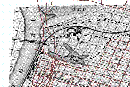
Available historical maps of the downtown area were in Adobe Acrobat format. I converted the documents to .tiff format by printing to an image writer. I then added the maps to a project containing a TIGER file of Sacramento County roads. I georeferenced each map -- published in the years 1873, 1906, 1907 and 1917 -- to the street data.
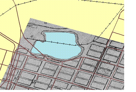
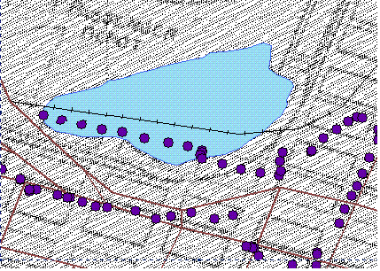
Using ArcGIS editor, I created polygon shapefiles for each year of the slough by tracing the outline of the lake on the newly georeferenced maps.
I also wanted to confirm the maps with the historical account of the lake's location. With a GPS receiver, I followed as closely as possible the boundaries of the lake as described in various historical texts.
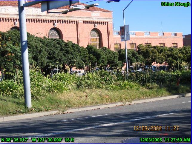
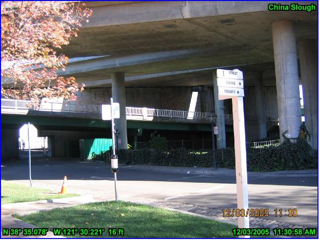
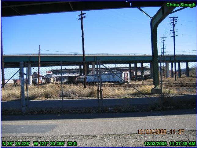
Using GPS-PhotoLink software, I linked my track to several digital photos of the former slough area.
Results
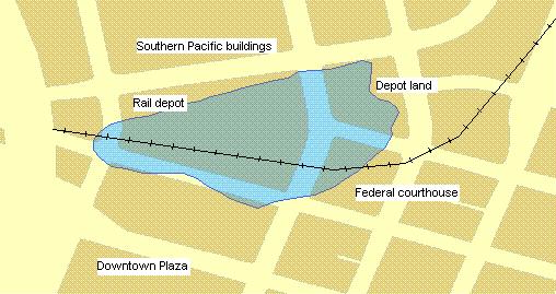
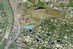
The results can be divided into two categories -- the historical record and future possibilities. From a historical standpoint, the analysis showed what has become of China Slough almost a century after its filling in. Its west end is now occupied by the California State Railroad Museum and the interchange between I Street and Interstate 5.
The main part of the former slough hosts the railroad depot. The former Southern Pacific shops -- from where passengers used to disembark into a slough-borne stench -- sit behind a fence as government leaders try to figure out what to do next (a situation not unlike the deliberations about the slough more than a century ago).
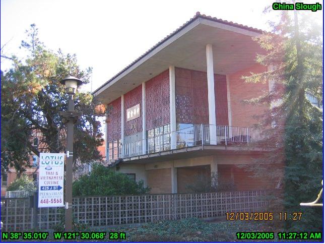
There also are reminders of the Asian community that once lived along China Slough. In 1889 and 1901, fires destroyed many of the residences along the north side of I Street along the slough. Today, the north side of I Street is occupied by the federal courthouse and the county jail. But the south side features an Asian community center and other Asian-themed buildings and restaurants, evoking the roots of the area.
After plotting as accurately as possible the slough's footprint, I overlayed census track data. I linked the tracts to SF1 population data. I identified all tracts that were within a mile of the former slough. I then compared those figures to the population within a similar distance of other recreation-oriented bodies of water in Sacramento County.
|
Name
|
Size (acres)
|
Population within one (1) mile
|
|
China Slough
|
12.84
|
22,681
|
|
Southside Park Pond
|
4.3
|
27,650
|
|
|
Lake Natoma
|
597
|
74,136
|
|
Rancho Seco
|
362
|
6,803
|
Finally, the project yielded a map of what currently occupies the slough's footprint.
Analysis
The main challenge of this study was finding accurate maps and descriptions of the slough's location. What you see here is a best estimate. Historical descriptions describe the slough as covering about 50 acres at its peak size. The largest slough generated by this analysis -- from an 1873 map -- was about 14 acres. That suggests that the maps of the day were off slightly.
The lack of access to the entire lake footprint was also an obstacle. It would have been useful to be able to walk the entire boundary of the lake. That is a possibility for future study (with local government's permission).
In addition, the presence of the federal courthouse and county jail in the study area imposed some security concerns. During the GPS-Photolink component of the project, I decided to limit his photos of the area to avoid unnecessary law enforcement interest.
Conclusion
China Slough is a fascinating part of downtown Sacramento history. Hopefully this project gives downtown workers and residents an idea about one part of the area's past.
Is it practical to restore the lake where it was? It does not seem to be so. There is a railroad depot, federal courthouse and other buildings covering what once was the slough. The freeway covers parts of the lake's western half.
But how about nearby? As noted, development plans for the area north of the railroad depot remain in flux. Development could incorporate a new-and-improved China Slough (or something of a different name). As of 2000, there were almost 23,000 people living within a mile of the old slough. Thousands of additional residents could fully justify a slough. Unlike the old China Slough, a new one could actually improve the region's quality of life.
Subjects for further research include exploring the level of toxic contamination on the land north of the current rail depot. In addition, there needs to be an examination of how any inlet off the American or Sacramento rivers would affect the region's flood protection. A weir might be necessary.
References
Davis, 1890. An Illustrated History of Sacramento County. Chicago, Ill.
Howell-North, 1960. History of Sacramento County. Berkeley, Calif.
Jenkins, John C. and J.A. McGowan, 1966. Sutter Lake or China Slough. Sacramento Historical Society.
Yee, Alfred, Summer 1994. What Happened to China Slough? Sacramento Historical Society Golden Notes 40:2