Title
Finnon Lake Campground
Author
Guy Barritt, Jr.
American River College, Geography 350: Data Acquisition in GIS; Fall 2006
Abstract
Finnon Campgrounds started out of a prior commitment I made with the Mosquito Volunteer Fire Department to produce a map for the campground they purchased from the California Department of forestry. The project actually started prior to starting the Data Acquisition Class. I made the decision to combine the two commitments into one to save time and energy that would be wasted on multiple projects. Having the software available at home, work and school gave me ample ability to work on the project anywhere. We had good GPS equipment at work and along with the Garmin GPS76s from school I had my bases covered.
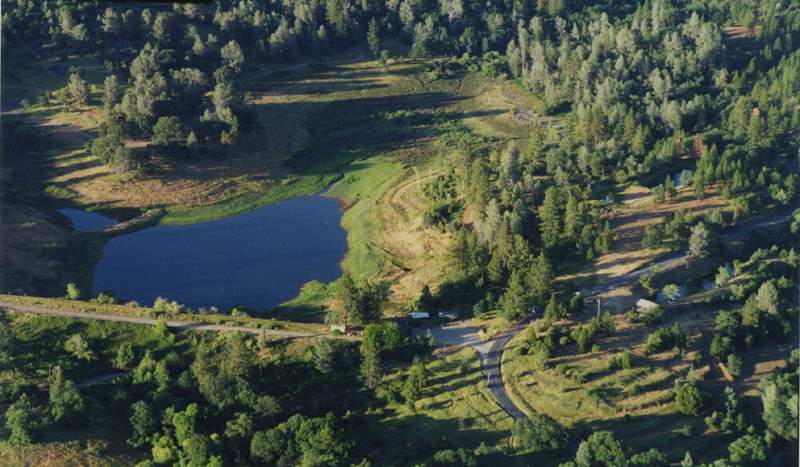
Finnon Lake aerial image from private aircraft. Looking east across dam.
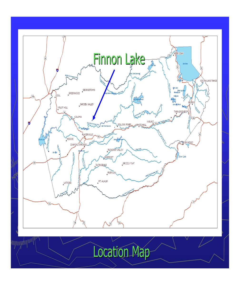
Location map of Finnon Lake
Introduction
I’ve always had an interest in maps throughout my whole life. I became a pilot at the age of 18, which introduced me to Aerial maps, something I found very interesting. Everywhere I have lived I’ve always had a 7.5 USGS Topo map, which I still have today. Now armed with the ability to produce high quality maps as a profession, I am always eager to produce my wares. Volunteering is a major part of my life. Offering to produce maps for the Volunteer Fire department goes right in line with that purpose. Finally, combining both of these projects into one was a win – win for me.
Background
Located approximately 5 aerial miles due north of Placerville, California, is the small community of Mosquito (Swansboro, to others). Nestled just above the southern edge of the Georgetown Divide, a geographic area created by the North Fork and South Fork of the American Rivers flowing into the Sacramento River. The geography of the area is marked by deep canyons created by both rivers, offering a natural barrier to development for hundreds of years until the mid-1800s. Between the 1850s and 1940s it was dominated by a vigorous harvesting of the 6 foot sugar pines that existed in the area. Passing through Mosquito, for 75 years travelers made the trip into Pino’ Grande, (pronounced “Pine-Oh-Grande”) once the largest wood processing mill on the west coast. Finnon Lake was created to support local farmers and sawmills in the area up until the early 1900s. Mosquito, now a very thriving community isolated by the American river canyon, flourishes today. Finnon Lake was purchased by the Mosquito Volunteer Fire Department in 2002, has been converted into a lake campground area for use by visitors and locals alike. My project is to produce a detailed map of the Campground and property.
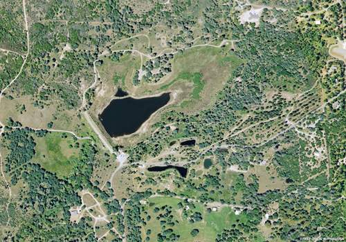
Finnon Lake and area; AirPhotoUSA world referenced raster image
Methods
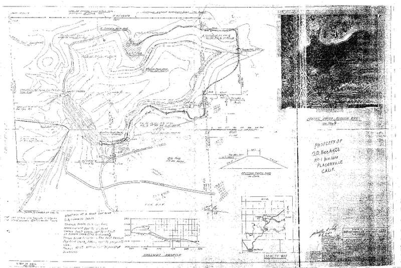
The process proceeds along classic lines, determined the maps purpose, and intended audience. Obtain the necessary data for the project. Process the data and develop it into the necessary document required by the requesting party. The initial purpose of the map was to provide site map for a use permit required by the El Dorado County Planning department. Also it is to be used for a development of a brochure for the park. The next phase of the project was to obtain as much documentation on the lake as I could fine. I started with the Mosquito Volunteer Fire Department in Mosquito. I was given a 3 inch binder of documents of the history of the Lake and its development by the California Department of Fish and Game. Along with the binder were two sets of plans, one for the Fire House Country Kitchen, and the drawing for Finnon lake produced by the Calif. Dept. of Fish and Game. Having access to a large format scanner, I scanned the documents and maps for use in digitizing later in the process.
Scanned California Department of Agriculture Natural Resources Conservation Service DrawingThe next step was to locate as much digital data for the project as possible. My employer, El Dorado Irrigation District, has access to county data files, high resolution aerials, which made data mining very simple. Armed with all this data, my next step was to digitize the drawing in AutoCAD Land Development Desktop for use in generating surface TIN’s (Triangular Irregular Networks) in hopes of creating DEM’s or Grid files for surface analysis. I proceeded to overlay the raster images of the drawing onto a world reference .tif, and digitized the contour lines of the lake. What happened next was a bone of contension for me, the files were scaled wrong. Apparently, even though I imported the raster images as a world file set to NAS83, California State Plane II feet. The scale turned out wrong when importing the information into ESRI. I worked on the files for about a month trying to resolve the issue. I finally gave up and utilized the USGS/Slt1010.dem file for generating the contour lines for the project.
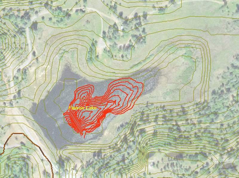
Section lines created from the USGS/slt1010.dem file
Aerial showing the Green contour lines created from the slt1010.dem file and the AutoCAD Created .dem files imiported shape files.
The scale should be at least 2 to 2.5 times larger. Both of these contour line features were created from the same world .tif file.
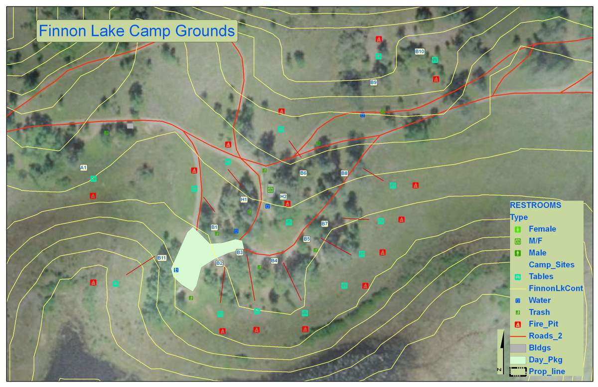
The next phase was to gather GPS data for the lake. I started by collecting points for the roads, then the park details, i.e., facilities, benches, fire pits, water outlets--all in all, collecting over 400 points within the park. Processing the point data for the lake turned out to be the easiest part of the project. The points were downloaded from the Trimble GeoXT using Trimble GPS Pathfinder Office 2.90. Post correcting the point to improve their accuracy, and them exporting the files as .shp file into ArcInfo. I arranged each point set into their prospective layers. Connected the dots for the road detail, assigned symbols for the facilities, campsites, water outlets, benches, and fire-pits. The next process in digitizing was to draw an accurate property boundary for the lake. Thinking that I had all the drawing information I required I proceeded to draw the boundary in AutoCAD.
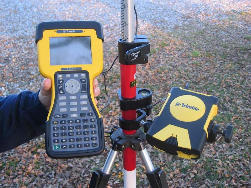
Trimble GPS Pathfinder Pro Software
Trimble Ranger Data Recorder along with the Trimble ProXH antenna and receiver. Both are BlueTooth interfaced.
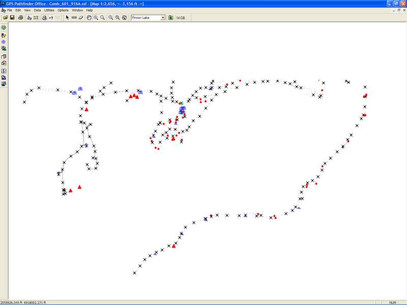
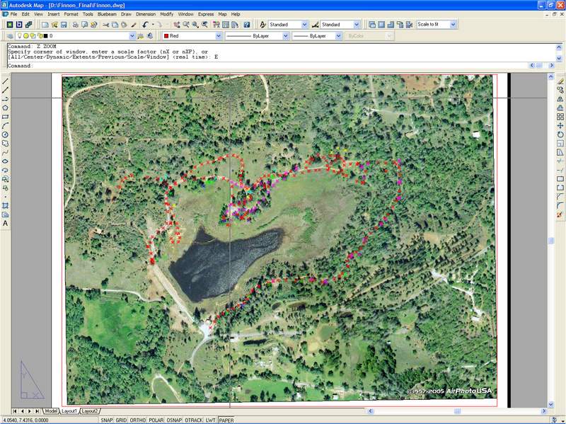
Finnon Lake aerial with all collected GPS points illustrated
Finnon Lake Campground area enlarged with symbols
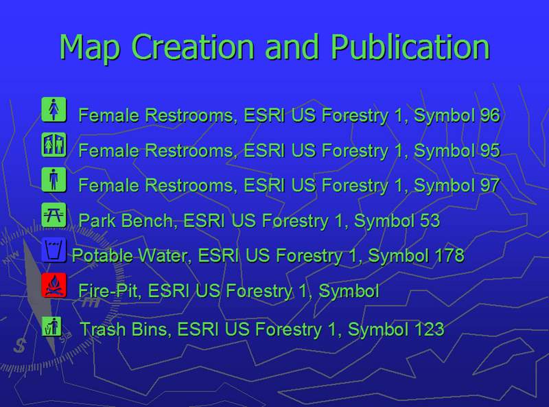
Point Symbol Definition
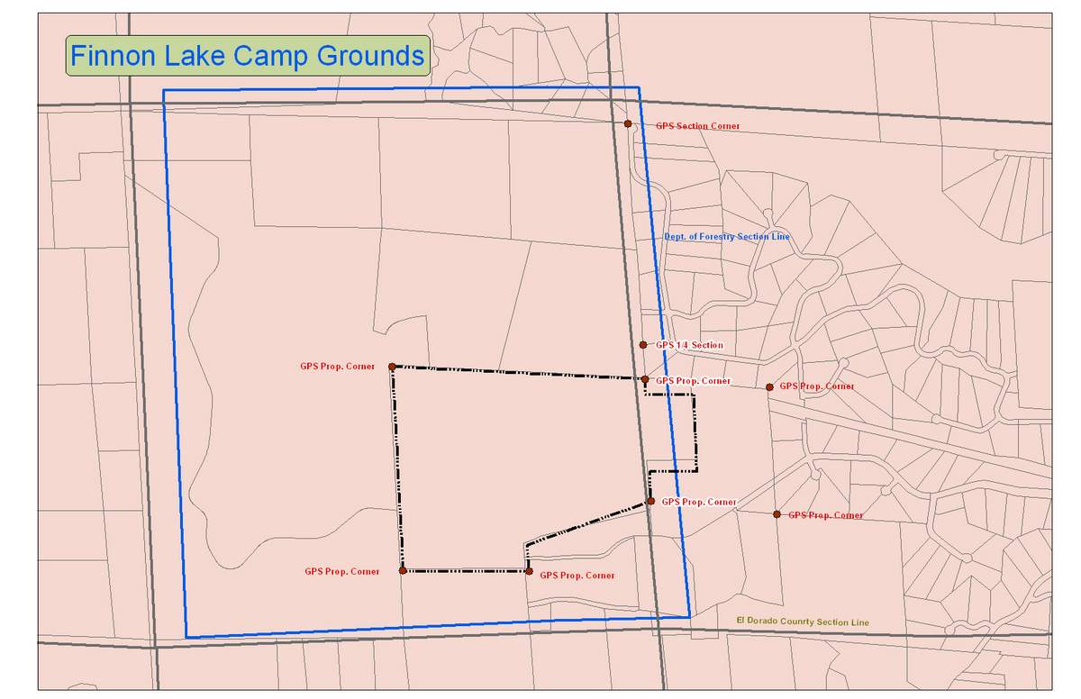
Drawing the boundary was not the problem, it was deciding on what data base to match it to. I had three references in which to build the data on. Using the Deed information to furnish the bearing and distance information to draw the property boundary was easy. Next importing the information into ESRI turned out to be easy as well. What was plaguing the process was that I had three data references to pin the line work onto. One was the section line information provided by USGS, the second, was the parcel information I found from the Land Survey Information System (http://www.geocommunicator.gov/LSIS6/map.jsp). The information varied as much as 30 to 50 feet from corner to corner on the section line information. To add to the mix I also had the El Dorado County parcel information shape file (parwdata.shp) and it did not match either of the section line information files. Armed with my trusty GPS unit I proceeded to return to the lake area and locate as many corner post and section corner associated with the property as I could find. See detail Maps. As it turned out the county parcel data information was the most accurate. So I went with the county parcel data information, which had some minor property boundary limits issue.
Section Line Data; Blue: US Dept. Forestry Section Line Data; Brown: USGS Section Line Data; Dash-Dot line: Finnon Lake property
boundary with Red Monument GPS points. Notice how much closer the County parcel data is to the GPS points. From this display a
decision was made to use the GPS Monument point with the County parcel data and discard the section line information from the USGS and USDF.Location Data:
Title: Finnon Lake Campgrounds
Location: WGS84 -- 120° 45’ 4.34”W, 38°47’57.34”N
Location NAD83 CalII F – 6,917,583.11, 2,054,821.47
Datum: NAD83
Elevation: 2,245 feet
Time Zone: (GMT-08:00) Pacific Standard Time
Projection: NAD83, California State Plane II feet
Results
The map turned out well. I was still disappointed that I could not get the Topo line conversions to work in creating new DEM files. The map has been presented to the Mosquito Volunteer Fire Department with good feedback. The document will be utilized as a brochure for the park. I am proceeding to generate the AutoCAD Site map for the county use permit, which takes a different format from that of the ESRI Map.
Analysis
What looks like to be a simple job often times turns out to be hours of investigation, analysis, and field work. I still have a lot to learn on processing DEM, TINS, and GRID files for surface analysis. The most frustrating part of this project was just that. The data point collection was not a problem. Transferring the point data into ESRI was simple and direct.
Conclusions
Cross check data files for accuracy and then again. Once you think your are satisfied, cross check them again. I still have a lot of work on data organization and file management. Database organization could also use some work. I do not believe my data files were as efficient as they could be. I did not use a geodatabase to build the data. The files were simple shape files that were constructed and displayed.
References
- http://old.casil.ucdavis.edu/casil/ -- Dem Files
- http://data.geocomm.com/catalog/US/61069/sublist.html -- County Data
- http://photomapper.com/ -- Rasters Images
- http://www.co.el-dorado.ca.us/ -- Dem files, County Data
- http://www.ngs.noaa.gov/cgi-bin/datasheet.prl -- Bench mark datasheets
- http://www.geocommunicator.gov/LSIS6/map.jsp) – Section line boundry files.
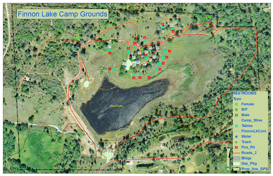
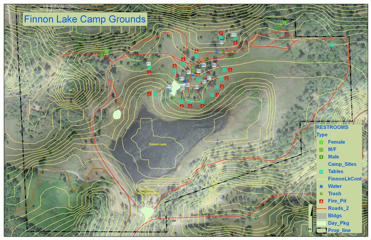
Final map submitted to Mosquito Volunteer Fire Department