It's So Amazing | ||||||||||||||||||||||||||||||||||||||||||||||||||||||||
AuthorJody Johnson | ||||||||||||||||||||||||||||||||||||||||||||||||||||||||
AbstractThis is the summary of the entire paper. All the following sections should be represented by a single sentence or two, with the exception of background and references. Write this last. | ||||||||||||||||||||||||||||||||||||||||||||||||||||||||
Introduction"The Amazing Race" is a race around the world that challenges teams physically and mentally and also tests their relationships with each other. Each two-person team must overcome stress, fatigue, hunger, and fear while accomplishing strenuous tasks in difficult environments. Working together with limited funds and little time, in far-flung cultures with various languages and customs, each team competes for the chance to win one million dollars. | ||||||||||||||||||||||||||||||||||||||||||||||||||||||||
Background"The Amazing Race" premiered on September 5, 2001; the timing was unfortunate as the events of September 11th put a damper on foreign travel. The show survived, however, and the 10th season finale aired in December 2006. The 11th "All-Star" season was already filming as this project began. I was hired by CBS to select the route and identify the challenges for Season 12, set to air in Fall 2007.
The Basics: Teams of two travel along a route that is broken into 11-13 legs. Teams usually travel between countries by airplane, but often drive themselves, take a cab, or obtain some other form of local travel within countries. After a set of challenges, teams race to a pitstop that usually marks the end of each leg. The last team to arrive at the pit stop may be eliminated. There are usually two non-elimination legs in each round, but the teams are penalized in some way; taking away possessions and money is the most common form of punishment. Challenges: There are three types of challenges along the route. Roadblocks must be performed by one team member. Each team member must complete an equal number of roadblocks during the race. Detours are tasks that both team members must complete. Both roadblocks and detours occur on every leg. Fast forwards do not occur on every leg. Only one team may take the fast forward, but no one is required to take it at all and they are often skipped. The first team to complete the task in the fast forward may skip the remaining challenges and travel directly to the pit stop. | ||||||||||||||||||||||||||||||||||||||||||||||||||||||||
MethodsThere is no existing or downloadable collection of "Amazing Race" data and, unfortunately, travelling the world with a Garmin wasn't an option for this project. Data for all 10 seasons was collected by studying the official website and tv.com webpages. Lists of locations and challenges were manually collected. | ||||||||||||||||||||||||||||||||||||||||||||||||||||||||
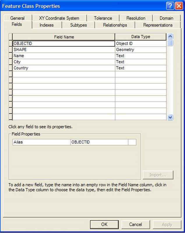
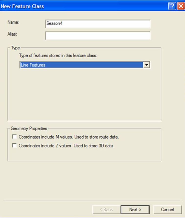
ArcCatalog was used to create a personal geodatabase, where all the feature classes needed for the project would be stored. The "Locations" feature class was created first, with field names and types defined. Fields in the Locations feature class are: Season, Leg, Name, City, Country, Roadblock, Fast Foward, Detour. Tables were also created for the challenges. The three distinct types of challenges were broken into three feature classes, Roadblocks, Detours, and FastForward. Each challenge feature class contains two fields: Name and Description, with the Name field to be used in a join with the Locations feature class in ArcMap. Although tedious, challenge data entry was a straightforward task. Compiling location data was much more challenging. |
 |
|||||||||||||||||||||||||||||||||||||||||||||||||||||||
|
ESRI's set of world data was used to map many of the locations. First, a world basemap was added to an ArcMap window. Although the scale is too small for detailed views of locations, for showing routes over large distances, it is ideal. 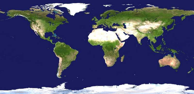 Next, the ESRI world city dataset was added to the ArcMap document. Although it did not contain every location needed, it could be searched... 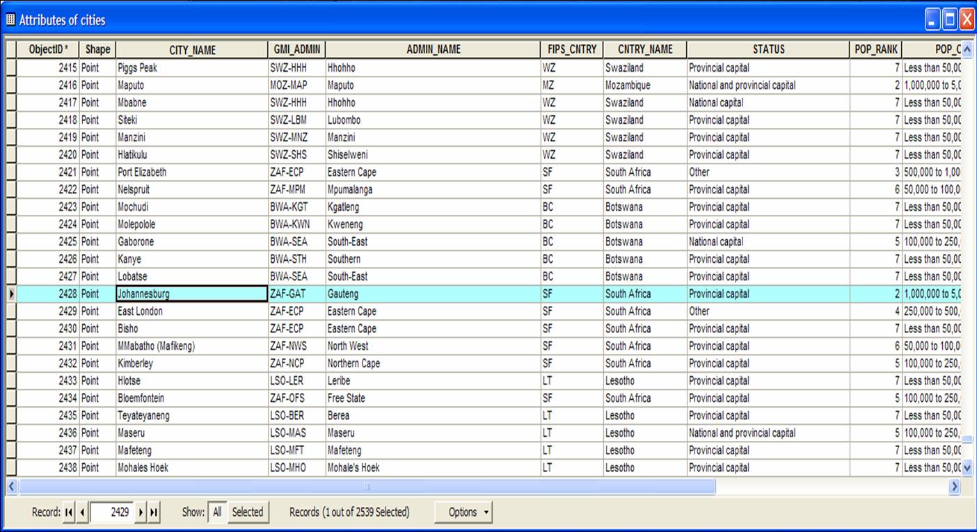 ..the location zoomed to on the screen... 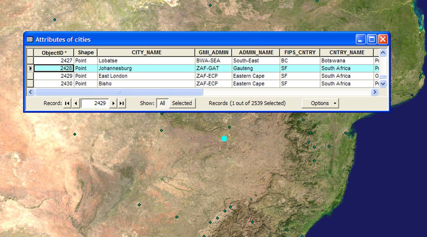 ..and then an ArcEditor system was used to add the location to the Locations feature class. Not all of the remote locations could be identified, even with the use of web sources 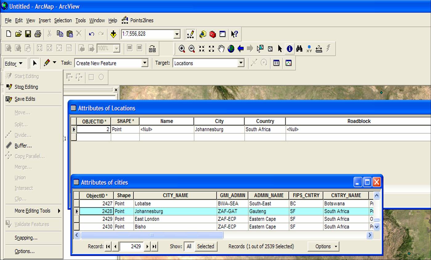 | ||||||||||||||||||||||||||||||||||||||||||||||||||||||||
|
The Locations feature class was joined to the three challenge features in ArcMap. 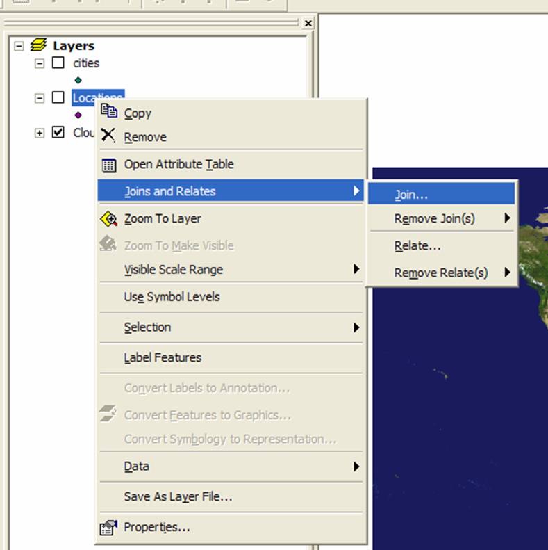
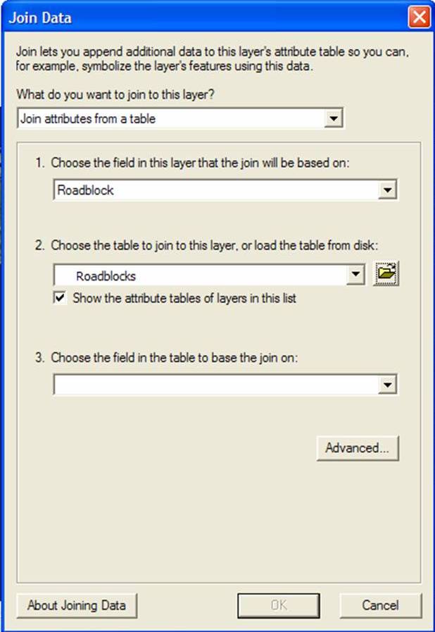 ...and then the Locations feature class fields for each were populated. 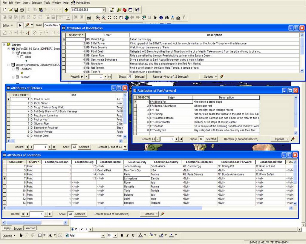 |
||||||||||||||||||||||||||||||||||||||||||||||||||||||||
Finally, the Season feature class was created to store the legs and routes for each season. Although they could have been incorporated into one feature class, each season was given it's own for ease of use. The locations for a season were displayed by filtering the Locations feature class on the Season field. The Editor function in ArcMap was used to connect desinations together, primarily by cities with airports as those were the significant travel junctions. |
 | |||||||||||||||||||||||||||||||||||||||||||||||||||||||
ResultsThe end result is a map showing the route for each season. Locations are labeled on the map and queries can be performed regarding challenges for each leg. 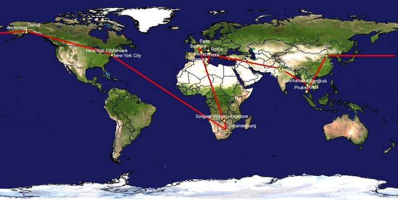
The Roadblocks, Fast Forwards and Detours for Season 1 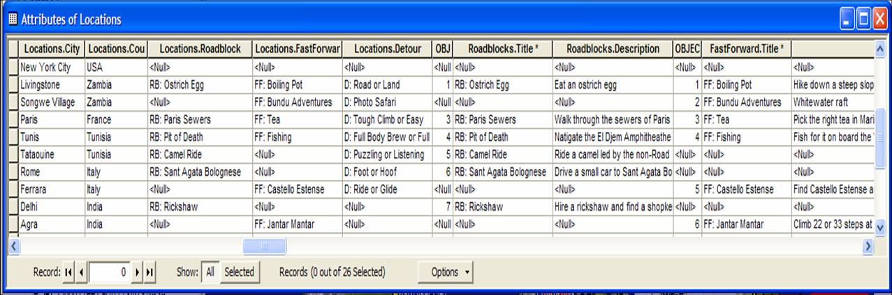 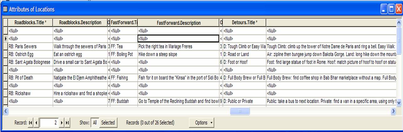 | ||||||||||||||||||||||||||||||||||||||||||||||||||||||||
|
Season-by-season summary table with information about total places visited and distance traveled (in miles).
|
||||||||||||||||||||||||||||||||||||||||||||||||||||||||
Analysis | ||||||||||||||||||||||||||||||||||||||||||||||||||||||||
Conclusions | ||||||||||||||||||||||||||||||||||||||||||||||||||||||||
ReferencesRaw project data Location data | ||||||||||||||||||||||||||||||||||||||||||||||||||||||||