| Title The Stagecoach Trail | ||
|
Author Christopher KnechelAmerican River College, Geography 350: Data Acquisition in GIS; Fall 2006 | ||
|
Abstract This project is about the Stagecoach Trail. Aquiring GIS data and using ArcGIS software has been the primary means of providing information about the trail. | ||
|
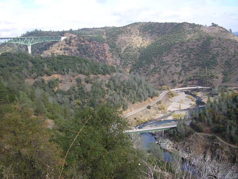
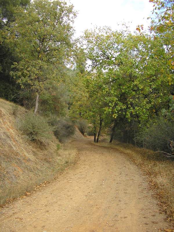
Introduction The Stagecoach Trail is one of the Sacramento areas best local hikes. The trail is easily accessible, located only a few minutes from Interstate 80 on the edge of Auburn in the Auburn State Recreation Area. As you hike along the trail you are greeted with excellent views of the American River canyon. You will also be rewarded with views of the Foresthill Bridge. At 730 feet above the north fork of the American River it is the tallest bridge in California (Ferris 39). Many people will probably find the trail long and steep enough to provide excellent physical exercise. Convenace, beauty, and the challenge of hiking up the canyon make a trip to the Stagecoach Trail a rewarding experience. | ||
|
Background You start out by hiking downhill towards the confluence of the North and Middle forks of the American River. The return trip is up hill so carry plenty of water, pace yourself and use your judgement as to whether you will be able to hike the entire trial. It is possible to start from the bottom (by the river) but this requires a winedy and somewhat difficult drive down highway 49. Also parking is quite limited. It is two miles downhill and two miles back up the trail. The total elevation gain/loss is 800 feet. | ||
|
||
|
Methods The method used to aquire the data was relatively simple. I used Google and searched using varying combinations of key words that would bring up the type of data I was looking for. For instance, I used words like: Auburn, DEM, Tiger files, ESRI and so forth. I took a digital camera and snapped the pictures shown above. | ||
|
Figures and Maps | ||
 Topographic Map from CaSIL |
||
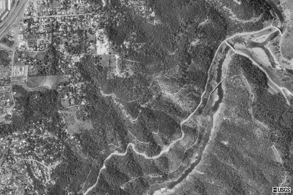 Aerial photograph from TerraServer |
||
 Semi-transparent DEM with hillshade underneath Also visable are the street and water TIGER files |
||
 Hillshade with contour lines added using 3D Analyst |
||
|
Analysis The TIGER files, or Topologically Integrated Geographic Encoding and Referencing system, came from ESRI's website. Layers downloaded include streets, water bodies and waterways. I encountered a couple of problems with the TIGER files. On a very small segment of the American River there was no data, so it appeared that the river stopped. To correct this I drew a line to connect the segments of the river. A similar situation occured for the trail. Most of the trail had been drawn, except for a very short segment at the start and end of the trail. The Stagecoach Trail is, as the name implies, an old route for stagecoaches, so this is probably why the trail appears on the streets layer. Also the trail can now serve as a fire road if the need occurs. The fact that the two ends of the trail are missing is somewhat puzzling. I drew in a line approximating where the trail was, but since the data was missing it is only an approximation of the actual route. Some of the symbology was changed on the streets layer to make major roads and the trail stand out. The topographic map was downloaded from the California Spatial Information Library (CaSIL). One advantage of the topographic map is that it showed the entire trail, unlike the TIGER streets layer. I traced the double dashed line that showed the route of the trail with a red line to make the path standed out. There was one major drawback to the map however. All the features on the map downloaded as one layer so changing any of the symbology or performing spatial analysis is basically impossible. The Digital Elevation Model (DEM) came from the Bay Area Regional Database (BARD). BARD has 24K DEM's of the Bay Area and Sacramento area. In order to open the file it was necessary to exstract the file using WinZip. To see the DEM in ArcMap I had to use ArcToolbox: I selected Conversion Tools, then To Raster, then DEM to Raster. 3D Analyst was used to create the hillshade appearence. With 3D Analyst I was also able to add in contour lines at one hundred foot intervels. I found that it was better to download the DEM and add the contour lines rather than use the topographic map. This method gives you much more control over the appearence and it gives you access to attribute data. The aerial photo was downloaded from TerraServer. It helps to provide some perspective on what the area looks like. Also the pictures that were taken from the trail help to show the area. | ||
|
Conclusions The main goal of this project was to learn more about GIS and the aquisition of GIS data. Also, it is my hope that this project will encourage people to hike. In turn, through exploration of this beautiful landscape people will increase their awareness of the need to conserve and protect such places. | ||
|
References
Ferris Jim, et al., 2005. American River Canyon Hikes: Practical Guides to Hikes in the Canyons of the North and Middle Forks American River. Auburn: Auburn State Recreation Area Canyon Keepers Mandel, Stephanie, et al., 1989. American River: North, Middle and South Forks. Auburn:Protect American River Canyons | ||
|
Links
For more information about the Stagecoach Trail, Auburn State Recreation Area or conservation of the American River Canyons, please visit the websites below.
|