|
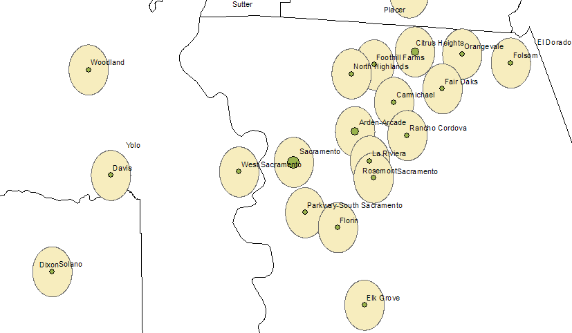
Title Hypothetical Ideal sites for a theme park in Sacramento and or in Yolo County Author Clarence Leung Abstract The main idea of the project is to find an ideal possible locations of a theme park based on demographic data, which are population ages of children and teens from 5 to 21 years greater than or equal to 2000 in the Sacramento and Yolo Counties. The site has to be within 2 miles of a major city, be in open space, and within 1 mile of a major interstate freeway, which all limits to a few possible site locations. Introduction This project is a hypothetical analysis of suitable sites for a theme park in Sacramento and or Yolo County. The closest theme park is Water World at Cal Expo and Six Flags in Vallejo, which is too far from the city. Water World is a good location for the park, but I am going to eliminate this site because it does not fall into my criteria, which is, the area has to be within a 2 mile buffer distance of a major city. In this case, downtown Sacramento and Arden Arcade buffer distance does not meet according to my map. My goal here is to begin from scratch and work my way up beginning with generalized features and pin pointing these sites, based on GIS data I collect from CASIL, California Spatial Library. Background I have to limit the specific location in Sacramento and or Yolo County to a particular site. I use spatial analyst to plot of land that would be best suited for building a hypothetical theme park based on a few criteria, which are; A. WITH IN A 1 MILE BUFFER FROM A MAJOR INTERSTATE FREEWAY; The site has to
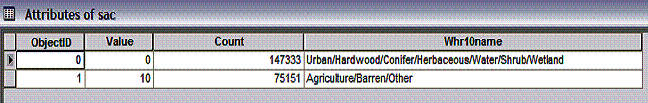
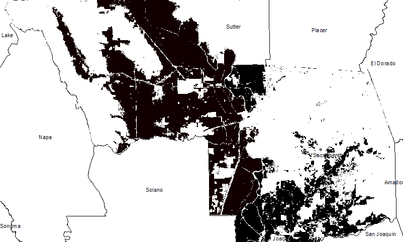
be seen from the freeway, where people are Davis, CA Elk Grove, CA B. OPEN SPACE = agriculture, barren, other; A large theme park has to be built on suitable land. From the ‘Whr10name’ attribute table, from the vegetation data layer, land is classified into a few categories, urban, harwood, conifer, herbaceous, water, shrub, wetland, agriculture, barren, and other. I just select by attributes of agriculture, barren, and other to be reclassified by giving these 3 a value of 1, which means suitable, and assign the value of 0 to urban, harwood, conifer, herbaceous, water, shrub, and wetland, these sites are impossible to built anything on. The end result is areas in black means suitable and areas in white are unsuitable.
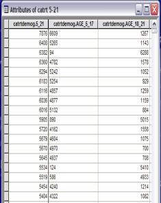
Attributes of Sacramento Suitable and Unsuitable C. POPULATION AGE 5 TO 21 YEARS >= 2000; Assuming a theme park mostly attracts youngster and teenagers, I have to select the areas in which there are many people in these age groups and the area has to have a population of 2000. From the attribute table of California census tract demographic data, there are two columns of age data which are needed in analysis, ‘age 5 to 17’ and ‘age 18 to 21.’ I must combine these two data columns into one column by adding a field and calculate the values to add values from the ‘age 5 to 17’ and the column ‘age 18 to 21,’ which the output becomes the area ‘5 to 21.’ After adding these two together, I have to create a new layer based on these two fields, which is a layer called ‘5 to 21.’ Then select by location the areas where the population is greater than or equal to 2000.
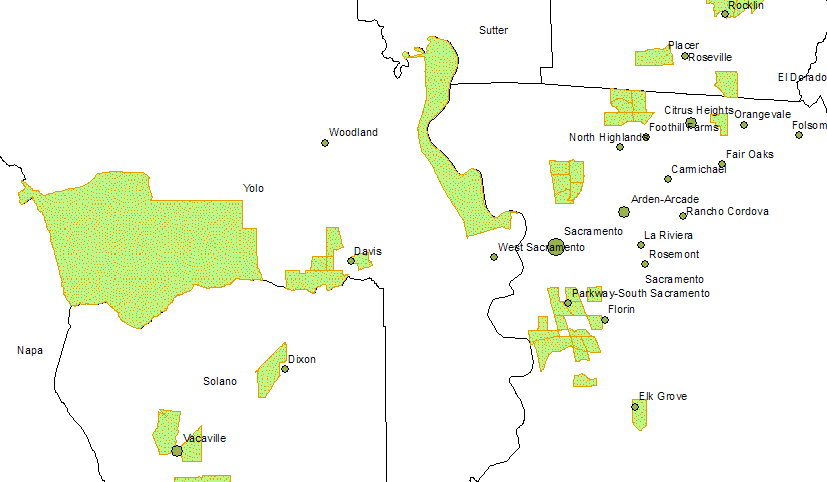
Attributes of Demographics D. AREA WITHIN 2 MILES OF A MAJOR CITY. The site has to be or near a major city within a 2-mile buffer of the major city. I just buffered the major cities with 2 mile.
Elk Grove, CA
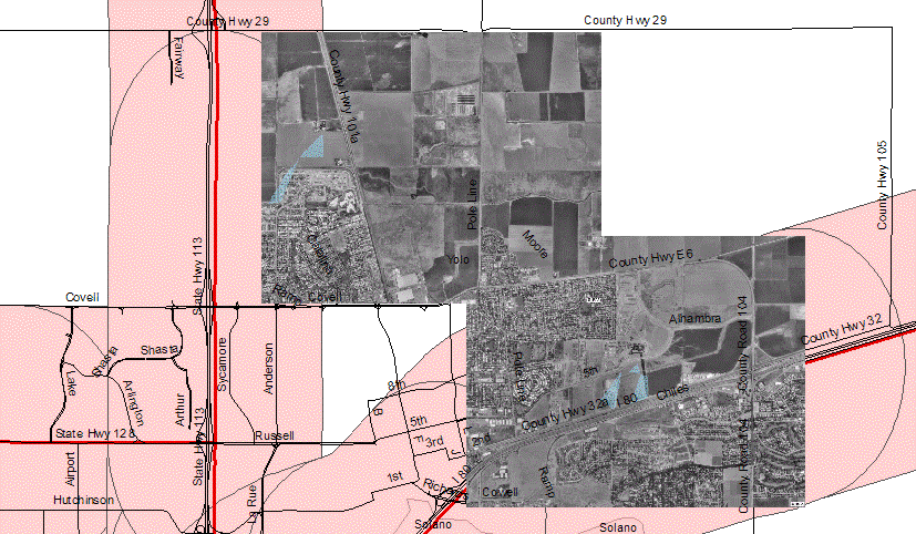
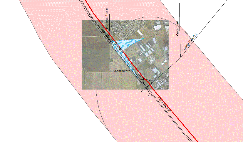
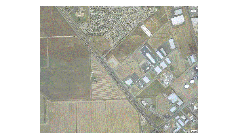
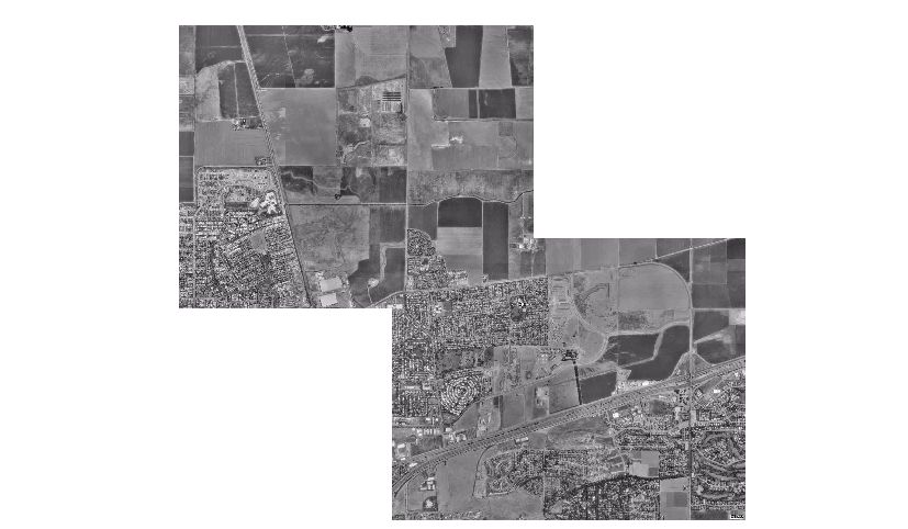
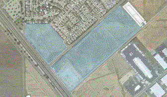
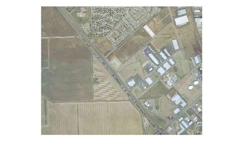
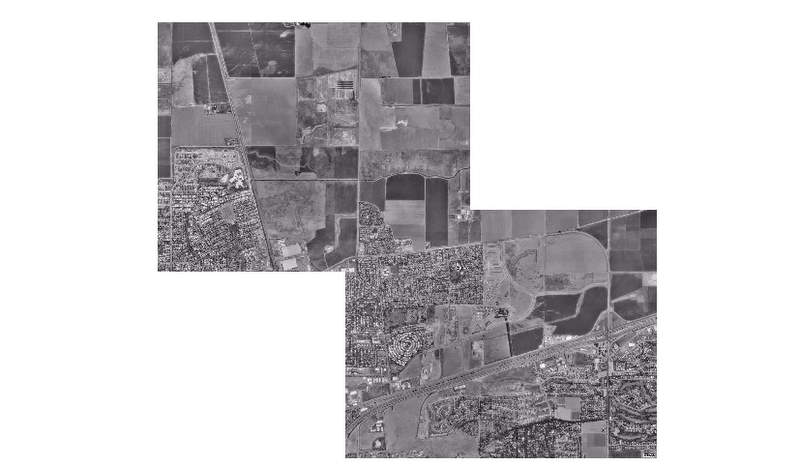
Davis, CA E. SPECIFIC AREA TO BE DIGITIZED TO APPROPRIATE LAND AREA. Block polygons to be created by digitizing actual land cover area according to the air photo. Elk Grove, CA Davis, CA F. AIR PHOTO OF THE AREA IS NEEDED. Photo is needed to specify the actual location instead of approximate location based on the actual analysis. The photo was retrieved from Terra Server.
Elk Grove, CA Davis, CA Methods I begin by retrieving data from CASIL, such as shape files; demographic data, highway, road themes, cities, and land cover data. With these files, I am now able to manipulate data layers by using ARCGIS geoprocessing tools, such as clip, buffer, union, intersect, adding fields to attribute tables, calculate those fields, join tables based on a common attribute, dissolve polygons with similar attributes, define a projection for imported air photos from Terra Server, reclassify vegetation layers into suitable and unsuitable sites, use appropriate symbology to represent data, buffer major roads, and buffer major cities. I also need to limit the area from a large-scale perspective to a more specific area by using the select by location, select by attributes, and to digitize the actual land area according to the air photos to give me an actual location of the area. Results According to my analysis and criteria, which are: A. The area has to be within a 1-mile buffer zone from a major interstate and or freeway. I just used the buffer geoprocessing tool to create a 1-mile buffer zone from the highway. Any area within this zone is appropriate. 1-mile buffer zone for freeway B. The area has to have open space for future development. I had to retrieve land cover data from CASIL and import Yolo and Sacramento County into Arc Map. Then I reclassified the land use to 2 criteria, suitable and unsuitable. Suitable land cover will be barren, agriculture and other. Unsuitable land cover will be urban, hardwood, conifer, herbaceous, water, shrub and wetlands. Suitable and Unsuitable Land Cover Data C. Population of the surrounding area has to be greater or equal to 2000 youngsters from the age of 5 to 21 years old, assuming this age group will want to play on the rides.
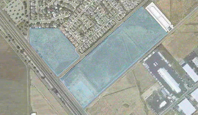
Demographic Data D. The area has to be within a 2-mile buffer zone of a major city. I buffered the cities with 2 miles, anything within the 2-mile radius will be appropriate, and anything outside will be eliminated from analysis. 2 – mile buffer zone from city E. The actual area has to be digitized according to the air photo for appropriate land use area. I compared the air photo and the suitability site and digitized polygon shape files assuming the theme park could be build on the land.
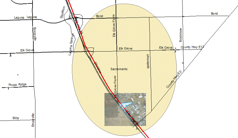
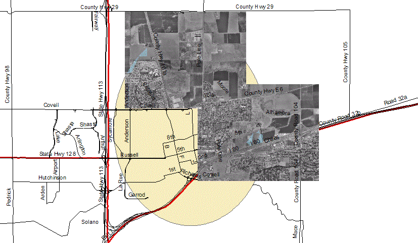
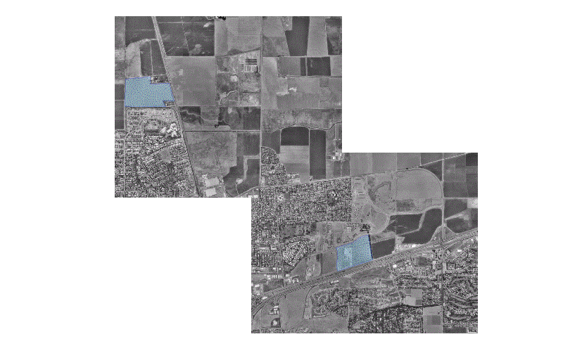
Digitizing Elk Grove, CA Digitizing Davis, CA F. Air photo is needed. The air photo was retrieved from the Terra Server web site of the actual area where the theme park site is appropriate according to my criteria. There are four sites according to my analysis where this area meets all the above. There two sites south of Elk Grove, California off of highway 99 adjacent to Elk Grove Florin Road and East Stockton Blvd. One site off of highway 80 in Davis, California, and another site off of highway 113 north of Davis ad County road 101A.
Elk Grove, CA Davis, CA Analysis I learned how to manipulate data using many geoprocessing tools and elements. As I go along with the project, I found myself more focused on the specific suitability sites. I began with a broad interpretation of the site and try to narrow down the analysis to a specific area by applying constraints and reducing the suitable sites. I ended up with 52 data layers because each geoprocessing application I used created a new data layer and every spatial analyst function I performed created new layers. The multiple air photos were also analyzed in the project. Conclusions Based on the certain criteria I specified above, I was able to locate 4 possible sites, 2 in the Davis area and 2 in the Elk Grove area. These 4 sites all fit into my criteria. With more research, it is possible that one day, there might be a theme park in the area. References California Spatial Library
http://gis.ca.gov |