Title
Construction of Background Map for Garmin
|
||||||||||||||||||||||||||||||||||||||||||||||||||||||||||||||||||||||||||||||||||||||||||||||||
|
Author
Fui Fang Thong
|
||||||||||||||||||||||||||||||||||||||||||||||||||||||||||||||||||||||||||||||||||||||||||||||||
|
Abstract
This study involved selection of software, data
acquisition on tracks and waypoints for Jedediah Smith Memorial Bicycle
Trail with Garmin GPS Map 76S,
and digitizing of American River and bike trail based on
National Agriculture Imagery Program (NAIP)
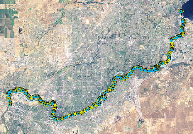
California Sacramento SID file. A total of 153 waypoints and 2347 track points were
obtained during a four-days field surveys. MN DNR Garmin of Minnesota Department of Natural Resources was used for
projection and uploading data from the GPS receiver to ArcMap. The software was
also used to download layer files from ArcMap and upload to GPS receiver. MapWel software was
selected since it includes multiple steps of mapping, editing and uploading in
a single software, and Mapwel is designed for Garmin compatible receivers.
Other than that, the Mapwel demo version supports ESRI shape files
(.shp) and provides free tool on coordinates adjustment. The shape file of
American River was edited and uploaded with Mapwel to GPS receiver as background
map. As the trial version Mapwel truncates maps during uploading, the
digitized Jedediah Smith Memorial Bicycle Trail, Call Boxes waypoints,
Drinking Water Fountain waypoints, Restroom waypoints, Picnic Areas
waypoints, Mile Markers waypoints, Starting Point waypoint, End Point
waypoint, Nimbus Fish Hatchery waypoint and Camp Site waypoint were edited
with ArcMap, and uploaded into GPS receiver by MN DNR Garmin. The uploaded background
maps were tested at Sacramento Bar Park and call box at Nimbus Fish Hatchery. The GPS
receiver was be able to locate the actual positions with the uploaded background
maps.
|
||||||||||||||||||||||||||||||||||||||||||||||||||||||||||||||||||||||||||||||||||||||||||||||||
|
Introduction
The Global Positioning System (GPS) is a
satellite-based navigation system made up of a network of 24 satellites
placed into orbit by the U.S. Department of Defense. GPS was originally
intended for military applications, but in the 1980s, the government made
the system available for civilian use. However, most of the background maps for GPS
are mainly made for street navigation but lack of detailed for the
purposes of bicycling, hiking, fishing, snowmobiling and others.
|
||||||||||||||||||||||||||||||||||||||||||||||||||||||||||||||||||||||||||||||||||||||||||||||||
|
Background
The first bicycle trail along the American River was built in 1896 by a recreational organization
name "The Capital City Wheelman" (County of Sacramento
Department of Regional Parks, 2005). The trail was a cinder path which extended from Sacramento to Folsom, and
vehicle use was banned by the County Board of Supervisors. Over the years,
the path suffered from misuse, fell into disrepair and for the most part
disappeared. Today's bicycle trail was designed in 1967 and completed in
1985. The trail runs along 32 miles along the American River Parkway
from Old Sacramento to Folsom Lake. The trail is used for bicycling,
walking, jogging, in-line skating, and with an equestrian trail parallels.
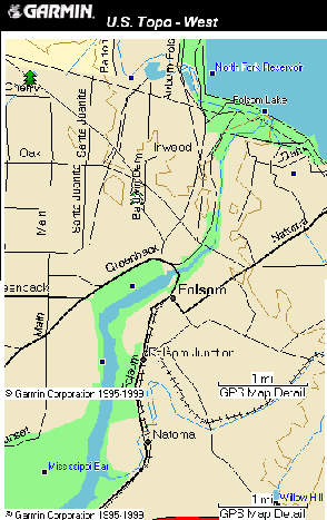
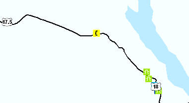
On the other hand, most of the background maps for GPS receiver such as MapSource U.S. Topo by Garmin (Figure 2) are mainly made for street
navigation and provide general information on land elevations but lack of detailed for the purposes of hiking, fishing,
snowmobiling. Lack of detailed maps are only a problem of the developing
countries, but trails in places such as Grand Canyon National Park, USA
are not properly mapped (Odilon
Ferreira Junior, 2002).
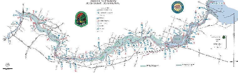
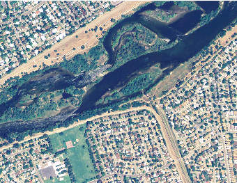
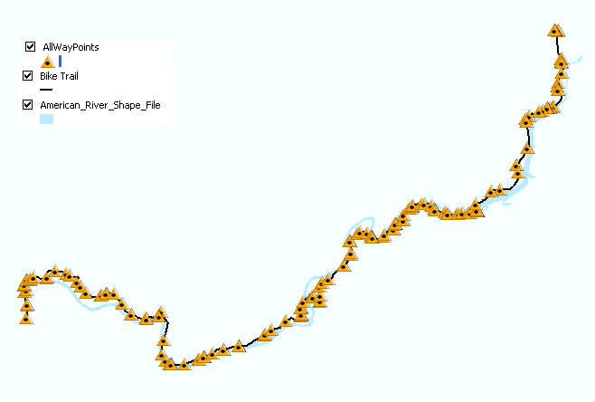
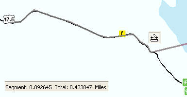
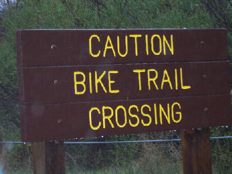
The study was intended to construct digital maps for GPS receiver because GPS receiver has advantages of storing enormous of map data and providing information on real time location. Besides of easy access location, Jedediah Smith Memorial Trail was selected as the case study because of the current background map of Garmin GPS Map 76S fails to depict the trail and the segment on American River is only about 1 mile long (Figure 3).
|
||||||||||||||||||||||||||||||||||||||||||||||||||||||||||||||||||||||||||||||||||||||||||||||||
|
Methods Field SurveyGarmin GPS Map 76S was used to collect waypoints and tracks. The Set Up for the GPS receiver on Location was as below, Location Format: UTM UPS Map Datum: NAD 83 The Track settings were as below,
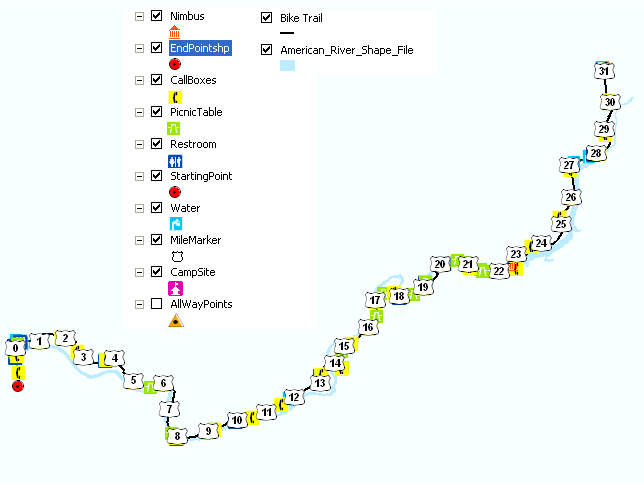
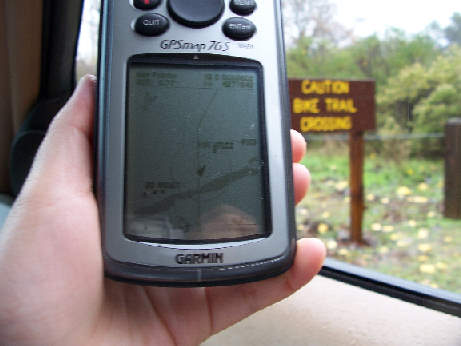
The field survey were conducted on 4th November, 5th November, 12th November and 24th November. The Waypoints on call boxes, restrooms, drinking water fountains, picnic areas, mile markers, starting point from Old Sacramento, ending point at Folsom Lake, camp site and Nimbus Fish Hatchery were marked during the four days survey (Figure 4). The last trip was started from Folsom to Nimbus Dam as the advantage of time by traveling from high elevation (412 ft) to low elevation (90 ft). The tracks were recorded in order to locate Jedediah Smith Memorial Bicycle Trail on aerial photo of National Agriculture Imagery Program (NAIP).
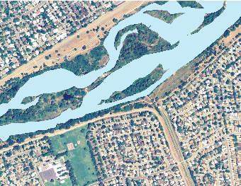
The projection for NAIP of Sacramento County on ArcMap is UTM NAD 83 Zone 10N. The shape file for the American River was digitized as polygon for cartography purpose (Figure 5).
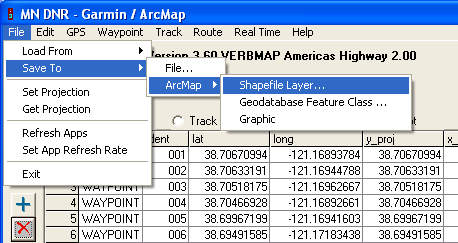
All the waypoints and tracks were projected into UTM NAD 83 Zone 10N. At the same time, ArcMap was turned in order to trigger the ESRI extension on MN DNR Garmin. The data on MN DNR Garmin were saved to ArcMap in shape file layer (Figure 6) and the shape file was projected automatically on the ArcMap document (Figure 7).
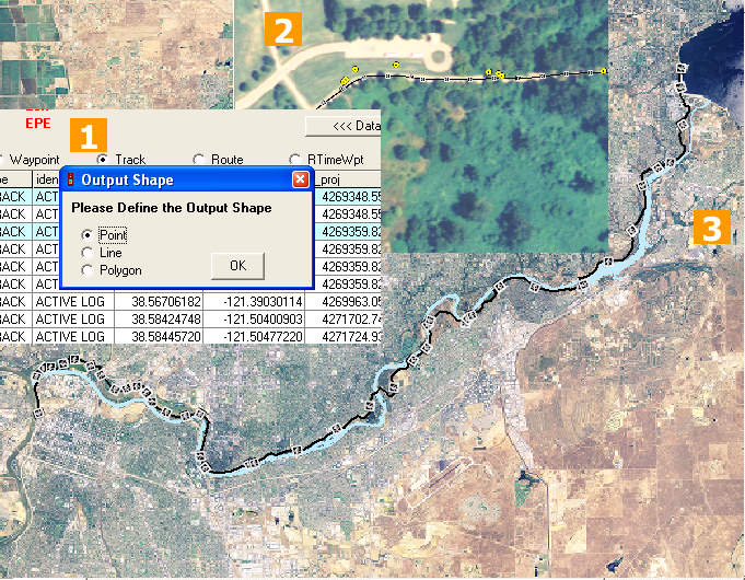
The tracks data were exported to ArcMap as point in output shape and the point shape layer was used to locate Jedediah Smith Memorial Bicycle Trail for mapping purpose (Figure 8).
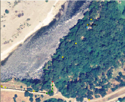
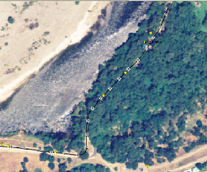
Personal judgment with the guide of tracks shape layer was applied in locating the trail, which was covered by bushes or trees (Figure 9).
Query Data
|
||||||||||||||||||||||||||||||||||||||||||||||||||||||||||||||||||||||||||||||||||||||||||||||||
|
Analysis
Editing Mile Markers Point Features
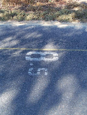
Figure 12: Mile marker marked on the trail or on the sign board The waypoints for 6.5, 10, 11, 11.5, 12, 12.5, 15.5 and 18 miles weren't be taken due to unavailable of mile markers on the spot or failure to observe these markers during the survey. Thus, the mile marker of 6.5, 10, 11, 11.5, 12, 12.5, 15.5, 18, 22.5, 23.5, 24.5, 25.5, 26.5, 27.5, 28.5, 30.5 and 31 miles were measured with Measure tool and added in by Editor tool in ArcMap (Figure 13).
Two waypoints on mile marker for 29 miles were observed at
the trail. Both of the waypoints were measured by the Measure tool and
the unrelated waypoint for the mile marker was deleted by Editor tool
(Figure 14)
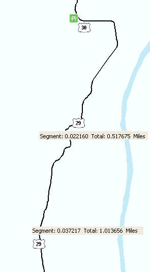
Figure 14: 2 waypoints for 29 miles mile marker were observed on the trail
Cross Check Data through Georeferencing
The ArcMap document with river, trail and waypoints layers
were overlaid with the map by Department of Regional Park (Figure 15)
through the method of georeferencing. The orientation of the map is not
at the top of the map but at the Northeast as labeled at the map.
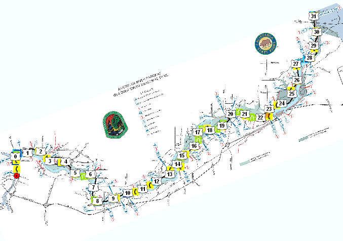
Figure 15: Georeferencing on the map by Department of Regional Park to shape layers The waypoints and the digitized trail on the map layers were
cross-checked with the map by Department of Regional Park and some of
the differences were shown in Figure 16.
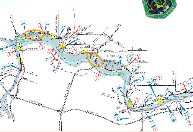
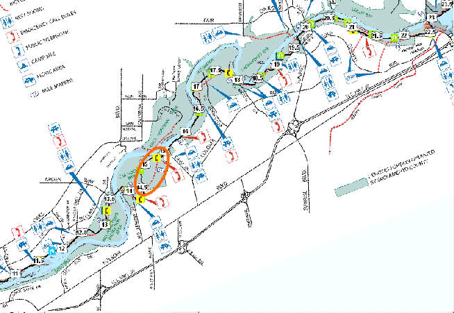
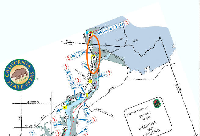
Figure 16: Comparison of trail and waypoints between shape layers and the map by Department of Regional Park From the pictures, there were a few differences between
the shape layers and the map by the Department of Regional Park. The
mile markers waypoints from the field survey were very close to the mile
markers on the paper map. The public phone at mile marker of 7 mile was
not longer available. The trail at the segment of 14 to 15.5 miles of
the digitized trail has maximum of 0.3 miles differences with the map by
the Department of Regional Park. The aerial photo layer, GPS tracks
layer and the digitized trail layer were turned on for verification
(Figure 17). There was not changes necessary for this segment of
digitized trail since the trail layer had good accuracy in
correspondence to the aerial photo, tracks layer and mile
marker waypoints.
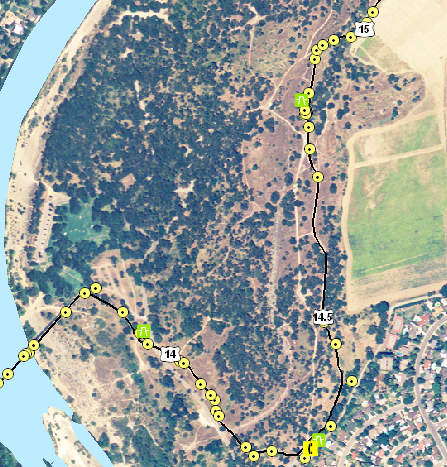
Figure 17: Aerial photo with trail and GPS tracks shape layers No tracks and waypoints were recorded after 30 to 31 miles
(Figure 19) because the trip was misleaded by unavailable bicycle access symbol
on the paper map (Figure 18). Thus, beginning point for the last the trip
was started at the junction of Folsom-Auburn with Folsom Dam Road. However, according to the map again, major facilities including car
access, public phone and camp site are located around the end point of Jedediah Smith Memorial Bicycle Trail. Thus, another trip was taken and
have verified that there was a bicycle access to this area. The bicycle
access at this segment was then cross-checked with aerial photo. This shown that the Department
of Regional Park had left out the bicycle access between the Folsom-Auburn
Road to the end point of Jedediah Smith Memorial Bicycle Trail.
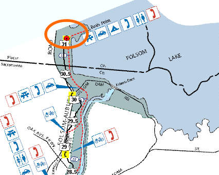
Figure18: The map by the Department of Regional Park fails to depict the bicycle access at the trail end point 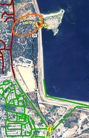
Figure 19: Bicycle access was observed between the Folsom-Auburn Road to the end point of the trail GPS Software Selection
Three major GPS software including GPS TrackMaker, Mapwel and GPSMapEdit were downloaded and were tested. For educational purpose, only the demo or free version software were utilized. Mapwel demo version was selected in the study due to multi-capabilities to map, edit and upload map data in a single software, and it's compatibility to Garmin receivers. Besides that, the Mapwel demo version supports ESRI shape files (.shp) and provides free tool on coordinates adjustment. The strongest strength for Mapwel is the ability to upload data into Garmin unit without additional purchasing on Garmin MapSource software and any added map in Mapwel format (.mpw) could be erased without erasing the original map background. The evaluations between these three GPS software are shown in Table 1.
Table 1: Evaluations on 3 major GPS
software
Uploading Maps to GPS Receiver
Since Mapwel doesn't support overlay of multiple layers
for shape files, all the shape files were loaded on Mapwel one by one with the
setting as below (Figure 20),
Geographic Coordinate System: WSG 84
Projected Coordinate System: UTM Zone 10N.
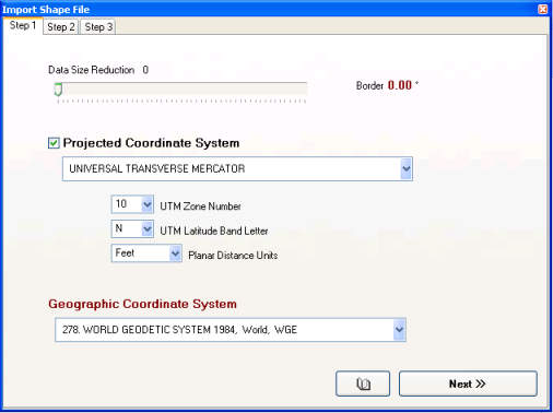 Figure 20: Setting for shape file in Mapwel After a shape file was loaded, the shape file was not
projected in a correct coordinates (Figure 21). Thus, some
corrections on projection values were edited with reference
from Metadata of ArcCatalog (Figure 22 and Figure 23). The
correct projections are to ensure the shape file will be exported in
correct position in the GPS receiver.
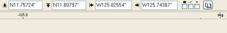 Figure 21: Default projection for
shape file in Mapwel which needed to be corrected
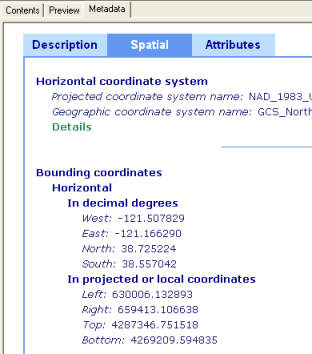 Figure 22: Get the projection in
decimal degree from Metadata of ArcCatalog
 Figure 23: Corrected projection in
Mapwel
The river shape
file was labeled and edited with blue (Figure 24 and Figure 25).
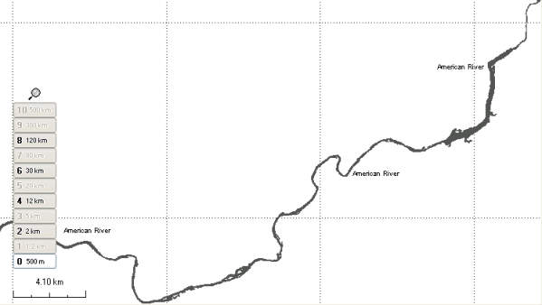 Figure 24: American River map in grey scale 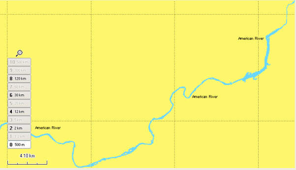 Figure 25: American River map in color Before any map was uploaded into GPS receiver, the
Preference dialog was turned on by double-click any of the tab located
at the bottom of the application. "Transparent" under the Map
Export preference was checked as to ensure that only the river feature
will be overlay on the top of the original background map (Figure 26).
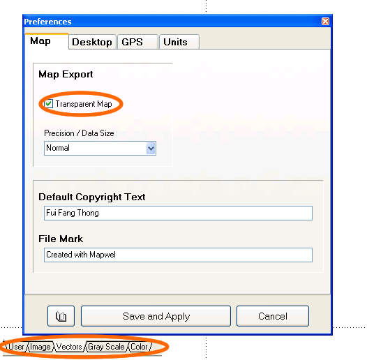 Figure 26: Setting for Preference
dialog
The Map Transfer dialog was triggered by click event on
Upload Map to GPS. All the edited shape files were saved in .mwp
format and were added in the application. However, only one layer of
map was appeared in the GPS receiver because the demo version Mapwel
truncated the rest of the shape files (Figure 27).
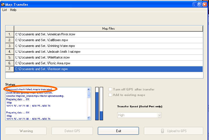 Figure 27: Password check failed and map is truncated for unregistered version In order to resolve this problem for the purpose of this
study, only American River
map was uploaded in the GPS receiver. The waypoints and Jedediah Smith
Memorial Bicycle Trail were uploaded with MN DNR Garmin. These were
done by turning on the ArcMap document, and the trail layer and the
waypoints layer at ArcMap document were downloaded into MN DNR Garmin
before uploaded into GPS receiver (Figure 28).
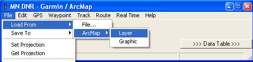 Figure 28: Using MN DNR Garmin to
load trail layer and waypoints layer from ArcMap
The digitized shape file for the trail instance of the
recorded tracks data was uploaded into GPS receiver. This was because
the digitized trail layer has cleaner data but the recorded trails
carried errors from GPS multipath and provided unrelated data (Figure
29). In the Setup of Garmin GPSmap 70S, all the tracks records were cleared and the Recording for the
Tracks in was set to off before the digitized trail shape file was
uploaded. This is to avoid any new track to be recorded when the GPS is
used at the same area, which will cause confusion.
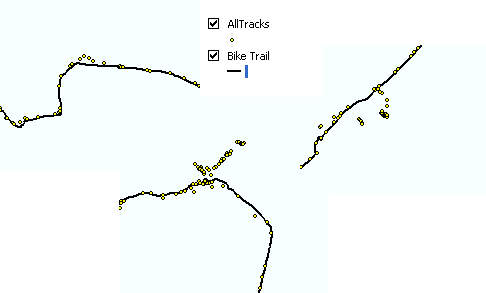 Figure 29: Shape files for GPS
recorded trails and digitized trail
The waypoints names were modified before uploaded into
GPS receiver because the GPS receiver doesn't clarify "." character,
allows 10 characters for each waypoint name, and receives only unique
names without duplication. In order to avoid confusion and lost of
data, the .5 in mile markers waypoints were changed to H, and the rest
of the characters for waypoints names were reduced to within 10
characters (Figure 30).
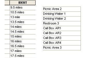 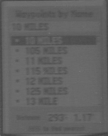
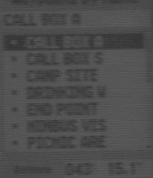 Figure 30: "." character was truncated and only 10 characters were taken in GPS receiver |
||||||||||||||||||||||||||||||||||||||||||||||||||||||||||||||||||||||||||||||||||||||||||||||||
|
Results
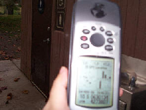
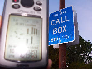
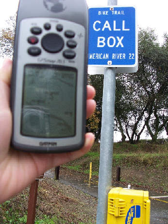
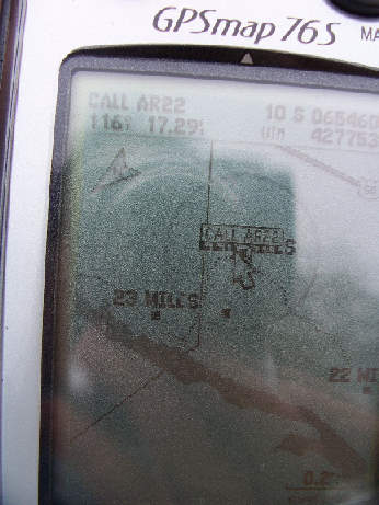
The uploaded background maps in the GPS receiver were tested at call box nearby Nimbus Fish Hatchery (Figure 31) and at Sacramento Bar Park (Figure 32). The GPS receiver was be able to locate the actual positions with the uploaded background maps.
|
||||||||||||||||||||||||||||||||||||||||||||||||||||||||||||||||||||||||||||||||||||||||||||||||
|
Conclusion
Digital maps such as the background map for GPS receivers
are getting more and more popular because of the advantages of storing enormous
of map data and providing information on real time location. In order to
construct a detailed background map for GPS receiver, primary data
acquisition such as on-site field survey with GPS and aerial photo are
desired. The secondary data such as the maps from other sources or
organizations should be used as references as to avoid any inherited
mistakes. No every map will provide perfect information because there
are always some degrees of inaccuracy and imprecision during the
processes of data acquisition, mapping and editing. As a result, the map
users have the responsibilities to prevent the problems by making
their own judgments.
|
||||||||||||||||||||||||||||||||||||||||||||||||||||||||||||||||||||||||||||||||||||||||||||||||
|
Reference MapSource software and information at http://www.garmin.com/cartography/ Mapwel software and information: http://www.mapwel.com GPSMapEdit software and information at http://www.geopainting.com/en/ GPS Tracker Maker software and information at http://www.gpstm.com MapDekote software and information at http://paginas.terra.com.br/informatica/download1/dekode_download.htm cGPSmapper software and information at http://cgpsmapper.com/ An open community of GPS users, hikers, geocachers and outdoors enthusiasts: http://www.keenpeople.com/ Tutorials on how to make custom TOPO map for Garmin receivers by other software than Mapwel: http://home.cinci.rr.com/creek/garmin.htm#5
Site to find and download hundreds of free GPS Maps for hiking, fishing,
snowmobiling, on- and off road sightseeing: Free California remote sensing and aerial photos of National Agriculture Imagery Program (NAIP) could be downloaded at http://new.casil.ucdavis.edu/casil/remote_sensing/naip_2005/ For free geospatial software download including MN DNR Garmin, free GIS software and ERDAS ViewerFinder to convert regular imagine file to .img: http://sal.uamont.edu/pages/nsdd/geospatial_tools.htm
Information on Sacramento Parks:
http://www.sacparks.net/ |
||||||||||||||||||||||||||||||||||||||||||||||||||||||||||||||||||||||||||||||||||||||||||||||||
|
Disclosure
This project was conducted as part of a school project without
permission of either entity. The website could only be linked by any
educational institution and is not be linked by any commercial party.
None of the information and graphic of the website could be copied,
modified and resold.
|
||||||||||||||||||||||||||||||||||||||||||||||||||||||||||||||||||||||||||||||||||||||||||||||||
|
Notes
|
||||||||||||||||||||||||||||||||||||||||||||||||||||||||||||||||||||||||||||||||||||||||||||||||
|
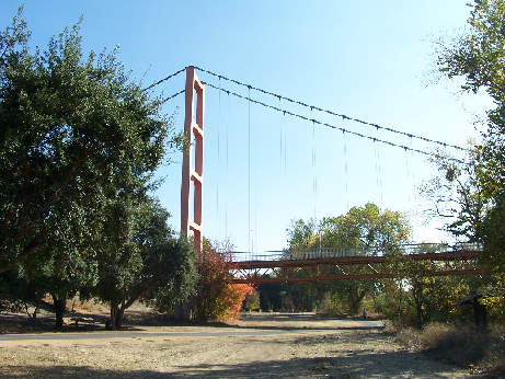
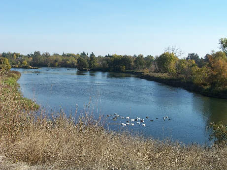
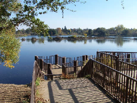
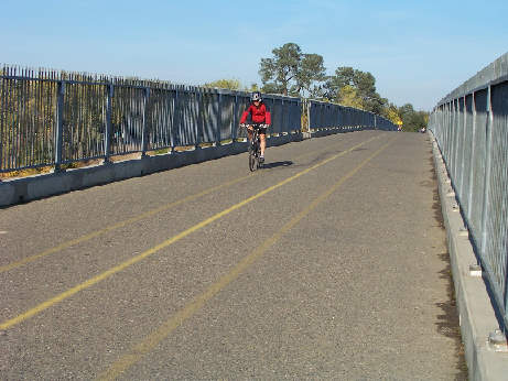
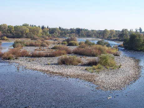
Photo Gallery
|
||||||||||||||||||||||||||||||||||||||||||||||||||||||||||||||||||||||||||||||||||||||||||||||||