Title
Updating Fire Stations in El Dorado County
Author
Linda Wright
American River College, Geography 350:
Data Acquisition in GIS;
Spring 2006
Abstract
Updating the fire station layer in GIS was done in three stages:
1) Gather fire station data from paper, electronic, and people sources
2) Physically locate (GPS) the fire stations
3) Process the GPS data, validate it, and put it into GIS
Information as to where all the fire stations were located mainly came from 4 sources - the current GIS point files, CDF who dispatches fire trucks, Rescue Fire Protection District, and a colleague of mine (Jeff Whitford) who has traveled the county's back roads (perhaps searching for the best snow boarding places). Locating the stations was not as easy as I thought it would be. El Dorado County has over 1700 square miles (much of this is state and federal land) with a varied terrain and over 3000 miles of paved and unpaved roads. Timing of data collection was critical since some of the rural roads close for winter, so getting these points took priority. The addresses were verified when possible, and the points were collected and processed in GIS.
Introduction
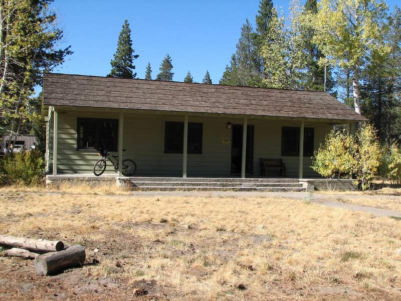
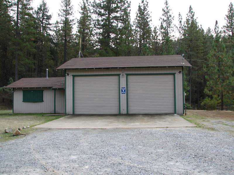
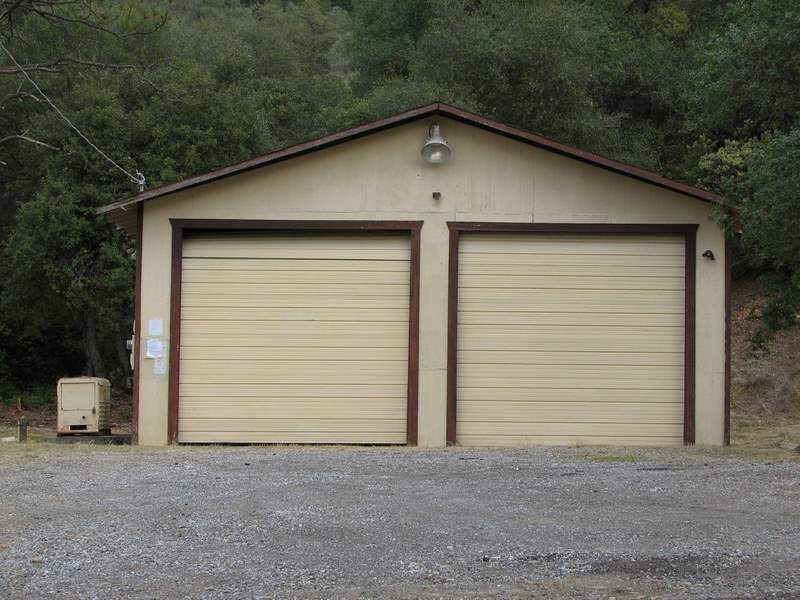
Five years ago, I was asked to make a wall map of El Dorado County showing schools, shelters, and fire stations. The data for schools and shelters was available in GIS, but the fire stations had not been entered. Since the wall map was at a scale where exact locations were not an issue, one of the deputies drew points on a draft copy of the map and I created a point coverage of the fire stations. Through the years, some of the points were moved to a closer proximity of the actual station, but we needed better location data. The scope of this project was to use gps, aerials and other ancillary GIS data to determine more accurate locations. I also took photographs of the fire stations. Since many of the stations are volunteer based, OES personnel requested that I collect this data as well.
Background
The county has several sources for fire stations, including the point coverage I made five years ago. The goal here was to get all of the county fire stations (regardless of agency in charge) into GIS and provide accurate addresses, location (gps), and indicate status (is the staff volunteer, paid or a combination).
There are 3 parts to this project:
Gather fire station data from paper, electronic, and people sources
Physically locate (GPS) and photograph the fire stations
Process the GPS data, validate it, and put it into GIS
Methods
The first task in this project was to gather as much information of where fire stations might be. The first contact was the yellow pages in the phone book - but there was no new information to be gleaned - that is, only some of the manned stations were listed and none of the volunteer stations were listed. So the second contact was Diane Grove at CDF (California Dept of Forestry and Fire Protection) who dispatches the fire trucks. This was a good list, but did not include Tahoe basin data. The next source was Chris Paper at the Rescue Fire Protection District who faxed me his list. Jeff Whitford who also works in the Surveyor's Office gave me some very valuable information on some of the more remote stations. He also drove me around in the Tahoe Basin area - a scary drive on some of the remote sections.
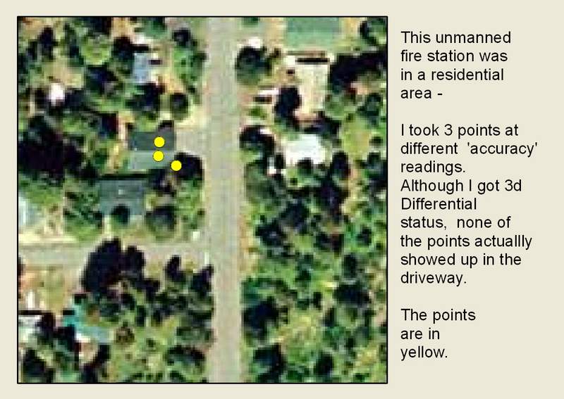
Locating the fire stations was the most time-consuming part of the project. I used a Garmin 76S GPS unit to collect the data. For consistency, I took the points from the middle of the driveway whenever possible. I got a 3d differential signal for all but 2 stations. I took multiple points on some locations when the 'accuracy' reading changed. I also took a photo of the fire stations with the exception of Fallen Leaf where I forgot to take the picture. The photos were collected for possible use in a future website application.
Processing the data was not difficult. I used vbgarmin software to download the points into a text file, then loaded the text file into ArcMap. Once the event was created, I exported the points to a shape file and projected it to State Plane Coordinate System (California zone 2, feet, NAD 83). Once the data was in GIS, I weeded out the duplicate points noting that the accuracy of the GPS did not improve with Although, most points were taken in the driveway, only a couple points actually fell in this area. I loaded 2003 aerials from AirPhotoUSA and moved the points to the roofs of the facilities - if the canopy interfered, I placed the point where the roof would logically be. Since the accuracy statement of the aerials reported "an average of 8.58 feet horizontal precision to reference at 95% confidence level", I felt confident that the point aligned to the aerials was a good choice for accuracy. Since we GPS our roads, I also verified the accuracy of the aerials by the position of the centerline file. Attributes were updated for addresses, station number, station name, volunteer or paid, and district or agency responsible. I also included a comments field for unusual notes - eg "Ground Crew Housing Only" etc.
Results
The accuracy of the GPS unit did not make a lot of difference
The USFS facility below houses ground crews only, but I included it because it is a USFS fire facility.
This used to be a fire station, now it is a Search and Rescue Facility at Jims Fort. I included it and attributed the agency as OES.
Station 24 is on the old list, but not on CDFs dispatch list. I included it even though I could not verify the address because it is not on the building.
Analysis
Collecting this data took 3 weekends, 1 day in South Lake Tahoe, and 6 afternoons to complete. Aside from the Lake Tahoe trip where I rode in the county vehicle, I put over 600 miles on my car. The upside, is that for the first time since moving here in 2000, I was able to see more of the county than the road between my house and work. The downside was that my navigation and photography skills need improvement! The photographs would have been better if all of the stations were facing the same way - with the sun in front of them and behind me as I took the pictures!! Some of the locations were so remote and hard to find, that I was grateful that I had another person with me on 3 of the outings (including South Lake Tahoe). On the treks where I drove alone, I found it hard to look for the stations and drive in unfamiliar territory could have been lessened (slightly) if my navigation skills had been better (they got better by the 3rd weekend!). Timing was vital, because once the snow level drops, some of the fire stations are not easily accessible. Getting the points into GIS was not difficult, neither was downloading the points from the GPS unit. Once the data was in my computer, it was just a matter of moving the points to 'roofs' in aerials and updating the attributes from field notes and existing tables. In the future, this GIS layer will be transferred to SDE and eventually into a website.
Conclusions
All in all, this project went pretty smoothly after I decided to collect all ‘possible’ fire stations. The task of sorting the data out will be done through the attributes. The County of El Dorado now has a complete point file of fire stations and I am confident that the accuracy is well within any application tolerance level. I also enjoyed seeing the county’s wonderful diversity while driving the roads.
References
Grove, Diane (CDF), personal conversation, 2006
Paper, Chris (Rescue Fire Protection District), fax, 2006
Whtiford, Jeff (Surveyor's Office), personal conversation, 2006
http://www.airphotousa.gov
http://garmin.com
|