Commuting Methods in Sacramento
Author: Erik Skall
American River College
Geography 350:
Data Acquisition in GIS; Fall 2007
Contact Information: erik.skall@gmail.com
.
ABSTRACT
The average Sacramento area resident has a 26-minute drive to work, according to 2005 data compiled by the U S Census Bureau. This is nine minutes less than commuters in New York City, which has the nation's longest commute times. About one in four commuters in our four-county region has a less-than-15-minute commute, while 36.5 percent spend 15 to 29 minutes driving to work. About 22 percent have 30 to 40 minute commutes and 7.4 percent endure 45 to 59 minute drives to work.
I wanted to determine whether there were feasible alternatives to commuting by car. I compared my commute to work and school using a car, bus, and bicycle and recorded and analyzed the results, including recording the route using a Garmin GPS unit. My findings suggested that while bicycling is my preferred transportation method, problems did arise, forcing me to see the benefits of using a car. Although Sacramento has little elevation change and a mild climate, we are spread out and therefore cannot effectively use public transit, bicycles, or our feet. While many people and organizations support bicycles and public transit, Sacramento, and the World, is very dependent on the automobile.
INTRODUCTION
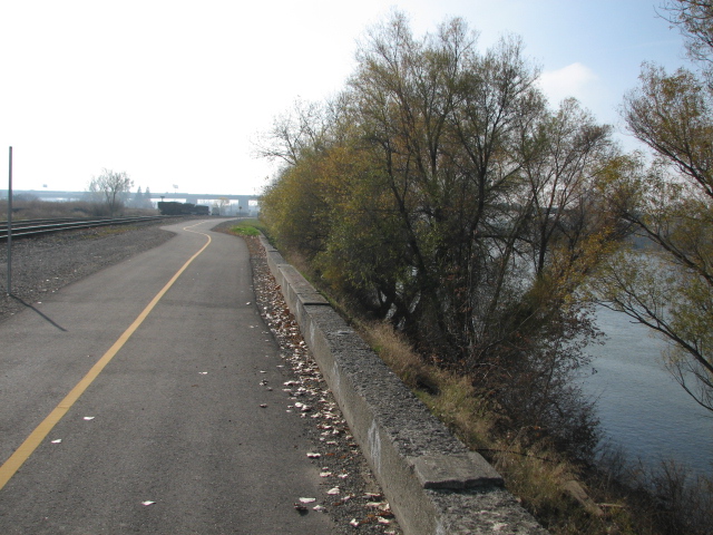
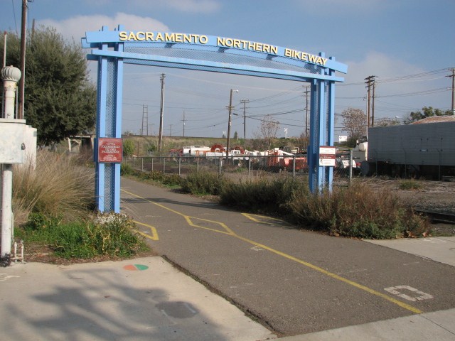
I am a 25 year old male who uses a decent quality ($1200 retail) road bike to travel to work and school. I live in midtown and am conveniently located to many services. Sacramento, with its fair climate and flat elevation, provides a relatively ideal environment for cycling. I am fortunate enough to live less than 15 miles from school and work. Even more advantageous is the fact that I am able to use exclusive bicycle paths for most of my commute to work and school.
I assessed the numerous routes and methods one can choose to reach my destinations. Routes varied from predominately highway to levee bike trails, and several combinations in between. Methods included cycling of course, public transit, and automobile. Being a cyclist, I am a bit biased toward one method of transportation. I attempted to be as objective as possible in my evaluation of the different modes. I traveled many routes to reach two different locations from my house: American River Colleges Ethan Way Center and Sam Brannan Middle School. Many factors were considered in comparing cycling, public transit, and automobile: finances, time, convenience, reliability, health, climate, safety, enjoyment, topography, and pollution.

American River Bike Trail
BACKGROUND
Numerous articles and papers have been created to address commuting in America, California, Northern California, and the Sacramento Region. The publications I encountered were predominately anti-single-occupancy vehicle (although I wasnt actively searching for pro-auto literature). Nevertheless, I was not surprised to observe that while most written pieces promoted and encouraged alternatives to the automobile, they were also quick to point out the unfortunate truth: we are still a very-dependent and very much in love with our cars.
Several organizations including SABA (Sacramento Area Bicycle Advocates), Sac TMA (Sacramento transportation management Association), RT (Sacramento Regional Transit), and SACOG (Sacramento Area Council of Governments) claim to encourage public transit use and cycling in lieu of the car. SABA is naturally very cyclist friendly yet their site and articles lack the sophistication and professionalism to make a meaningful impact on policy. Sac TMA offers many suggestions for commuters looking for alternatives. They encourage carpooling and help commuters network with one another in order to form carpooling groups. RT obviously encourages public transit and attempts to appeal to cyclists by offering bicycle transport and periodical promotions. SACOG claims promote alternative methods yet it also is vested in expanding and improving the road network (which is sorely needed.)
Some studies and editorials examined suburban sprawl, smart growth, and
social and financial impacts in relation to commuting. Suburban sprawl
forces commuters to rely on their cars more, yet many individuals seemed
to prefer the extended duration of their commutes. They were cited as
enjoying their freedom, personal kingdom, and time alone during their
hours behind the wheel. The smart growth articles were praising urban
living and pointed out how it made it possible for one to access numerous
services by walking, cycling, and public transit. These articles were also
sponsored by real estate companies specializing in Grid properties. A
handful of articles claimed that rail ridership was on the rise,
especially on Amtraks Capitol Corridor. In AAAs annual driver spending
report, fuel-efficient cars were the predictable recommendation for people
intending to save money and uphold their environmental morality. No where
was it mentioned to choose something besides a car to get around. Other
studies that compared commuting trends among different nations placed the
U.S. at the bottom of alternate transportation methods. We are also one of
the fattest nations. Im just saying


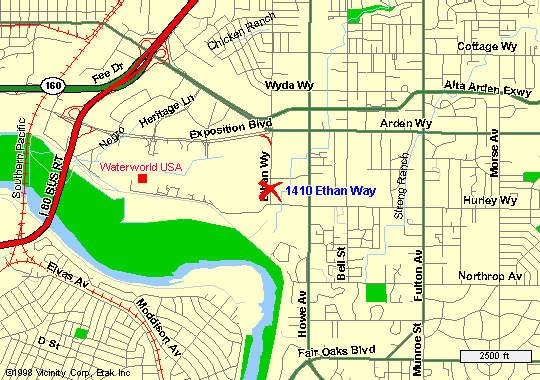
Locations of
Destinations: Work and School, respectively 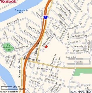

South Sacramento Bicycle Route Network
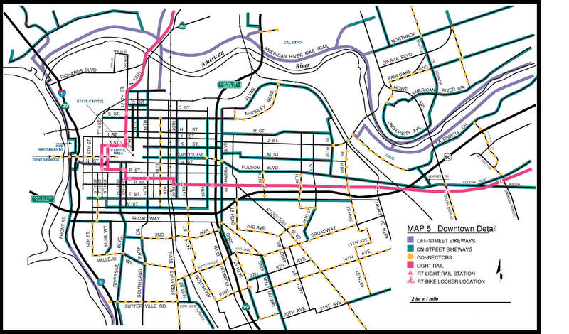
Downtown Bicycle and Transit Route Detail
Equipment Used:
Field Equipment
Canon Powershot S3-IS 6.0 MP digital
camera
Garmin GPSMAP S76 global positioning system (GPS)
RT
Bus Schedules
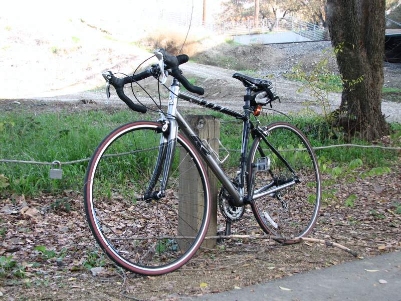
2005 K2 Mach 3.0 21-speed road bike
Reserve
batteries for camera and GPS,
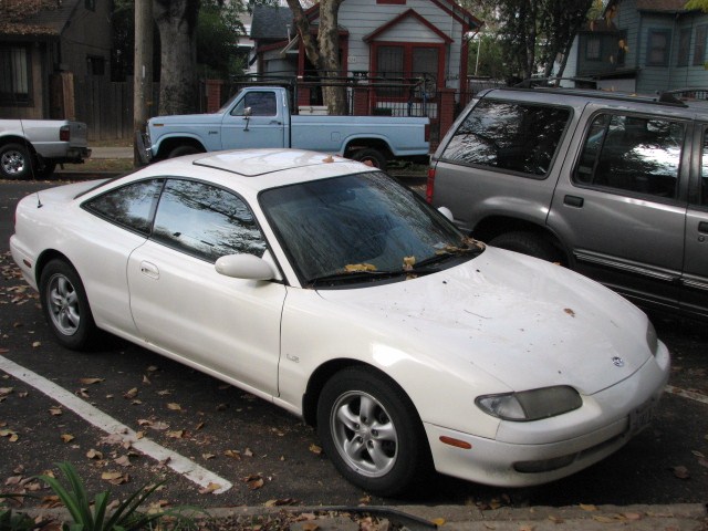
1995 Mazda MX6
RT Bus
Clipboard, pens (2 or more colors); pencils
Computer Equipment and Programs
Windows Vista HP PC
ArcGis Software.
Expert GPS Software
GIS Data, various sources
(See Bibliography)
Google Maps
Photobucket Online Image-Sharing
Software
Glossary
Archival Photos: Photos
taken at specific points in the study area.
Track:
Term used to describe the course of travel within the study area
used
to record GPS and photographic data. The main asphalt trail running
the length of the Parkway is the travelway used for the track in this
case.
GIS (syn. Geographic Information System)
Software with database capabilities
used to analyze geographic
information.
GPS (syn. Global Positioning System)
Satellite based system that allowsgeographic locations
to be recorded
in the field.
METHODS and EQUIPMENT USED
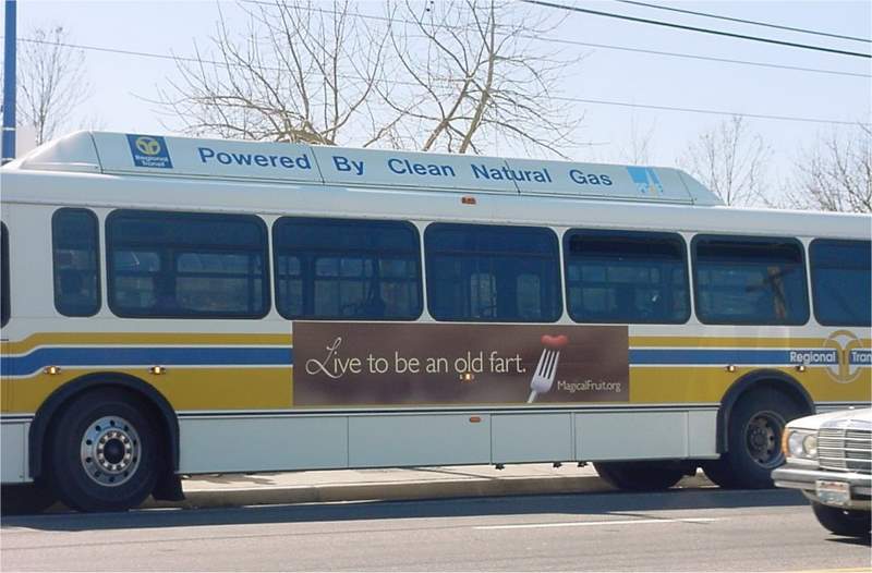
I Googled the directions to work and school using Google Maps. Directions, details, and a map were generated. I used the information to plan my route and to allow enough time to reach my destination. I checked the weather: cold and clear. Would need an umbrella if it was raining since I had to walk 8 blocks to the bus stop. I left at 7:22 AM.
The method for traveling to school was similar to traveling to work. Differences included time of day, which again affected traffic, and distance.
Cycling:
This experiment was more or less routine since I travel the route almost every day. A significant difference was that I had to hold the Garmin unit and track points while riding. It was a successful experiment in multitasking and balance.
For my route to Work (5301 Elmer Way) from Home (F and 14th St in midtown) I needed 25 minutes for travel time, including managing the GPS unit and any unexpected delays. I left my house at 7:50 AM (work starts at 8:25.) Before I left I thoroughly checked the forecast: chilly yet clear. As long as its not windy or rainy, Im fine.
I activated the Garmin, which took 3 minutes because of tree canopy. Once I received a good signal I marked my first point as Home. As I made my way to work, I marked several landmarks for reference. I was also able to keep track of my speed, bearing, and time.
My method for traveling to School (1410 Ethan Way) was similar to traveling to work. A few differences involved traveling at night and for a longer distance.
Driving:
For this experiment, I chose 2 different routes to and from work and school: using and avoiding the freeways. I needed 15 minutes for travel time, including anticipating traffic. I left my house at 8:00 AM. Before leaving I checked traffic conditions using Yahoo Maps and TANN: no major incidents or delays on my route. I glanced at the forecast: cold and cloudy. It didnt matter too much since I had the protection of my cars interior. I checked to see that I had enough gas. I noted the route and time it took.
My method for traveling to School (1410 Ethan Way) was similar to traveling to work. A few differences involved traveling with the flow of rush hour traffic and time of day. (5:30 PM)
RESULTS
I categorized my results into tables based on several factors.
I created links to maps using Google maps for my trips taken by auto and bus.
I transferred my GPS waypoints to Expert GPS Mapping Software in the computer lab. I then modified the routes and added labels to produce a more animated map. I then saved the maps in ArcMap and converted them into pdf files that can be viewed by clicking the links to the left.
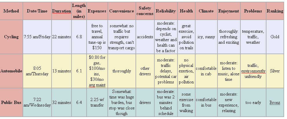
Commuting to Work (one way) Results
Commuting to School (one way) Results
The bicycle route data was collected using the Garmin unit. I chose Expert GPS to help display the results because it was a free (for me), simple, effective tool. Google maps provided adequate displays of the routes taken by car and bus.
I wanted to display the elevation of the Sacramento Valley. I
accomplished this by downloading NED data from the USGS website site and
adding it as a layer in ArcMAP. Unfortunately I was unable to add vector
data for reference.
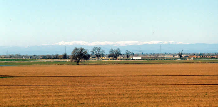
Sacramento Valley Elevation Map
|
Links to Route Maps: |


ANALYSIS
Not surprisingly, cycling was the preferred method. It is free, environmentally friendly, healthy, and relatively reliable. Sacramentos climate and topography is ideal for cycling almost year-round. There is virtually no elevation fluctuation heading North and South and a very slight change in elevation heading East towards the hills. Despite the cold temperatures, I encountered no problems cycling. I welcome our current drought as rain is severely problematic for cycling. There were a few days when I was feeling slightly sick. On Fridays I am expected to bring in supplies to which was not possible with the bike. Safety was an issue, especially when I was traveling home from class at 9:00 pm. Although I use lights and am very cautious, it is risky. Fortunately I havent been in any accidents. Besides these setbacks, cycling was an excellent choice for commuting.
Driving to and from work and school was my second choice. I have
the luxury of living fairly close to both school and work, and
experience minimal traffic. My feelings would be different if I had
to endure a longer commute and/or more traffic. I did encounter
moderate back-ups on Highway 160 heading towards the American River
from Downtown. Since I leave at 5:30 pm I am in rush hour traffic.
Without traffic the drive is only 10 minutes, yet the parking lot in
which 160 becomes doubles that figure. I must admit driving is
convenient, reliable, and safe. It can be relaxing if traffic is
minimal, yet requires virtually no physical activity. It is a strain
on the environment and has been known to negatively affect peoples
stress and anger levels. Unfortunately, driving is just sort of
mandatory for the vast majority of commuters to get their
destinations.
I was pleased that my bicycle route was recorded accurately
using the Garmin and Expert GPS. Light was a problem on the bike
trail at night. I did notice that according to the Garmin I was
traveling on interstate 5 instead of the bike trail at times.
Difficulties included opening raster data in Arc on my home PC.
It worked in the computer lab. Also some minor HTML problems.
CONCLUSION
The solution is more funding, education, and
support for alternative transportation methods. An example would be
to make the American Bike Trail more appealing for commuting at
night: add lights!!! SACOG has suggested that it will cost $22.5
billion to fund the first tier of Sacramentos 2025 Metropolitan
Transportation Plan. Of that, $350 million (1.5%) is allocated for
bicycle and pedestrian projects and $7.3 billion (32%) will fund
Public Transit programs. Although this is an attempt towards
encouraging alternative methods, it ultimately boils down to the
individual. Sacramento is an ideal environment for bicycling, yet
isnt convenient, comfortable, or efficient enough for the average
resident.
RESULTS
Resources - Bibliography
U.S.G.S. National Map Seamless Server, U.S. Department of the Interior | U.S. Geological Survey URL: http://seamless.usgs.gov/index.php, 2007
Sacramento Valley Cycling, http://www.saccycle.com/bikewaymaps/Sacramento_Area_Bikeway_Maps.htm, 2007
Sacramanto Area Bicycle Advovates, http://www.sacbike.org/, 2007
Sacramento Area Council of Governments, http://www.sacog.org/, http://www.sacog.org/mtp/, 2007
Google Maps 2007
Google Image Search 2007
International Bicycle Fund: Facts, Statistics, Resources, 2007