Figure Two: CalWater Planning Watershed
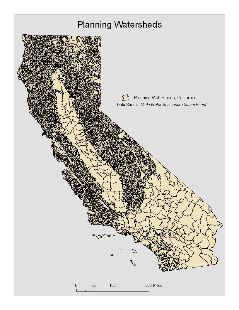
* Used as the intersect, slight difference from the CalWater Watershed shapefile
Figure Three: Partial Beneficial Use
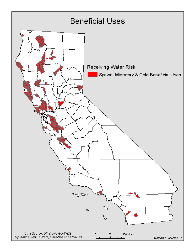
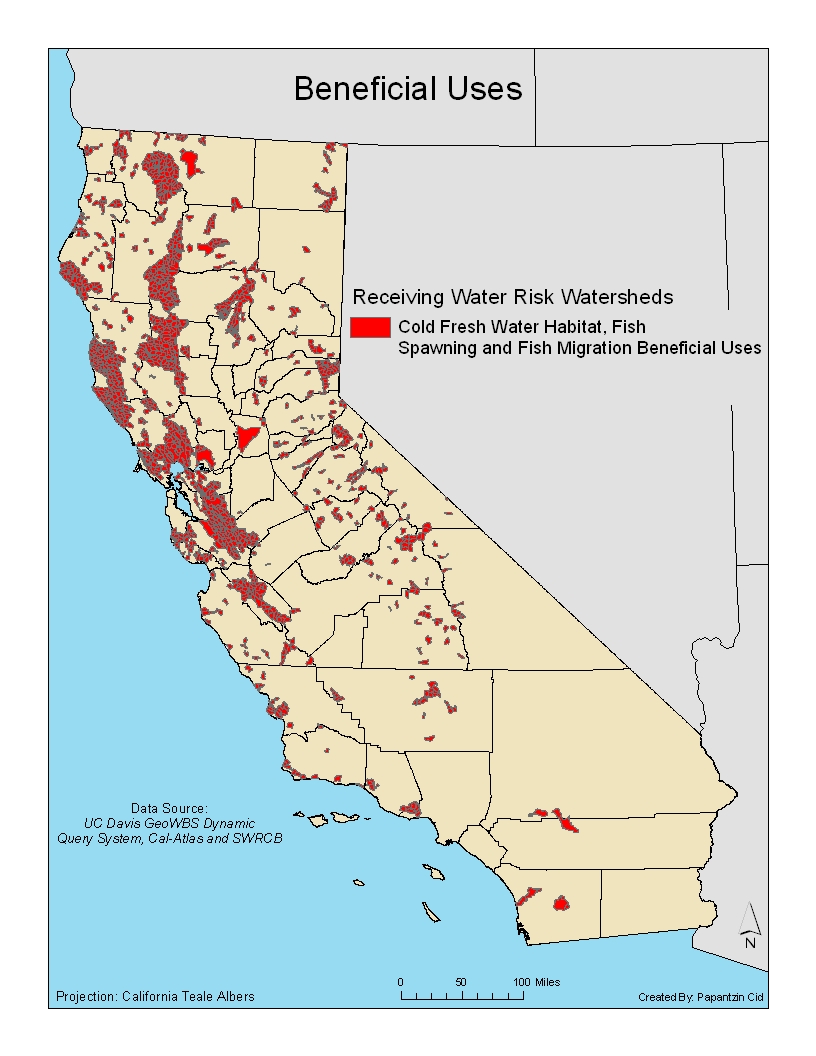
Figure Four: Completed Beneficial Use Map
Analysis
The final map shows which watersheds contain all three beneficial uses. Northern California is more consentrated than Southern California. This is logical because Northern California has more water bodies while Southern California is desert. It was challenging finding and deleting duplicate hydrological names in Excel, using Access was much eaiser. Importing the table into ArcGIS and relating the final table to the CalWater shapefile was also difficult in the matter of keeping files organized. Five different columns needed to be related, naming and keeping track of each field was more challenging then anticipated. The defult layer name, "relate1" was originally used, this was troublesome because it was hard to keep track of which field was already used. The solution was to re-do the relates and name them appropriately depending on the field heading. Using the intersect tool was the easiest part aside from just downloading data. Intersecting the related shapefiles with the CalWater Planning Watershed shapefile was easily done because of proper experience. The challenge again being organization of created files.
Conclusion
The map created only shows a fraction of the 20 defined beneficial uses stated by the SWRCB. Focusing on the COLD, MIGR and SPWN could be a start on identifying which areas in California are at a higher risk for habitat destruction. The map could be used to help guide enforcement action on future construction sites. If the site falls within one of the identified planning watersheds it should have more restrictions than a site that does not. The CGP has construction sites divided into three risk categories, one being a lower risk factor than three. This map could be used to identify which construction sites fall in a higher risk three category. In the future adding other uses such as estuary habitats and shellfish harvesting will create a comprehensive view on areas that should have stronger regulations and enforcement when it comes to construction activity.
References
1. "Chapter 2: Beneficial Uses." California Environmental Protection Agency San Francisco Bay Regional Water Quality Board. 2007. State Water Resources Control Board, Web. 10 Nov 2009. http://www.waterboards.ca.gov/sanfranciscobay/water_issues/programs/planningtmdls/basinplan/web/bp_ch2.shtml
2. "California Spatial Information Library Categories." Cal-Atlas Geospatial Clearing House. 07/05/2008. Cal-Atlas, Web. 10 Nov 2009. http://www.atlas.ca.gov/download.html
3. "Geo Waterbody System Query." Geospatial Waterbody System. University California Davis, Web. 10 Nov 2009. http://endeavor.des.ucdavis.edu/geowbs/
4. "Geo Waterbody System Beneficial Uses." Information Center for the Environment. University California Davis, Web. 10 Nov 2009. http://endeavor.des.ucdavis.edu/geowbs/asp/wbquse.asp
5. "Storm Water Program." California Environmental Protection Agency State Water Resources Control Board. 09/25/2009. State Water Resources Control Board, Web. 10 Nov 2009. http://www.swrcb.ca.gov/water_issues/programs/stormwater/constpermits.shtml
Glossary
Beneficial Use: Beneficial uses of the waters of the state that may be protected against quality degradation included, but are not limited to, domestic, municipal, agricultural and industrial supply; power generation; recreation; aesthetic enjoyment; navigation; and preservation and enhancement of fish, wildlife, and other aquatic resources or preserves.
Cold Fresh Water Habitat: Uses of water that support cold water ecosystems, including, but not limited to, preservation or enhancement of aquatic habitats, vegetation, fish, or wildlife, including invertebrates. Cold freshwater habitats generally support trout and may support the anadromous salmon and steelhead fisheries as well. Cold water habitats are commonly well-oxygenated. Life within these waters is relatively intolerant to environmental stresses. Often, soft waters feed cold water habitats. These waters render fish more susceptible to toxic metals, such as copper, because of their lower buffering capacity.
Fish Migration: Uses of water that support habitats necessary for migration, acclimatization between fresh water and salt water, and protection of aquatic organisms that are temporary inhabitants of waters within the region. The water quality provisions acceptable to cold water fish generally protect anadromous fish as well. However, particular attention must be paid to maintaining zones of passage. Any barrier to migration or free movement of migratory fish is harmful. Natural tidal movement in estuaries and unimpeded river flows are necessary to sustain migratory fish and their offspring. A water quality barrier, whether thermal, physical, or chemical, can destroy the integrity of the migration route and lead to the rapid decline of dependent fisheries. Water quality may vary through a zone of passage as a result of natural or human- induced activities. Fresh water entering estuaries may float on the surface of the denser salt water or hug one shore as a result of density differences related to water temperature, salinity, or suspended matter.
Fish Spawning: Uses of water that support high quality aquatic habitats suitable for reproduction and early development of fish. Dissolved oxygen levels in spawning areas should ideally approach saturation levels. Free movement of water is essential to maintain well-oxygenated conditions around eggs deposited in sediments. Water temperature, size distribution and organic content of sediments, water depth, and current velocity are also important determinants of spawning area adequacy.
Hydrological Unit: Major Rivers.
Hydrological Area: Major Tributaries.
Hydrologic Sub-Area: Major segments of an hydrological areas having significant geographical characteristics.
Receiving Water Risk: Receiving water risk is based on whether a project drains to a sediment-sensitive waterbody.
Sediment: Solid particulate matter, both mineral and organic, that is in suspension, is being transported, or has been moved from its site of origin by air, water, gravity, or ice and has come to rest on the earth's surface either above or below sea level.