| Title Sacramento's Unbuilt Freeways | |
|
Author Robert Mulford American River College, Geography 350: Data Acquisition in GIS; Spring 2011 robert_mulford@yahoo.com | |
|
Abstract The plan for a freeway system devised in the 1950’s contained more routes than Sacramento’s current freeway system. This project uses GIS to determine if some of these planned freeways could still be built today despite the rate of development in Sacramento County. The intersection of land parcels and freeway routes is used as a criterion in evaluating the viability of proposed routes and the effects on homeowners in the freeway path. | |
|
Introduction The purpose of this project is to determine if the unbuilt freeways could be constructed on their planned routes given the current level of development in Sacramento. This project focuses on the number of homes that would have to be demolished, or moved, and the population density and the demographic characteristics of the population in the areas nearby. | |
|
Background In Application of GIS in Transportation Planning: The Case of Riyadh Mezyad Alterkaw examined the use of GIS in freeway planning in Riyadh, Saudi Arabia (Alterkaw 1994). Mike Baysdell uses GIS to examine freeway planning using existing roads in Ann Arbor Michigan(Baysdell 2011). Few have examined the issues in routing major freeways through developed areas in larger cities like Sacramento. | |
|
Methods | |
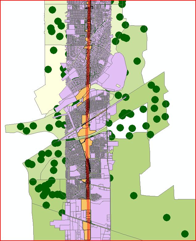
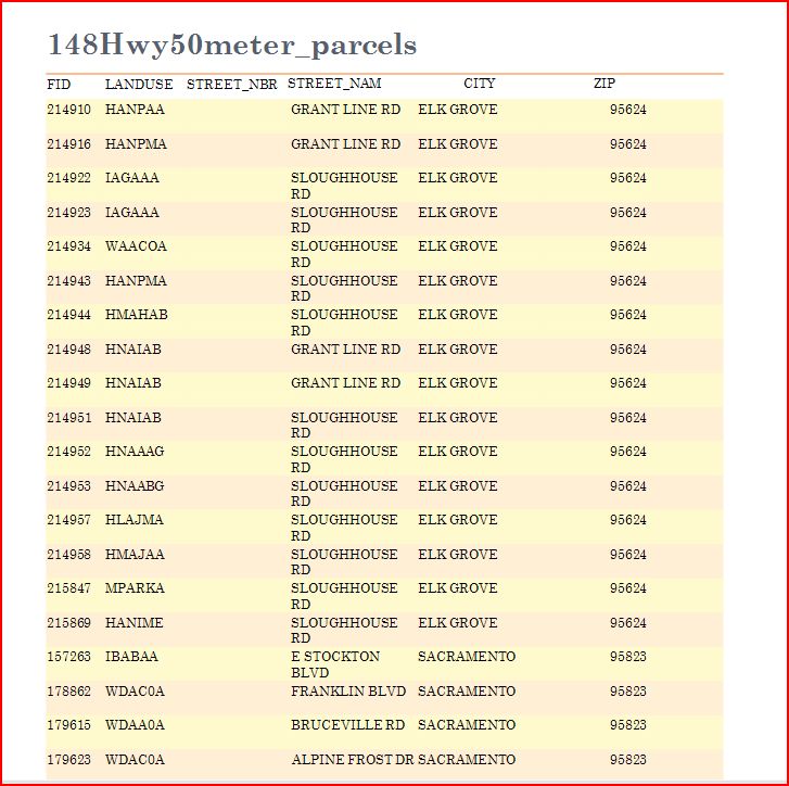
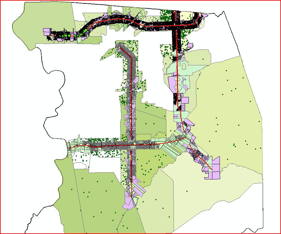
| A 1994 map showing the proposed freeways was georeferenced to a polygon of Sacramento County. The four proposed freeways were traced on to new separate map layers. Each freeway was buffered to a width of 50 meters. A half-mile buffer was added around each 50 meter freeway width to represent the affected area. This distance was chosen because being within a half-mile of a freeway is considered detrimental to human health and property values. Select by Location was used to identify parcels that intersected with the 50 meter freeway area and also the half-mile affected areas. New shapefile were created from the selections and color coded. Reports, listing information like address and zip code, were generated listing the attribute data for the parcel shapefiles. Select by Location was also used to identify census blocks that intersected the half-mile affected areas. The block selections were then color coded to identify blocks with high minority populations. A dot-density shapefile was created to display population density in the census blocks. |
|
|
Results | |
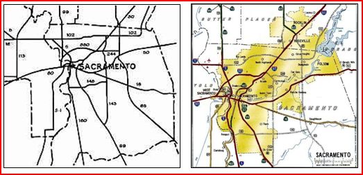
| The 1994 freeway map was chosen over the 1950’s planning map because it showed correct locations of existing freeways and better represented the geographic area. The major roads layer and Parcels polygon layers were obtained from the County website. The census data was obtained from the US Census Bureau website. Population data from the 2000 census was used because 2010 numbers for the entire county are not currently available. While the data displayed on maps is useful in identifying population concentrations and areas where homogeneous ethnic populations might occur, probably the most directly useful data is in the attribute tables. The reports generated from table data list the exact address of each affected property and could be joined with data listing contact information for property owners. |
|
|
Analysis The Elkhorn Freeway would require demolition of 2,310 homes and affect the property values of an additional 29,095 parcels. The Sunrise Freeway would require demolition of 2,018 homes and affectan additional 19,073. Extending Highway 65 extension requires 865 homes to be demolished and affects 9,896 parcels. Highway 148 would require demolishing 1,319 homes and affects 14,332 properties. All four of the proposed freeways travel through heavily populated areas for approximately half of their length. Although determining if the freeways run through ethnically homogeneous neighborhoods is not possible given the large geographic extent of some of census blocks, areas in need of further study are highlighted. | |
| |
|
Conclusions The plan for the Sunrise freeway probably stands little chance of being revitalized. The surrounding area has been too heavily developed. The Elkhorn freeway would need to be routed further to the North where the land has not been as heavily developed. Highway 148 would need to be relocated farther South. Locating the Highway 65 extension farther East of its planned route would make its completion more likely, as areas to its east are less heavily populated. Further research would need to be conducted in areas with high minority populations to determine whether any of the proposed freeways would split, or even demolish, any ethnically homogeneous neighborhoods. The combined total of houses in the county that would need to be demolished for all four proposed freeways is approximately 6,500. Currently there are over 55,000 vacant housing units in the City of Sacramento alone, making it possible to relocate all of the residents who would lose their homes. It is not likely that any of these freeway projects would be considered in the near future. | |
|
References Alterkawi, Mezyad. Application of GIS in Transportation Planning: The Case of Riyadh, the Kingdom of Saudi Arabia. (2011). www.ksu.eda.sa. | |
|
Basdell, Mike. The Ann Arbor Freeway System. (2011, May 09). www.umich.edu | |
|
California Home Sale Price Medians by County and City. (2011, May 09). www.dqnews.com/Charts/Monthly-Charts. | |
|
Demographic Profiles. (2011)U.S. Census Bureau. 2010.census.gov/news/press-kits/demographic-profiles. | |
|
Faigin, Daniel P. The History of Sacramento Freeway Development. (2011, May 09). www.cahighways.org. | |
|
Geographic Information Services. (2011, April 27). County of Sacramento. www.msa2.saccounty.net/gis/Pages. | |
|
Sacramento Freeway Plan History. (2011, May 05). www.indyroads.com. | |
|
Goodchild, M.F. and J.
Proctor, 1997. Scale in a digital geographic world. Geographical &
Environmental Modelling, 1(1):5-23. | |