Title
Pugliese Credit Union
The Search for a New Branch Location
Author
Jerry Pugliese
American River College
Geography 350: Data Acquisition in GIS
Spring 2011
Jerry Pugliese
American River College
Geography 350: Data Acquisition in GIS
Spring 2011
Introduction
This purpose of this project is to find a suitable location for opening a new credit union branch in the Sacramento region. The problem involves identifying an area of high density population while not having any other financial institutions located nearby. I am initially defining "nearby" as being within 5 miles.
Methods
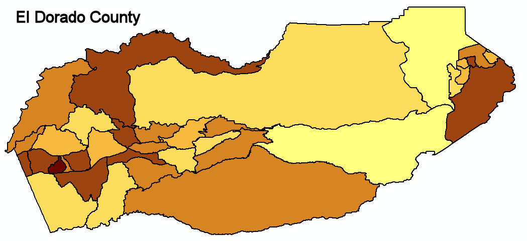
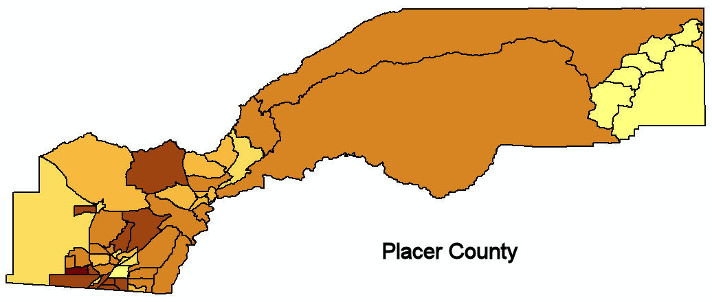
After obtaining the county census tract outlines and the population data from ESRI.com, I joined the data to the census tract shape file on the STFID field so the population information could be displayed by tract. Then I went into the properties of the shape file, on the Symbology tab, and chose to display the Quantities with Graduated colors. I chose overall population as the value to display, breaking the values up into 6 different classifications, resulting in the pictures shown to the right and below showing the population densities of Sacramento, El Dorado, and Placer counties, by census tract.
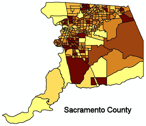
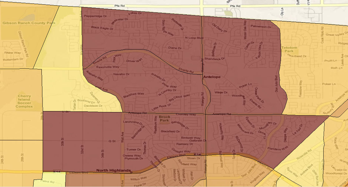
With Bing Maps as my basemap, I set the transparency of the Sacramento County layer to 40%, then zoomed in on my chosen high density population area so I could see the streets and major intersections.
Results
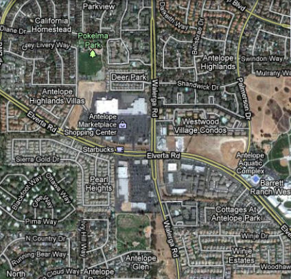
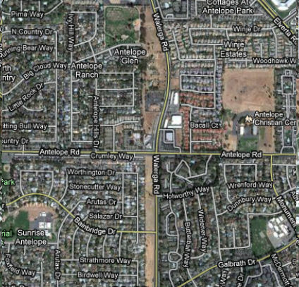
Having existing branches locationed in the southern part of Sacramento county, I wanted to expand either northward or to the east. Both El Dorado and Placer counties have small areas of dense population, but in general, their populations are spread out into larger areas. Deciding to stick with Sacramento county, I chose the Antelope area, in the northern part of the county. I drove to the area and found two different major intersections to take a look at the surrounding business environment as well as the traffic in the area.
At each intersection I parked and did a search for financial institutions on my Garmin GPS unit to get a listing of my potential competition and to see how far away they were from my desired location. The charts below show the results of my searches.
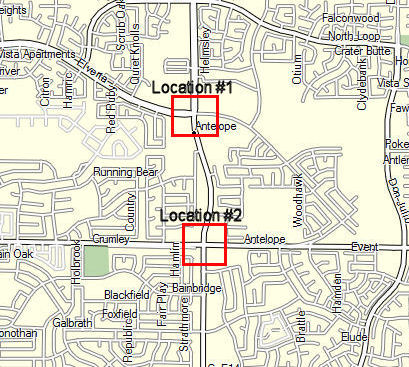
Location # 1 - The corner of Walerga Rd & Elverta Rd
|
|
| Institution | Distance |
| Safe Federal CU | 0.1 mile |
| Chase | 0.2 mile |
| Wells Fargo Bank | 1.2 mile |
| Bank of America | 1.3 mile |
| Wells Fargo Bank | 2.8 mile |
| El Dorado Savings Bank | 2.9 mile |
Location # 2 - The corner of Walerga Rd & Antelope Rd
|
|
| Institution | Distance |
| Safe Federal CU | 0.5 mile |
| Chase | 0.7 mile |
| Wells Fargo Bank | 1.0 mile |
| Bank of America | 1.0 mile |
| Wells Fargo Bank | 2.8 mile |
| El Dorado Savings Bank | 3.0 mile |
Analysis
When it became obvious that I couldn't find a suitable location using my "within 5 miles" criteria I quickly discarded this requirement, and focused on just finding a good location where I could have a good shot at competing with the other financial institutions in the area. While the two locations aren't very far apart, I determined that Location #1 was far more suitable since there is a large number of businesses in the area, including a large shopping center and an aquatic center. Location #2 is slightly farther away from other financial institutions, but is primarily a residential area, and didn't have the draw that Location #1 has.
Conclusions
I quickly realized that my dream of finding the "perfect" location for opening a new credit union branch, based strictly on location, wouldn't be possible. I decided to revise my requirement and place the emphasis on factors such as the draw of surrounding businesses or entertainment facilities, rather than just hoping for a location with little or no competition.
links
|| ESRI Data Download ||
|| ESRI Data Download ||