The Difference in Annual Fish Assemblage in the Yolo Bypass in 2006 (Wet Year) and 2009 (Dry Year)


Author Information
Jared Frantzich
American River College, Geography 26: Data Acquisition in GIS; Fall 2011
2504 Clearlake Way, Sacramento, CA. 95826, 916-366-5538

Abstract
The Yolo Bypass is the largest seasonal engineered floodplain in the Central Valley. It was predominately designed to capture and convey flood waters from the Sacramento River drainage. The Yolo Bypass also provides a unique seasonal floodplain habitat for several native and non-native Central Valley fishes. The annual variation in water year types within the Sacramento Valley constantly alters the fish assemblages within the Yolo Bypass. During the wet years the Bypass can inundate for weeks, providing preferred habitat for two key species: Chinook salmon Oncorhynchus tshawytscha and Sacramento splittail Pogonichthys macrolepidotus. These two species are highly adapted for floodplain rearing and growth, and their population abundances are directly correlated with high-flow years. Through the analyses of total catch data from Department of Water Resources (DWR) two beach seine site locations and a rotary screw trap located in the Toe Drain of the Yolo Bypass, we can show the increases in native fish abundance in the Bypass during wet years.

Introduction
The Yolo Bypass (Picture 1) is an engineered floodplain for the lower Sacramento River. It was developed as the central part of the Sacramento River Flood Control Project, which conveys floodwaters from three major Central Valley rivers: Sacramento, American and Feather, as well as their tributaries. Historically these rivers experienced seasonal flooding events that contributed to the unique geography and biotic community of California's Central Valley (Sommer, 2001). One of the most beneficial attributes of the Bypass is the habitat it provides for many of the native fish species. The Department of Water Resources (DWR) Aquatic Ecology Section has been responsible for the annual monitoring of fish assemblage and lower trophic data in the Yolo Bypass since 1998. Several native Central Valley fishes (some listed as threatened or endangered) in the Sacramento-San Joaquin Delta are adapted to use floodplain habitat for spawning, rearing and growth. Due to variability in water year type annually the Yolo Bypass does not always inundate, and therefore the fish assemblage changes annually due to availability of preferred habitat and water quality conditions. In an effort to understand native and non-native fish assemblage in the Yolo Bypass data from various fish sampling techniques by DWR was analyzed for 2006 (wet year) and 2009 (dry year).

Picture 1. Yolo Bypass Floodplain and view of downtown Sacramento

Yolo Bypass Map 1


Background
The Yolo Bypass was designed and constructed by Will Green with the U.S. Army Corps of Engineers and began operation in 1930. It addressed the long-time need for flood protection for growing communities in the Sacramento Valley, which historically dealt with extreme valley flood inundations (Sommer, 2001). The Yolo Bypass encompasses a 24,000 hectacre (ha) leveed floodplain that is utilized annually not only for flood control but also supports agriculture, wetlands, wildlife and fisheries habitat. Flooding of the Bypass usually occurs during the high flow periods of winter and spring (Peak period of January-March) and when completely inundated doubles the wetted area of the entire Sacramento-San Joaquin Delta (Sommer, 2003).

Figure 1. Yolo Bypass Floodplain and Orientation to the Sacramento-San Joaquin Delta

Yolo Bypass Map 1


The hydrology in the Yolo Bypass is affected primarily by the Fremont Weir which is located at the northern most end of the Bypass (Figure 1). The flooding of the Bypass occurs when river stage at the Fremont Weir exceed 9.2m, which allows flood waters from the Sacramento and Feather rivers to cascade over the concrete weir into the floodplain (Sommer 2001). There are also a series of additional water inputs into the Yolo Bypass that can affect the inundation period: 1) Sacramento Weir, 2) Knights Landing Ridge Cut, 3) Cache Creek, 4) Willow Slough Bypass, and 5) Putah Creek (Figure 2). These all drain into the perennial Toe Drain on the east side of the Bypass (Sommer, 2003).

Figure 2. Yolo Bypass and Hydrologic Inputs

Yolo Bypass Map 2


The Yolo Bypass gives us a glimpse into the floodplain habitat the Central Valley used to provide for many native fishes. Though the Bypass only inundates during California's wet years, it's those years that demonstrate the utility that a floodplain habitat plays in the spawning, growth, and rearing of several Sacramento-San Joaquin Delta fishes. The drastic changes to the watersheds of Northern California through the construction of dams and leveed river channels, have inevitably led to the decline in many of the native Central Valley fishes. Two of the most notable native fish that thrive from seasonal floodplain habitat are the Chinook salmon Oncorhynchus tshawytscha (Picture 2) and Sacramento splittail Pogonichthys macrolepidotus(Feyrer, 2006).

The Chinook salmon has 17 recognized genetically distinct "runs" or "stocks" that spawn in California's many rivers and tributaries and of those a total of 4 Central Valley "runs" can utilize the Yolo Bypass floodplain based on the length and timing of the inundation period. The 1) Sacramento River Winter-run is listed as endangered under the Endangered Species Act (ESA), while the 2) Central Valley Spring-run is threatened and both the 3) Central Valley Fall and 4) Late Fall-runs are a species of concern (Moyle, 2002). The utility of the Yolo Bypass is in the productive food-web that it provides for juvenile Chinook salmon that spread-out into the Bypass during inundation events. Juvenile Chinook salmon are able to take advantage of the shallower warmer habitat of floodplain that provides higher prey densities for rearing and growth, compared to the cooler less productive and altered Sacramento River (Sommer "Floodplain rearing", 2001).

Picture 2. Juvenile Chinook salmon caught in Yolo Bypass rotary screw trap

Juvenile Chinook salmon


The Sacramento splittail is an endemic cyprinid to the Sacramento-San Joaquin Delta and was listed as threatened under the ESA in 1999. The threatened listing was lifted in 2003 after populations numbers bounced back with the return of wet years in the late 1990s (Sommer, 2007). The splittail is biologically adapted to the variability of the brackish and freshwater environments of the Delta. Splittail are known to make significant migrations in the late fall and winter months when river flows increase in an effort to reach newly flooded freshwater habitat for spawning. The overall year class success of splittail is positively correlated with wet years due to the access of spawning adults to suitable spawning grounds and available cover for survival of their young (Moyle, 2002).

Picture 3. Juvenile and adult Sacramento splittail

juvenile Sacramento splittail


adult splittail


The DWR Aquatic Ecology Section (AES) began a fish monitoring project in 1998 through the support of the Interagency Ecological Program (IEP), it was their mission to unveil the intricacies of the Yolo Bypass floodplain habitat on native fish growth and survival. The scope of work in the Yolo Bypass has gone through changes over the thirteen years of monitoring, but there have been several consistent sampling procedures that have occurred each year to obtain an understanding of seasonal fish abundance. As part of the original study plan the AES deployed a rotary screw trap in the Toe drain and began a routine beach seine sampling regime to expose the diversity and abundance of juvenile fishes that use the Yolo Bypass annually. In 1999, the addition of a fyke trap was included as part of the sampling effort to capture upstream migrating adult fishes. Sampling efforts have revealed that there are at least 42 different fish species some seasonal and some resident that use the Yolo Bypass floodplain (Sommer, 2003). The continued monitoring of the Yolo Bypass will be essential in unlocking the ecosystem benefits of seasonal floodplain habitats in California and will provide guidance in future restoration projects.

Methods
The annual total catch data for 2006 and 2009 for both beach seine and rotary screw trap (RST) sampling were queried from AES internal database. The global positioning system (GPS) coordinates for all sampling site locations were obtained for spatial reference within the Yolo Bypass.

Table 1. Yolo Bypass sampling site GPS coordinates
Site Code Sampling Method Latitude (NAD83) Longitude (NAD83)
Lisbon Beach Seine 38.4738 -121.5890
BL4 Beach Seine 38.3549 -121.6422
RST Rotary Screw Trap 38.3534 -121.6429

The AES has maintained two long-term beach seine site locations: Lisbon and BL4. The beach seine sampling occurred biweekly throughout the year as long as conditions permitted safe execution. A 15m beach seine net (Picture 4) was used to complete 25-30m near shore transects. All fish collected were counted, identified, and measured following release.

All fish caught in 2006 and 2009 at both Lisbon and BL4 beach seine locations were grouped into native or non-native. This method of analyses was used to see differences in fish assemblage use in the Yolo Bypass during the two different water year types. The beach seine data for both site locations were further broken down into Chinook salmon total catch. This was analyzed to show increased use of the Yolo Bypass as a seasonal floodplain rearing habitat for juvenile Chinook salmon in late winter and early spring inundation periods.

Picture 4. DWR staff beach seining the Yolo Bypass during an inundation event

Beach seine


The RST (Picture 5) is deployed in January and in operation until late June; length of operation is contingent on flow and water temperature conditions. The fish from the RST are counted, identified, and measured four days a week, as long as conditions permit safe daily execution.

The RST daily catch efficiency within the Toe Drain of the Yolo Bypass is far superior to discrete beach seine transects. Therefore data from both 2006 and 2009 total catch of two key floodplain fish species:Chinook salmon and Sacramento splittail were analyzed to show a positive relationship between Yolo Bypass floodplain inundation and native fish abundance.

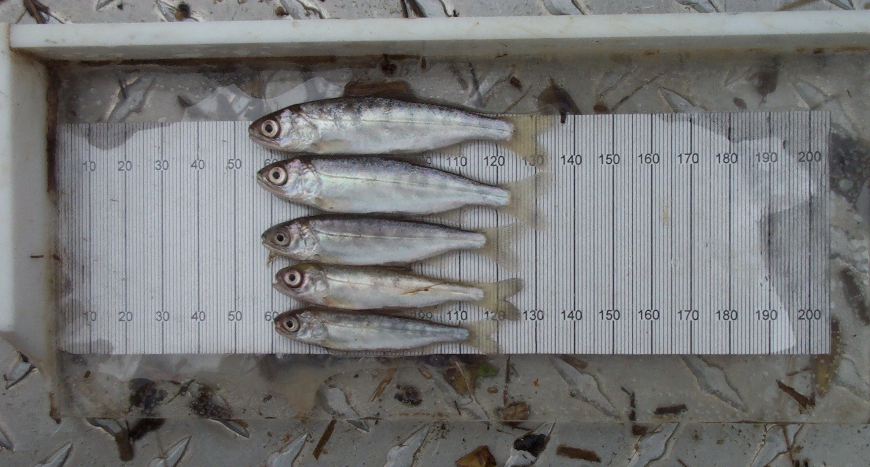
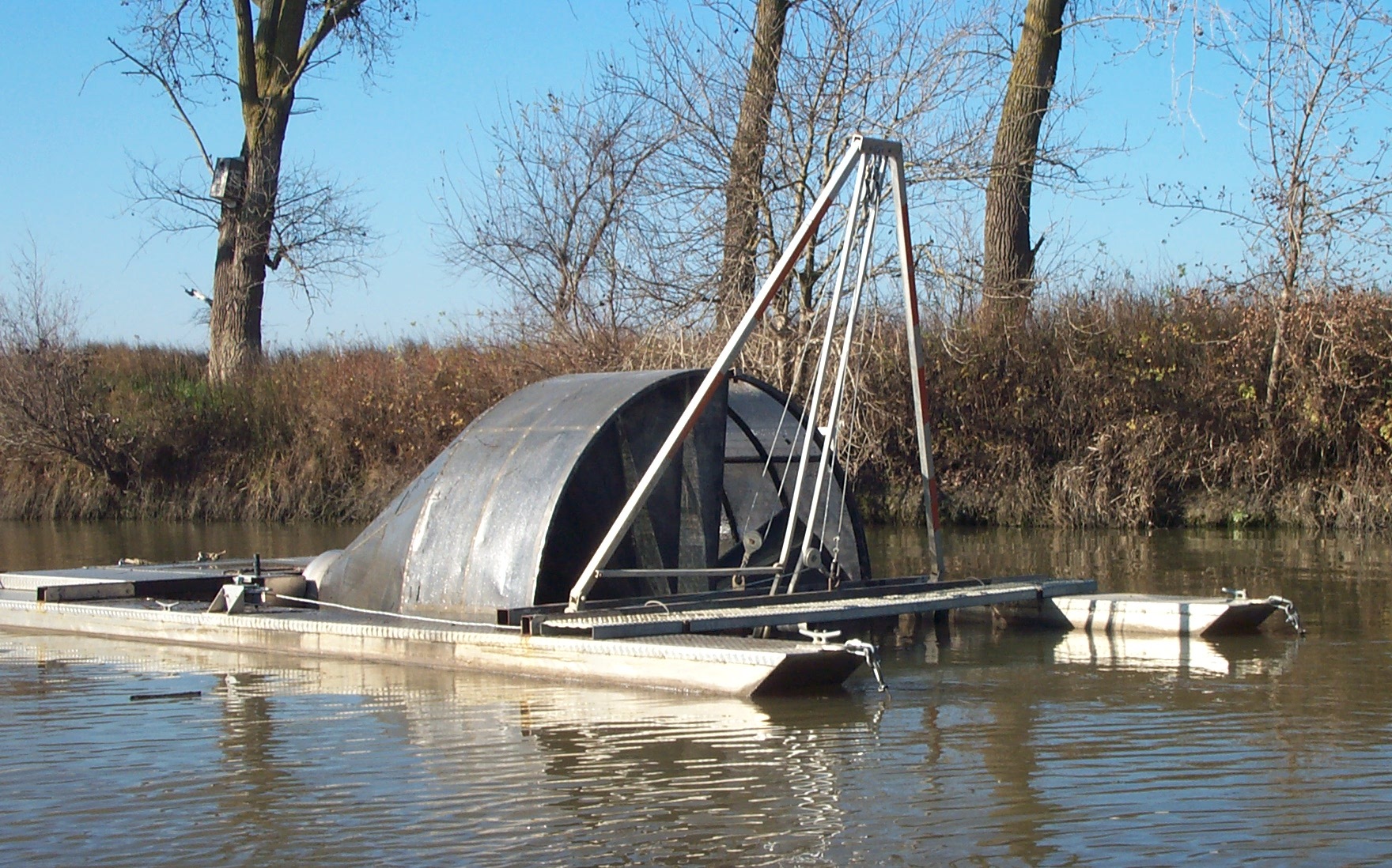
Picture 5. DWR rotary screw trap located in the Toe Drain of the Yolo Bypass

Rotary screw trap


Results
A comparison between 2006(wet year) and 2009(dry year) total catch from Lisbon and BL4 beach seine site locations shows a significant difference in the number of native and non-native fish present in the Yolo Bypass (Figure 3). The sampling data for both 2006 and 2009 was dominated by non-native fishes, but the most significant difference was the total catch of Chinook salmon during the wet year (Figure 4). In 2006 Lisbon recorded a total of 55 Chinook salmon and in 2009 recorded only 1. In 2006 BL4 recorded a total of 110 Chinook salmon and in 2009 recorded only 1, which was 89% of the total catch of native fish at BL4 in 2006 (Figure 5). There was also an increase in the catch total of several prominent invasive species.


Figure 3. 2006 (Wet Year) vs. 2009 (Dry Year) - Native and Non-Native Fish Abundance in the Yolo Bypass at Lisbon and BL4 Beach Seine Sites


Yolo Bypass Map - 2009 Beach Seine Data


Yolo Bypass Map - 2006 Beach Seine Data


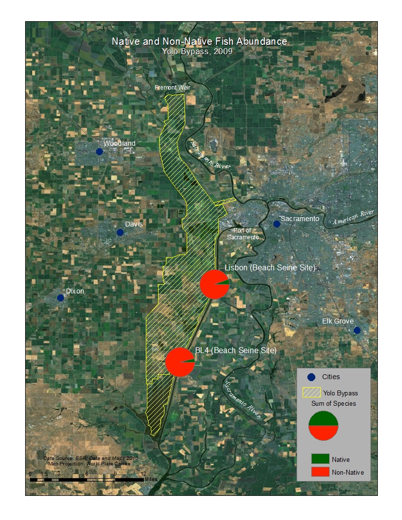
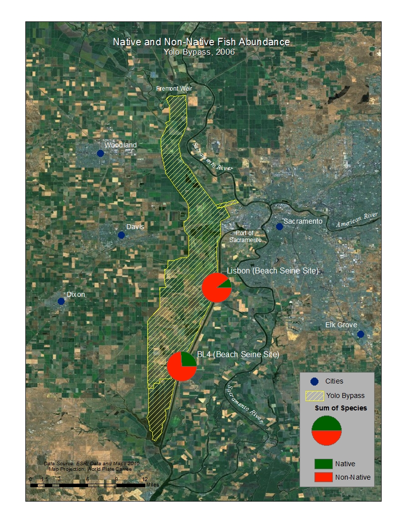
Figure 4. 2006 (Wet Year) vs. 2009 (Dry Year) - Juvenile Chinook Salmon Abundance in the Yolo Bypass at Lisbon and BL4 Beach Seine Sites


Yolo Bypass Map - 2009 CHN Abundance


Yolo Bypass Map - 2006 CHN Abundance


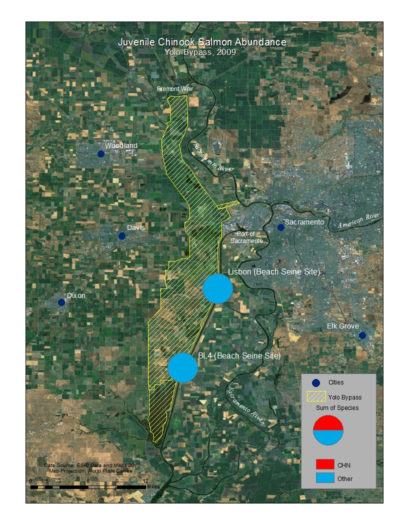
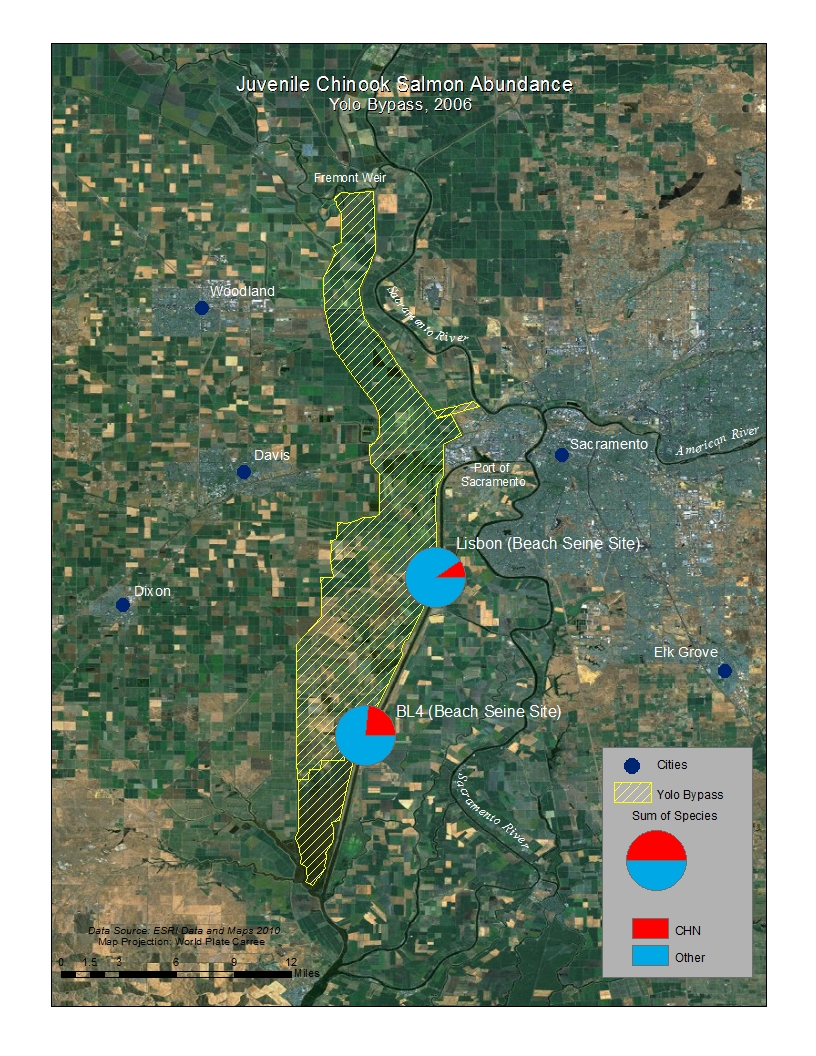
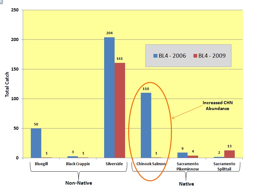
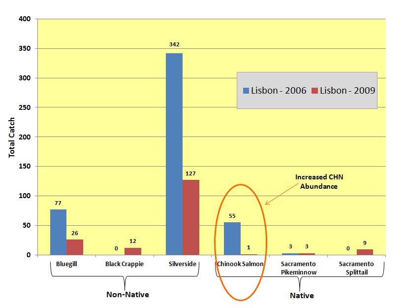
Figure 5. 2006 and 2009 Beach Seine Total Annual Catch of Three Prominent Native and Non-Native Fishes in the Yolo Bypass


Graph 2006 and 2009 - BL4 Beach Seine Data


Graph 2006 and 2009 - Lisbon Beach Seine Data


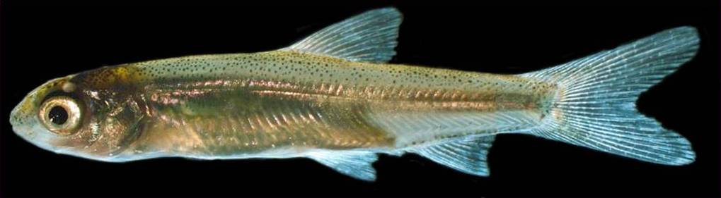
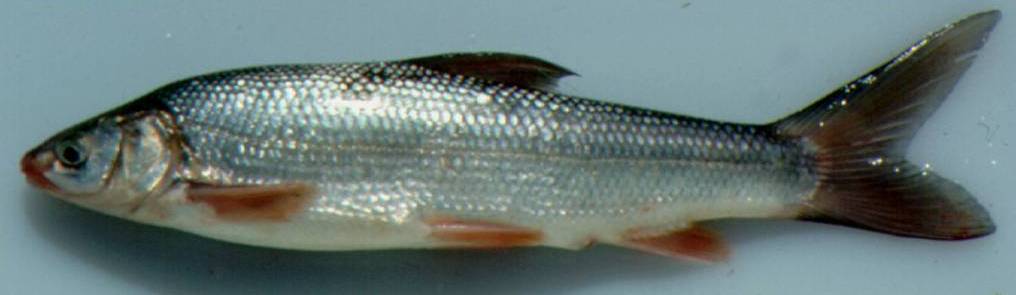
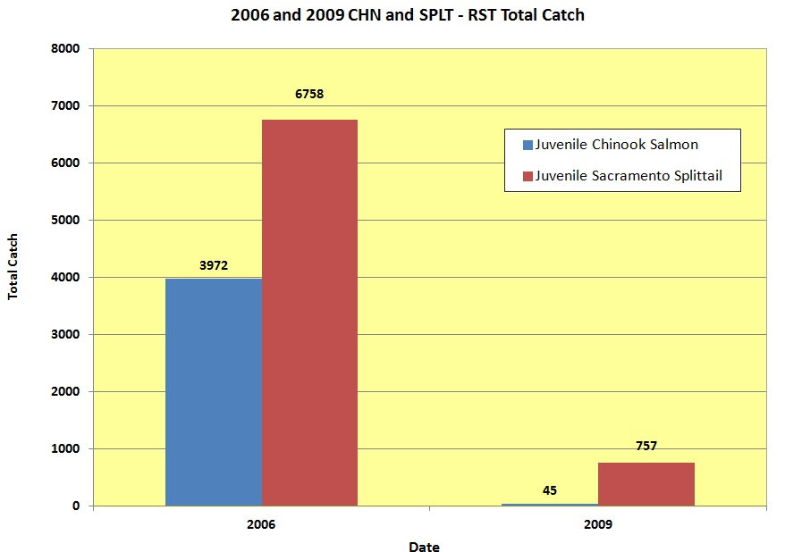
The total catch of juvenile Chinook salmon and Sacramento splittail in the RST in 2006 and 2009 was significantly different (Figure 6). In 2006 total catch of Chinook salmon was 3,972 and 6,758 Sacramento splittail were caught, which was 38% of the total fish catch for the RST that year. In 2009 total catch of Chinook salmon was 45 and 757 splittail were caught, which was 3% of the total fish catch that year (Figure 7).

Figure 6. 2006 (Wet Year) vs. 2009 (Dry Year) - Juvenile Chinook Salmon and Sacramento Splittail Abundance at Yolo Bypass Rotary Screw Trap


Yolo Bypass Map - 2009 RST CHN and SPLT Abundance


Yolo Bypass Map - 2006 CHN and SPLT Abundance


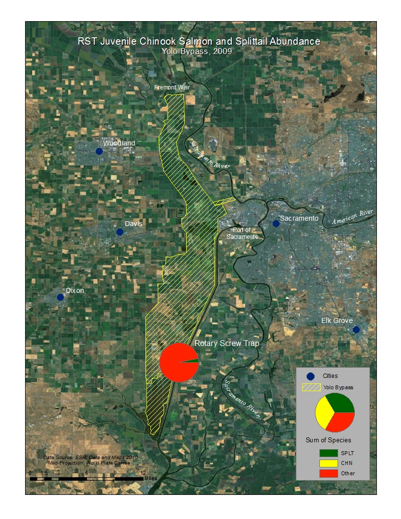
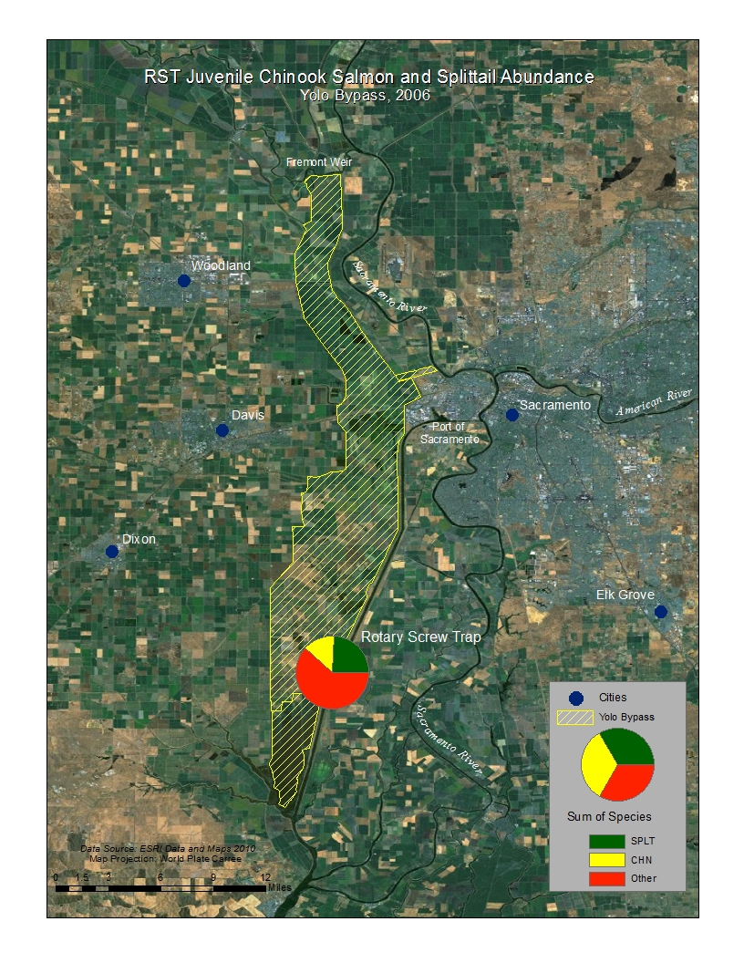
Figure 7. RST - Juvenile Chinook salmon and Sacramento splittail total catch 2006 and 2009

Graph RST- CHN and SPLT


Analysis
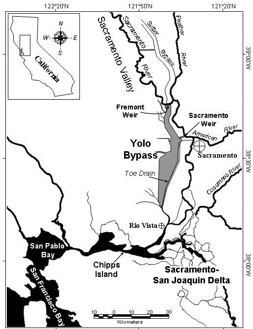
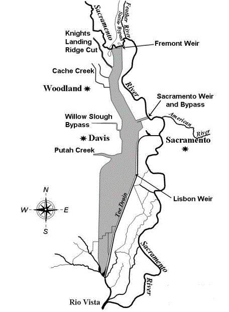
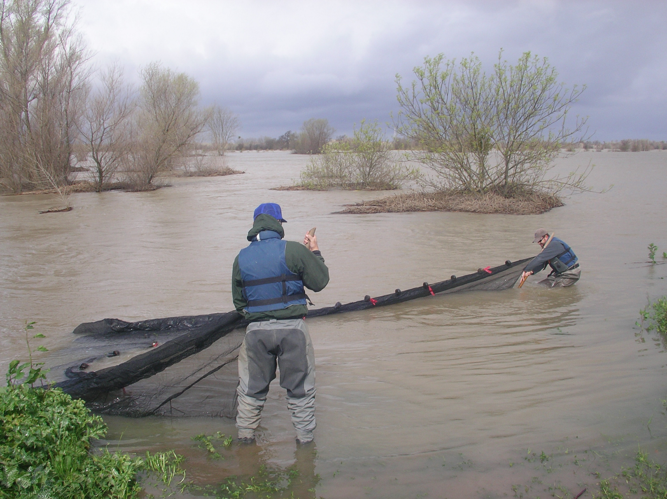
The use of both the DWR beach seine and RST data effectively showed changes in the fish assemblage in the Yolo Bypass during wet and dry years. It became important to realize that there are key native fish species that utilize seasonal floodplain habitat. The data revealed that the Yolo 
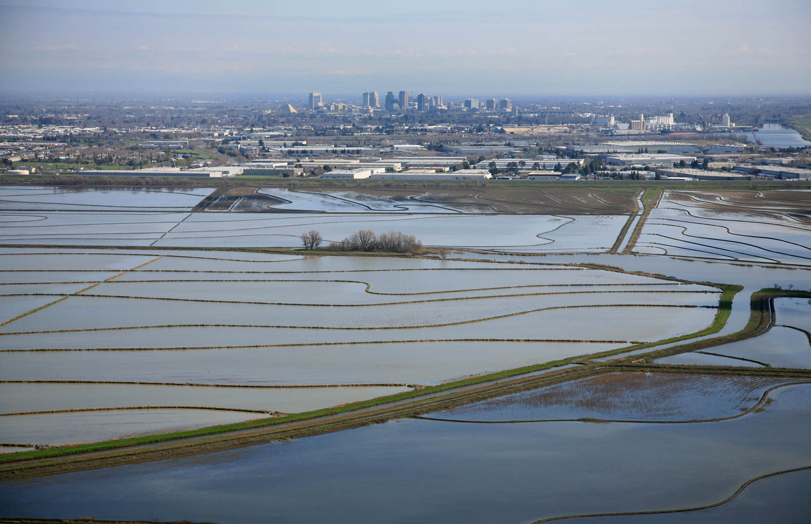
Bypass is dominated by non-native fish species much like the rest of the Sacramento-San Joaquin Delta, but seasonal inundations of the Bypass resulted in the beneficial spawning of the native Sacramento splittail and rearing of juvenile Chinook salmon. It became essential to also include the RST data in my analysis of native and non-native fish abundance in the Yolo Bypass, because it is a far more efficient sampling method than using two biweekly beach seine site transects in the Toe Drain.

Conclusion
The Yolo Bypass provides vital habitat and a sanctuary for a declining native fishery in the Sacramento-San Joaquin Delta. It's in the best interest of California to continue the research and monitoring in a seasonal floodplain habitat. The continued funding of IEP and the effort by DWR to collect annual data on fish and food-web dynamics have already exposed many of the benefits to floodplain preservation. I hope that the Yolo Bypass can be used as an example of future efforts to develop restoration efforts throughout the Central Valley to protect native fishes.

References
Feyrer, F, T. Sommer, and W. Harrell. 2006. Importance of flood dynamics versus intrinsic physical habitat in structuring fish communities: evidence from two adjacent engineered floodplains on the Sacramento River, California. North American Journal of Fisheries Management 26:408-417.

Sommer, T., R. Baxter, and F. Feyrer. 2007. Splittail revisited: how recent population trends and restoration activities led to the "delisting" of this native minnow. Pages 25-38 in M.J. Brouder and J.A. Scheuer, editors. Status, distribution, and conservation of freshwater fishes of western North America. American Fisheries Society Symposium 53. Bethesda, Maryland.

Sommer, T. R., W. C. Harrell, M. Nobriga, R. Brown, P.B. Moyle, W. J. Kimmerer and L. Schemel. 2001. California's Yolo Bypass: evidence that flood control can be compatible with fish, wetlands, wildlife and agriculture.California's Yolo Bypass: evidence that flood control can be compatible with fish, wetlands, wildlife and agriculture. Fisheries 26(8):6-16.

Sommer, T. R., M. L. Nobriga, W. C. Harrell, W. Batham, and W. J. Kimmerer. 2001. Floodplain rearing of juvenile chinook salmon: evidence of enhanced growth and survival. Canadian Journal of Fisheries and Aquatic Sciences 58(2):325-333

Sommer, T.R., W.C. Harrell, M.L. Nobriga and R. Kurth. 2003. Floodplain as habitat for native fish: Lessons from California's Yolo Bypass. Pages 81-87 in P.M. Faber, editor. California riparian systems: Processes and floodplain management, ecology, and restoration. 2001 Riparian Habitat and Floodplains Conference Proceedings, Riparian Habitat Joint Venture, Sacramento, California