| Title Beginner Mountain Unicyle | |
Author Jesse King American River College, Geography 350: Data Acquisition in GIS; Fall 2011 | |
Abstract My Paper is really geared toward recreation and not so much on the hard data aquisition. I decided to map a few trails that would be Mountain Unicycle, here in so forth known as MUni, beginner friendly. There is a lot of Mountain Bike trail maps ou there but not really any MUni trail maps. I thought a good way for beginners to get more into the sport would be to have a few trails mapped out for them. | |
Introduction As I said earlier, there is no maps readily available for a MUni rider. There are some generalized trail maps for very basic information, but not really on how many times one can expect to either fall off or need to dismount from their MUni. What I hoped to do was provide adequit details as well as mark places where one might expect to dismount before a hill or an obsticle. | |
Background
Very close to Sacramento is the Folsom Lake. There are a number of trails that follow the lake or stem off from the lake. It is a haven for hikers, mountain bikers, and equestrian enthusiasts. Hopefully MUni riders will be added to this list as well. The trails are not very well documented, unless you pay twenty or thirty dollars for a book of trail maps, or a mountain bike trail guide. Both of which give a good idea of what type of trail it is and what the elevation change is. But for a MUni you need to know more than just the length and the over all elevation gain. You need to know what type of trail it is, is it a loose sand, a shale rock trail, Single track, old fire road, or even soft grassy. All of these affect the way one rides a MUni. The loose sand is going to suck the energy right out of your legs, leaving you tired and not wanting to ride for longer than a few hundred yards. Where as the shale rock can be hazardous, the rock might slip from under your wheel and then you go down on hard sharp rocks. Another thing a beginner MUni might want to take into consideration is the availability of handups, or something to help them remount onto their MUnis. As a beginner remounting is a skill that you learn after you know how to ride. Because you need to know how to ride once you are able to get on the Muni without any walls or trees to help stabilize you. If a trail is a nice and smooth hard packed trail, it might be nbice to ride along, howver if a beginner has to dismount, or falls off and there are not any trees or something of the kind, then the beginner has nothing to help him remount. So now his nice ride turns into a nice hike with a unicycle for a walking stick.
Because I found no maps that would give any details about these trail attributes, I decided to map at least one trail. It also happened to be one that I have ridden on my Mountain bike, but not on my MUni. Because of the prior experience I knew it would be a fairly beginner friendly. I just did not know where the trouble spots where, or where one might find themselves with a very heavy and not very effective walking stick. The goal of myine was to use a GPS device to help mark where I would fall off or need to dismount to go up a hill, or down in some cases. It was not to give a complete elevation, or a turn by turn distance analysis.
A background on GPS itself, for it is a little more complicated. The GlobalPositioning System (GPS) is a satellite-based navigation system made up of a network of 24 satellites, also known as the cloud, placed into orbit by the U.S. Department of Defense. The satellites are powered by the sun, but have batteries that kick in during a solar eclipse or if they are in the Earth's shadow. Each satellite circles the earth twice a day and transmits a signal constantly to earth. GPS receivers take this information and use triangulation to calculate the user's location, down to the receiver's error. Public domain could be a few meters, where the private and or military is much more accurate. Keeping the satellites in their proper orbit, are small rocket booster to help with the propulsion. The satellites, in order to make their twice daily orbits, hit approximate speeds of 7,000 miles an hour. The Department of Defense GPS developed them originaly for military purposes, hoowever in the 1980s, the U.S. government made it readily available for civilian use. GPS works in any weather conditions, anywhere in the world, 24 hours a day. (As long as you have aclear signal from the sky without any major obstructions.)
| |
Methods
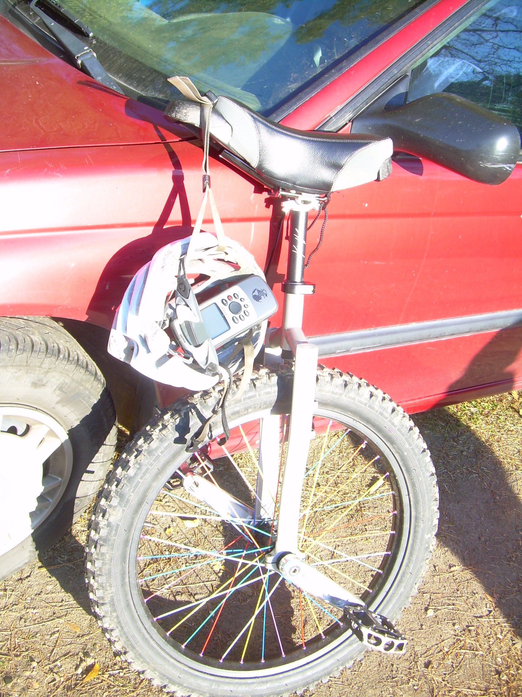
This being the first time I have played with a GPS unit for more than five minutes, it took som egetting used to. The controls were easy enough to figure out, although having the manual helped immensely. With the GPS unit I took a track of the trail I wanted to map out, while riding my MUni and marking waypoints along the way.
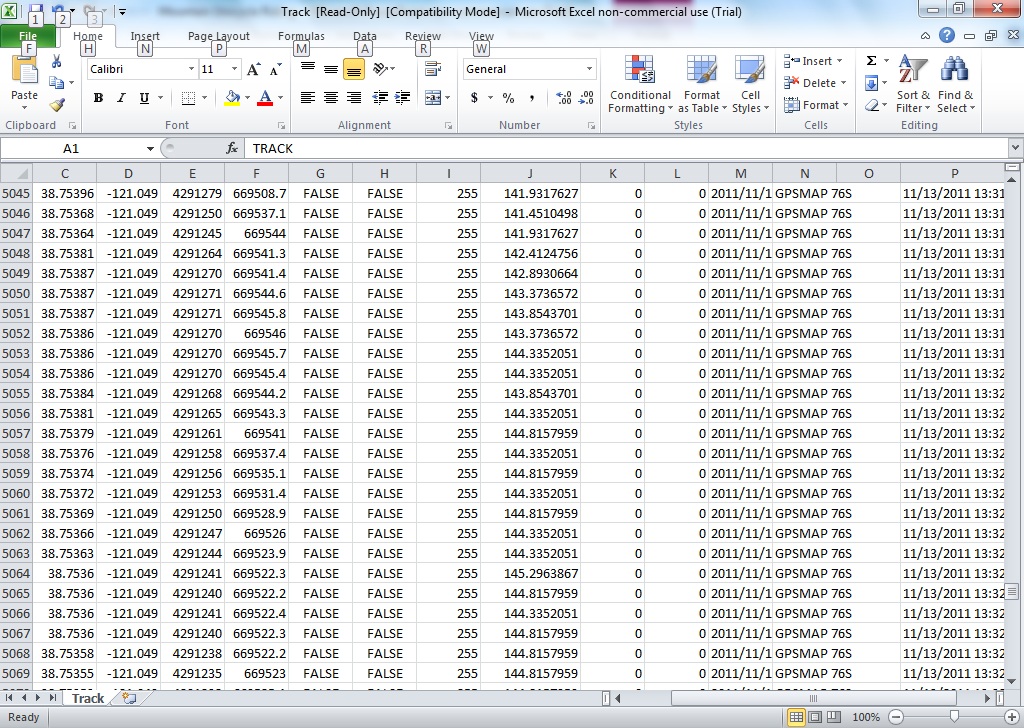
Exported that to an Excel file.
After this I used ArcMap to import the spreadsheet and use the coordinates to display the point data.
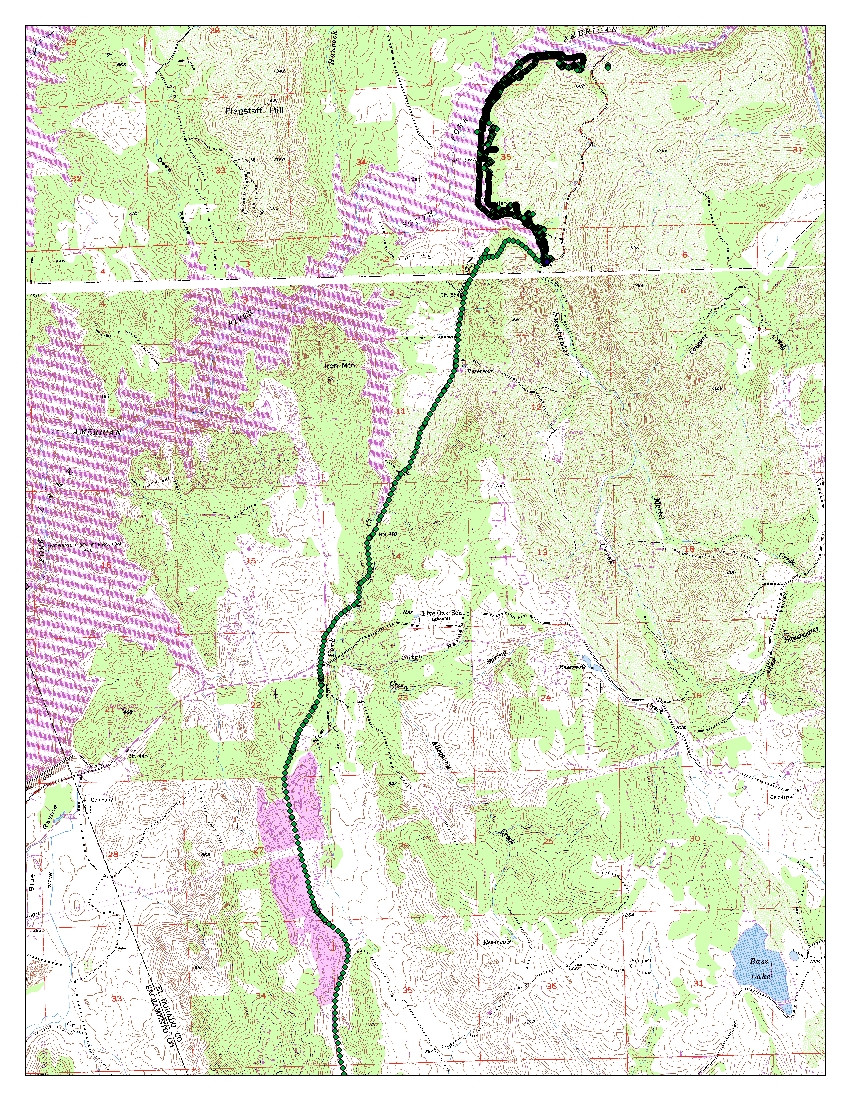
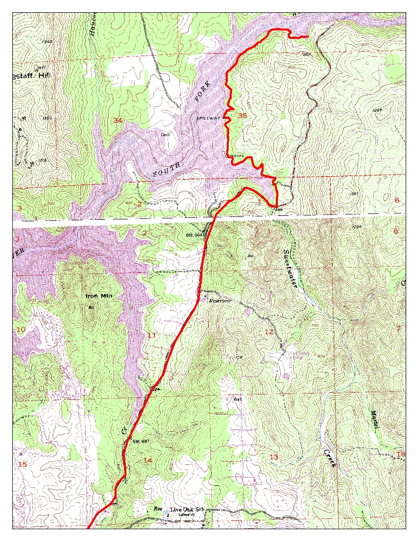
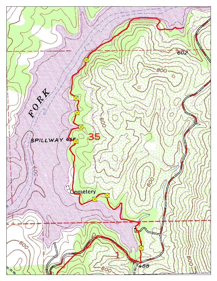
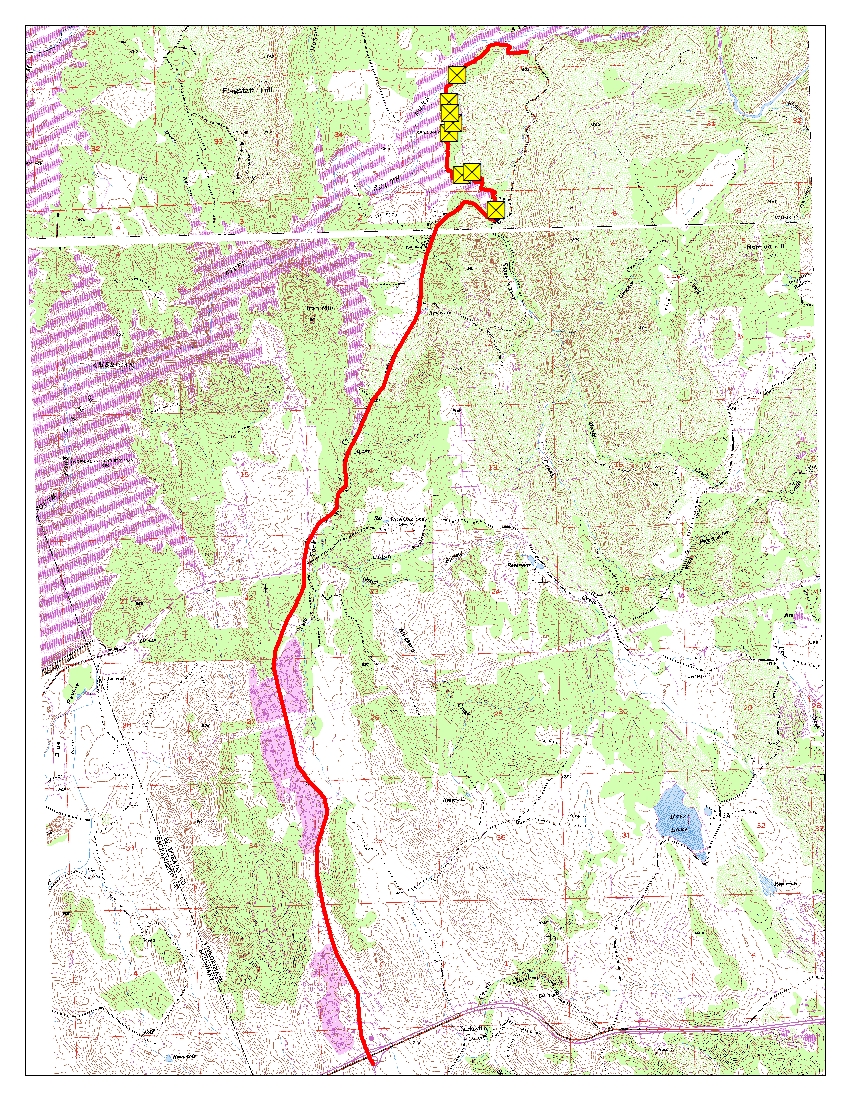
From there I used a new line tool to "connect the dots". More rather I traced the path I took with the GPS unit with a line tool to see how long I went as well as to make a more pleasing appearance.
I also used a USGS togographical map, several actually, to act as a background to the new "trail" I made.
Then there were the waypoints I had taken everytime either fell off or had to dismount due to an obstacle or a hill I could not ride up or down.
Using all of these elements I was able to make a map that I hope will inspire new MUni riders, or at least give them more information than was readily available.
| |
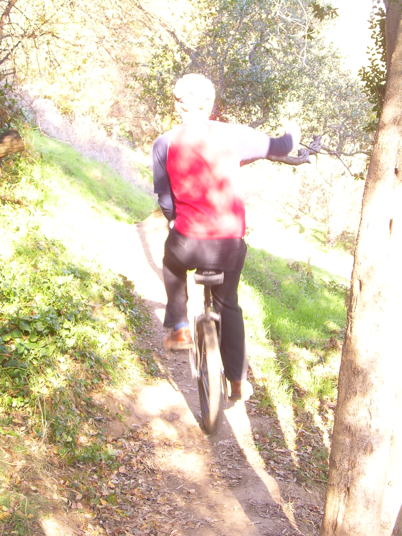
Results I think that the results turned out rather well. There was a hickup here or there when it came down to learning about the GPS unit. As well as a few bruises from the pedals coming back and hitting me in the shin, but it was all for the greater good. Hopefully my pain and suffering can help beginners have more fun and less pain. | |
Analysis Even though this map is of a specific target audience, and is of a fairly well documented area, the same steps I took could be used for other purposes as well. I could have also mapped a different area, one with less resources on it, or used my methods for a different audience. One good thing about using GPS devices is that they are extremely versatile. The problems I encountered were weather, getting my body able and willing to suffer, someone to take pictures with me, and the setting of the track interval was too fast at one point.
| |
Conclusions The next time I would like to explore more trails that would be good for a beginner, mayhaps even an intermidiate or two. I would also like to involve more of my friends in the process. The more MUnis the better.
| |
References http://garmin.com http://www.usgs.gov GPS World, February 2003 | |
links USGS |