Riparian Corridor Restoration: | ||||||||||||||||||||||||||||||||||||||||||||||||||||||||||||||||
Author InformationWendy ToffolettiAmerican River College Geography 350: Data Acquisition in GIS Fall 2011 7016 Woodknoll Way, Carmichael, CA 95608 rwtoffoletti@sbcglobal.net | ||||||||||||||||||||||||||||||||||||||||||||||||||||||||||||||||
AbstractRiparian corridor restoration projects are occuring all along the American River. Many non-profit orgainizations recruit hundreds of volunteers | ||||||||||||||||||||||||||||||||||||||||||||||||||||||||||||||||
IntroductionThe American River is one of the best rivers in the nation. It originates in the Sierra Nevada mountain range and empties into the Sacramento River.Here in Sacramento, the American River is buffeted by a 23-mile riparian corridor known as the American River Parkway. The American River Parkway Foundation (ARPF) is one of many non-profit organizations dedicated to protecting this local treasure. Among other conservation efforts, the ARPF has championed the Oak Mitigation Project, a project designed to restore the riparian buffer zone hugging the banks of the American River. The objective of this project is to gather both qualitative and quantitative spatial data to analyze the success of their restoration efforts. | ||||||||||||||||||||||||||||||||||||||||||||||||||||||||||||||||
Background
In the Spring of 2009, I chaperoned my daughter's 6th grade science field trip to Rossmoor Bar, a section of the American River Parkway | ||||||||||||||||||||||||||||||||||||||||||||||||||||||||||||||||
MethodsA dataset of existing mitigation sites in the American River Parkway was acquired from the County of Sacramento Regional Parks Department. Using ArcMapthis dataset was projected and given a topographic basemap. The map produced is excellent for location reference and highlighting Elmanto Grove along the Parkway. Multiple field surveys were conducted and qualitative and quantitaive data was collected. Using the Garmin GPSmap76S waypoints for each tree in the Elmanto Grove were recorded. The species class, cage type and height of each tree was also recorded. Then using ArcMap these waypoints were projected and given an aerial basemap. In addition, an attribute table containing the recorded qualitative and quantitative data was created and linked to this new map layer. | ||||||||||||||||||||||||||||||||||||||||||||||||||||||||||||||||
ResultsThe following table is a sample of the data recorded during the field surveys. Species identification was done visually and confirmed by two people.Height was measured using a 12' tape measure. And all cage types were recorded.
| ||||||||||||||||||||||||||||||||||||||||||||||||||||||||||||||||
Figures and Maps | ||||||||||||||||||||||||||||||||||||||||||||||||||||||||||||||||
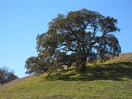 Valley Oak |
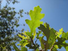 Valley Oak Leaves | |||||||||||||||||||||||||||||||||||||||||||||||||||||||||||||||
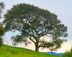 Interior Live Oak |
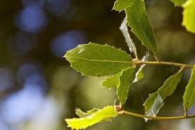 Interior Live Oak Leaves | |||||||||||||||||||||||||||||||||||||||||||||||||||||||||||||||
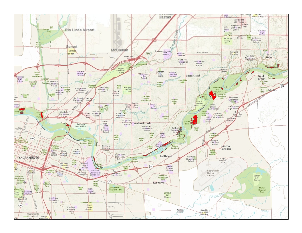 Mitigation Sites in the American River Parkway |
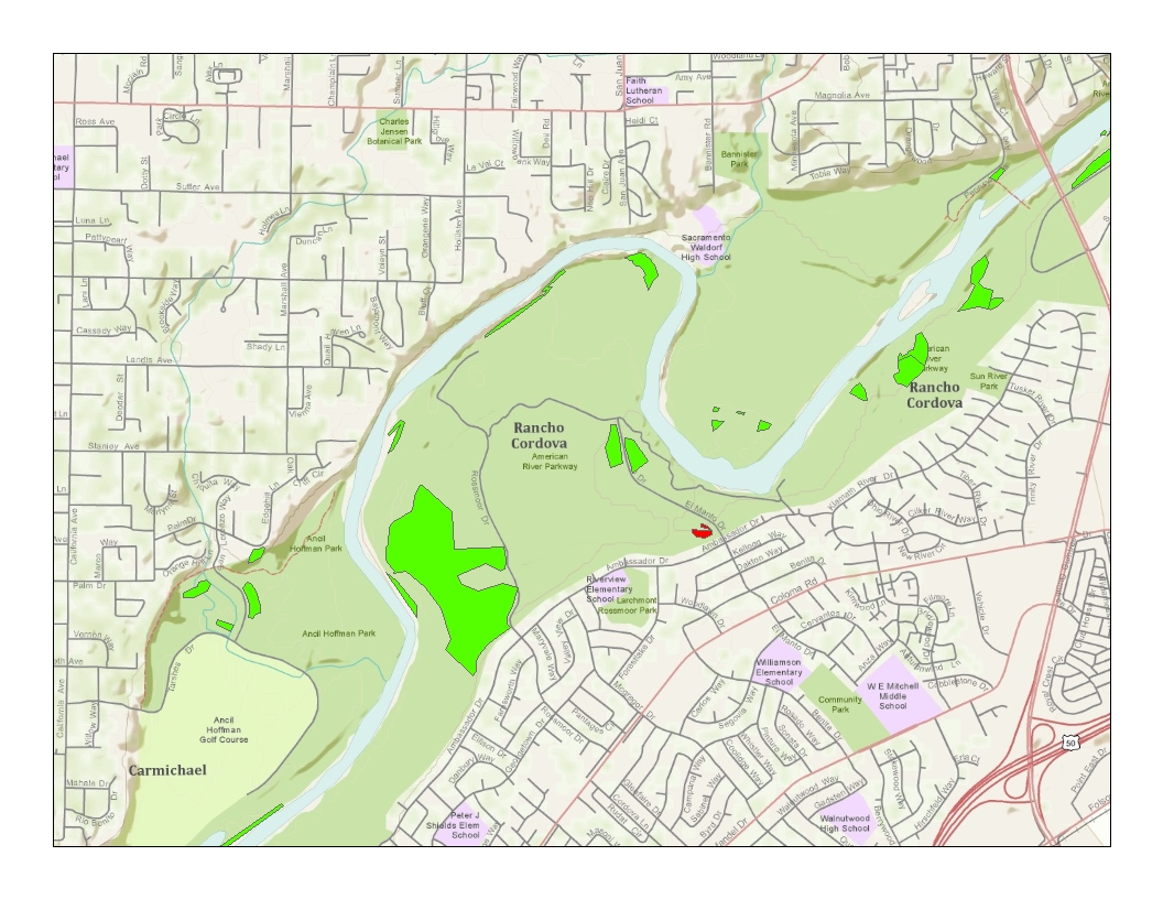 Elmanto Grove Higlighted | |||||||||||||||||||||||||||||||||||||||||||||||||||||||||||||||
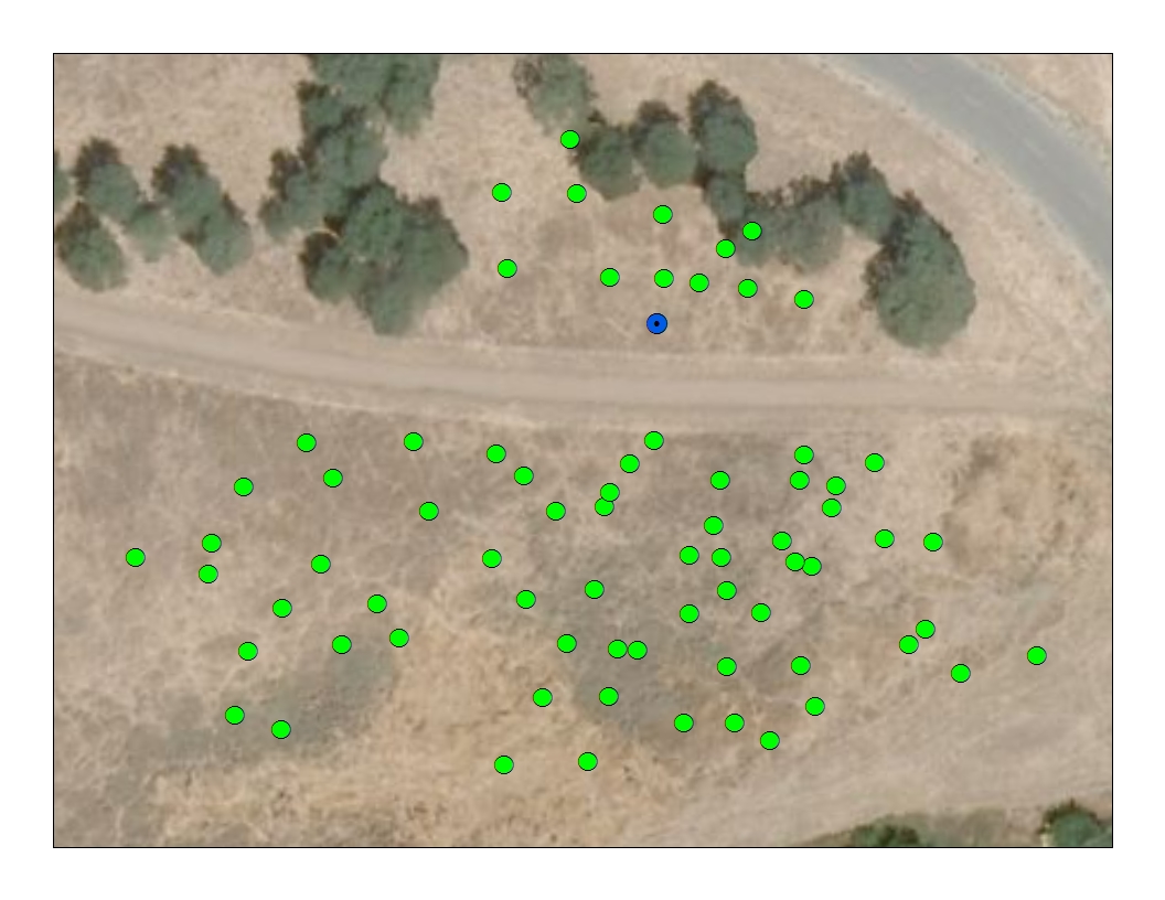 Marked Waypoints of Trees in Elmanto Grove |
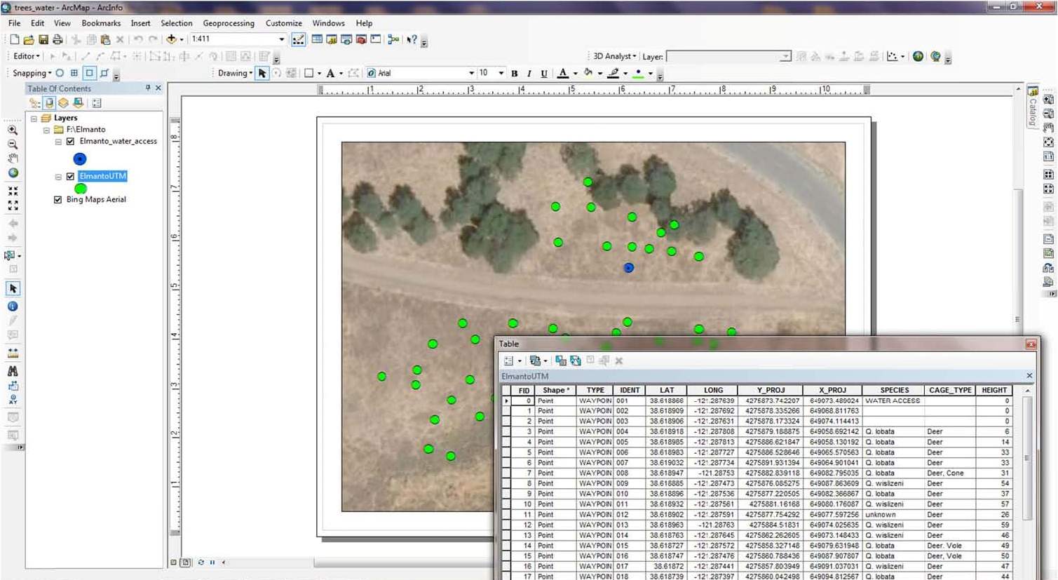 Georelational Model: Elmanto Grove with Corresponding Attribute Table | |||||||||||||||||||||||||||||||||||||||||||||||||||||||||||||||
AnalysisField survey data was easily obtained using the Garmin 76S. However, due to lack of experience, multiple trips to the grove were needed to obtain more relevant data.Manipulating the data in ArcMap was also restricted due to my limited knowledge and experience with this software. The final georelational model is good but incomplete. More comprehensive data is needed. As I progressed in my research I discovered many variables that can potentially influence tree growth and health that were not observed nor recorded. This missing data coupled with the fact that I only obtained one height measurement makes it difficult to qualitatively measure the success of Elmanto Grove. However, I do think the qualitative and quantitative data recorded will be extremely valuable for future analysis. | ||||||||||||||||||||||||||||||||||||||||||||||||||||||||||||||||
ConclusionThe qualitative and quantitative data recorded and given spatial reference will be very valuable for future analysis. The continued monitoring of Elmanto Gove willcreate opportunities to see correlations between species, cage type, invasive weed populations, oak predator activity, annual precipitation levels and tree health. Visual examination of Elmanto Grove alone has been encouraging. However, good data formally recorded is more useful and conclusive. Sufficient data is necessary to making good predictions and decisions about current and future mitigation efforts. The ARPF had recorded information about Elmanto Grove from its inception but the fire in 2010 made all that information obsolete. And since this is the first season of recordings since the fire the data is insufficient for making any kind of comparison. Fortunately, predictions and observations can still be made and tested. And now there is a formal place to record future findings. Today, Elmanto Grove is alive and thriving. Honest efforts are being made all along the American River Parkway to restore its riparian corridor. Implementing GIS into these efforts will produce positive results and positively influence future decisions regarding this local treasure. And I can think of twenty-eight 6th graders who would love to get their hands dirty again. | ||||||||||||||||||||||||||||||||||||||||||||||||||||||||||||||||
ReferencesAmerican River Parkway Foundation www.arpf.orgCounty of Sacramento: Regional Parks www.msa2.saccounty.net/parks Maret, Mary. Senior Natural Resource Specialist. Sacramento County Department of Regional parks. "GIS Data Files." Message to author. 11 October 2011. e-mail. Myatt, Ken. American River Parkway Foundation Program Coordinator. Personal interview. | ||||||||||||||||||||||||||||||||||||||||||||||||||||||||||||||||