Title
A GIS
Approach Analysis for a High Speed Rail System in
Author
Adolfo Galindo,
Abstract
This paper provides an overview of how GIS analysis can be
used towards understanding and assessing the conditions to construct a HSR
(high speed rail) system for
Introduction
Aside from political and fiscal
obstructions which have so far hindered the construction process of a
In a nutshell, my question is; how is it that we don't have an American version of a high speed "Euro-pass rail system" by now, when it makes perfect sense for other countries to do so?
Background
On
As a recent user of light rail transportation, I discovered the benefits of having an efficiently designed light rail system for getting in and out metropolitan places versus the hassles of parking and traffic to the same destination. Furthermore, if we took the process of traveling to other metropolitan places several hundred miles away, the convenience would be the same with the added benefit of reduced travel cost and time savings if conventional means (auto or airline) were to be used.
If we can envision a truly
well designed high speed rail network for the continental
The American mind set for using more mass transit on a grand scale needs to be addressed and set in place so that the public at large can “adopt” and get used to the idea travelling from Sacramento to L.A. a little more than 2 hours vs. 8 hours and perhaps offer the choice to live further away from cities altogether, thereby lessening urban congestion.
One should also consider the fact that unlike most airline routes, a high speed rail system can provide stops along a destination route, without having to cut greatly into travel time, and therefore, give the rider more opportunities to do more business, or pleasure and at the same time, see more of the country along the way, even when traveling at 200 mph.
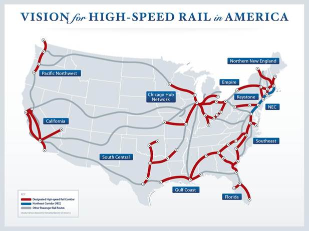
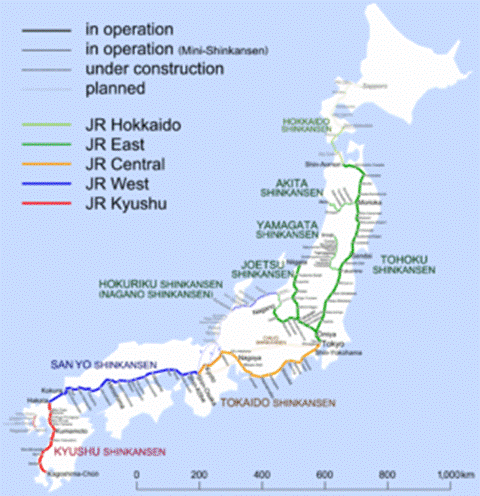
Below is a high speed rail map for the
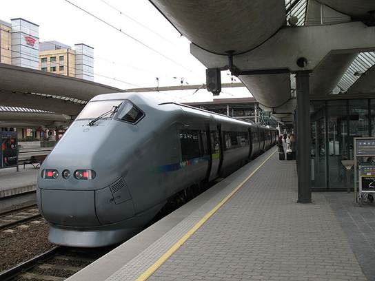
The same concept, although, now an everyday reality for most
part of
A High Speed Rail station in
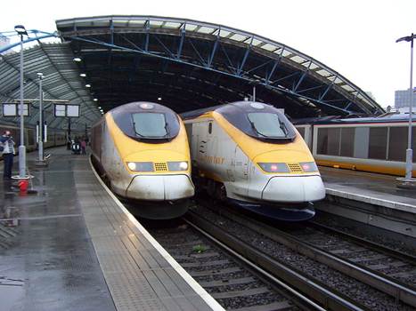
A high speed station at
.
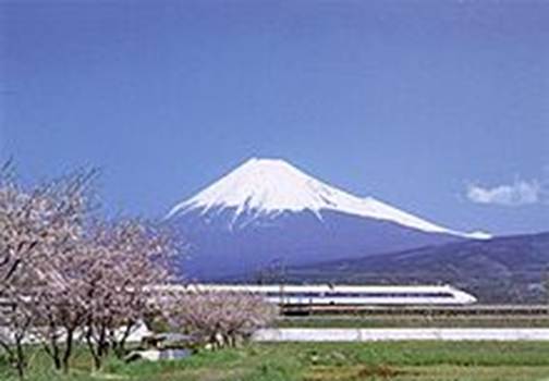
The famous Shinkansen trains of
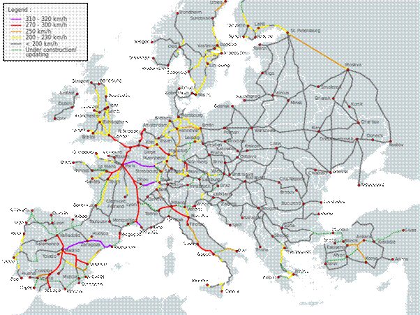
High Speed Rail System –
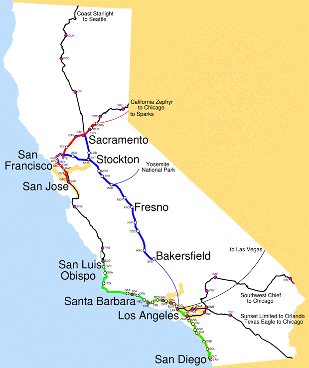
Proposed High Speed Rail routes for
Methods
High speed rail has been an interest in the United States for sometime, however, the movement to facilitate a complete country wide system, let alone one in California, has been put off by too many constraints, primarily funding and political support.
As fuel prices rise, consumers have been looking for ways to utilize mass transportation that is not only convenient but an efficient way to save time and travel cost. However, through the adversity and the hype of the cost of building a high speed rail service, one must consider how the rail design and construction could be accommodated. The use of cadastral mapping thru GIS is one method to address this problem.
Cadastrals can be easily examined using a GIS where pertinent information about specific land parcel features and their attributes could in turn provide an analysis for suitable rail locations. Likewise, a spatial query for rider access, environmental impacts and other concerns can also be addressed when selecting the two most important considerations for a high speed rail; track and station location.
Consider the following examples of a GIS suitability
analysis taken from a study done in
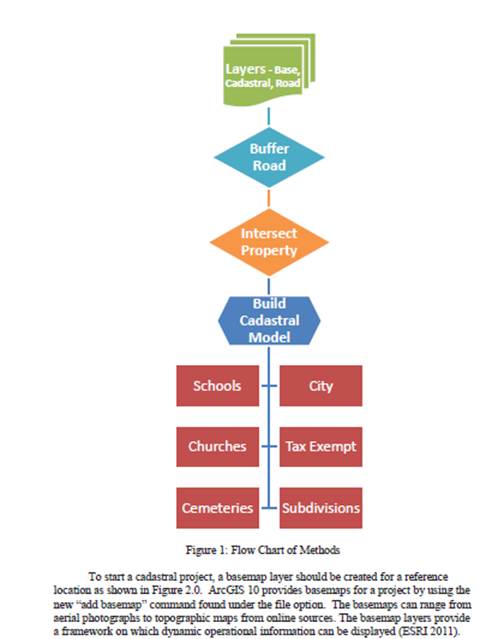
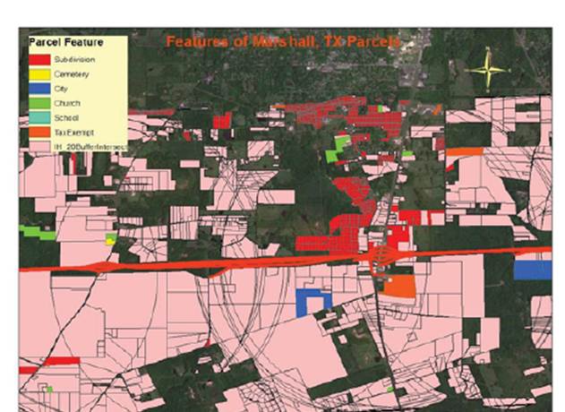
Map of features where rail line track cannot be placed using GIS buffers and intersect tools.
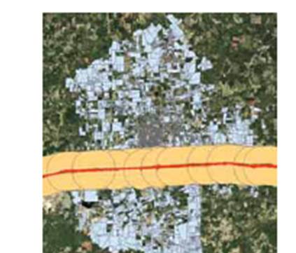
A two mile buffer radius thru a proposed town
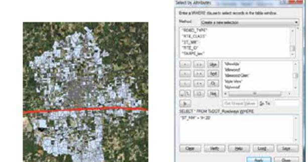
Query selection for attributes on ownership and right of way
Available basemaps
A partial listing of potential factors and considerations which may impact high speed rail construction include, but are not limited to:
Right of way
Parcel ownership
Environmental impact
Grading
Traffic analysis and Networking
Topology
Public and private facilities
Accessibility to stations (distance)
Parking facilities
Noise levels
Public and private amenities (car rentals)
Lodging and public facilities
Fiscal analysis
References
Using cadastral
maps for high speed rail systems in
Jennifer Kennedy,
E.I.T,
http://proceedings.esri.com/library/userconf/survey11/papers/pap_3947.pdf
High-Speed and Intercity Passenger RailVision of High-Speed Rail in America
http://www.fra.dot.gov/rpd/passenger/31.shtml
Potential E.I.R analysis of high speed rail
http://escholarship.org/uc/item/5nd761fx#page-1
California High speed Rail Authority