| Title Historic Davis | |
|
Author Rebecca Flores American River College, Geography 350: Data Acquisition in GIS; Fall 2012 Contact Information - email: floresri@imail.losrios.edu | |
|
Abstract Plotting the historical growth of Davis will have to wait another day. Today we will aid the Yolo County GIS site by providing a photograph and property information to parcels within an area known as Old North Davis. | |
|
Introduction The original idea for this project was to create a historical display of the growth of a specific area of downtown Davis, known as Old North Davis, using parcel data to represent the growth by year. What I ended up with was slightly different. I intended to use historic aerial photography to map out the yearly growth of the city.Unfortunately, I was not able to find free historic aerial photograph online. My next thought was to use USGS historic quads. This too was an issue. The level of detail on the 7.5 minute quads was not adequate, and it did not show enough structures to get a sense of yearly growth. In the end, this idea was scrapped and I decided to document the current residence in Old North Davis by taking photographs of the buildings and including whatever availble documentation the county assessor had to offer as a hyperlink to the parcel data I downloaded from the Yolo County GIS site. | |
|
Background The first step I took after deciding on a project was to check out the county GIS page. To be honest, I wasn't expecting much.In my experience, the California County GIS sites seem to vary quite a bit. Some have lot of free data, others have fees for their data, and other counties are still in progress building their site. Yolo County GIS had a few layers I was interested in. After analyzing the parcel layer attributes, no year built information was found. My intent was to contribute (non-directly) to the Yolo County GIS data by adding year built information to the parcel layer. One note, I later discovered the Yolo County Assessors Office does contain this data, but it is only available for a fee. | |
|
Methods Once I had a more clear idea as to what my project was to entail, I then thought it was fitting to collect some data. As I previously stated, I downloaded the parcel layer from the county, as well as shapefile for the roads. I already had an idea of my study area, but I totally over estimated the time and effort this would take. Originally my study area included a five by four block area. I realized soon after that this area was just too large. I then downsized my study area to a roughly two by one block area, which was much more managable for a one person survey. (see image) | |
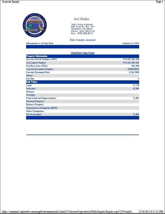
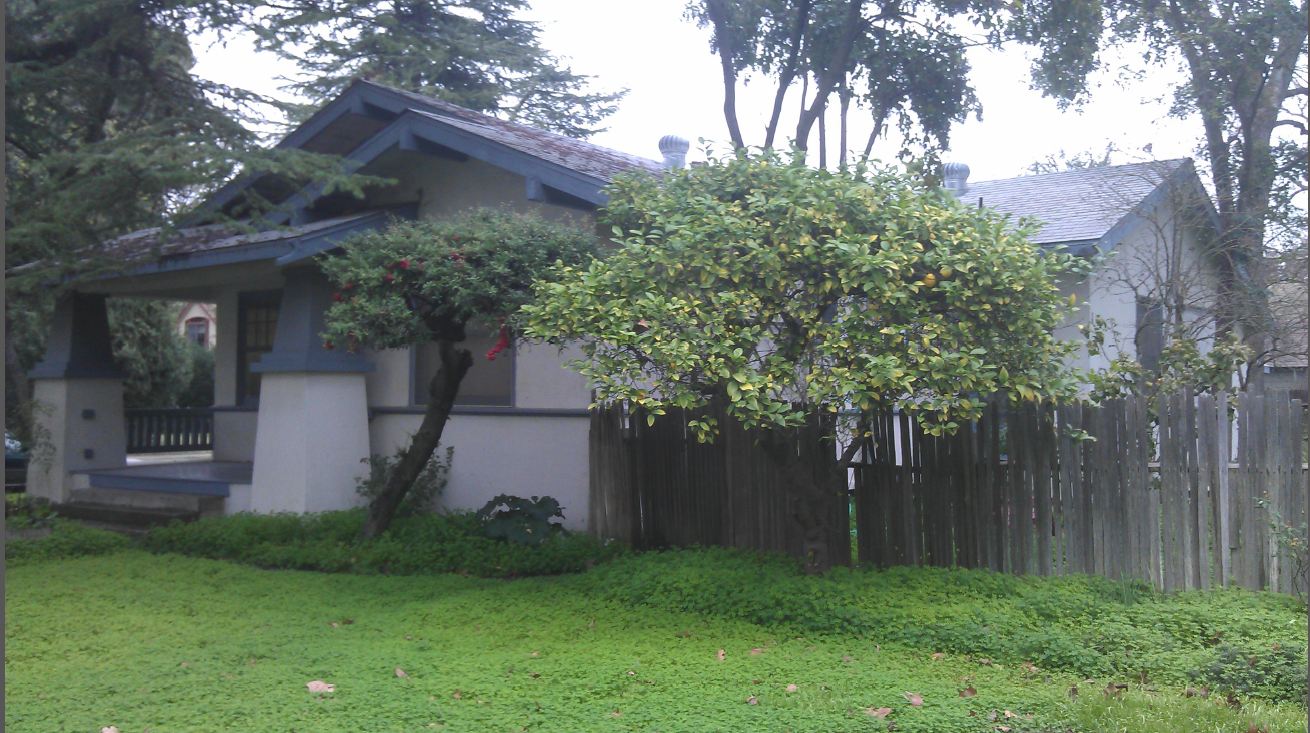
| I then set out to do some fieldwork, as it were. I originally imagined I'd use the GPS loaned to me in class, take waypoints and photographs, then plot them out once I got back home. I found this a bit redundent. Because I used my phone to take the images, which contains built in GPS, I did not need to carry around an additional GPS. After the photographs had been downloaded and assigned to the appropriate parcel, I then printed to PDF some additional property information available from the County Recorders site. I then exported the photographs from the original jpg format, to a pdf and then combined them with the property data. I did this for each parcel. I then created hyperlinks in the parcel layer so one could click on a parcel to receive more information regarding that parcel. |
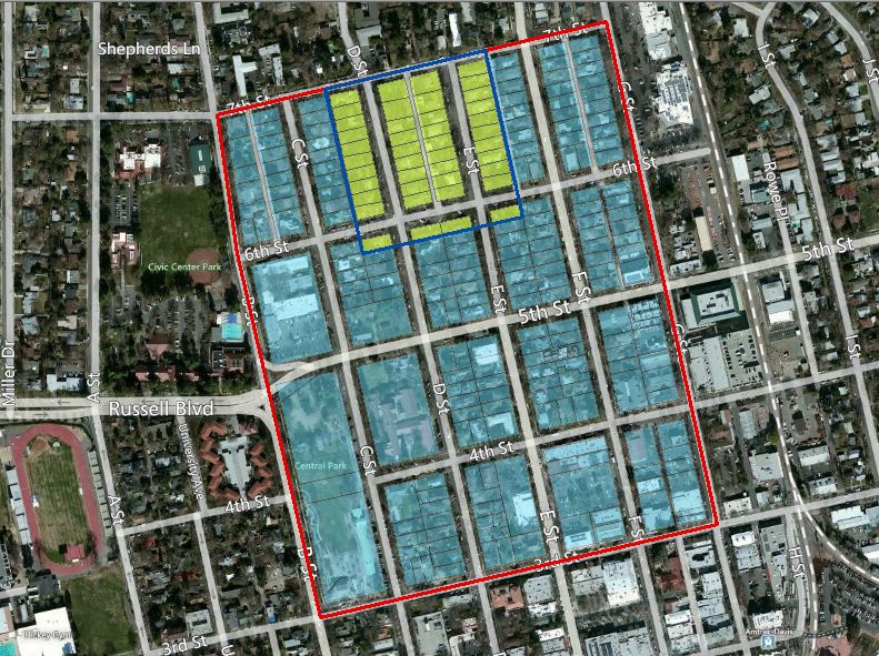 (Showing Original study area (red) and the revised study area (blue) |
|
Results Like I mentioned before, the parcel data was obtained through the Yolo County GIS site. The photographs were taken by me, with my phone an HTC Sensation.The parcel information was obtained through the Yolo County Recorder's site. | |
|
Figures and Maps Sample property information | |
 |
 |
|
Analysis I had to modify my project significantly, and I did not meet the original guidelines I had set for myself. However, I do think it was successful in the sense that I was able to adapt and create new guidelines for the project.
I think the tool I created could be useful for citizens or visitors of the Yolo County Assessor site. | |
|
Conclusions In the future, with additional research at the library, I think I could accomplish my task of mapping the growth of Davis. In the mean time, I think the tool I created could be useful for citizens or visitors of the Yolo County Assessor site. | |
|
References Yolo County GIS, http://www.yolocounty.org/Index.aspx?page=587 Yolo County Recorder's Office, http://www.yolocounty.org/index.aspx?page=344 | |