| Title Frequency of Malignant Mesothelioma in California by County, 2000-2004 | |
Author William Esparza American River College, Geography 350: Data Acquisition in GIS; Fall 2013 Contact Information: willesparza@yahoo.com | |
Abstract Malignant mesothelioma is an asbestos-related cancer that is being targeted by aggressive law firms. Is the disease worthy of the negative attention and is it truly related to asbestos? After comparing the geologic formations throughout California with the known occurrences of the disease the map certainly shows a correlation. The available data is ten years old, so a comparison to more current data is needed to determine if the lawyers are correct. | |
Introduction Have you ever seen those late night commercials with the law firms that want you to call if you believe you have been exposed to asbestos or have been diagnosed with mesothelioma? These commercials would indicate that mesothelioma is a global crisis. Malignant mesothelioma is the most serious of all asbestos-related diseases and it is thought to be caused by a single exposure incident. However the disease is rare. According to the Centers for Disease Control (CDC) about 200 cases are diagnosed each year in the United States and approximately 2 percent of all miners and textile workers who work with asbestos contract mesothelioma. | |
Background | |
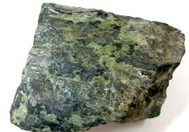
| Mesothelioma is an aggressive and rare form of cancer that most often occurs in the thin membrane lining of the lungs, chest and abdomen. Virtually all cases of mesothelioma are linked with asbestos exposure and has a latency period of 30-40 years. California is a hotspot for this discussion because of the prevalence of the serpentine rock. Serpentine is known as the “State Rock of California” and is the source for chrysotile asbestos, which can be found in hundreds of building products as well as the very ground we live on. |
 |
Methods I began the project by first collecting a background map of California from ESRI depicting the counties with various demographic categories of information. The demographic data for each county includes population, race, gender, household sizes and owner-occupied homes. I also collected shape files for cities, major roads, hydrography and the Public Land Survey System for California to allow for further analyses. I then acquired geologic maps of California from the U.S. Geologic Survey (USGS) and isolated out the mineral serpentine. Data from the USGS can also be used to show fault lines in addition to the many different types of geologic formations throughout the state. Lastly, I scoured the internet for statistics regarding deaths caused by malignant mesothelioma. All information I found through various organizations was ultimately referenced back to the CDC. I downloaded several spreadsheets with death statistics for all of the U.S. over different year ranges. I selected data from 2000 through 2004 because it gave a comprehensive account of deaths broken down by county. | |
Results Naturally Occurring Asbestos (NOA) is shown to be abundant in the coastal mountain ranges of the northern part of the state by isolating out the serpentine in the USGS geologic data. Additionally, NOA is also known to be prevalent in the foothills of the “Gold Country” through personal knowledge and numerous media reports. In fact, El Dorado Hills is known around the world as “ground zero” for NOA. | |
Figures and Maps Map of known serpentine deposits in California and data from CDC depicting mesothelioma deaths between 2000 and 2004. | |
 |  |
Analysis | |
 |
Each county is color coded to show the number of deaths caused by mesothelioma. The choropleth map depicts the data as predicted: Red counties have more than 20 deaths between 2000 and 2004. Dark orange counties have between 15 and 20 deaths during this time period. Convesely, yellow counties have less than five deaths during this time period. |
Conclusions The counties with the serpentine deposits have more mesothelioma-related deaths. Also, the counties in the Sierra foothills that are known to have high amounts of NOA also have more deaths. The one and only anomaly is Siskiyou County, which has over 30 deaths between 2000 and 2004 and is not in the previously defined locations. However, further analysis with the geological data may show the reason for this anomaly. | |
References California Environmental Protection Agency, Air Resources Board, 2002, Naturally Occurring Asbestos General Information. National Institute for Occupational Safety and Health, Malignant mesothelioma: Age-adjusted death rates by county, U.S. residents age 15 and over, 2000- 2004, (Ref. No. 2007F07-03) United States Department of the Interior, U.S. Geological Survey, Preliminary Integrated Geologic Map Databases for the United States - Western States: California, Nevada, Arizona, Washington, Oregon, Idaho, and Utah. United States, Environmental Protection Agency (USEPA), June 1985, Guidance for Controlling Asbestos-Containing Materials in Buildings, (EPA 560/5-85-024) | |