| Title The Use of GIS in Agriculture | |||||||||
|
Author Nirmal Sandhar American River College, Geography 350: Data Acquisition in GIS; Fall 2014 Contact Information smin73@gmail.com | |||||||||
|
Abstract California is one of if not the leading state within the agricultural industry. ArcGIS has become a leading software application used for tracking business growth, risk management and various other aspects. Could these two fields be combined and used together? I will make an attempt to show how ArcGIS could be used within Agriculture and determine if it could be used to help grow the production within the business. | |||||||||
|
Introduction My family has been involved in agriculture for as long as I can remember. Because of this background in agriculture, I decided to see how I could incorporate it into the day to day operations of farming. The way I intend to implement GIS in agriculture is by tracking the trees within each orchard with features such as the age of the tree, the variety of the tree, and annual costs by orchard. As a start, I think tracking these types of things would allow me to visualize how the orchards are doing every year, how production costs could be reduced and it would allow me to keep track of how often trees are replaced. Eventually I would like to be able to track things like irrigation schedules and pesticide application schedules. I think tying in things like weather could be used to help irrigation timings and tracking moth movement by season could allow one to time pesticide applications more efficiently. | |||||||||
|
Background California is home to over 200 different crops, some of which are grown in no other place in the nation. California is home to the nearly entire production of crops such as almonds, apricots, dates, figs, kiwi fruit, nectarines, olives, pistachios, prunes and walnuts. Nearly 73% of the state’s agricultural revenues are derived from crops while the rest (27%) of the revenue is generated from livestock. | |||||||||
|
Methods When I first began my GIS education, I had the idea of mapping all of my parent’s orchards to see how I could incorporate GIS in agriculture. I initially started with purchasing a hand held GPS unit and driving around the orchard on an ATV marking tree points. 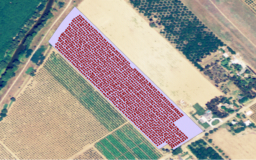 However, once I got back to a computer and imported those coordinates, I found that some of the points were off by a couple feet. To fix this problem, I had to start an editing session and move points so they matched up with where the trees actually were. This ended up being a rather tedious task. To help remedy this, I created a web app for a different class which allowed me to mark the trees using a background image. 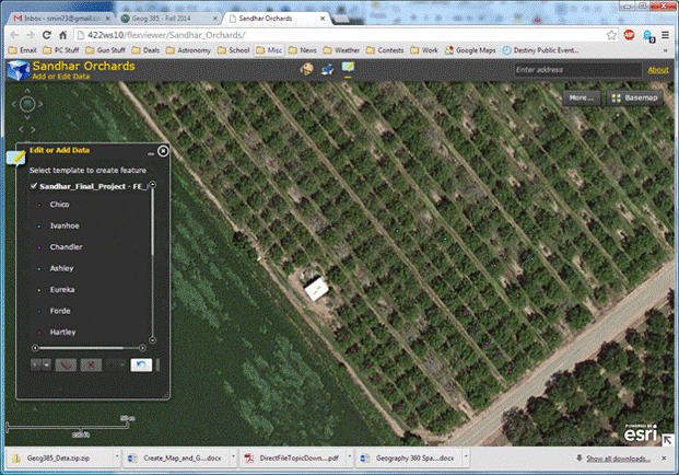 While I was creating the web application, I decided to create a Geoprocessing Process to count the number of trees according to the variety of the tree. To do this, I created a model within ArcMap to perform this operation. This is the model which was created: 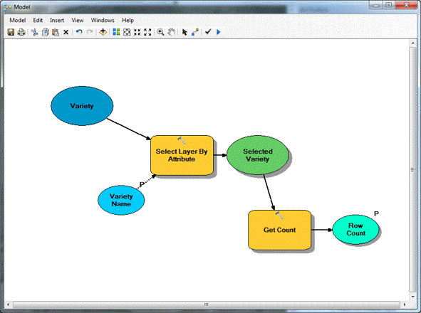 This is the result of running the model in the web application. 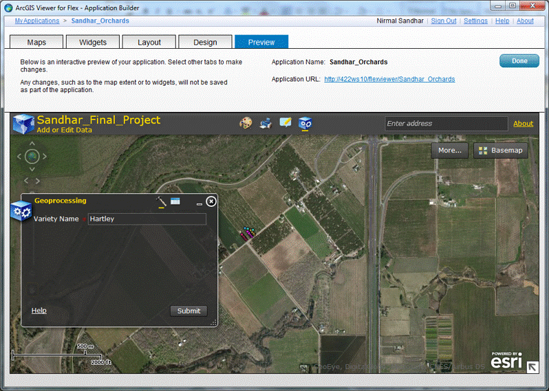 Althought this image doesn't show it, instead of typing out the variety name, the model was cahnged to allow the user to pick a variety from a drop down list of the different varieties.
| Results Both methods (using a handheld GPS and the web application) were very promising for gathering tree data. However, while each had their own issues, the issue could be resolved by using the other method. In the case of using the web application to mark trees, when there wasn’t imagery was too old and didn’t contain the trees, one could use the handheld GPS and mark the trees manually. 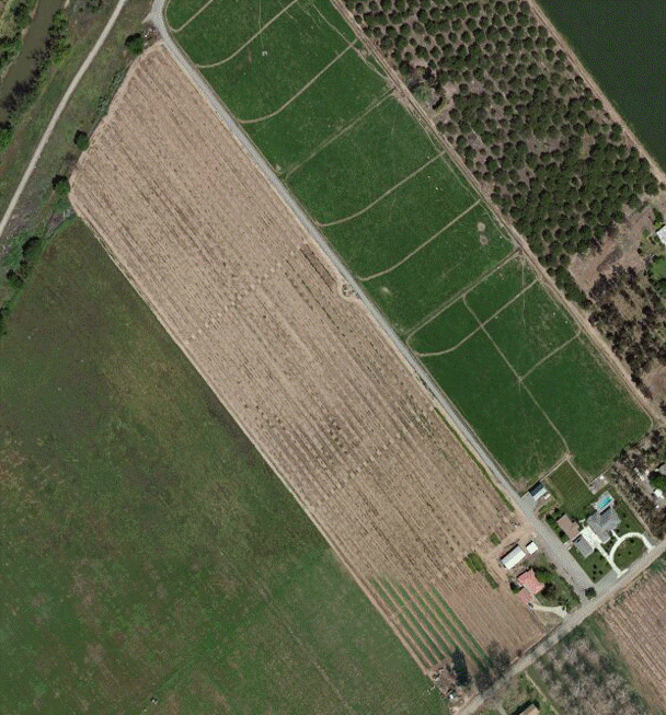
| Analysis Although the results were very promising, what I found out was creating a database takes a lot longer than I had expected. From the web application which was created, I was able to mark trees and the variety of each tree. With a little more work, I could have included the age of the tree and which year it was planted. Eventually I could also keep track of the amount of irrigation used for each orchard, the amount of pesticides used for each orchard and the time frame when these applications occurred. Weather patterns could also be tracked however with the unpredictable nature of weather that data would be difficult to use for future irrigation schedules.
| Conclusions GIS could be a powerful tool in just about any field of study. This project showed me that it could be very useful in agriculture. With further expansion of the type of data collected, it could be extremely useful with the various operations of running an agricultural business.
| References Netstate.com/Economy Last updated: May 5, 2014 |