American River Parkway Amenities Framework


Author Information
Edward Nieto
American River College, Geography 350: Data Acquisition in GIS; Fall 2015
nietosac@gmail.com

Abstract
To show the feasibility of having an online map for the American River Parkway amenities, the ArcGIS Online system was used to produce a framework that can be used with an mobile device (e.g., cellular phone) with a specialized software named Collector for ArcGIS by ESRI, Inc. The vision would be to allow anyone to collect and post online the additional amenitities as well and add the additional information to the online map.

Introduction
The American River Parkway is one of the most scenic and accessible area in the greater Sacramento area. This project establishes an Internet online option to view the amenities where individuals visit the parkway every day. The amenities identified are common park features that one would expect at regional parks. In addition, the frameworks allows the addition of more features and input on specific information on the feature (akin to Wikipedia but to spatial based items).

The need for an online modifiable map is based on the classic shortfalls of a paper map. The first shortfall is the information is not up to date. In a beautiful map produced by the American River Foundation was produced in 2009. The other shortfall is the scaling of the map. The Parkway extends some 32 plus miles from Old Sacramento to Folsom Lake. A paper map to be used while visiting the parkway is physically limited to a certain size and thus the levels of details of the amenities are also limited. These and others shortfalls are oversome by anconline editable map. However, the flexibility and the management of the online map raises other issues such as the quality control of the information, the type and security control of the information to be placed on such online sources and lastly the assurance that the online map will be available when needed.

Background
The parkway was recognized in 1962 as part of the Sacramento County General Plan and in 1985 the use was placed in the American River Parkway Plan. Over the years and managed by the County of Sacramento. The role of the County is best understood by reviewing its American River Parkway webpage. Beyond government controls, the parkway is promoted by nongovernmental agencies including the American River Parkway Foundation webpage . This foundation produces a map that is available at its VOlunteer Center located at the Ancill Hoffman Park within the Parkway.

Methods
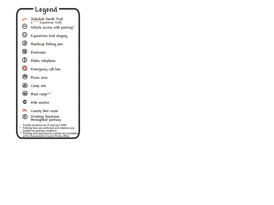
The production of the framework began with review of the legend of the Foundation Map to identify potential amenities. The typical items were found such as restooms and Picnic Area. These along with additional amenities were part of the allowed identification in a underlying database for the online map through the domain control.
Foundation Map Legend


The next steps was to produce the online map through the ArcGIS Online. Using the ArcGIS online data management, map distribution security, feature symbology as well as information management can be controlled by the author. As only the feasibility of the framework was the goal, the symbology and synchronization of the amenities data was demostration.
ArcGIS Online Webpage


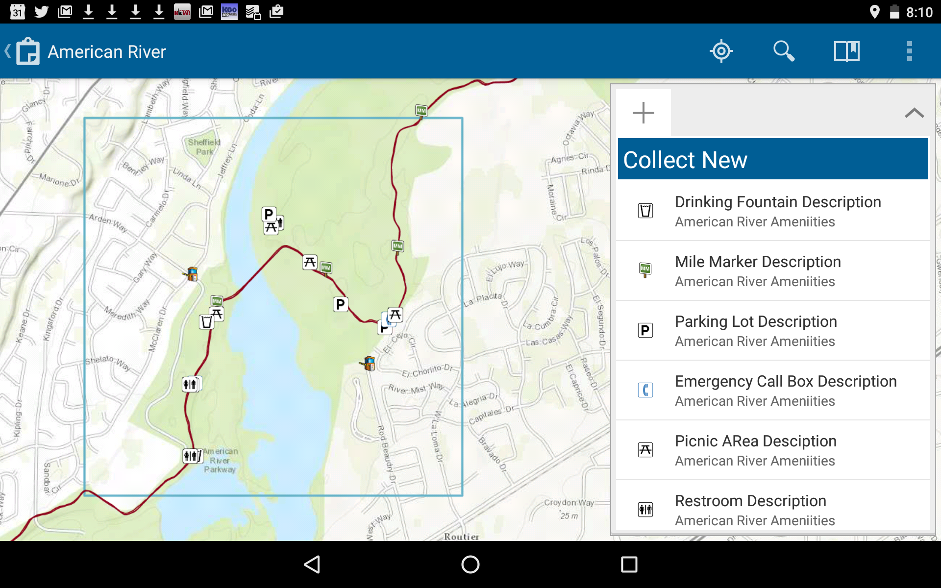
To prepare for the data collection, the online map needed to be published with a limited spatial area. I chose the William B. Pond Park as my area of interest. The approximately 1 square mile had over 30 amenities. Using a Nexus 7 as a mobile device with a GPS feature and the software Collector for ArcGIS, I was able to transverse the William B Pond Park on my Bike and collect over 30 amenities within 45 minutes. As the Nexus 7 is a Android base tablet there was no active online connection, however synchronization is done easily enough when the tablet is connected to the Internet with a WIFI. Give the low cost of such tablet (less than $50) and a non profit group like the American River Parkway Foundation could easily add spatial information throughout the parkway and not just the limited area that I chose.

ArcGIS Collector Screen


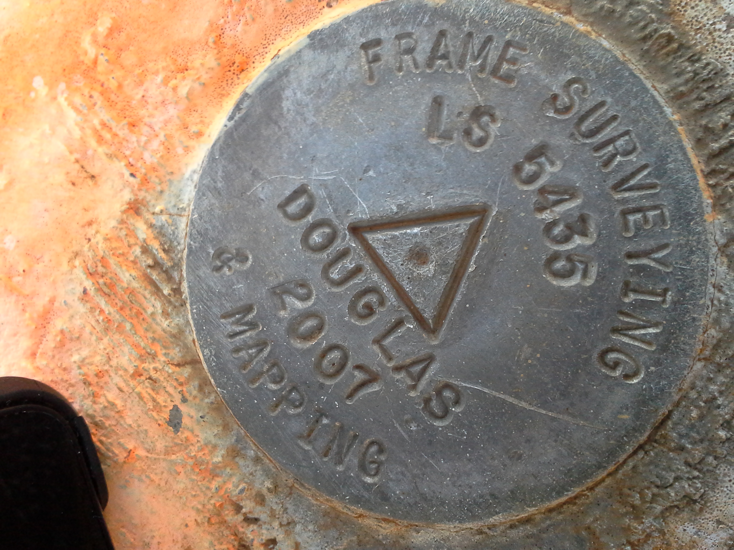
To measure the accuracy of the device, I check the measurements with a survey control station. Accessing the National Geodetic Survey for information datasheet. The specific Permanent Identifiers I chose was DL9154 as this was relatively close to the Parkway as well as a safe and easily accessible location compared to another possible Permanent Identifier DH6483. While DL9154 has a sidewalk access to a creek crossing on Sunrise Boulevard, DH6483 is located about 15 meters south from Highway 50 freeway traffic.

In taking measurements, I mimic the method I had taken when locating the amenities at the William B Pond Park. I would take an immediate measure and move to the next amenity this would take some 5 seconds to open the Software and make theselection. In calibrating measures at the Survey control, I took a quick measure and then waited a minute before taking a second reading without moving the Nexus 7. To see if the device could differ, I brought a Samsung Mobile phone and allowed it to sit for a minute before measuring the location.

Permanent Identifier DL9154


Results
The results of the spatial location measurements shows that the Nexus 7 could provide information that could be a meter to a handful of meters from the actual location. The result also reflect what others suggest that a GPS unit should sit for a minute or two before measuring location to ensure a more accurate measurement. .

Source of Measure Easting Northing SQRT((Del X)^2+(Del Y)^2)) (meters)
Survey Control 652,955.034 4,269,525.060 Ref. Point
Nexus 7 (Immediate) 652,955.803 4,269,531.160 6.148
Nexus 7 (1 min wait) 652,954.763 4,269,524.174 1.134
Samsung (1 min wait) 652,954.763 4,269,524.818 0.363


As a demonstration of the resulting maps, below is a screen shot of the ArcGIS Online Map that was produced as part of the project. The map options can be altered by the Map administrator to allow who can access it to modify the features or add information are all explained the ArcGIS Online tutorials.

Analysis
The difficulties of the project began with understanding the limits of the softwares. After a few false starts, I recognized that the feature dataset and domains were best done in ArcGIS for Desktop. Although symbology can be done in ArcGIS for Desktop, the transfer of the icons did not work and I resorted to the ArcGIS Online symbology. The data collection was done in Collector for ArcGIS. This software was a bit quirky but overtime I was able to use for the data. The central storage of the data on ArcGIS Online was very convenient. The ability to extract data was useful to compare to the Survey Control to estimate the level of accuracy of the spatial collected amenities.

In addition to the Nexus device, the mobile phone and t5:08 PM 12/16/2015he exercise software – Runtastic- came in very handy in collecting route information during my data collection. This additional software and hardware demonstrated that it could complement the physically larger Nexus and specific function of the Collector for ArcGIS. The Runtastic software has a minimal cost (free or 2.99 for the pro version), but tracked my movement every two seconds and uploaded the spatial location to their Internet site, which in turn allowed me to obtain a GPX file by right clicking the calendared event.

One major problem was a possible quirk in ArcGIS Online. When I added the GPX information that was downloaded, ArcGIS would no longer allow me to enable Offline Mode for my map. This was crucial for use of the Nexus devise as it only connection is Wifi and not a cellular tower. Upon discovery the cause of the limitation, I simply removed the imported GPS layer from the Online Map until all the collection was completed. An inquiry to the ArcGIS technical support was submitted but the response directed me to Hugh Howard the site’s primary contact as I am an authorized caller.

Conclusion
Although more evaluation would be needed to ensure that an online map is appropriate for identifying amenities along the American River Parkway, the project demonstrated the feasibility that a relatively low cost option is availble to collect the data to rpoduce such a map. As to the cost for use of ArcGIS Online Service for the 100,000s of individuals that potentially would access the map, further study would be required.

References
ArcGIS Online, https://www.arcgis.com/home/ (2015 accessed)
American River Parkway Foundation, http://www.arpf.org/ (2015 accessed
American River Parkway Foundation, http://arpf.org/pdf_files/ARPmap.pdf (2015 accessed)
Chuck Taylor Toolbox, http://home.hiwaay.net/~taylorc/toolbox/geography/geoutm.html (2015 accessed)
National Geodetic Survey for information datasheet, http://www.ngs.noaa.gov/cgi-bin/datasheet.prl (2015 accessed)
Runtastic, https://www.runtastic.com/ (2015 accessed)