|
|
|
|
Author Loan Braswell American River College Geography 350: Data
Acquisition in GIS Fall 2016 |
|
|
Abstract Cash advance businesses are
mostly located in the urban areas of Sacramento, and none are located in the
top 75 wealthiest zip codes of Sacramento. |
|
|
Introduction Mapping cash advance businesses
in the Sacramento region to see where these businesses are in relation to
household income or other demographic data. |
|
|
Background
What is a cash advance? Cash advances, also referred to as payday loans or
personal loans, are intended to cover financial emergencies until your next
payday or sooner. Source: Ace
Cash Express |
|
|
|
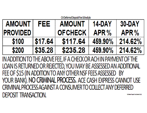
Short Term Lending Rates Source: Ace Cash Express
|
|
Methods
|
|
|
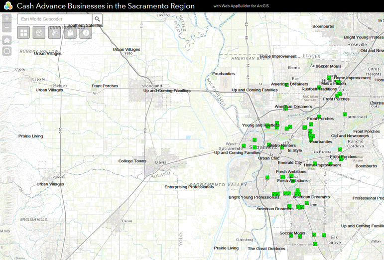
Results A web map application was created to overlay all of the
data onto one map. I decided to use a web map because it could be easily
shared online from any desktop or mobile device whereas using an ArcMap
document cannot. |
|
|
Figures and Maps Screenshot below: Web Map
Application |
|
|
|
|
|
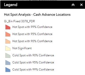
Analysis The first analysis I did
was to conduct a hot spot analysis of the cash advance locations and all of locations turned
out to be not significant. I do not think there were enough data points.
|
|
|
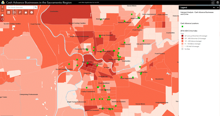
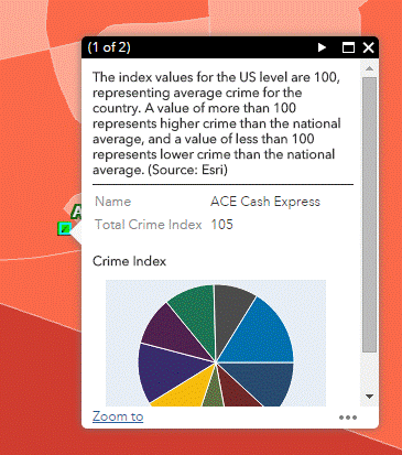
The second analysis I
performed was an overlay of the cash advance locations with the 2016 Esri
Crime Index Layer. The cash advance locations
are in areas above the national average.
Intersect results shown as
a pop-up:
|
|
|
Conclusions I
used layers from the 2016 Esri living atlas such as the unemployment rate, tapestry
segmentation, alcoholic beverage spending, median
household income, however, these layers displayed data for the entire USA. To
refine the look of the web map, I applied a filter to only display California
results. Editing the living atlas layers is limited, for example, I could not
adjust the visibility range. Also there are different layers for each
visibility scale. Another issue is if you make a bar chart, you cannot switch
it to a pie chart easily, you have to recreate it. This
all requires careful thought before implementation. Here
are some interesting facts I concluded from overlaying the data with the
living atlas layers: 1) Majority of the cash advance locations are in
Sacramento city proper, almost none are located in the suburbs. 2) Majority of cash advance locations contains residents living
in the 11,600 - 42,200 median household income range. 3) The more money you have,
the more alcohol you purchase (which could also mean that the more expensive
the alcohol you purchase is). |
|
|
References Ace Cash Express website, accessed 20161213 https://www.acecashexpress.com/cash-advance/what-is-a-cash-advance Google Earth, accessed 20161016 www.googlemaps.com |
|
|
links |
|