|
Call For Service Description
|
# Reports
|
|
Suspicious Subject/Circumstance-In Progress
|
13
|
|
Drunk Subject
|
9
|
|
Subject Stop
|
9
|
|
Welfare Check
|
9
|
|
Report Number Assignment
|
7
|
|
Misdemeanor Assault-In Progress
|
5
|
|
Stolen Vehicle-Report
|
5
|
|
Disturbance-Clarify
|
4
|
|
Traffic Stop
|
3
|
|
Vehicle Accident-Injuries
|
3
|
|
Alarm-Crime Occd
|
2
|
|
Felony Assault-In Progress
|
2
|
|
Petty Theft-In Progress
|
2
|
|
Reckless/Hazardous Driver
|
2
|
|
Suspicious Activity-Report
|
2
|
|
Suspicious Subject/Circumstance-Weapon Involved
|
2
|
|
Vehicle Accident-No or Unknown Injuries
|
2
|
|
Arson
|
2
|
|
Burglary-Report
|
1
|
|
Business Check
|
1
|
|
Dead Body
|
1
|
|
Drunk Driver
|
1
|
|
Felony Assault-In Progress
|
1
|
|
Felony Battery-Report-No Weapons
|
1
|
|
Found Property
|
1
|
|
Medical Aid
|
1
|
|
Petty Theft-Report
|
1
|
|
Robbery-Less Than 15 Ago
|
1
|
|
Shots Fired-Less Thank 15 Ago
|
1
|
|
Suspicious Vehicle-Occupied
|
1
|
|
Transportation
|
1
|
|
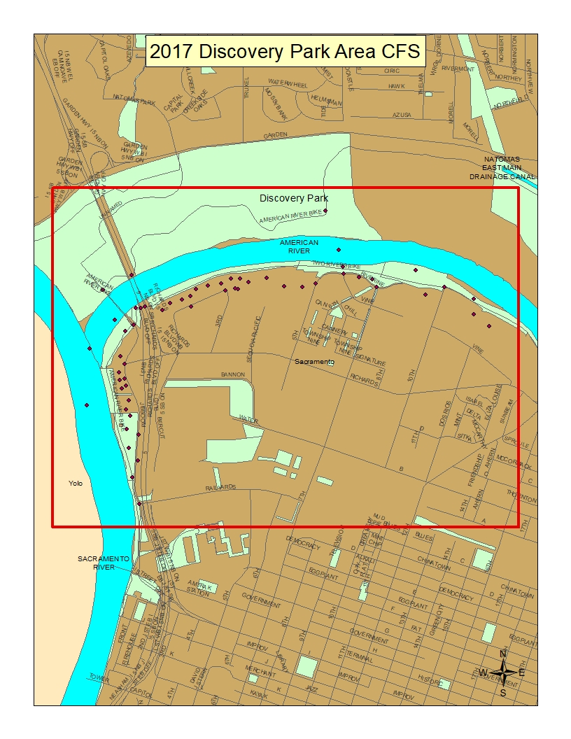
Total
|
96
|