| Title Is Natomas area still in Flood Risk? | |
|
Author Name: Oksana Grinevich American River College, Geography 350: Data Acquisition in GIS; Fall 2017 | |
|
Abstract In February, 1986 in Sacramento, for 11 days nearly 10 inches of rain fell. The floodwaters destroyed levees in Natomas area during that time.
But still many homes were built since then. | |
|
Introduction The original idea of this project, was to analyze the land cover of the city Natomas, CA, and show if this area is still in danger of flood loss compare to 1986 year by using flood depth data. According to MavensNotebook.com, Natomas “was built in 1912 to 1914 by a private company that bought 75% of the acreage in Natomas for $1 an acre”. Since then, some major floods happened, including one in 1986. Is this area still in danger condition? Is any levee's improvement happened during last decade? What was done to save lives, properties or businesses? I want to see if new flood occures what neighborhoods in that area will be in danger. | |
|
Background 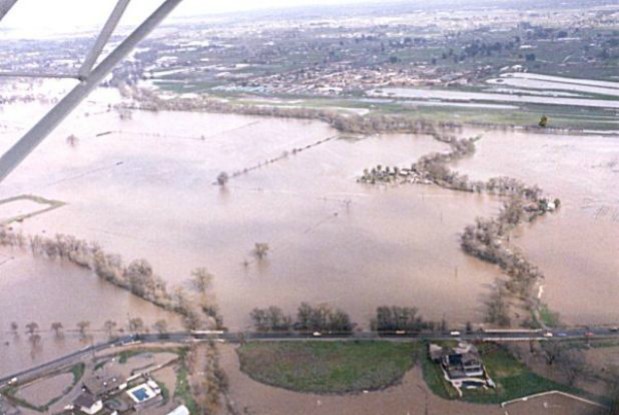 While taking one of Geography class I was shocked
to open for myself that Natomas area, known as "Dead valley" was drained and rebuilt
after huge flood in 1986.
In February, 1986 in Sacramento, for 11 days nearly 10 inches of rain fell. The floodwaters destroyed levees in Natomas area during that time.
So many houses were built since that and homeowners in that
neighborhood are paying high rate flood insurance. Would it better to use high insurance rates for improoving the areas' levees? While taking one of Geography class I was shocked
to open for myself that Natomas area, known as "Dead valley" was drained and rebuilt
after huge flood in 1986.
In February, 1986 in Sacramento, for 11 days nearly 10 inches of rain fell. The floodwaters destroyed levees in Natomas area during that time.
So many houses were built since that and homeowners in that
neighborhood are paying high rate flood insurance. Would it better to use high insurance rates for improoving the areas' levees?
| |
|
Methods
| |
|
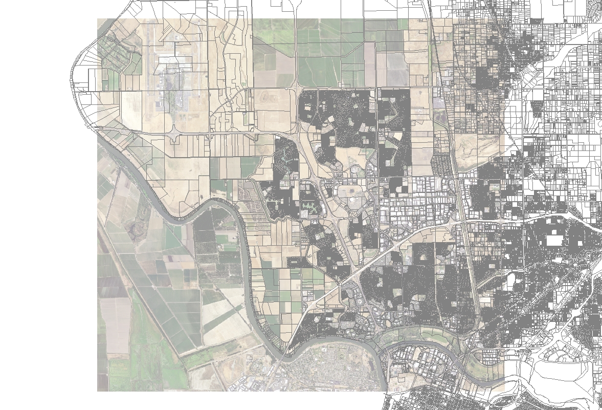
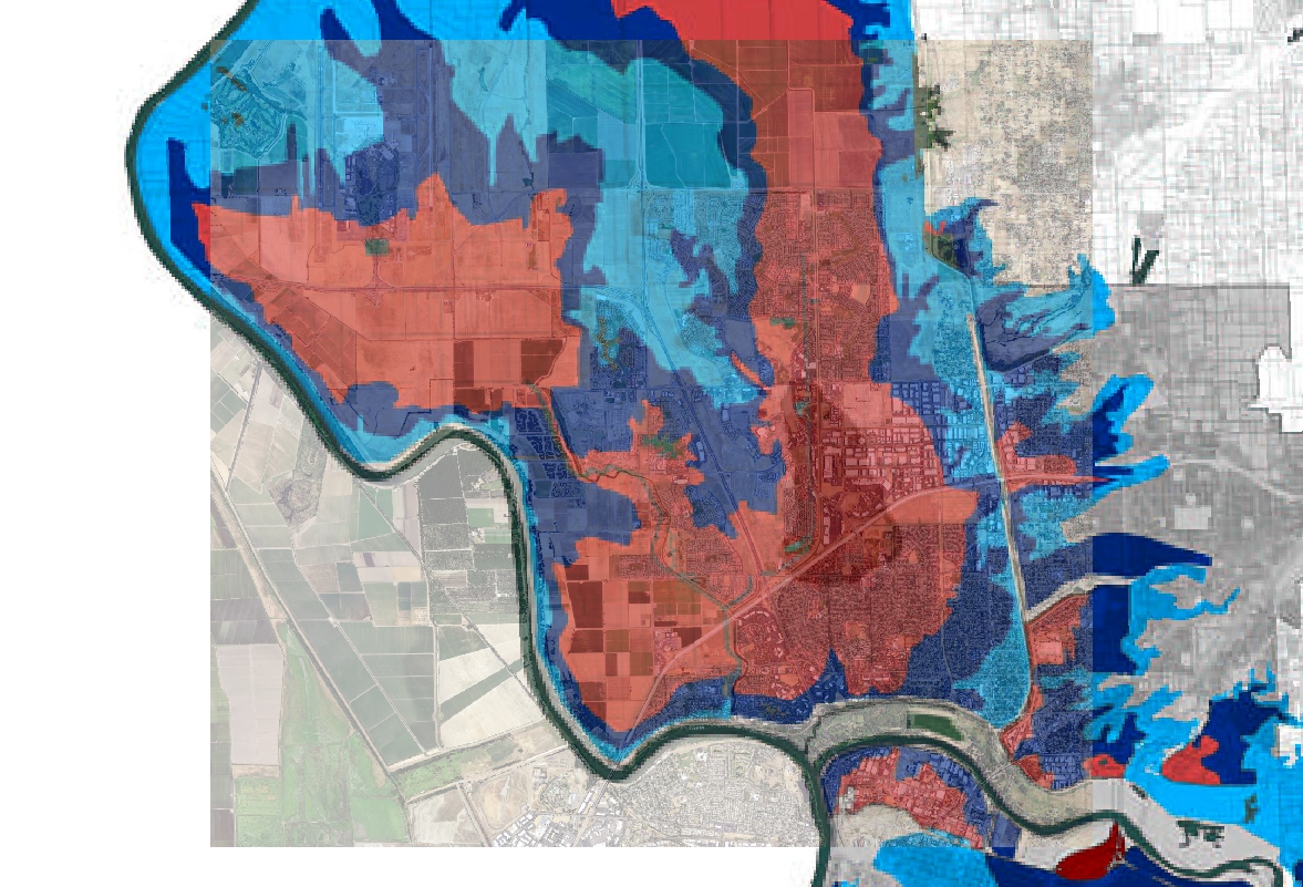
Results After georeferencing Flood Depth and adding Pacel data I see high population where flood risk and flood depth are the worst. | |
|
|
|
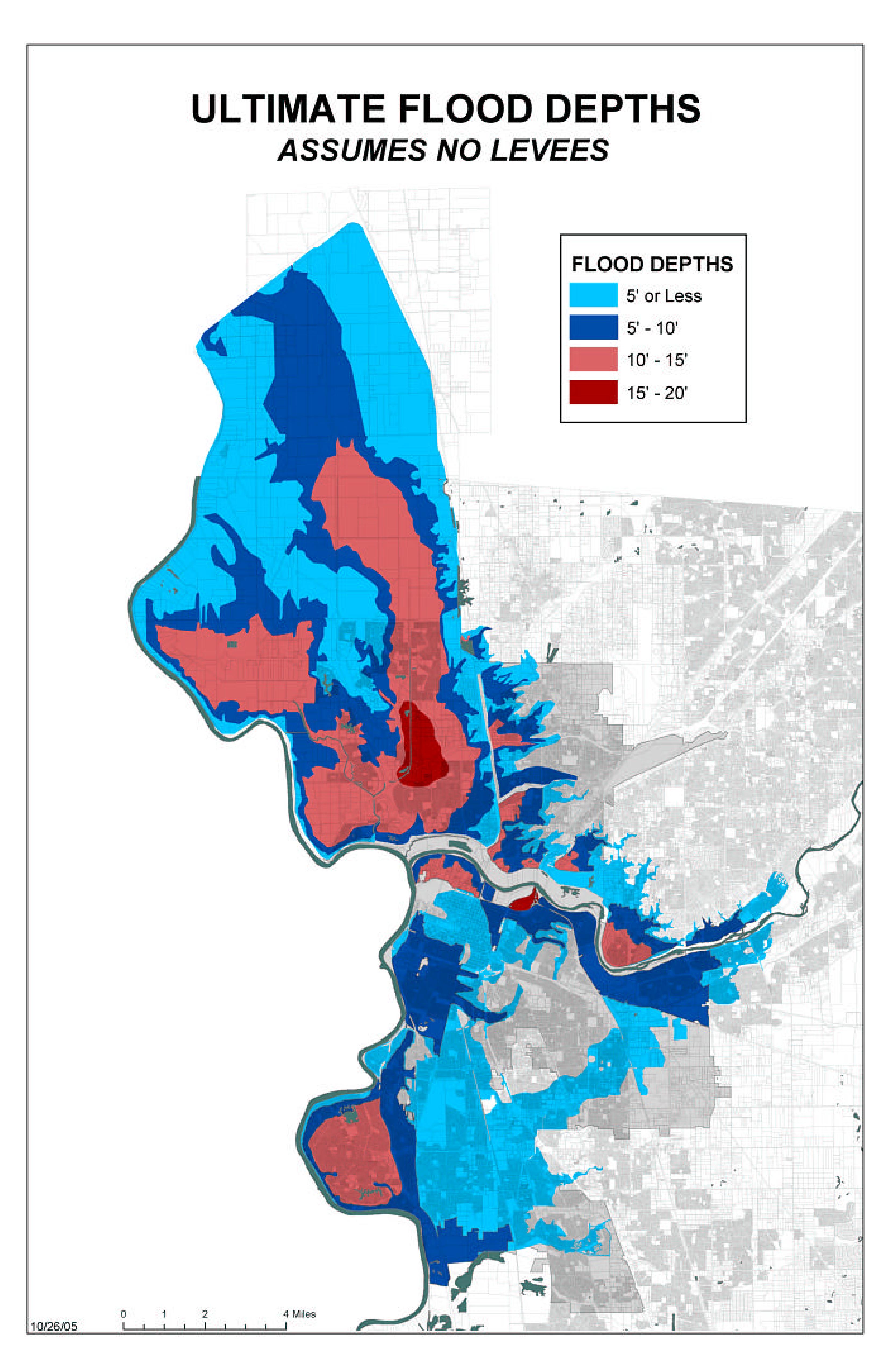
Analysis From the first map it is easy to see that my study area (in violet color) could be under +16 feet of water. And on the third map it shows that evacuation routes will be impossible to use after 16 hours!!!!
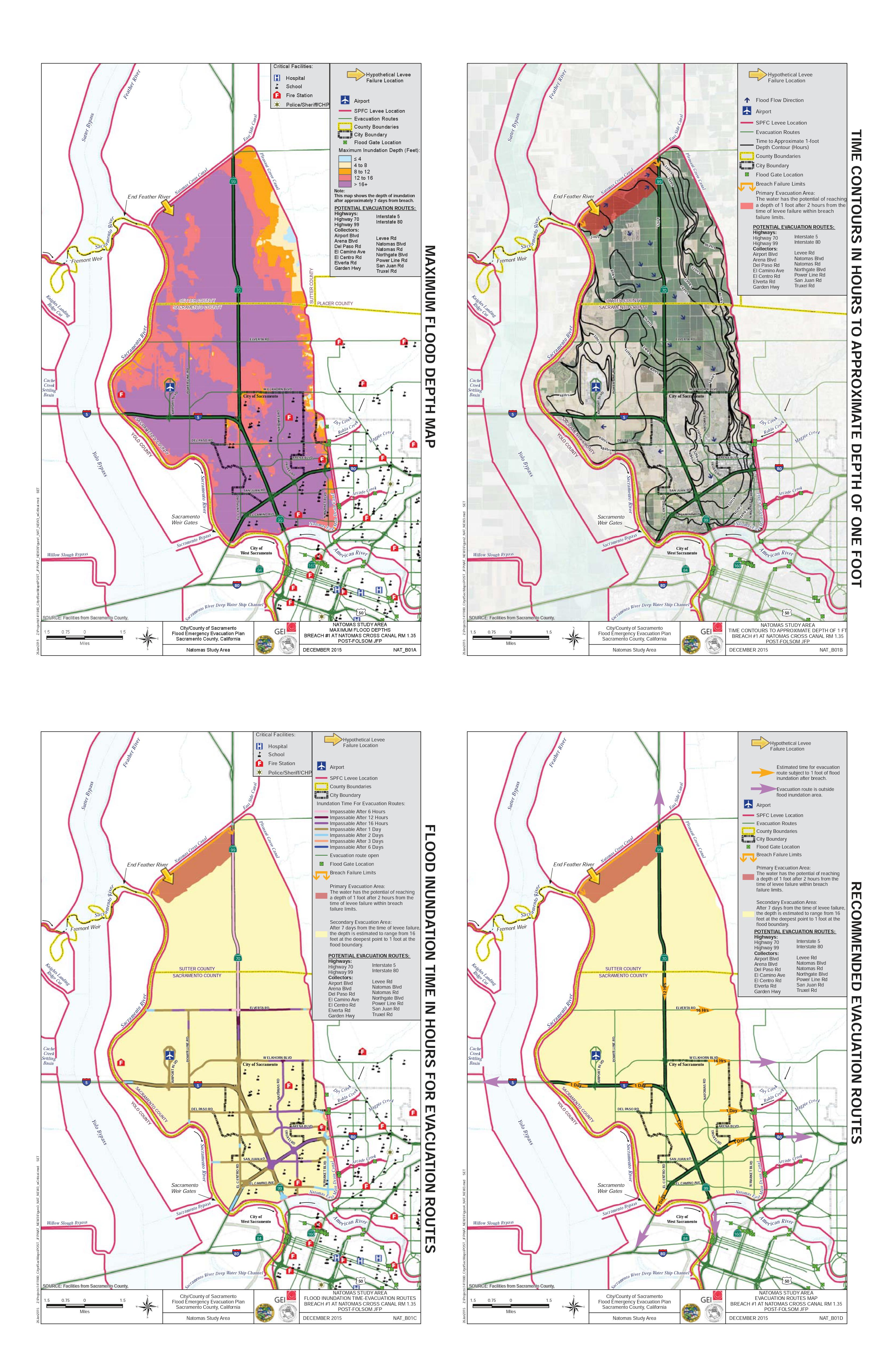
The map below shows that condition of levees in my study area is "usage certification expired". Those areas are reliant on levees for flood control. The levees in my study area are not in good condition and are not be able to protect the community. 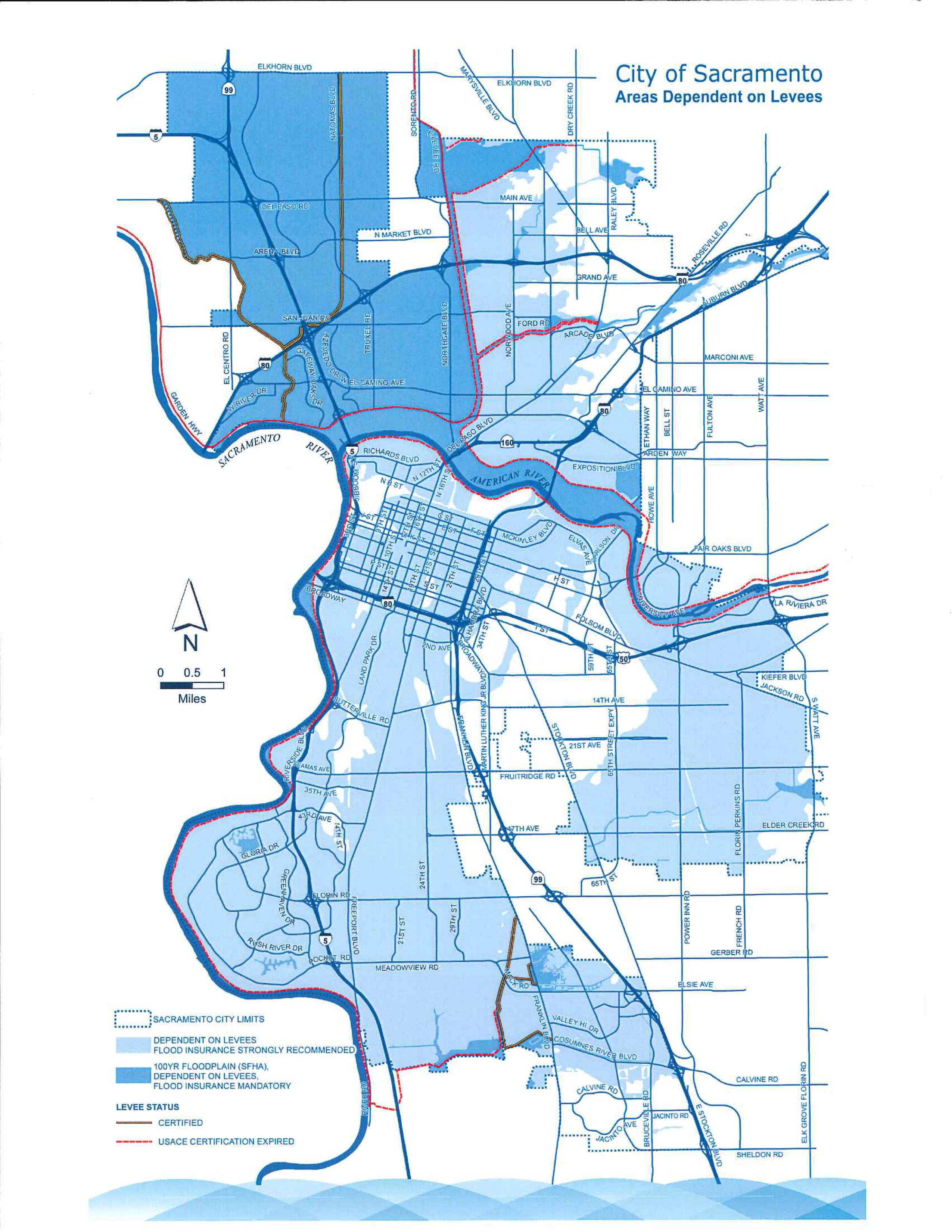 | |
|
Conclusions After analyzing Flood Depth, Levees’ Condition, and Evacuation route data, I have an opinion that Natomas area still has a high risk of flooding even improvement of levees has been done since 1986. According to cityofsacramento.org, “After re-evaluation of the levees by the US Army Corps of Engineers, FEMA remapped the Natomas Basin area into a floodplain with an AE flood zone designation in December 2008. The AE flood zone designation required elevating or flood-proofing structures at or above the 100-year floodplain, which would be up to 20 feet in some areas.” Also, the article mentions Natomas has an A99 flood zone designation since June16, 2015. It means, according to cityofsacramento.org, those rates are “significantly higher than the “Preferred Risk Policy” rates.” So, it is better for home owners in the high risk areas, as Natomas, to carry flood insurance and to plan for emergencies. | |
|
References
| |