| Title Major Sources of Local Groundwater Contamintation in Sacramento County | |
|
Author Katie Miller American River College, Geography 350: Data Acquisition in GIS; Fall 2017 Contact Information (Sacramento CA, email: w1550574@apps.losrios.edu) | |
|
Abstract Groundwater contamination can be caused by many sources. Exposure to contaminants can threaten public health and the environment. GIS can be used to map contamination and inform the public. Government agencies and stakeholders can coordinate their resources to improve GIS data. Datasets can be updated as sites are cleaned up and contamination plumes change. | |
|
Introduction Many U.S. military bases are listed on the United States Environmental Protection Agency (EPA) list of Superfund sites. Superfund is an EPA program that identifies, investigates, and implements cleanup of hazardous waste sites. Currently there are 5 Superfund sites identified in Sacramento County. A concern for nearby residents is contamination of groundwater as some residences surrounding Superfund sites obtain their drinking water from private wells. The extent of groundwater contamination can be mapped as groundwater plumes using GIS. Plumes have the potential to migrate, change shape or expand. A 2,000 foot buffer is added to create a contamination transport zone surrounding the groundwater plume to account for movement and identify potential conduits (SWRCB). It is important to identify these contaminated sites, examine what is nearby, and inform the public of environmental hazards they are exposed to. The Safe Drinking Water Act provides standards to protect the public drinking water, but drinking water standards do not apply to private wells. Owners of private wells within the groundwater contamination or 2,000 foot buffer will be notified of the status of site cleanup and current levels of contamination. | |
|
Background Three sites of focus are McClellan Air Force base, Mather Air Force Base, and Aerojet General Corporation. The contaminants of concern among these sites include volatile organic compounds (VOCs) that pose a health risk to humans and the environment. Two major contaminants found in groundwater near these military bases are trichloroethylene (TCE) and tetrachloroethylene (PCE). According to the National Primary Drinking Water Regulations table, the highest level that is allowed in drinking water is 0.005 mg/L for TCE and 0.005 mg/L for PCE (https://www.epa.gov/ground-water-and-drinking-water/national-primary-drinking-water-regulations). Concentrations and exposure above this level are known to cause liver problems and increase the risk of cancer. According to performance measures established by EPA, the goal is to stabilize the migration of contaminated groundwater, complete cleanup of sites to a safe level, and eliminate human exposure. Widespread contamination at U.S. military bases threatens the health and wellbeing of service members, military families, and civilian communities (Hamilton, 2016). By mapping the extent of groundwater contamination and known water wells the public can be notified of the potential for exposure. In addition, all residents within contamination zones can be contacting by mail if needed. Since groundwater is not visible from the surface, there is a need for maps and GIS to display the information. EPA provides updates on cleanup of Superfund sites on their public website. Cleanup methods include groundwater extraction and treatment systems and reinjection of treated water into the aquifer. A model can be used to simulate preferential flow and generate maps of groundwater contamination risk (Sinkevich et al, 2005). Using GIS, a process was developed to determine areas with a high risk of contamination by toxic chemicals. The goal was to protect ground water resources and maintain groundwater quality. The model can be verified if there are enough sampling wells in the monitoring area to compare field data to results from the contamination risk model. With further coordination between the government agencies and stakeholders involved, a model can be created to demonstrate changes in groundwater contamination plumes as cleanup efforts continue. An alternative use is to run the model to show changes in contamination plumes if there was no cleanup currently happening at a site. | |
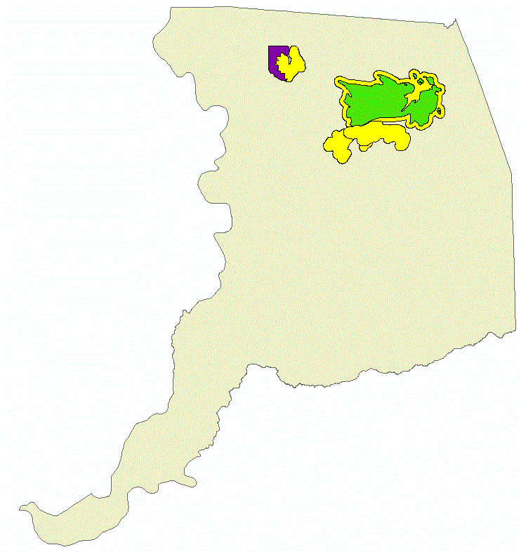
| Groundwater contamination areas in Sacramento County Mather AFB, CA Water in 36 homes was affected by trichloroethylene (TCE) contamination of a well on base. A new permanent water supply is to be provided to these homes. MATHER AIR FORCE BASE (AC&W DISPOSAL SITE) MATHER, CA McClellan AFB, CA An estimated 160 sites have been identified. Contaminants include organic compounds, such as trichloroethylene (TCE), methylene chloride, and 1-1 dichloreythlene. Wells both on and off base that had contaminants exceeding government standards have been shut down. Completed projects include alternate water supply for off base residents and a ground water containment system and treatment plant. MCCLELLAN AIR FORCE BASE (GROUND WATER CONTAMINATION) MCCLELLAN AFB, CA Aerojet General Corp. Rancho Cordova, CA Groundwater and surface water contain volatile organic compounds (VOCs) such as trichloroethene (TCE), perchloroethylene (PCE), 1,1-Dichloroethene, 1,1-Dichloroethane, 1,2-Dychloroethene, 1,2-Dichlorethane, 1,1,2-Trichloroethane, Carbon Tetrachloride, Vinyl chloride, Chloroform, and Freon-113 and other rocket propulsion waste products or components such as perchlorate and N-Nitrosodimethylamine (NDMA). AEROJET GENERAL CORP. |
|
|
Methods Known groundwater contamination is digitized as polygons from scanned maps. I use contact information from each site to obtain GIS data, but not all data was available and ready to be used in GIS. Well points were created for existing water wells as documented by Sacramento County Environmental Management Department. Not all known wells are documented and this dataset is incomplete. The FEMA flood zone will be used to assess potential risk of additional groundwater contamination during flood events. Wells can act as conduits for contaminants to reach an aquifer if the well head is not maintained according to well water standards. This information will be used to notify residents with private water wells of the environmental health risks they are exposed to and inform them of the status of cleanup efforts. It is important to notify the public as soon as possible instead of waiting until years later. This has been an issue as groundwater contamination and hazardous sites were kept secret and residents were exposed to health hazards without being notified. A Spatial Join between well points and parcels was used to create a mailing list to notify residents who have wells and are within a groundwater contamination plume. A 2000ft buffer was created surrounding each contamination plume. Larger datasets were clipped to the project area by selecting each contamination zone and exporting intersecting data (parcels, FEMA flood data, wells). FEMA flood zone is used to predict the likelihood of wells that will flood during major flood events. To document this, afield is added to the attribute table to designate the potential flood status of each well. The field is calculated using Select by Location and Field Calculator. An additional field is added to wells to designate the location within groundwater contamination (Plume, Buffer, or Prohibition Zone). These fields and values can be used to symbolize each well and create a map for different audiences. 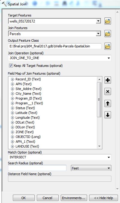 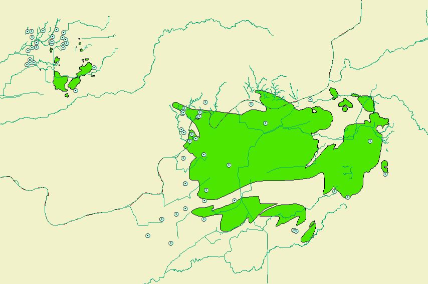
| |
| Wells located within groundwater contamination zones can be used for groundwater monitoring. Wells that are not built according to water well construction requirements may become a direct conduit to the aquifer. In flood events, if a well that is not watertight becomes inundated, contaminants may enter the groundwater. If there is groundwater cleanup going on at the site it is best to reduce the risk of further contamination. |
|
|
Results The results will be summarized in a report that includes tables for each statement below.
16 property owners will be notified that their well is within groundwater contamination and must be sampled for contaminants. 16 of 68 private wells are in contamination plumes. 31 of 68 wells are located within a buffer zone of 2,000 feet from the boundary of the contamination plume extent. 21 of 68 are located within the McClellan Prohibition Zone. According to Sacramento County Code 6.28.025: No permit shall be issued for and no person shall dig or drill a new water well within the prohibition area. 9 of 68 wells are located within high risk flood zone areas defined by FEMA (https://msc.fema.gov/portal). 5 of 68 wells are located within the 500 year flood zone. 1 of 5 wells located within the 500 year flood zone are in a contamination plume. | |
|
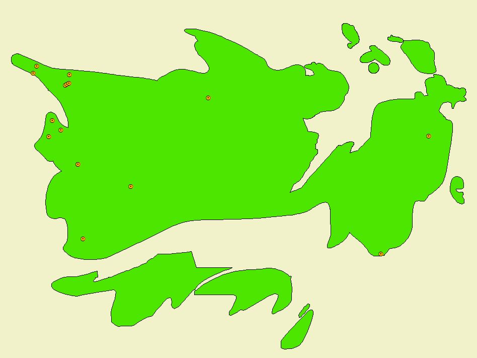
Contamination of Groundwater 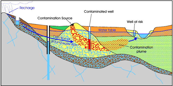 | |
 |
Wells located within FEMA flood zones.
Once more wells are indentified they can be ranked by flood risk using FEMA flood zones Wells located within areas with a higher potential for flooding should be inspected to ensure they are sealed to prefent further groundwater contamination. |
|
Analysis Using GIS to research groundwater contamination and the risk to public health is more efficient than researching a site by referencing several different paper maps. GIS is a great tool as the user can create a dataset that is unique for their own use. At my current job there is a need to map groundwater contamination plumes. In the past, specialists have referenced several outdated paper maps to determine if a well is within groundwater contamination. As the GIS data has been created, some wells that were approved for construction should not have been approved based on their proximity to groundwater contamination. This project has made research easier and faster.
The main difficulties in this project were finding current data and data of good quality. In the future I will continue to build the dataset of groundwater contamination in Sacramento County as there is a need for it.
| |
|
Conclusions By researching these sites and combining resources from multiple sources the public can be made aware of environmental issues in their area. As land use changes, the past will play a part in the present and future of public health. The use of GIS in the environmental field will expand in the future.
Since a central source of all known groundwater contamination for Sacramento County does not exist, this is a great starting point. Local and State government can contribute resources to create a dataset of groundwater contamination for use in GIS. Eventually the local data can be combined to create a larger dataset for the State of California. | |
|
References Hamilton, J.W., 2006. Contamination at U.S. Military Bases. Standford Environmental Law Journal, Vol. 35:2 Sinkevich, M.G. et al./ Ground Water Monitoring & Remediation 25, no. 4: 82–91 US EPA Superfund EPA's Superfund program |
|