| Title Histoic Properties in Sacramento Web Map Application | ||||||||||||||||
|
Author Cristian Viveros Geography 350: Data Acquisition in GIS; Fall 2017 American River College Contact Information: cristian.viveros@outlook.com | ||||||||||||||||
|
Abstract For my project, I intend to create a map application in ArcGIS-online with the intention to provide spatial and attribute information on historic properties in Sacramento listed in the National Registry of Historic Places. | ||||||||||||||||
|
Introduction Working for the Office of Historic Preservation, I came to appreciate the important of preserving our history. Doing so reminds us who we once were, and how far we have come. For this reason, I decided to create a web map application, depicting historic properties in Sacramento. With information obtained from the National Park Service, who administers the National Registry of Historic Places (NRHP), I created a feature class of most historic properties in Sacramento. Once created, the feature class was published to ArcGIS online, where an interactive map was created for those interested in knowing about historic properties in Sacramento. | ||||||||||||||||
|
Background Sactioned by the National Historic Preservation Act of 1966, the National Registry of Historic Places is the official list administered by the National Park Service depicting properties and places deemed worthy of preservation. The National Registry of Historic Places"is part of a national program to coordinate and support public and private efforts to identify, evaluate, and protect America's historic and archeological resources." National Park Service (2017) All properties and places nominated to the registry must first meet several criteria. Information about architectural styles, association with various aspects of social history and commerce, and ownership are all intetral parts of the nomination. The four National Register of Historic Places criteria are the following: • Criterion A, "Event," the property must make a contribution to the major pattern of American history. • Criterion B, "Person," is associated with significant people of the American past. • Criterion C, "Design/Construction," concerns the distinctive characteristics of the building by its architecture and construction, including having great artistic value or being the work of a master. • Criterion D, "Information potential," is satisfied if the property has yielded or may be likely to yield information important to prehistory or history. | ||||||||||||||||
|
Methods I had originally intended to obtain the geospatial dataset from the National Park Service's , provided in a geodatabase; however, I did not anticipate the poor quality of the data. When looking at the attribute table, I noticed some of the fields were either disorganized, missing, or coded. Not only that, I also realized that some of the information I wanted to include in the map application were not available in the dataset itself. So I decided to create my own data from scratch with information obtained from the NRHP. I selected predetermined attributes I deemed relevant such as architectural style and resource type (as shown in the table below), and began creating my feature class in ArcMap. Once sufficient points were created and the attribute table updated, I proceeded to publish the feature class as a service. | ||||||||||||||||
|
||||||||||||||||
|
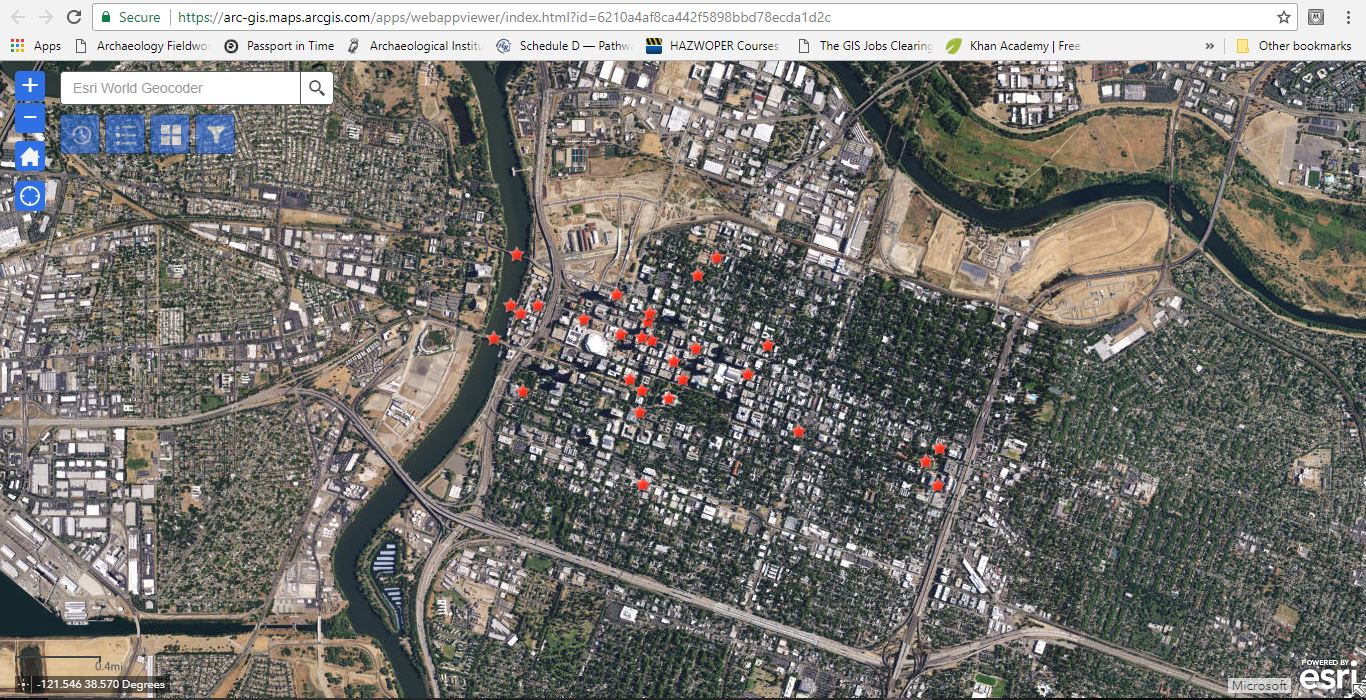
Results With the feature class published to my ArcGIS online account, I proceeded to create a web map. I edited the symbology and configured the attributes to display the fields I deemed appropriate. After I was pleased with the changed made, I proceeded to share and create the web map application using Web AppBuilder. What followed next was to add widgets to the wep application. I added a total of 4 widgets for this project. The first widget is the time-slider, which allows users to visualize the chronological order of when each of the historic properties were added to the NRHP. The next two widgets were the legend and basemaps widgets. The default for these were accepted as is. The last widget consisted of the filter widget. I created 4 filter expressions based on resource types (i.e., building, structure, site, and district). | ||||||||||||||||
|
Figures and Maps
|
| Analysis The geospatial dataset from the National Park Service was location innacurate and having the task to fix every single point proved to be troublesome and neverending, so I resorted to create a dataset from the beginning. Another problem that arose was that the time-slider was not functioning. I then realized it was because I had not previously enabled it. This ended it up being an easy fix. All that was needed was to enable the time-slider in the time settings when viewing the item details of the feature class in ArcGIS online.
| Conclusions The purpose of this web application was to provide information in an interactive map of historic propertiers in Sacramento with data obtained from the National Park Service. Although, only some historic properties were selected for this project, a comprehensive plan to include all historic properties at the local or national level is attainable.
| References “National Register of Historic Places Official Website-Part of the National Park Service.” National Parks Service, U.S. Department of the Interior, www.nps.gov/nr/ "Stutss, Matt, 2014. Geospatial Dataset.NRIS_CR_Standards_Public.gdb.zip, National Park Service, https://irma.nps.gov/DataStore/Reference/Profile/2210280
| | |||||||||||