Title
Park Accessibility and Public Health in Sacramento
Author
Cameron Gee
American River College • Geography 350: Data Acquisition in GIS • Fall 2020
Abstract
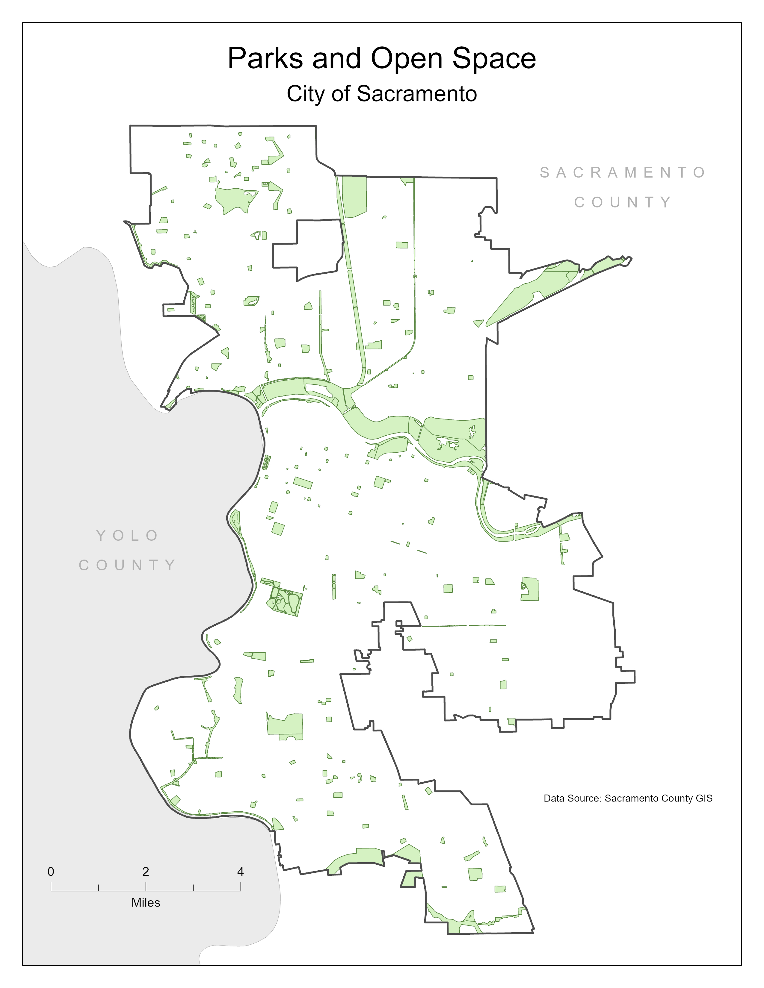
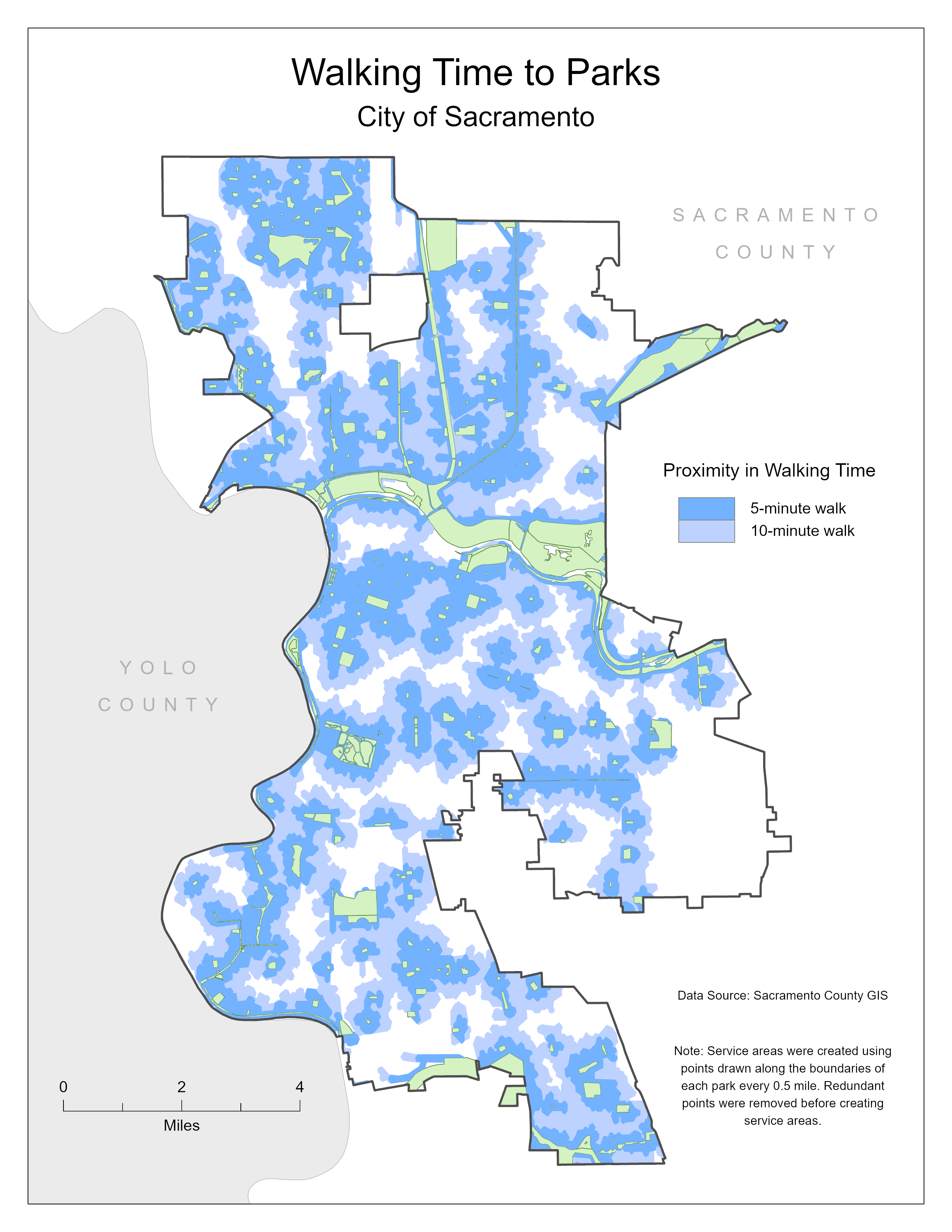
This project examines the current extent of parks and open spaces within the city of Sacramento, California. It studies the landscape of the COVID-19 pandemic to recommend areas within Sacramento that may be suitable locations for more parks, trails, and other forms of open spaces. Recommendations were made by creating service areas representing five- and 10-minute walk times from the perimeter of each existing park. The resulting gaps between park service areas were overlaid onto a map of total COVID-19 cases in Sacramento by zip code since the beginning of the pandemic. Gaps in areas with a higher total case count present themselves as priority neighborhoods to examine in greater detail. Emphasizing the need for outdoor recreation to allow communities to safely engage in physical activity and reduce risk factors for COVID-19 and other diseases, this project provides a basic method for identifying areas where safe, accessible open spaces should be constructed from a public health perspective.
Introduction
In 2007, the percentage of the global population living in urban areas surpassed 50%1. As more people move from rural areas to cities, it is critical to ensure that the growing population has an adequate amount of services necessary to maintain their well-being. Parks, trails, and other open spaces are one such service that provides essential community resources. Not only do parks allow people a chance to enjoy the outdoors in urban environments, they also serve as a means for people to engage in physical activity. The Center for Disease Control and Prevention recommends that children and adolescents engage in 60 minutes of physical activity each day, and adults engage in 150 minutes each week2. By practicing the recommended amounts of physical activity, individuals can reduce their risk of cardiovascular disease, type 2 diabetes, and some cancers3. To ensure that growing city populations are able to regularly engage in outdoor recreation, it is essential that open spaces in urban environments are accessible to communities. This is even more true in the climate of a pandemic such as COVID-19, as the severity of several infectious diseases can be combated by maintaining healthy lifestyles.
Background
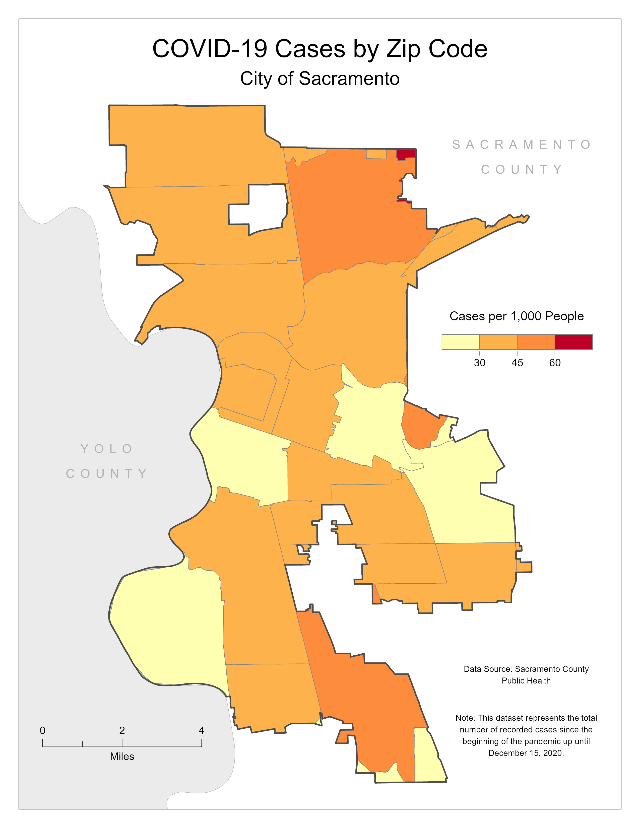
As of December 15, 2020, Sacramento County had recorded 51,297 total cases of COVID-19 since the beginning of the pandemic. The Center for Disease Control and Prevention encourages limiting interactions with others in close proximity, and visiting with others outdoors, when possible. Outdoor recreation, if socially distant, is a safe means of practicing physical activity4. Gyms and other indoor environments increase one's risk for spreading and contracting COVID-19. Having access to outdoor recreation spaces such as parks and trails encourages community residents to engage in physical activity. The closer one lives to a park, the more likely they are to walk or bike to it2. Unfortunately, in many cities such as Sacramento, parks are not within a reasonable walking distance to all residents.
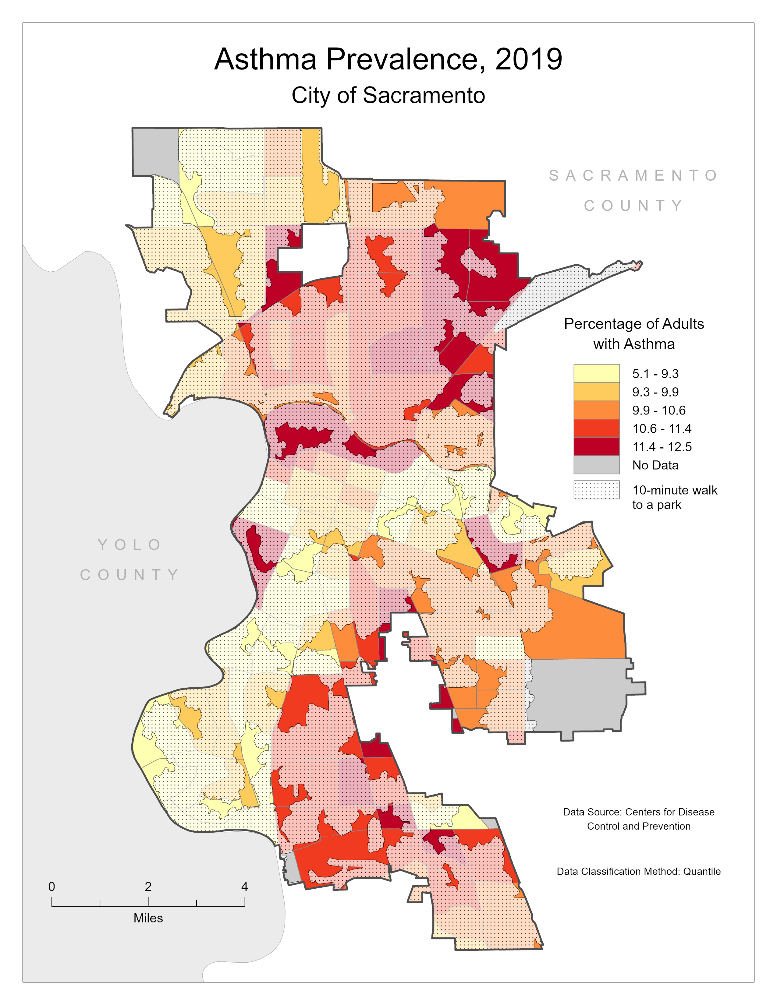
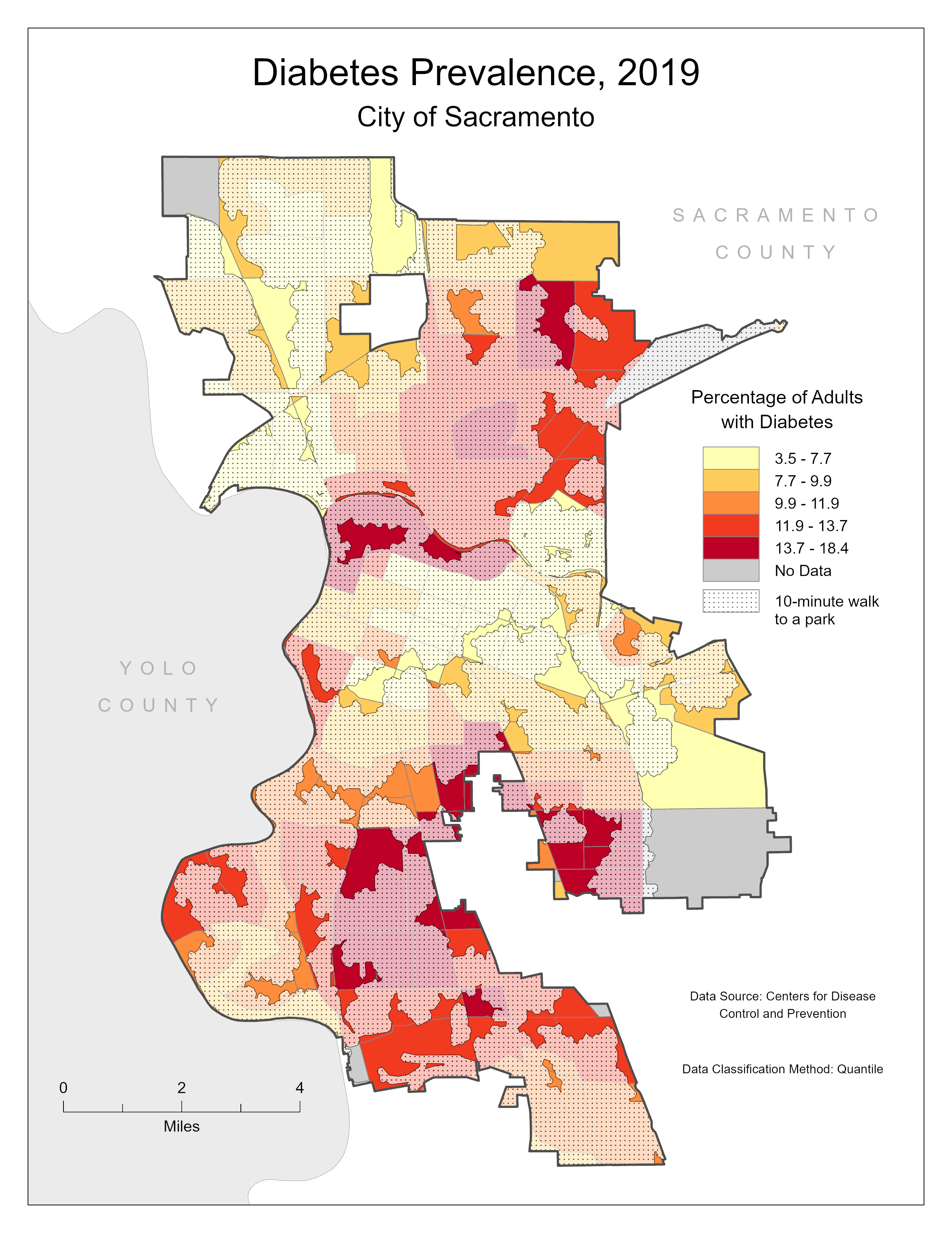
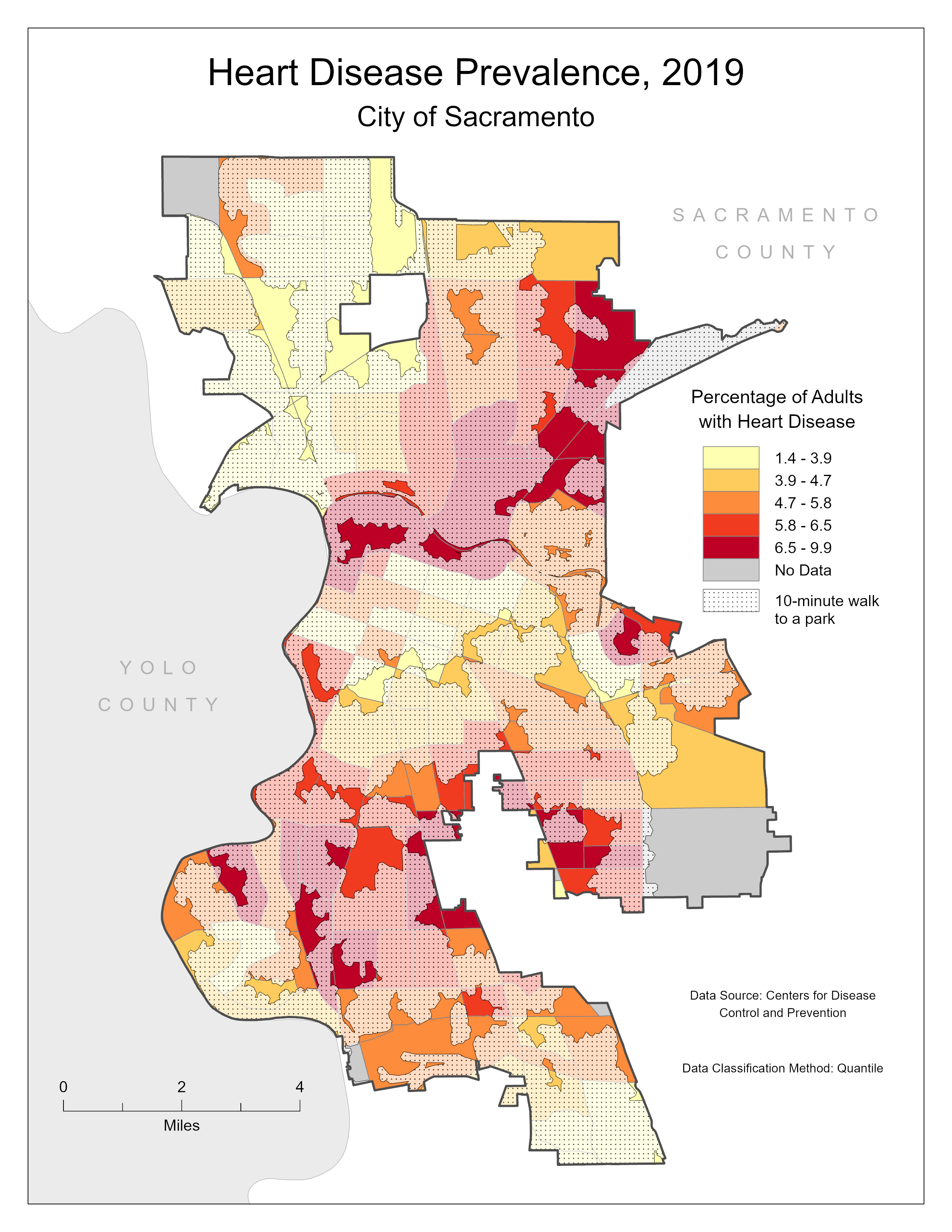
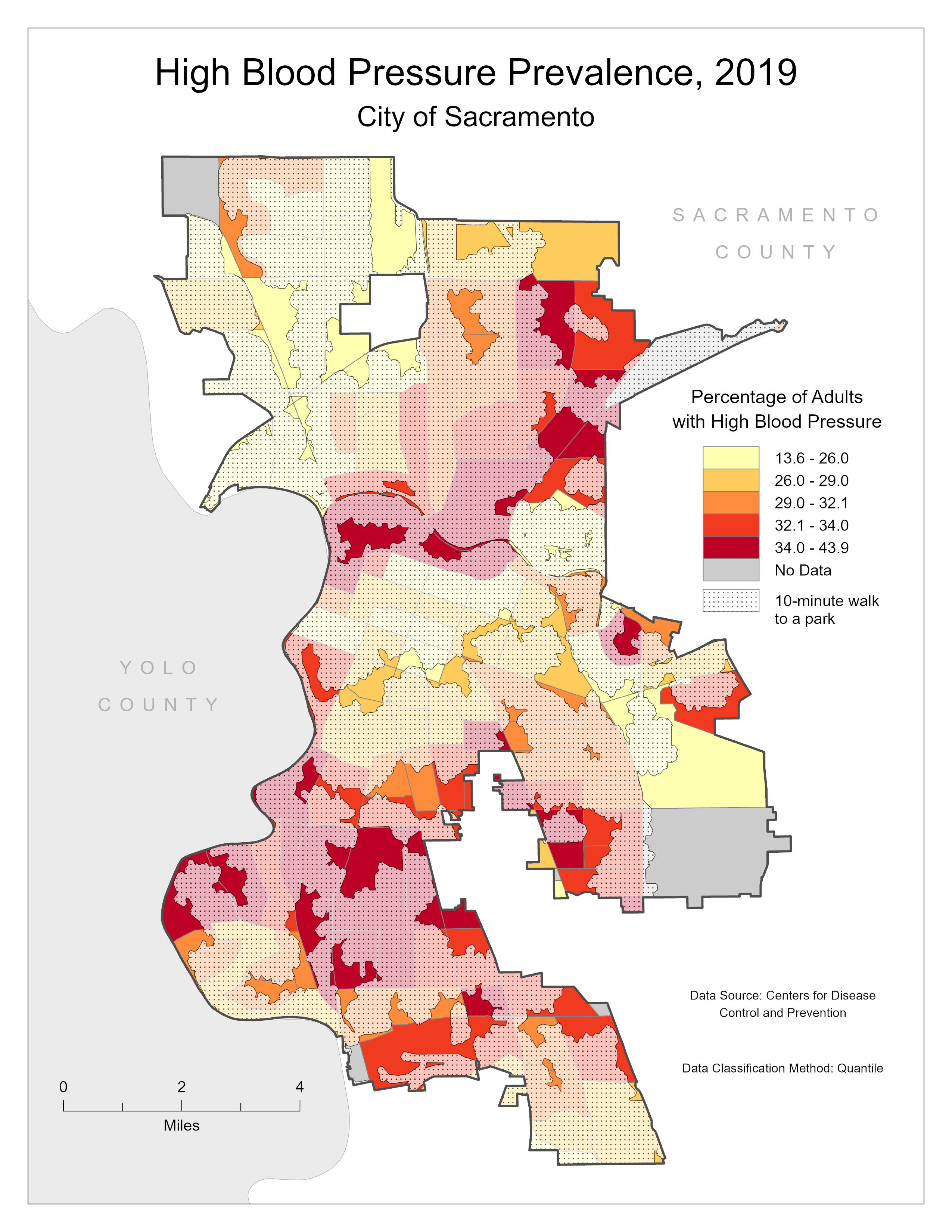
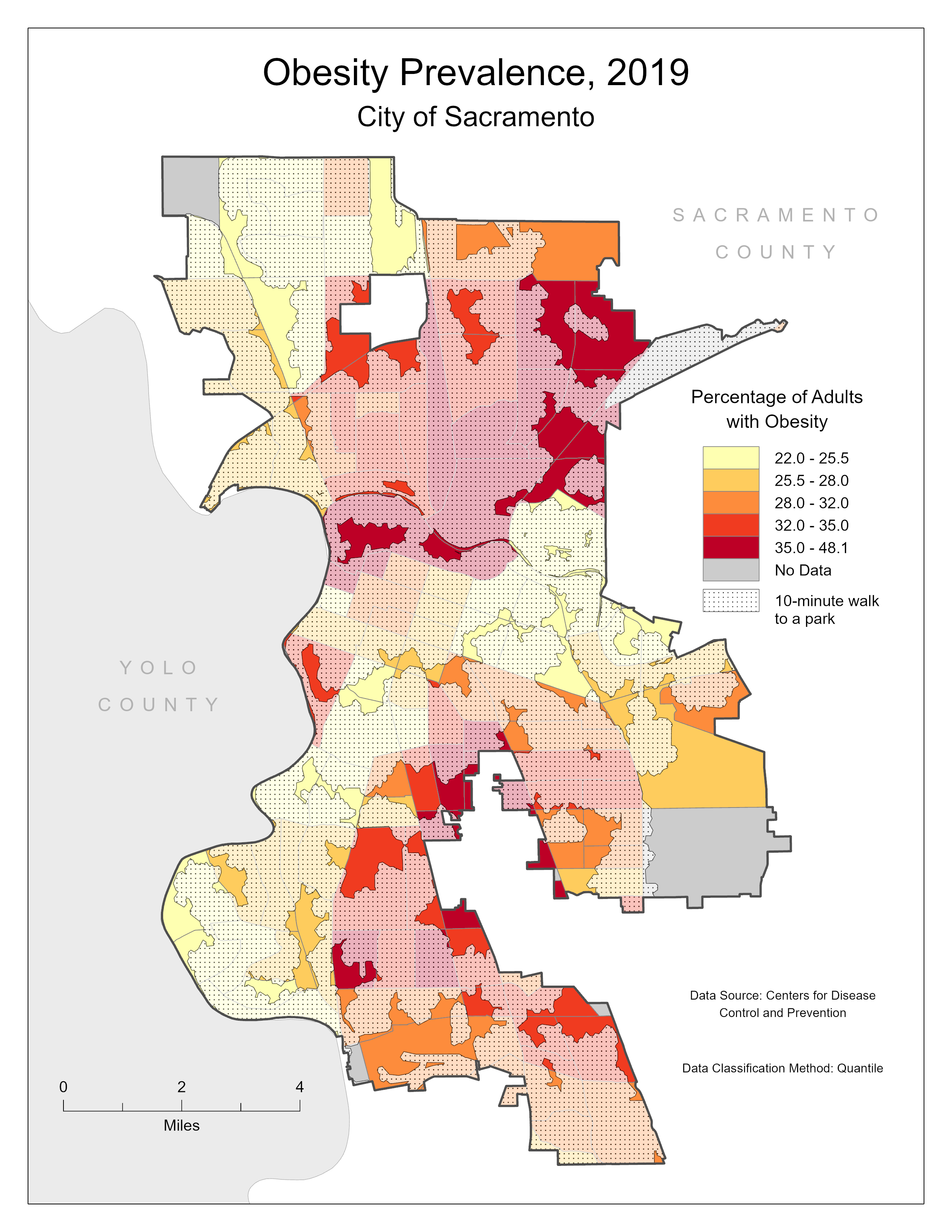
The following maps examine the spatial relationships between the 10-minute walk service area and the prevalence of several known risk factors for developing a serious case of COVID-19. The risk factors chosen for this study are:
- Asthma
- Diabetes
- Heart disease
- High blood pressure
- Obesity
Click each map to view a higher resolution.
|
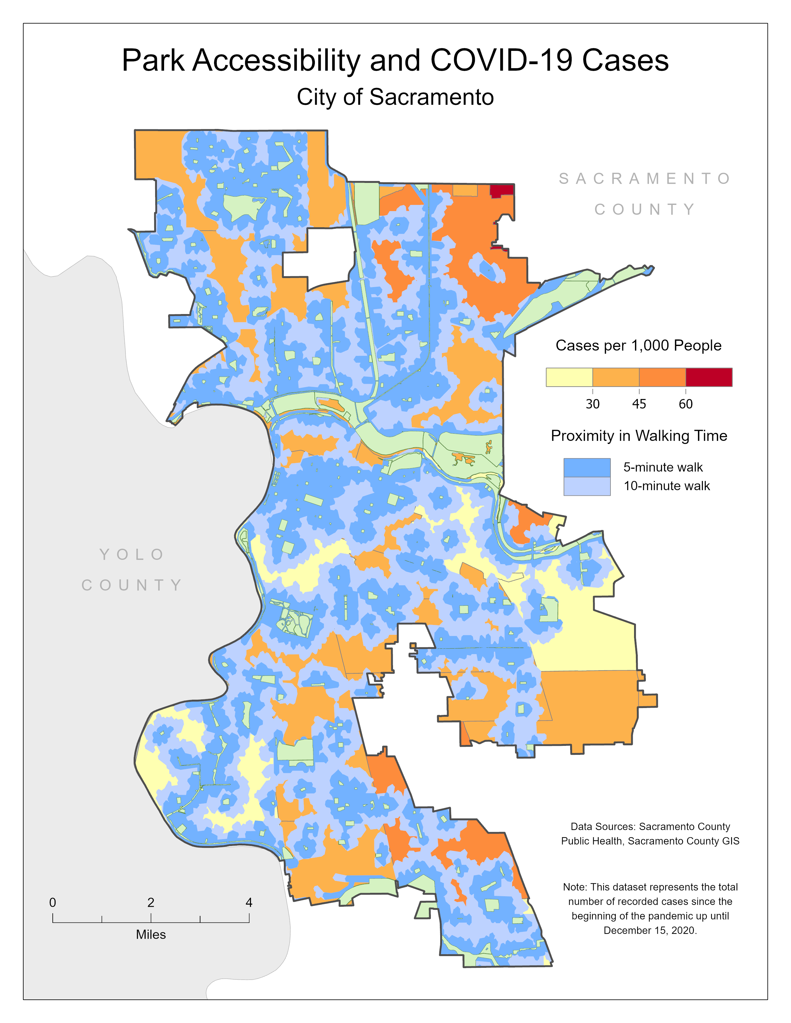
Analysis
The previous maps indicate current gaps in the accessibility of parks and open spaces in Sacramento and their relationship with the prevalence of certain COVID-19 risk factors. By examining these maps and comparing them with the COVID-19 cases by zip code map, it can be suggested that the prevalence of these risk factors reflect the prevalence of COVID-19 within Sacramento. Neighborhoods in North and South Sacramento on average have higher rates of asthma, diabetes, heart disease, high blood pressure, and obesity. Drawing this comparison reinforces the need to provide accessible parks and open spaces for the health benefits they provide to communities. Areas in darker orange and red that are not within a 10-minute walk to a park can be identified as areas with the greatest need for additional open space.
Conclusion
The goal of this study was to examine the relationship between existing parks and open spaces in Sacramento and the prevalence of COVID-19 cases over the course of the pandemic up until December 2020. The maps in this project suggest areas in which additional parks and open spaces can be prioritized with the goal of providing accessible outdoor recreation and improving the health of Sacramento residents. This project provides a framework for choosing these areas based on the existing prevalence of COVID-19 and some of its risk factors. To provide a more thorough investigation, these risk factors as well other health metrics could be aggregated into a single dataset based on their relative contribution to the public health goals of the community. A further study would ideally also incorporate socioeconomic characteristics, current measures of safety, and environmental factors.
References
Data sources are listed on each map.
1. “Cities – United Nations Sustainable Development.” United Nations, United Nations,
https://www.un.org/sustainabledevelopment/cities/
2. “Healthy Places.” Centers for Disease Control and Prevention, Centers for Disease Control and Prevention, 27 Oct. 2014,
https://www.cdc.gov/healthyplaces/healthtopics/parks.htm
3. “Benefits of Physical Activity.” Centers for Disease Control and Prevention, Centers for Disease Control and Prevention, 2 Dec. 2020,
https://www.cdc.gov/physicalactivity/basics/pa-health/index.htm
4. “Certain Medical Conditions and Risk for Severe COVID-19 Illness.” Centers for Disease Control and Prevention, Centers for Disease Control and Prevention, 1 Dec. 2020,
https://www.cdc.gov/coronavirus/2019-ncov/need-extra-precautions/people-with-medical-conditions.html
5. “ParkScore® - About, Methodology, and FAQ.” The Trust for Public Land,
https://www.tpl.org/parkscore/about