| Title Residential Proximity to Major Highways in Sacramento County | |
|
Author Zahraa Hussein American River College, Geography 350: Data Acquisition in GIS; Fall 2020 | |
|
Abstract Motor vehicle emissions represent a complex mixture of criteria air pollutants. Living close to major highways has been associated with air pollution. This project uses GIS to determine the population close to the highways in Sacramento County. | |
|
Introduction When choosing a house, School or daycare, aim for location as far from the highways as possible. Avoid sites with 150 meters (500 feet). The purpose of this project is to determine the population around the highways in Sacramento County. Living near highways with heavy traffic may be risky compared with being in other places in a community. This project focuses on the total population and the percentage of Sacramento County living within 150 meters (500 feet) to highways. | |
|
Background The main source used for this project is the report for (CDC) Center for Disease Control and Prevention. In this report used GIS to determine the population close to major highways _United States ,2010. | |
| Residential Proximity to Major Highways — United States, 2010 |
|
|
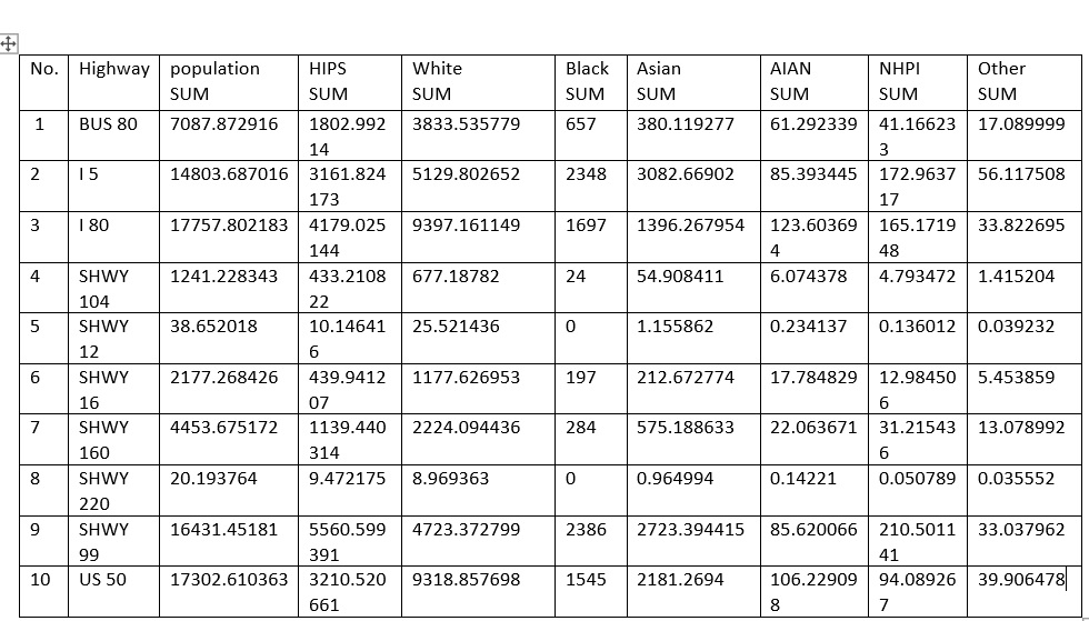
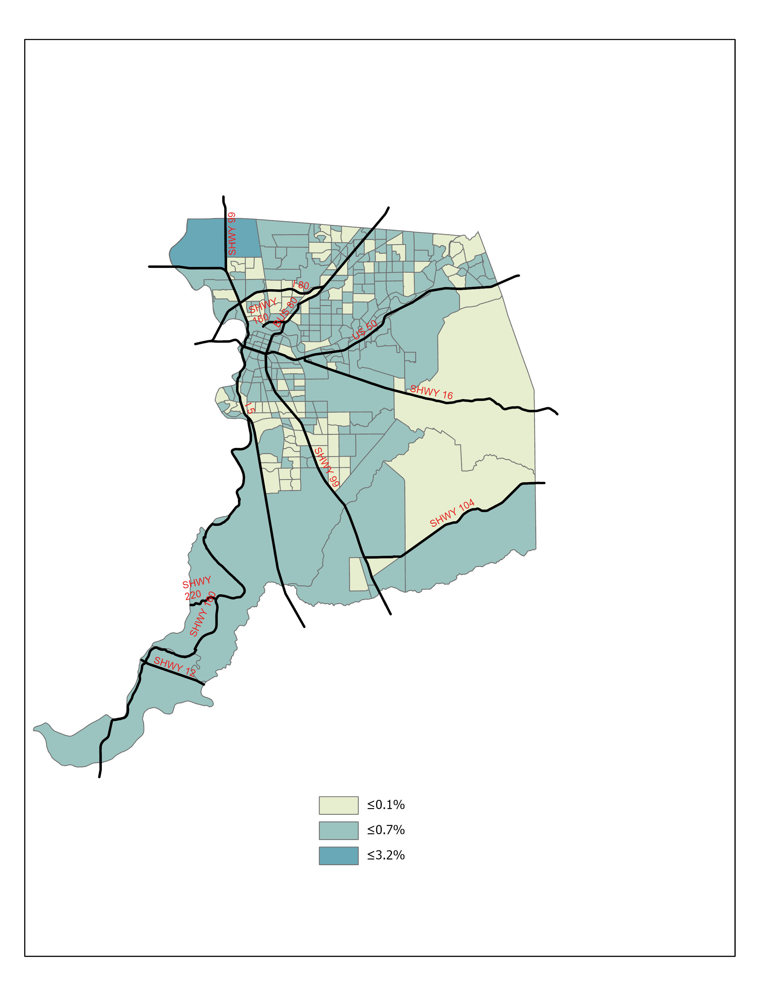
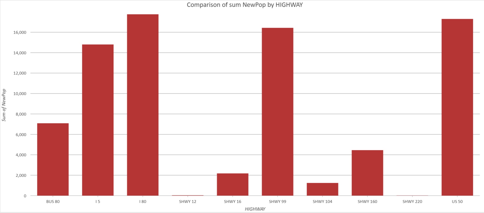
Methods The data source was used in this project from SACOG open data portal for the highways of Sacramento county and for census tracts _2010. Arc GIS pro software was used to create buffer within 150 meters around the major highways of Sacramento county. And intersect that buffer to the census tracts ,2010 to interpolate Some population. Added some field to calculate the new total population and new population for each race / ethnic around the highways within buffer 150 meters (500 feet). | |
|
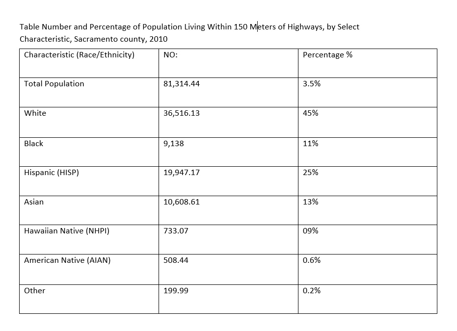
Results Total population close to Highways in Sacramento County (81,314.44) persons or (3.5%) of the (2,316,019) Sacramento County population. Total population for each (Race/Ethnicity) for white (36,516.13) (45%), for Black (9,138) (11%), for Hispanic (19,947.17) (25%), for Asian (10,608.61) (13%), for Hawaiian Native (733.07) (0.9%), for American Native (508.44) (0.6%) and other (199.99) (0.2%). | |
 |
|
 | >
|
|
Analysis Approximately 3.5% of total Sacramento County population lives within 150 meters of major highways. Estimates of residential proximity to major highways are depended on type of road and buffer distance used. In this project bases on Small buffer distance to select persons who are at the highest risk for exposure to air pollution | |
 | >|
 | >
|
|
Conclusions Total population exposure to traffic related air pollution may help inform how future highways are designed, influence future Landuse development and Landuse policies affecting the environment near highways. Shifting Landuse pattern and investing in strategies that increase air quality may lead to improved health outcomes. | |
|
References Living Near Highways and Air Pollution https://www.lung.org/clean-air/outdoors/who-is-at-risk/highways | |