| Identifying Groundwater Recharge Potential of Sacramento County Creeks | |
|
Author American River College, Geography 350: Data Acquisition in GIS; Fall 2020 hwitzens@gmail.com | |
|
Abstract This project is a simplified evaluation of Sacramento County creeks for their potential to recharge groundwater. Targeting creek segments best suited to this function can help focus and prioritize creek restoration efforts. The potential outcome would be two-fold: Restoring creek ecosystems while also securing our groundwater supplies. | |
|
Introduction Water management is one of California's most pressing issues. Significant human alterations to natural water flow over the past 100 years have strained the availability, reliability, and quality of water resources, while also degrading the riparian ecosystems that occur along streams and other water bodies. While water management has historically focused on surface waters, today's managers are also developing sustainable groundwater management practices. Naturally occurring groundwater basins offer more storage capacity than surface reservoirs, among other benefits. Because groundwater basins are currently being extracted beyond what can be replenished naturally, researchers are devising ways to re-fill these basins. While the main recharge approach is to intentionally flood large areas of land, I thought that perhaps Sacramento County's abundant streambeds could also be leveraged as potential groundwater recharge sites. To identify streambeds with the highest recharge potential, soil structure is the defining criteria. To limit areas to those that are most practical, economical and achievable, land use classification and land ownership must also be considered. Spatial analysis can then be performed to generate a map of suitable sites. | |
|
Background We have nearly maximized our ability to retain surface water (via dams) to provide enough water in drought years (Lawrence, 2011). Surface water storage is expensive and destructive to the environment; it is also not very efficient and will become even less so due to climate change (Investing for California's future, n.d.). Groundwater is a larger, more reliable water supply than surface water. Unfortunately, groundwater has been overdrawn for years, which threatens water availability and causes many other problems such as degradation of riparian habitats, degraded water quality, land subsidence and seawater intrusion (California Department of Water Resources, 2020). Groundwater depletion is exacerbated by current land management practices that prevent surface water from soaking into the soil and recharging groundwater (Sedlak, 2014). 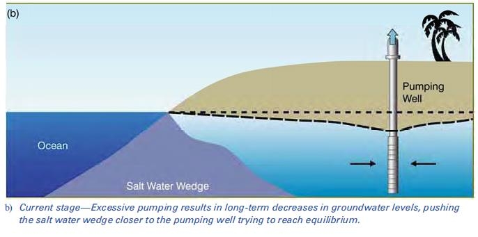 A lowered water table and saltwater intrusion, both illustrated here, are two potential consequences of groundwater overdraft. Image sourced from the UC Division of Agriculture and Natural Resources (UC ANR)'s Green Blog, 2013. Because groundwater has been overdrawn, water managers and researchers have begun to take a serious look at sustainable groundwater management. The Sustainable Groundwater Management Act, passed in 2014, requires that extraction rates not exceed replenishment rates by 2042. To accomplish this, groundwater must be recharged intentionally to make up for high extraction rates (California Department of Water Resources, 2020). The Soil Agricultural Groundwater Banking Index (SAGBI) identifies the agricultural lands most suitable for groundwater recharge. The index is based on five factors that examine soil structure and chemistry, topography, and crop types. Areas of high suitability can then be flooded for the purpose of recharging groundwater (O'Geen et al, 2015). 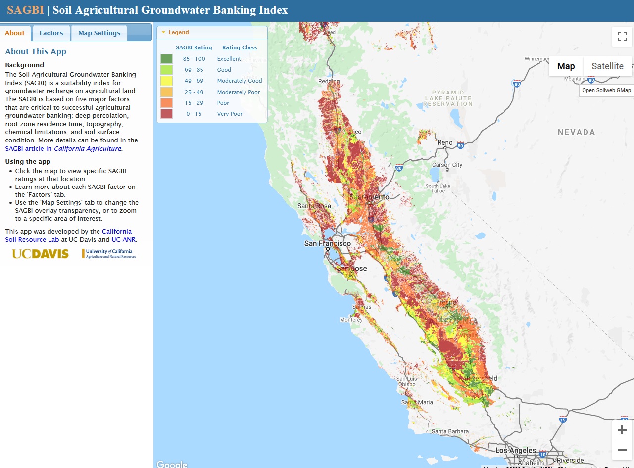 The SAGBI web app. A related environmental issue is declining stream health. Groundwater levels affect stream health because when the water table is high, streams have water in them for longer periods, because groundwater feeds the streams. These streams are called gaining streams because they gain volume from the addition of groundwater. When the water table is lowered, gaining streams turned into losing streams, meaning they often run dry as their water drains into the ground (Winter, Harvey, Franke & Alley, 1999). 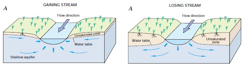 Illustration of the differences in groundwater interaction between gaining and losing streams. Image sourced from U.S. Geological Survey circular 1139. Urbanization and intensive agricultural practices have also significantly altered the character of streams. Soil erosion and compaction, vegetation removal and impermeable surfaces (paving, structures, etc.) result in an increase in runoff and a decrease in water infiltrating into the soil. The increased runoff scours streambeds, deepening and steepening the stream channels. Water enters and exits the streambeds at high volume and velocity, causing seasonal extremes of flooding and drought in the streams, while recharging very little groundwater (Sedlak, 2014). To partially address both issues concurrently, I thought stream restoration in Sacramento County could be prioritized in areas with high recharge potential. This would result in the dual benefit of improving riparian ecosystems while also contributing to groundwater recharge. Land use and ownership are essential considerations with any restoration project. The restoration project must not heavily disrupt the activities and people already present, and restorationists must also negotiate access to any privately owned sites. Both factors, as well as limited funding, often limit the size and scope of such projects (Clewell, A.F. and Aronson, J., 2013), meaning my final results would likely need to be constrained to two or three fairly short stretches of creek, perhaps each no more than 2-3 miles in length. | |
|
Methods My process for identifying streambed sites with high recharge potential was two-fold. First, I needed to find sites with characteristics amenable to groundwater recharge. Second, I needed to limit these sites to logistically practical areas. Finding appropriate characteristics: To define my area of study, I imported a county boundary shapefile from Sacramento County Open Data. I then imported a linear hydrology shapefile from the same source. This dataset includes linear water features of several classifications, such as river, canal, slough and creek. Rivers and sloughs do not seem like suitable sites for this project due to their large size, year-round flow, and the likelihood that they already contribute to groundwater recharge. Canals are designed to move water quickly and are often lined, which would prohibit soil infiltration. Therefore, I decided to limit my analysis to named creeks. To do this, I selected all features with a category of Creek and without a name value of Unknown, then exported these to a new feature class. 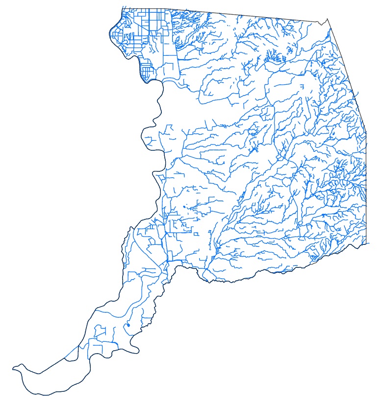 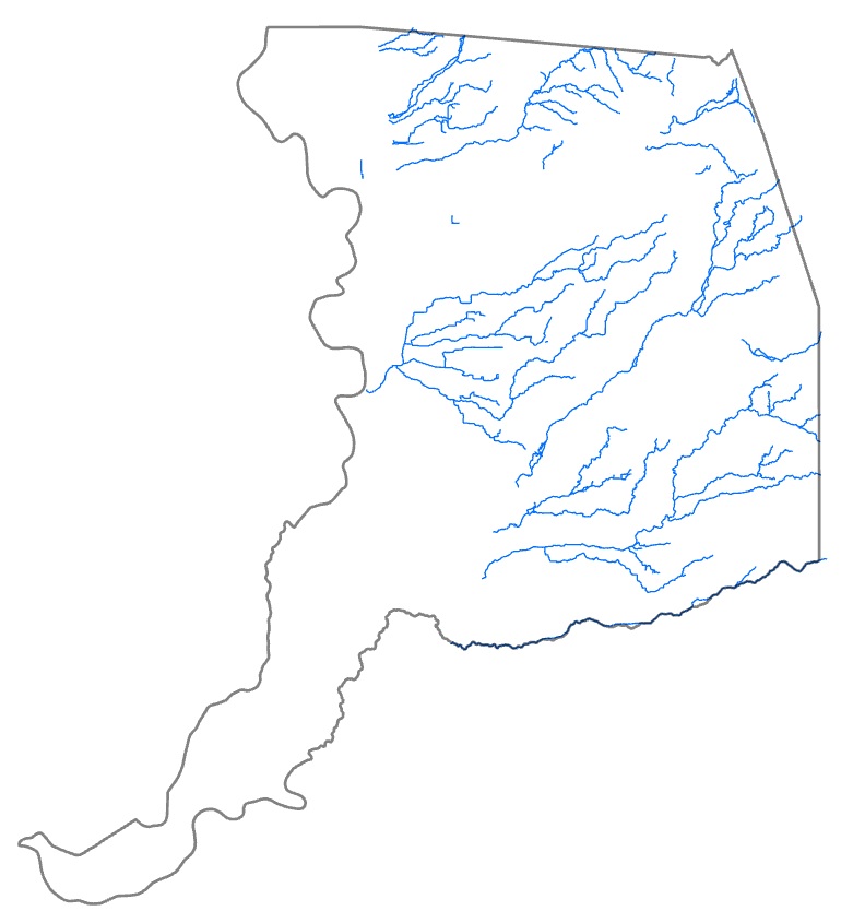 Left: The complete Linear Hydrology dataset. Right: The dataset confined to named creeks only. For a creekbed to recharge groundwater, it needs to be located above a groundwater basin. I used the CA Bulletin 118 Groundwater Basins shapefile by the California Department of Water Resources, accessed from the California Natural Resources Agency Open Data site. I clipped this layer to the Sacramento County boundary, and then clipped the creeks to the basin layer. 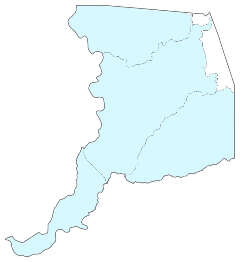 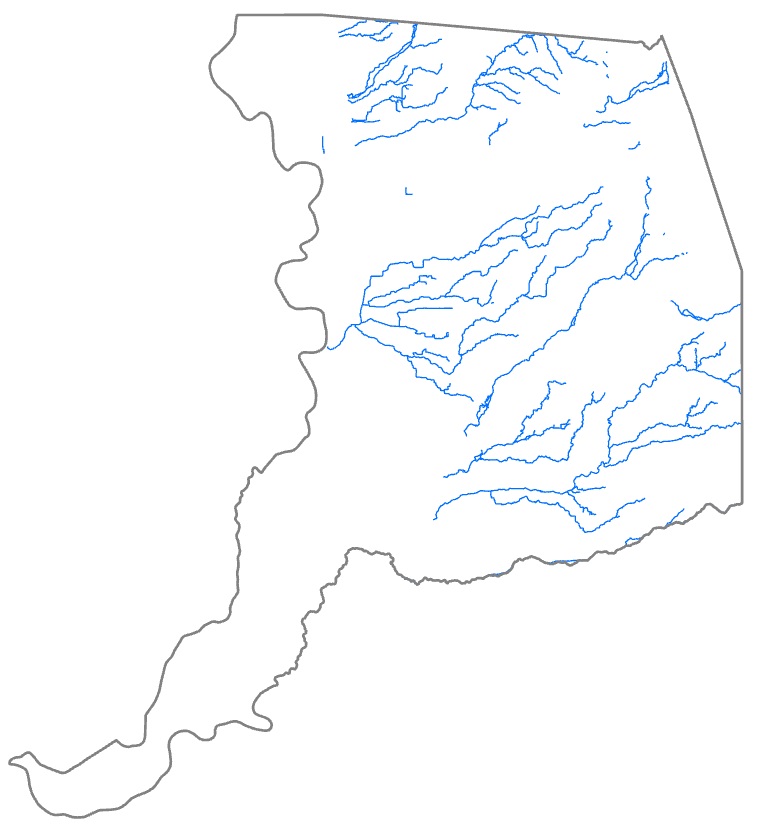 Left: The Groundwater Basins dataset clipped to Sacramento County. Right: The creeks clipped to the groundwater basins layer. The creekbeds also need to be in areas with suitable soil characteristics. While the SAGBI project mentioned above factored in several soil characteristics, to apply this level of detail to my project would require knowledge beyond my skillset. Therefore, I decided to base my soil analysis on a single factor: drainage class. Using ESRI's SSURGO Downloader web app, I downloaded project packages of soils data for each of the five subbasins that occur within the county (Lower American, Lower Sacramento, Upper Coon-Upper Auburn, Upper Cosumnes, and Upper Mokelumne subbasins). I opened each project package and exported its Map Units layer to a new feature class, then imported the resulting five feature classes into my project and clipped each to the county boundary. I merged the five feature classes into a single feature class, then symbolized this merged feature class using Unique Values from the Drainage Class - Dominant Condition field. Using attribute queries, I exported only those polygons within the Excessively drained, Moderately well drained, Well drained and Moderately well drained classes, then exported those to a new feature class. I then clipped the creeks to this feature class.  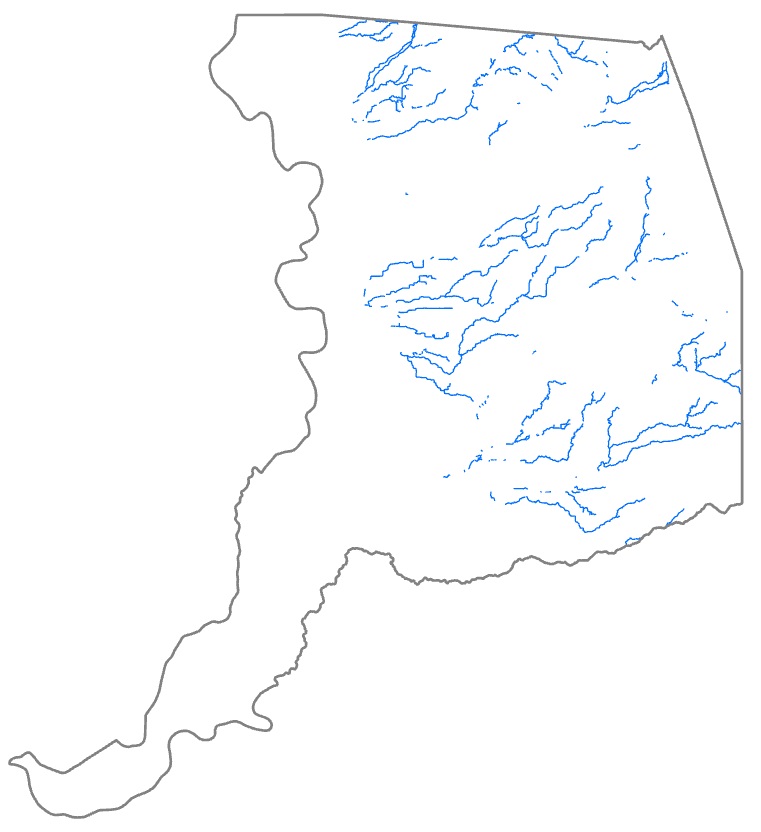 Left: The merged soils dataset. Right: The creeks clipped to the soil types classified as moderately well drained or better. Narrowing down to the most logistically feasible areas: To incorporate land use and ownership considerations, I used a parcel shapefile from Sacramento County Open Data and divided the parcels into two groups: desirable and undesirable. I first symbolized the layer using the Unique Values in the LU_GENERAL (general land use) field. After evaluating the various categories, I chose several categories as being desirable (due to assumed low population density and lack of complex land ownership issues) and the remaining categories as undesirable (heavily occupied areas such as residential, commercial, etc. that could be threatened by increased flood risk). I used an attribute query to select all parcels of desired general land use categories (Agricultural, Miscellaneous, Public/Utilities, Recreational, and Vacant), then exported these to a new feature class. Going back to the original parcel layer, I used another attribute query to select all parcels of undesired general land use categories (Care/Health, Church/Welfare, Industrial, Office, Residential and Retail/Commercial), then exported these to a second feature class. To exclude creek areas near undesirable parcel types, I edited the creeks feature by using the Divide: Clip tool, using the undesirable parcel layer as the input feature, with a buffer distance of 800 meters (approximately one-half mile), and choosing the Discard intersecting areas option. 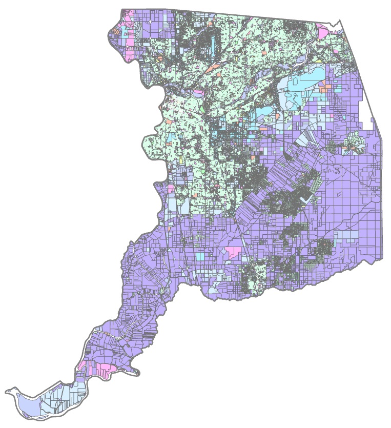 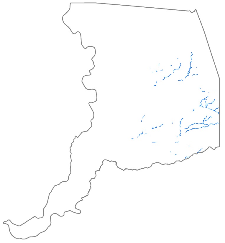 Left: The complete parcels dataset. Right: The creeks clipped to areas at least 800 meters from heavily occupied areas. Another important land use consideration is transportation routes, which are not captured in parcel data and so required a different dataset. I used two shapefiles, highways and railways, from Sacramento County Open Data, and merged them into a single layer. I then edited the creeks layer again, as described above, to remove all creek segments within 1,600 meters (approximately 1 mile) of the transportation layer. 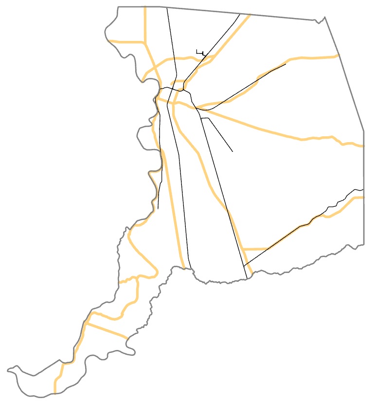 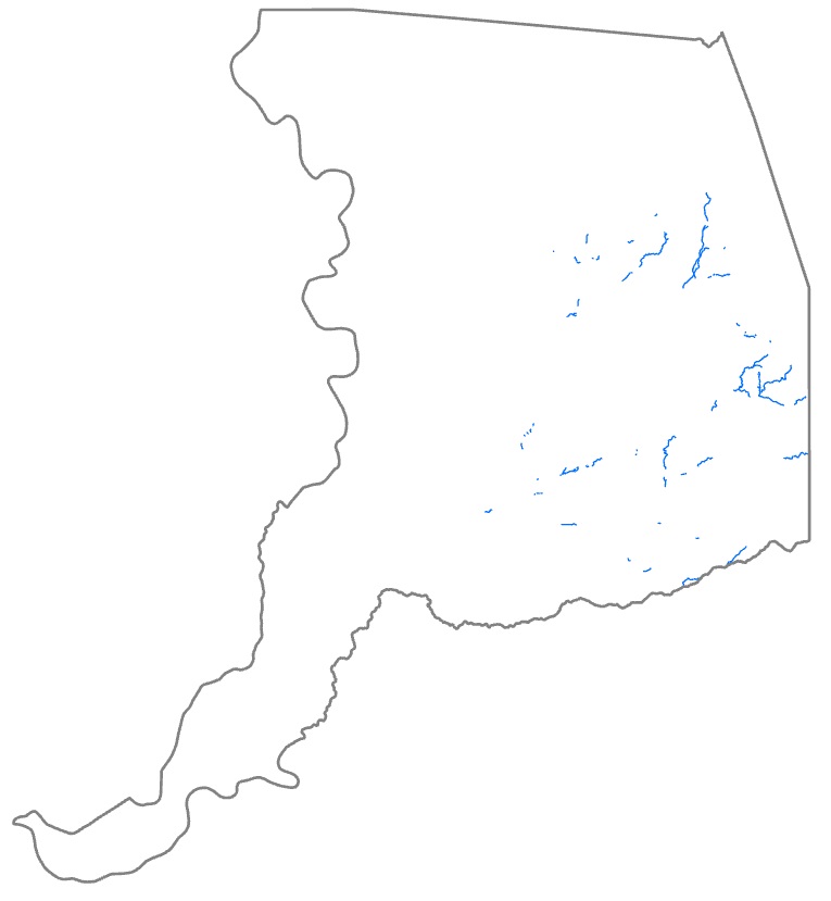 Left: Sacramento County highways (gold lines) and railways (black lines). Right: The creeks clipped to areas at least 1,600 meters from highways or railways. Even with all these restrictions, many creek areas remained. Since funding for restoration projects is typically limited, I wanted to fine-tune the restoration areas even further, selecting only the very best sites. I performed another attribute query on the Soils layer, selecting all polygons whose Drainage Class - Dominant Condition was not equal to Moderately well drained (which reduced the drainage classes from the best four to the best three). I exported the selection to a new feature class, which I used to again clip the creeks layer. 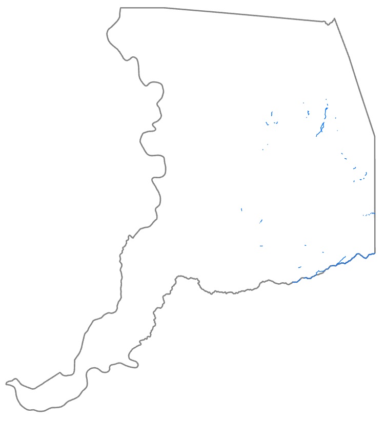 The creeks clipped to the top three soil drainage classes. By this point, I had many creek segments that appeared to be too small to be of use for this project. I again edited the creeks feature, using the Divide: Explode tool to break apart the creek segments into distinct objects. I then used an attribute query to select all creek segments with a Shape_Length of less than 500 meters (approximately one-third mile), then deleted these segments. Finally, I manually deleted a few remaining small segments, as well as one segment along the county line that previous clipping procedures did not catch due to inaccuracy in the county boundary shapefile. 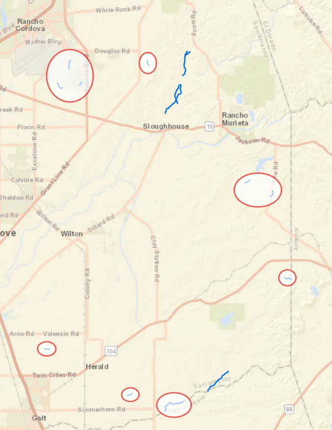 The circled segments were manually deleted. Once my creek selection was complete, I wanted to show the number and types of parcels that the creek segments occurred on. I used a location query to select all desirable parcels intersecting the final creeks layer, then exported these to a new feature class, the results of which are shown below. | |
|
Results This mapping process identified segments of four different Sacramento County creeks as being the most suitable for creek restoration projects intended to recharge groundwater. Three of the creeks (Coyote, Carson, and Deer creeks) are in the eastern part of the county between Highway 50 and Highway 16, while Dry Creek is near the southeast corner of the county. 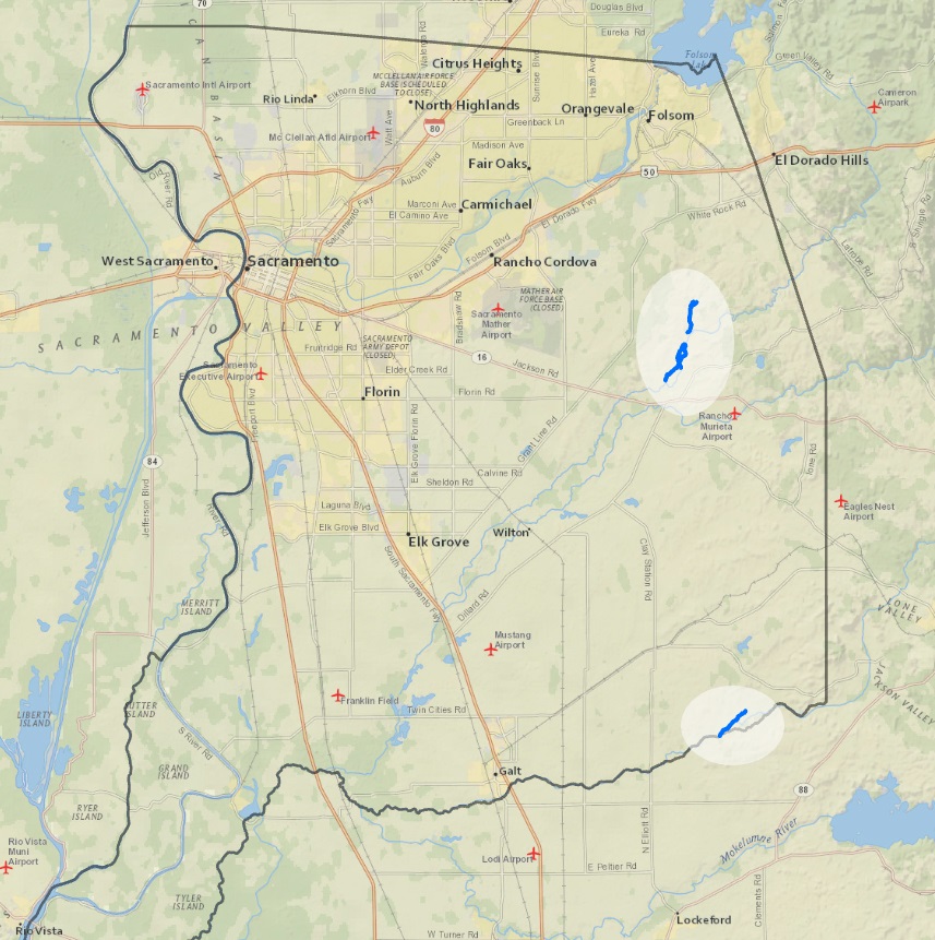 The final creek segments shown at the county level. The segments on Carson and Dry creeks are each approximately 3,400 meters (about 2 miles) in length, while the Deer Creek segment measures almost 7,000 meters (a little over 4 miles) in length. Although the Coyote Creek segment is only 640 meters, it was retained because it connects to the Carson Creek segment. The creek segments mostly occur on agricultural land. Out of 16 total parcels, 14 are classified as agricultural land use, one is vacant, and one is public/utilities. 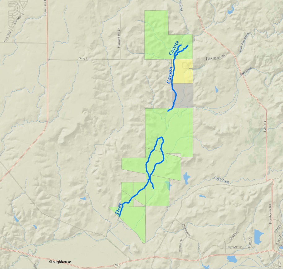 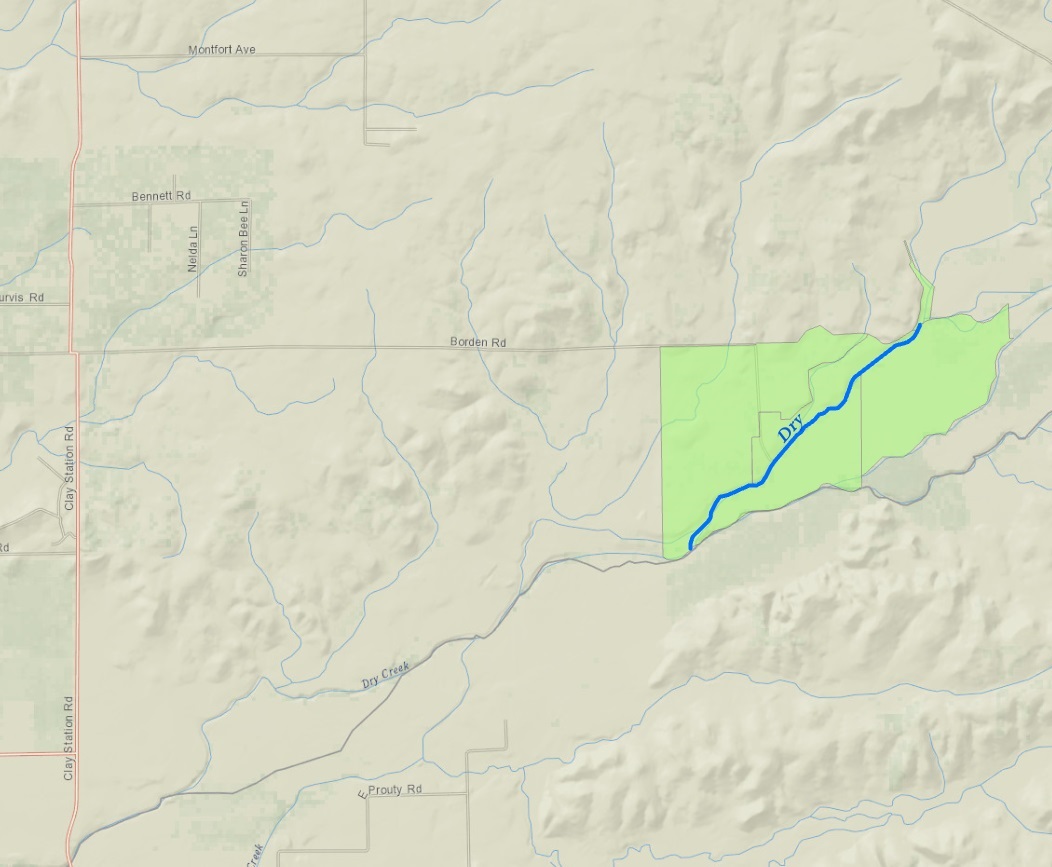 Top: The final creek segments along Carson Creek, Coyote Creek and Deer Creek. Bottom: The final creek segment along Dry Creek. The green parcels are agricultural, the yellow parcel is public/utilities, and the gray parcel is vacant. |
Analysis Overall, I am pleased with the outcome of this exercise, and feel it is a worthwhile "first-pass" identification of creek sites that may be suitable for groundwater recharge. However, as mentioned above, the Sacramento County shapefile was somewhat inaccurate, which I did not realize until the end of the project when I zoomed to the Dry Creek segment and saw that the county boundary in the shapefile did not match up with the basemap layer in that region. This led me to doubt the accuracy of the other Sacramento County data, particularly the creeks and parcels layers. Errors in these layers could significantly affect the results. My analysis also relied on numerous assumptions based on educated guesswork rather than expert knowledge, as well as simplifications of complex natural processes. The thoroughness and accuracy of the analysis would be greatly improved by consulting with domain experts in the fields of surface and groundwater hydrology, soils, cadastral, etc. Being fairly new to GIS, this project also allowed me to practice and refine my entire project process, from data collection and organization, to operation of the ArcGIS Pro software, to procedure documentation. For example, it would be more efficient to use definition queries to isolate data rather than selecting desired objects and repeatedly exporting them to new feature classes. |
|
Conclusions Once refined and verified by domain experts, this analysis of creeks in the Sacramento region could potentially be used as a starting point for projects designed to mitigate the dual problems of groundwater overdraft and riparian degradation. Restoring these targeted creek segments to their predisturbed state would improve creek habitat and temper extremes of water flow, allowing water to travel through the creekbed more gradually and increasing groundwater recharge rates. | |
|
References
California Department of Water Resources, Sustainable Groundwater Management Office, 2020. California's groundwater and the Sustainable Groundwater Management Act. https://water.ca.gov/-/media/DWR-Website/Web-Pages/Programs/Groundwater-Management/Sustainable-Groundwater-Management/Files/CA-Groundwater-and-SGMA-Fact-Sheet.pdf; accessed 2020.12.10 Clewell, A.F. and Aronson, J., 2013. Ecological restoration: Principles, values and structure of an emerging profession. Washington, DC: Island Press Investing for California's future - groundwater, not dams, n.d. https://www.cleanwateraction.org/features/investing-california%E2%80%99s-future-groundwater-not-dams; accessed 2020.12.05 Lawrence, Cathryn, 2011. Water storage in California. https://californiawaterblog.com/2011/09/13/water-storage-in-california-2/; accessed 2020.12.10 O'Geen, A., Saal, M., Dahlke, H., Doll, D., Elkins, R., Fulton, A., ... Walkinshaw, M., 2015. Soil suitability index identifies potential areas for groundwater banking on agricultural lands. California Agriculture 69(2), 75-84. https://doi.org/10.3733/ca.v069n02p75; accessed 2020.11.25 Sedlak, D., 2014. Water 4.0: The past, present, and future of the world's most vital resource. New Haven, CT: Yale University Press UC Division of Agriculture and Natural Resources, 2013. 18913_original.jpg (illustration of groundwater overdraft and saltwater intrusion). https://ucanr.edu/blogs/blogcore/postdetail.cfm?postnum=11846; accessed 2020.12.12 Winter, T., Harvey, J., Franke, O. and Alley, W., 1999. Ground water and surface water: A single resource. U.S. Geological Survey circular 1139. Denver, CO: U.S. Department of the Interior. https://pubs.usgs.gov/circ/circ1139/#pdf; accessed 2020.12.08 | |
|
Data Sources
CA Bulletin 118 Groundwater Basins (shapefile), California Department of Water Resources, https://atlas-dwr.opendata.arcgis.com/datasets/b5325164abf94d5cbeb48bb542fa616e_0 County Boundary (file geodatabase), Sacramento County Open Data, https://data-sacramentocounty.opendata.arcgis.com/datasets/eb878e7e45d1414181642075e2081aac_0 Highways (file geodatabase), Sacramento County Open Data, https://data-sacramentocounty.opendata.arcgis.com/datasets/92443895b2074c9ca7589a492169ede0_0 Hydrology Linear (file geodatabase), Sacramento County Open Data, https://data-sacramentocounty.opendata.arcgis.com/datasets/37820de5c27b44aaa10416fd151b0dcc_0 LowerAmerican_18020111 (project package), Natural Resources Conservation Service. Retrieved from ESRI's SSURGO Downloader web app, https://www.arcgis.com/apps/View/index.html?appid=cdc49bd63ea54dd2977f3f2853e07fff LowerSacramento_18020163 (project package), Natural Resources Conservation Service. Retrieved from ESRI's SSURGO Downloader web app, https://www.arcgis.com/apps/View/index.html?appid=cdc49bd63ea54dd2977f3f2853e07fff LowerSacramento_18020163 (project package), Natural Resources Conservation Service. Retrieved from ESRI's SSURGO Downloader web app, https://www.arcgis.com/apps/View/index.html?appid=cdc49bd63ea54dd2977f3f2853e07fff Parcels (file geodatabase), Sacramento County Open Data, https://data-sacramentocounty.opendata.arcgis.com/datasets/8d011b99aebc46d48060b2e5bdd7f4a0_0 Railways (file geodatabase), Sacramento County Open Data, https://data-sacramentocounty.opendata.arcgis.com/datasets/3217e0fecb39410cb48f373bdf91fd36_0 UpperCoonUpperAuburn_18020161 (project package), Natural Resources Conservation Service. Retrieved from ESRI's SSURGO Downloader web app, https://www.arcgis.com/apps/View/index.html?appid=cdc49bd63ea54dd2977f3f2853e07fff UpperCosumnes_18040013 (project package), Natural Resources Conservation Service. Retrieved from ESRI's SSURGO Downloader web app, https://www.arcgis.com/apps/View/index.html?appid=cdc49bd63ea54dd2977f3f2853e07fff UpperMokelumne_18040012 (project package), Natural Resources Conservation Service. Retrieved from ESRI's SSURGO Downloader web app, https://www.arcgis.com/apps/View/index.html?appid=cdc49bd63ea54dd2977f3f2853e07fff |