Building the Mokelumne Hill Experience
Karen Cole
Student GEOG385, American River College - Fall 2021
This project was a result of a desire to develop a place for interested parties to go to learn more about Mokelumne Hill.
The Mokelumne Hill Experience was built using existing Open Data. Processing was performed in ArcGIS Pro and AGOL. The final application was built using Experience Builder. In the final experience, the user can choose from visible layers on the Main Map. There are also buttons to view available historical maps. It is a good start to viewing what is Mokelumne Hill today. Future additions might include card widgets that highlight current businesses downtown.
Calaveras County GIS, an open data portal, was used for the majority of the data. They had already gathered much information and clipped it to the Calaveras County boundary.
Additional data was gathered from the California State Geoportal.
Geodetic control points were downloaded from Data.gov: National Geodetic Survey (NGS) Geodetic Control Stations.
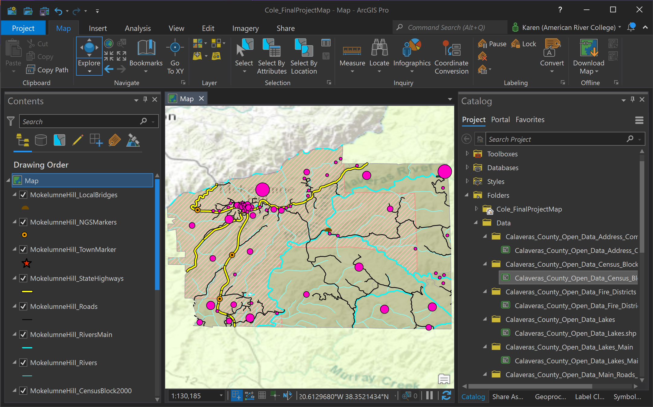
All data were then loaded into ArcGIS Pro for preparation. Based upon the restriction of parcel data size, all layers were clipped to the Address Community polygon layer, using a definition query to limit the COMMAREANA to Mokelumne Hill (Figure 1). After all layers were prepped, the Pro Map was Published as a Web Layer.
Figure 1: ArcGIS Pro
The remainder of the processing took place in AGOL. The Web Layer didn’t transfer all of the formatting, so time was spent in updating the formatting in a few individual Feature Layers.
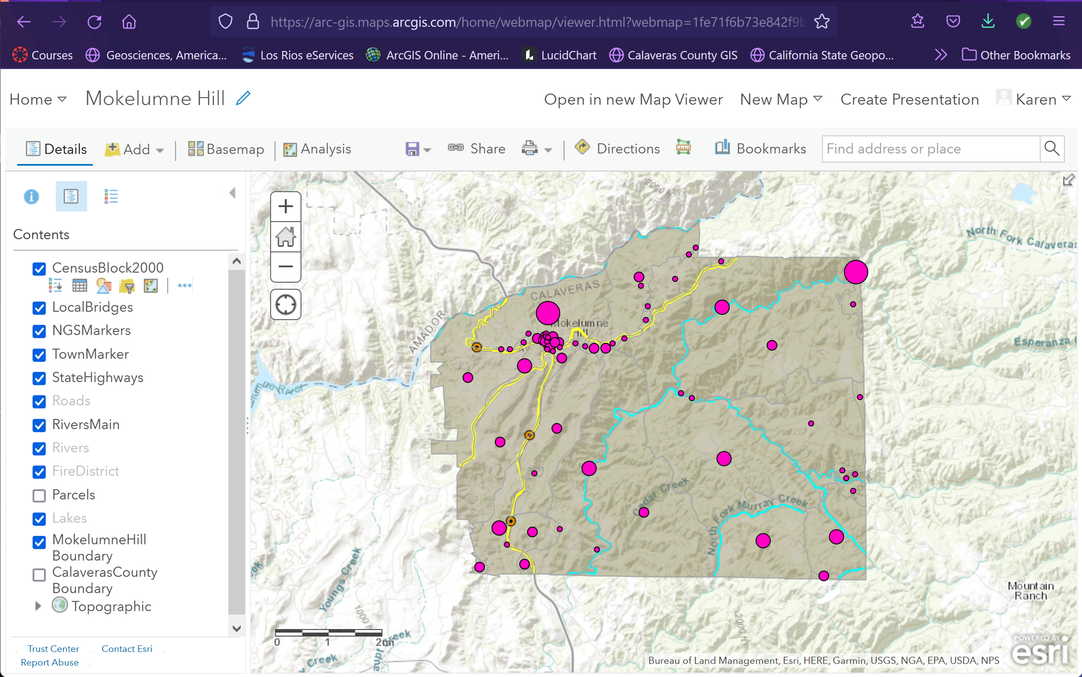
When this was completed, the Web Layer was opened in a new Web Map, and the preferred Scale was set.
From the Web Map, Experience Builder was opened by clicking on “Create Web App”.
Figure 2: AGOL Web Map
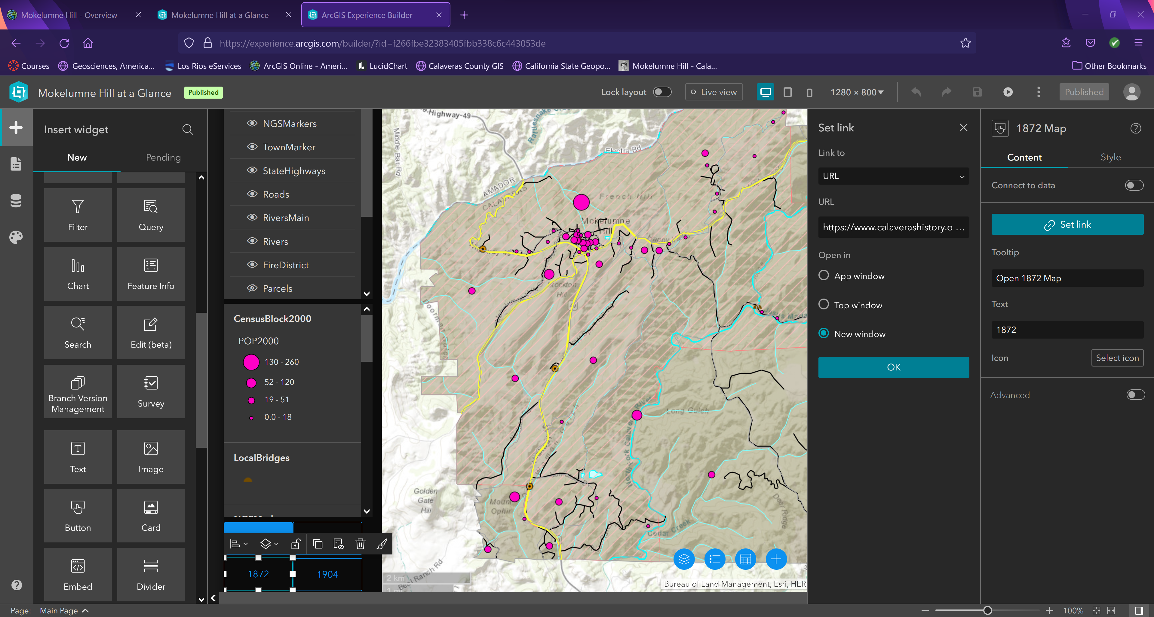
The work performed in Experience Builder included:
The buttons were created to lead to the three historical maps and the Mokelumne Hill Historical website. The website button simply contains a link.
The “1855” and “1904” buttons both needed to open a display of an image, so a separate page was created for each; to which each button leads.
The “1872” map is actually a PDF of a map divided into five pages. There currently is no format to display a PDF directly within the App, so the button has a link to the PDF and the user must decide what to do with the PDF (view or download).
Figure 3: Experience Builder
The “experience” in creating a website using Experience Builder was challenging and exciting. There was a learning curve involved in figuring out which widgets would support the material to be displayed. More material would have been available if more time spent in Mokelumne Hill would have been possible. Tourist sights could be added using Collector or Survey123 and photos to go with each point of interest.
There is already a considerable amount of interest on ESRI’s website regarding internal display of PDFs. That will be a welcome addition to what they have already started.
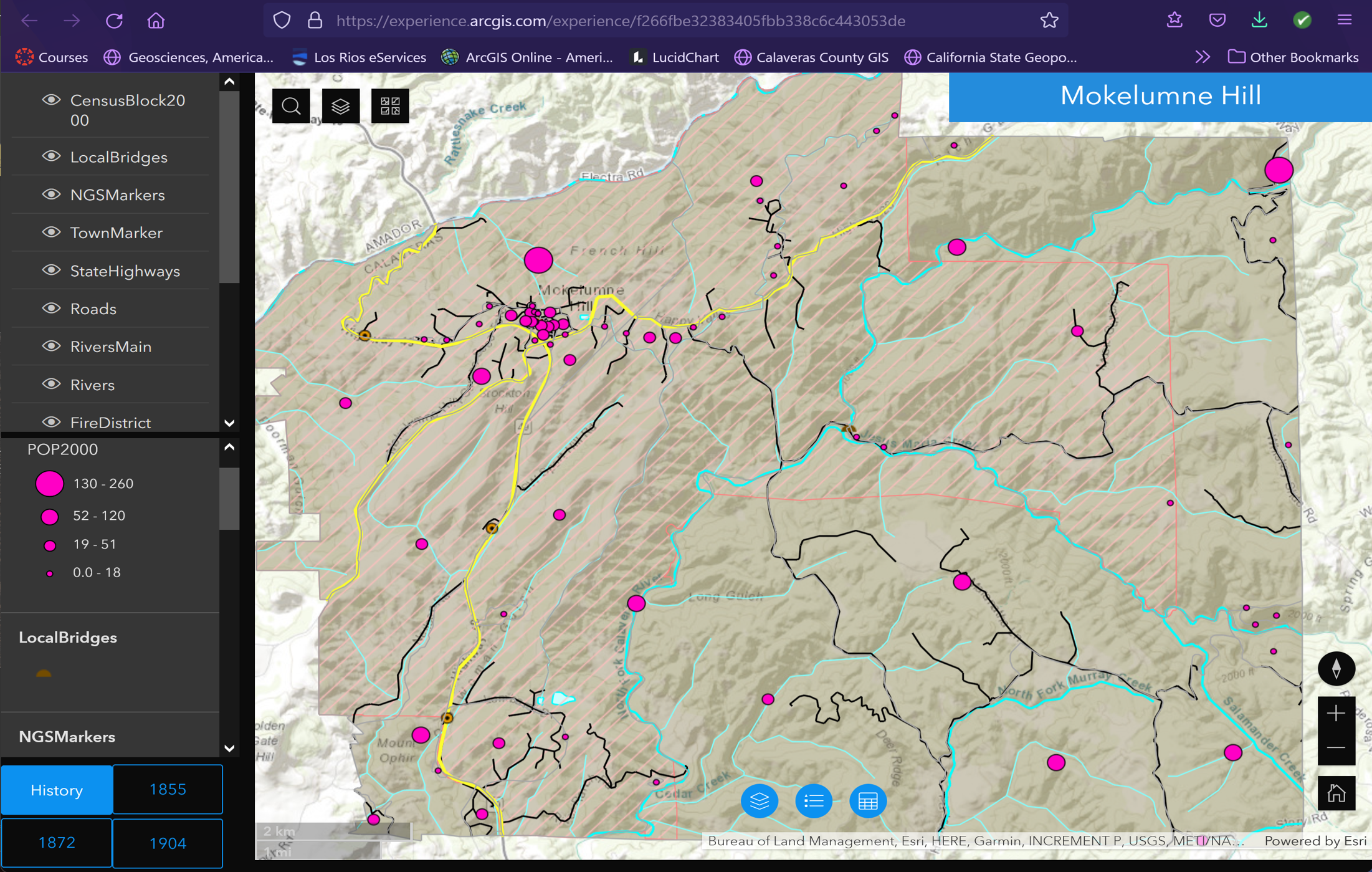
The final Experience website address is:
"Mokelumne Hill at a Glance"
https://experience.arcgis.com/experience/f266fbe32383405fbb338c6c443053de/Figure 4: Mokelumne Hill at a Glance Website
Calaveras County Open Data Portal, 2021
https://opendata-calaveras-gis.opendata.arcgis.com/California State Geoportal, 2021
https://gis.data.ca.gov/National Geodetic Survey (NGS) Geodetic Control Stations, (Horizontal and/or Vertical Control), March 2009
https://catalog.data.gov/dataset/national-geodetic-survey-ngs-geodetic-control-stations-horizontal-and-or-vertical-control-2009