TitleReservation Access to California State Campgrounds in Santa Cruz County, CA | |||||||||||||||||||||||||||||||||
AuthorMartin Delgado | |||||||||||||||||||||||||||||||||
AbstractAn ArcGIS Pro project, Web Map Application, and distributable maps that can serve as reference tools for those wishing to make camping reservations at the California State Park Campgrounds within Santa Cruz County through the ReserveCalifornia™ website. Additional analysis of campground and park amenities is also included. | |||||||||||||||||||||||||||||||||
IntroductionCamping within California State Parks is one the most enjoyable and sought-after experiences within California. The demand for access to California State Park campgrounds has grown tremendously over the years, and with the ReserveCalifornia™ website being launched in 2018, it is even easier for park visitors to make camping reservations in advance. Santa Cruz County, with a diverse environment which includes beaches and forests, is one of the most desirable camping regions within the state. The final Web Map Application provides an analysis of California State Campgrounds within Santa Cruz County that are available for camping reservations through the California State Parks ReserveCalifornia™ website. | |||||||||||||||||||||||||||||||||
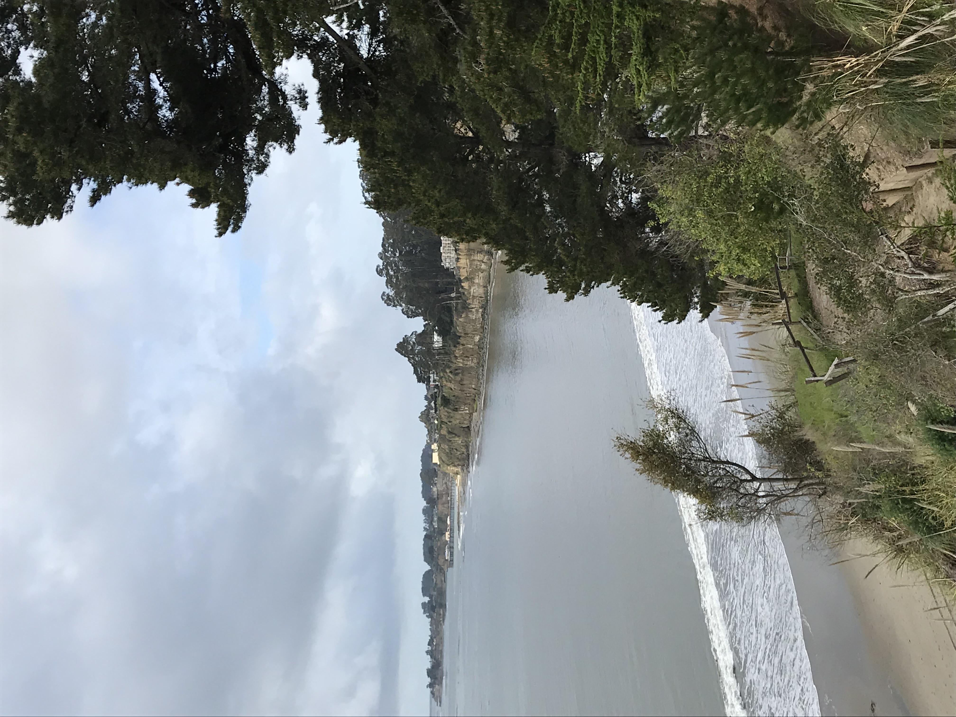
BackgroundThe inspiration for my project is my family’s annual camping trip to New Brighton State Beach in Santa Cruz County, which is something I always look forward to. Like many others who either live in California or visit here, camping in California State Parks is one of the most popular experiences with the demand for camping sites increasing each year. Per the 2016/2017 California State Parks Statistical Report there was a total of 7,265,525 overnight camping uses within all California State Parks, which was a 10.68% increase over the previous year. These statistics reflect the year immediately prior to the launch of the California State Parks own reservation website, ReserveCalifornia™, which went live on August 1st, 2017. At the initial website launch, only 110 parks were available for reservations, but as of 2020 there are now 145 options to choose from (Sze, 2017). Guests can book reservations up to six months in advance to their desired timeframe. After hearing the stories from my family members struggling to call and make reservations over the phone, this new website sounded like a major upgrade. The initial launch of the website was relatively well received, but there were some loopholes which allowed people to take advantage of the system. It was reported that because the system allowed reservations to be made on a rolling six-month period, campers were able to indefinitely extend their existing reservation with each new day. Reservations would never be available because the newly opened spots would be taken by guests extending their reservation instead. This drove some guests to use third party websites that would book reservations automatically for them. Because of this issue, a year after the website was launched a few changes were made to make the highly sought-after reservations more available. Firstly, reservations could only be modified twice while certain locations do not allow any reservation modifications. Secondly, third-party reservation vendors were banned (Trageser, 2018). Because this issue was so rampant, state Assembly Bill 472 was proposed specifically to “make it unlawful for a person to intentionally use or sell software or services to avoid a security control or measure used to ensure an equitable campsite reservation making process" (Boerner and Cooley, 2021). Although the bill passed both the State Assembly and State Senate, it was ultimately vetoed by Governor Newsom who stated that “the Department of Parks and Recreation has already implemented several security measures to ensure an equitable reservation process" (Newsom, 2021).
Because of my family’s annual camping trip, and my love of the Santa Cruz area, I decided to focus my project on the California State Parks and Campgrounds in Santa Cruz County. I wanted to create an easy-to-use Web Map Application and distributable maps that could be referenced by anyone before making their Santa Cruz County State Park campground reservation through the new ReserveCalifornia™ website. 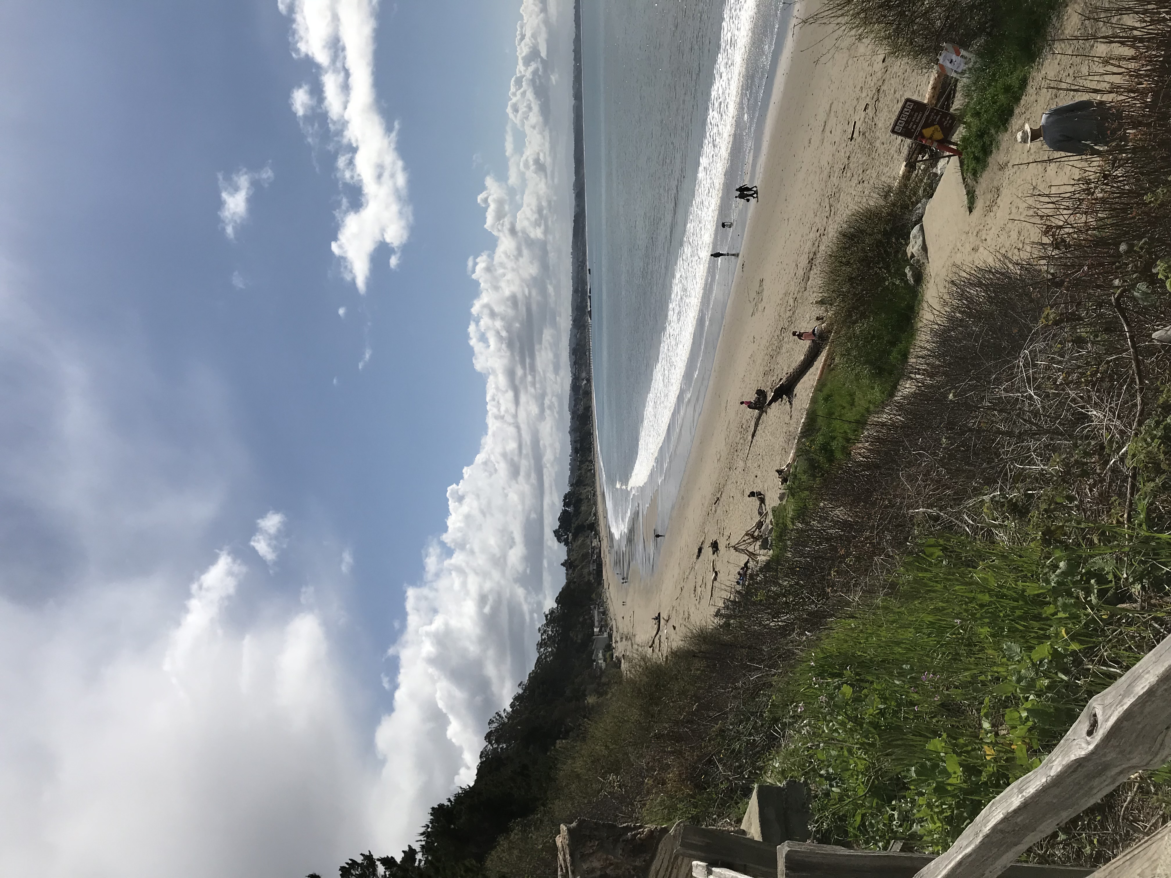
 | |||||||||||||||||||||||||||||||||
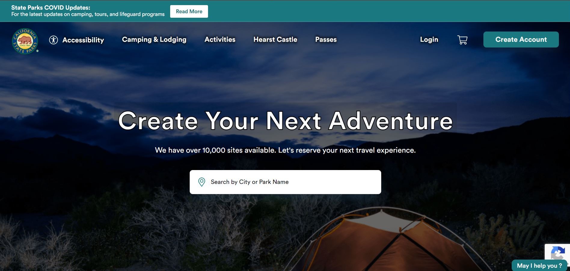
To the right is a screenshot of the ReserveCalifornia™ website. Visitors will have to make an account in order to make camping reservations. Camping reservations generally start at $35.00 a night or more for group camping sites. In addition to making camping reservations for state parks, you can also make reservations other activities such as guided tours and scheduled boat launches. Below is the link to the website. |
| ||||||||||||||||||||||||||||||||
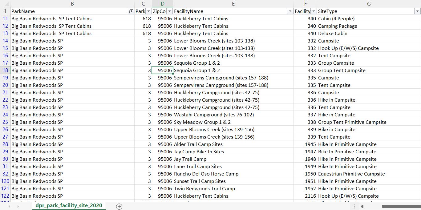
Data SourcesBelow is a list of the data layers collected and their respective websites. I provide detailed analysis procedures in the methods section below. Geodetic Control: Orthoimagery: Elevation: Hydrography: Transportation: Cadastral: Governmental Units: Additional Data: California State Parks Campground feature set from the California State Parks GIS Portal. California State Parks Campgrounds California State Parks buildings feature set, filtered to restroom facilities, from the California State Parks GIS Portal. California State Parks Restrooms California State Parks Picnic Areas feature set from the California State Parks GIS Portal. California State Parks Picnic Areas | |||||||||||||||||||||||||||||||||
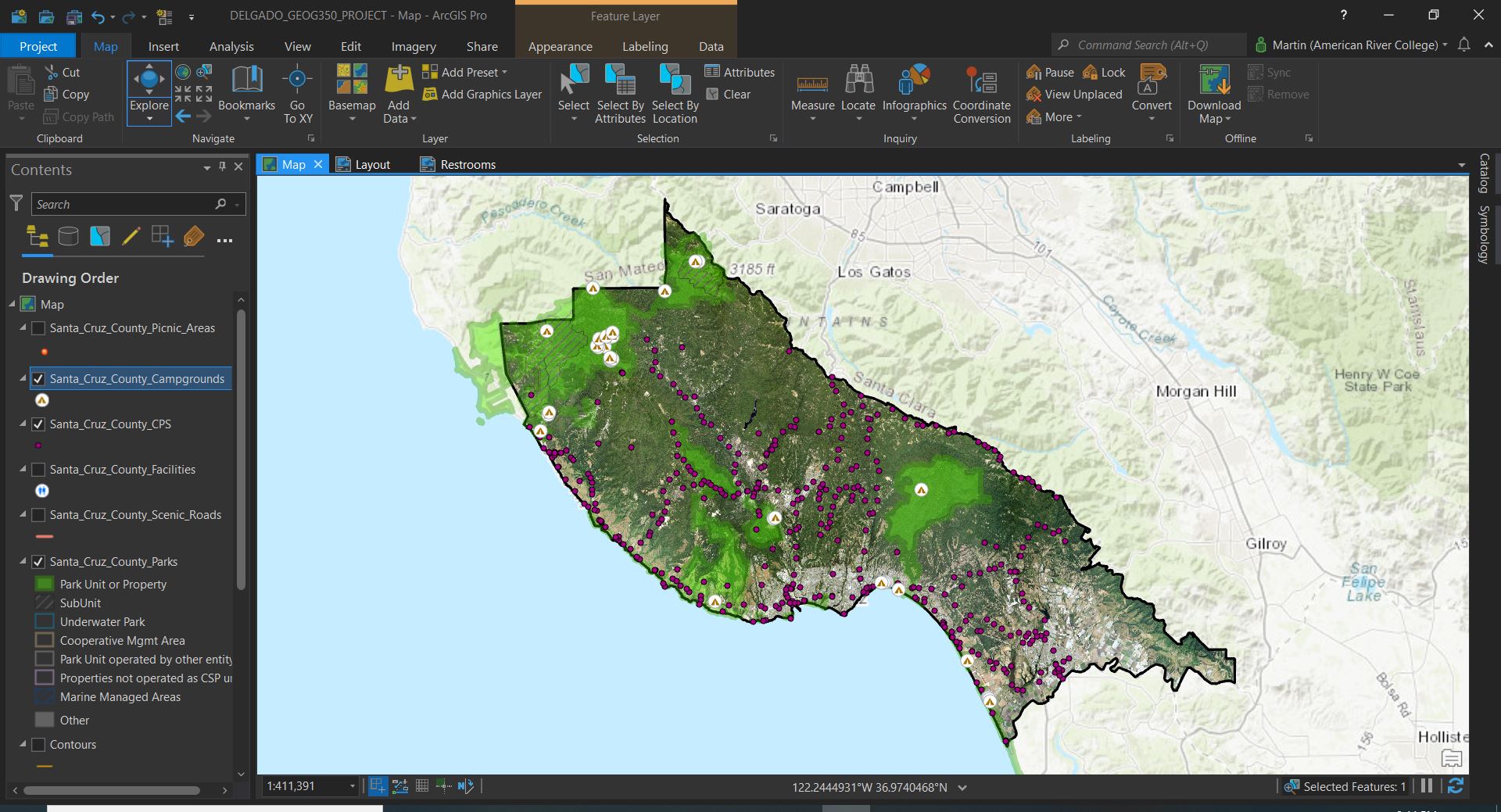
MethodsBelow is a breakdown of the procedures and steps I followed to prepare and perform the analysis of the data. | Once I had designated the study area as Santa Cruz County, I began by clipping the geodetic control points by the Santa Cruz County border polygon, followed by the California State Parks Campgrounds and the orthoimagery raster. I then selected the California State Parks feature set by location to select the parks that intersected the county polygon, which I created a new feature set from and removed all the previous statewide feature datasets. The three other FGDC standards datasets, the Streams, Scenic Roads, and Elevation Contour lines, were then added to the map and did not require any significant changes since they were already within the study area. Labeling and symbology were updated at this level as well to make it easier to view and analyze the map. |
|
|||||||||||||||||||||||||||||||
|
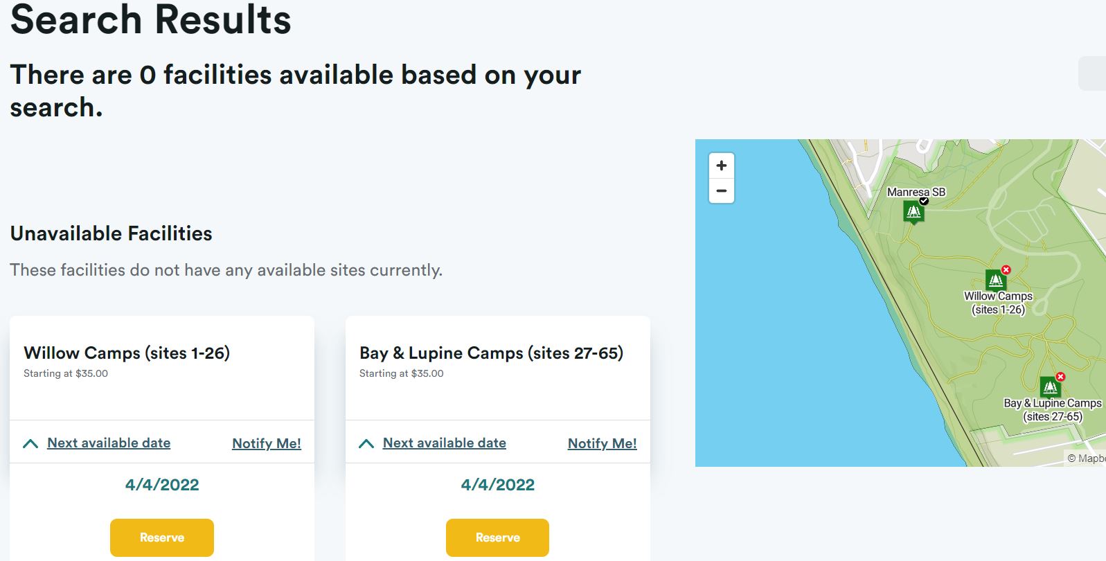
After completing this for all the campgrounds, I wanted to crosscheck with the actual website to see if there were any differences. On the website I did see that a few locations were not actually available for reservations for a couple reasons. The first being the Big Basin Redwoods State Park Campgrounds which were all viewable on the website, but they were all indefinitely closed due to the damage caused by the CZU Lightning Complex Fire in 2020. Manresa State Beach was only temporarily closed for the season, with reservation dates available in April 2022. | ||||||||||||||||||||||||||||||||
|
| |||||||||||||||||||||||||||||||||

|
| ||||||||||||||||||||||||||||||||
|
| |||||||||||||||||||||||||||||||||
|
I then went back and updated the "Reservable" field to "NO" for all of the Big Basin Redwoods State Park and Manresa State Beach campgrounds. I then symbolized the campgrounds by unique values and assigned a green tent symbol for those campgrounds that are open and a red tent symbol for those that are closed. This made it easier to differentiate on the map which campground options were currently available for reservations. I also wanted to perform spatial analysis with the two additional datasets collected from the California State Parks Open GIS Portal. I brought both into the project and clipped them both by the Santa Cruz County Boundary polygon. I used the "Select by Location" tool for each dataset to get the counts of picnic areas and restrooms per state park type. I then created a relate between Picnic Areas and Campgrounds by the "UNITNAME" field since the "UNITNBR" field for the picnic areas did not all match up to their respective parks or campgrounds. The relate between the Restrooms and Campgrounds used the "UNITNBR" field since they did match correctly. | ||||||||||||||||||||||||||||||||
|
| |||||||||||||||||||||||||||||||||

|
| ||||||||||||||||||||||||||||||||
ResultsThe table below lists the counts for each item for each California State Parks Type. SP for State Park, SB for State Beach, and Other for park sub-units such as nature preserves. Most of the State Parks and State Beaches had multiple campground options, thus creating additional park counts, because of the different kinds of campsites or areas within each park. Reservation methods on the ReserveCalifornia™ website also reflected this. An example is that New Brighton State Beach Campground has separate Group Camping, Northern End, and Southern End campground areas available for reservation on the website. The campsite options counts were calculated from the 2016/2017 State Parks Statistical Report. Because there are cabins available for reservations through the website, I have also included them in the total campsite count. | |||||||||||||||||||||||||||||||||
| |||||||||||||||||||||||||||||||||
AnalysisAs I began this project, I did not anticipate there being any limitations on the reservable campground options for this study area. It is very interesting to see how much of an impact the CZU Lightning Complex Fire had on the available reservable campground options and possible revenue loss for the California State Parks. The closure of the Big Basin Redwoods State Park alone accounted for twenty campgrounds and a combined 234 reservable campsite options not being available. This is a staggering 61.26% closure rate for all the California State Parks campsite options in the study area. Per the 2016/2017 California State Parks Statistical Report, the Big Basin Redwoods State Park had a combined Paid Day Use and Camping Use of 308,288 visits and combined revenue of $1,061,256. This was only second to New Brighton State Beach, which has three campground options and a combined Paid Day Use and Camping Use of 220,298 visits and combined visit revenue of $1,115,491. The current seasonal closure of Manresa State Beach Campground only removed 64 campsite options, or 18.99%, from the 337 available campsite options for all State Beaches in the study area (Statistical Report, 2017). | |||||||||||||||||||||||||||||||||
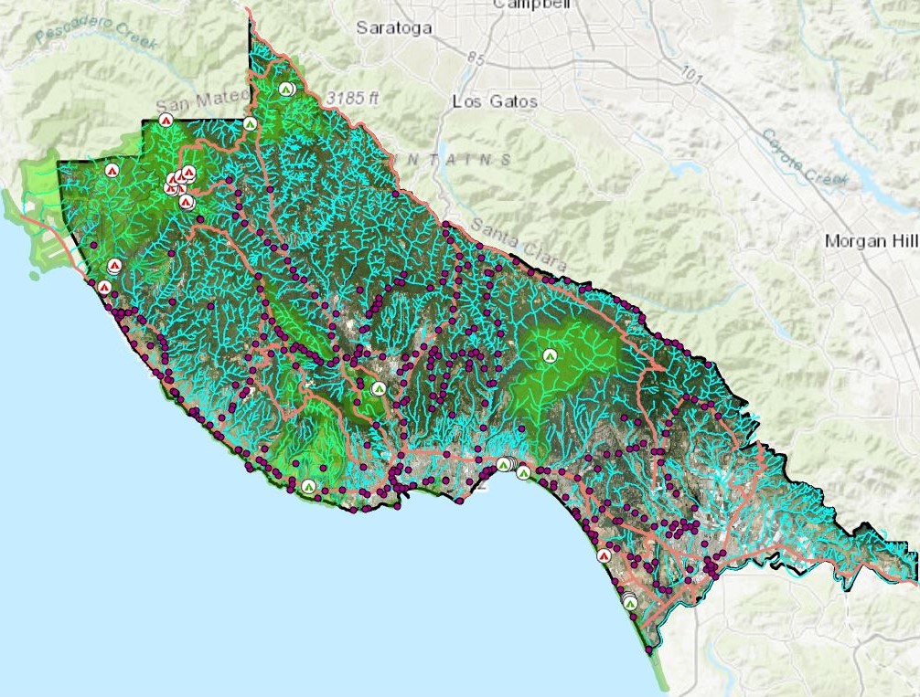
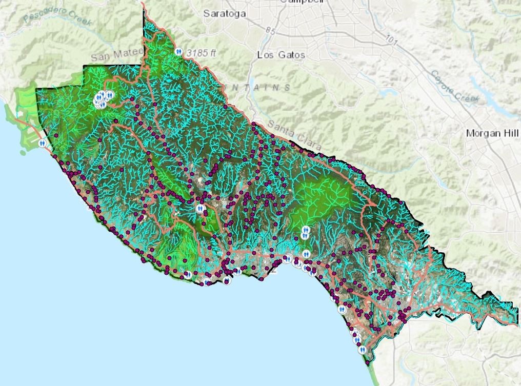
Final MapsOnce all the analysis was completed, I imported the entire project into ArcGIS Online and created the Web Map for users to view. After the Legend and Basemap Selector widgets, I added a layer List Selector widget so users can remove layers that don't apply to them from the map view. This is followed by a Reservable Campground Filter widget which filters out currently unavailable campgrounds. And the last Group Filter widget allows users to view both Picnic Areas and Restroom facilites available at the selected campground. Here is the link to the Web Map Application that has been shared with the GEOG 350 Group. Santa Cruz County State Parks Reservable Campgrounds Screenshot of the Web Map Application 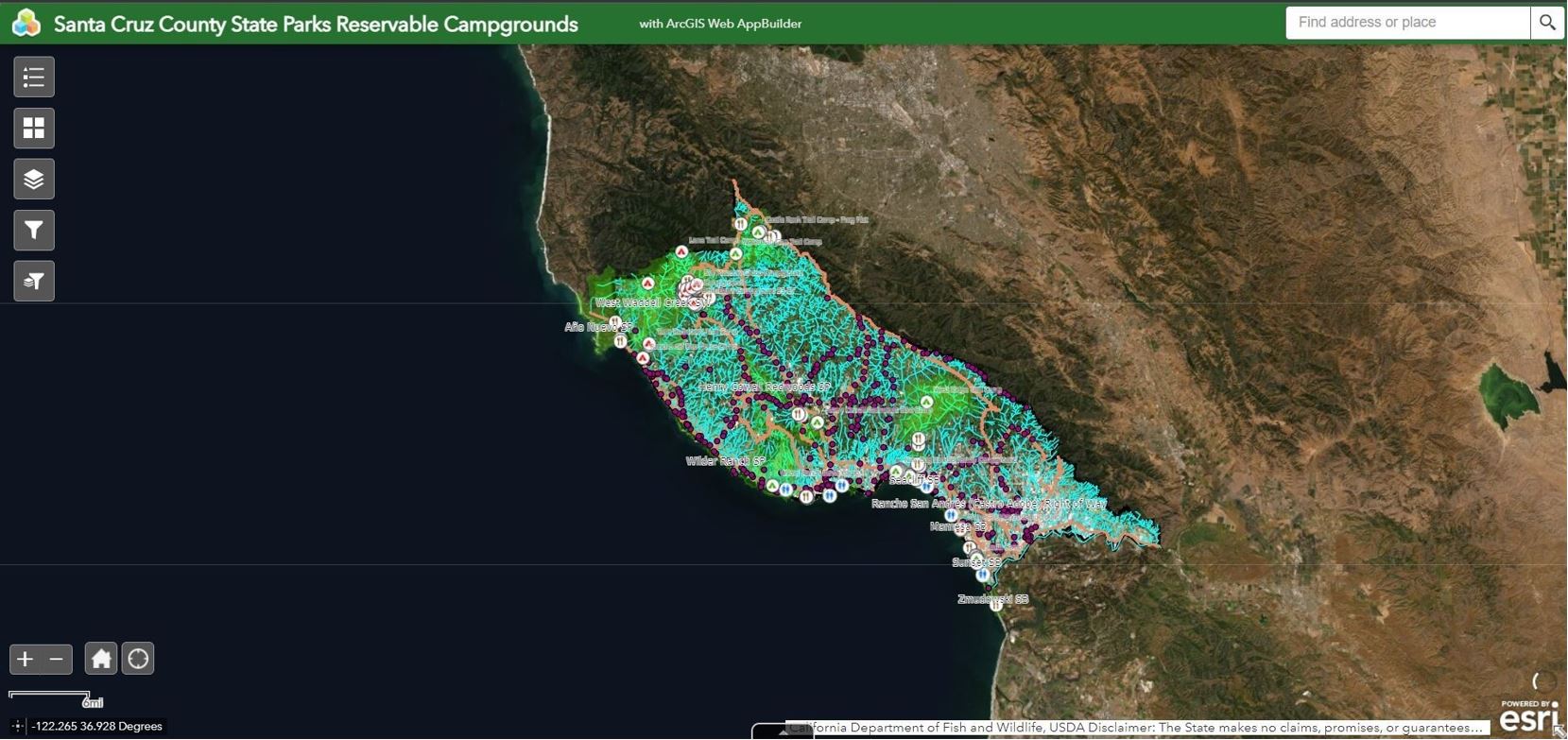 Screenshot of the Web Map Application Layer List Selector widget. 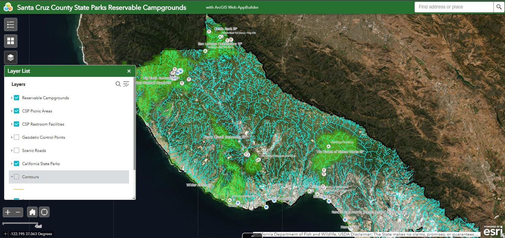 Screenshot of the Web Map Application Reservable Campground Filter widget. 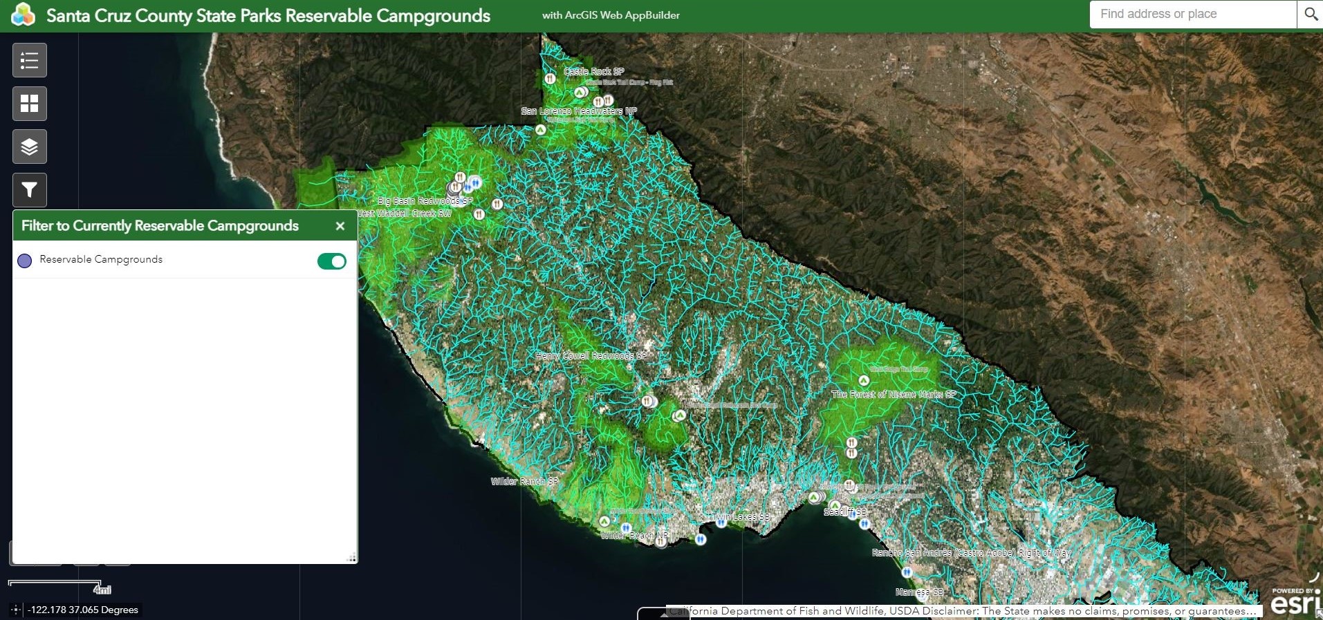 Screenshot of the Web Map Application Amenity by Location Filter widget. 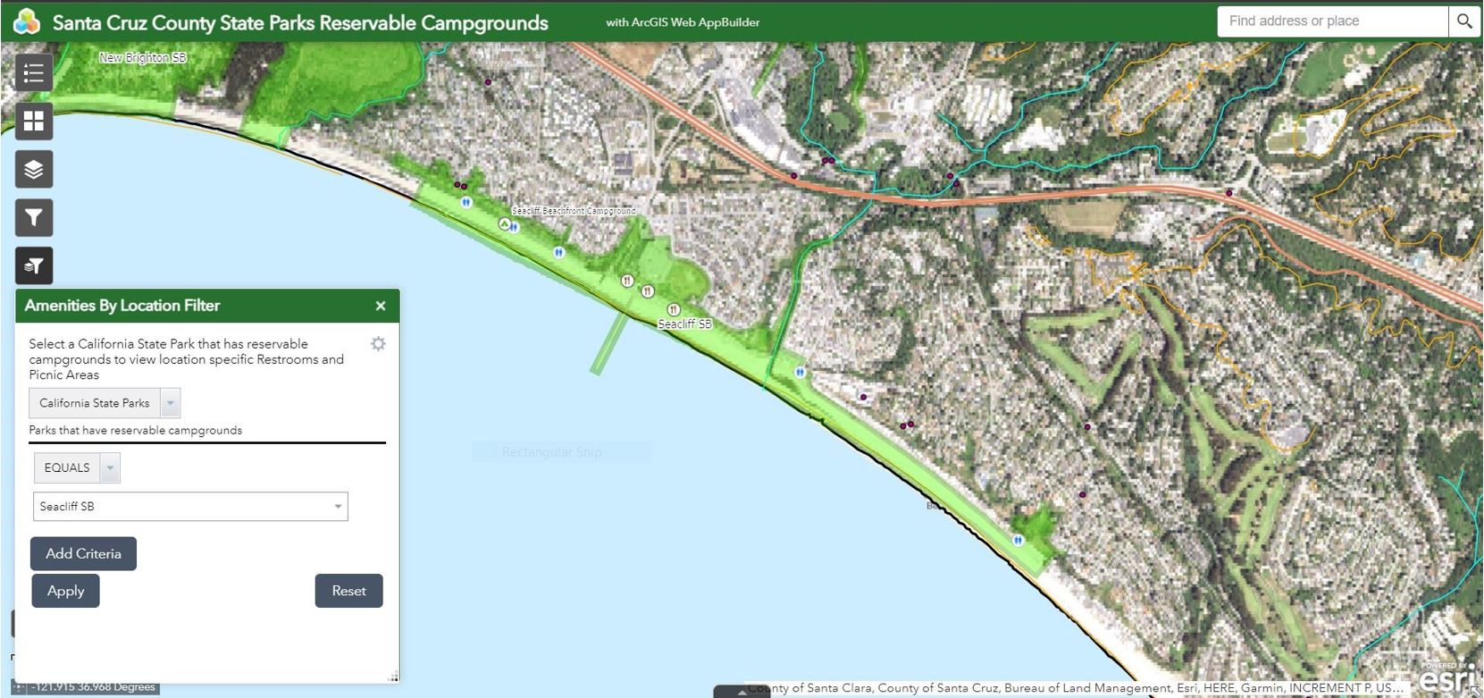 Below are the final reference maps I created that can be shared physically or electronically.  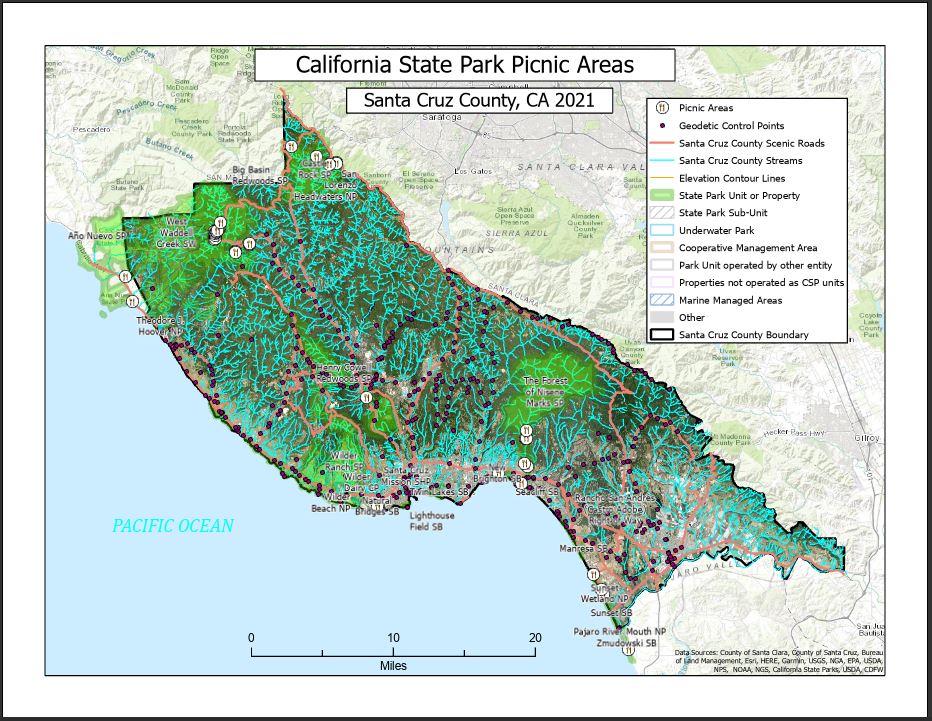 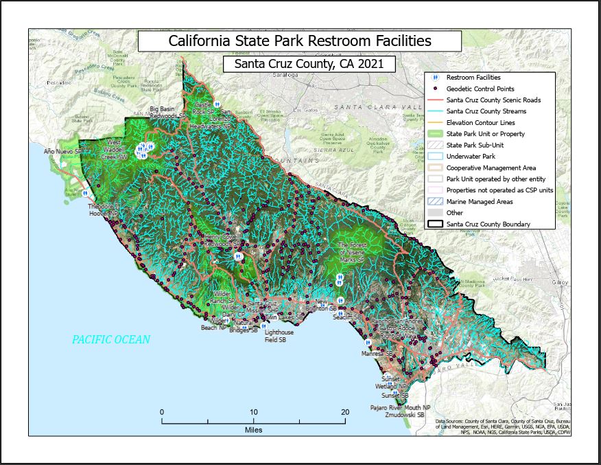 | |||||||||||||||||||||||||||||||||
ConclusionsI believe that the implementation of the ReserveCalifornia™ website created a large increase in California State Parks revenues and park visitation numbers. I contacted California State Parks to see if a more current Statistical Report was available to compare statistics from before and after the launch of the website, but unfortunately, they were unable to provide any current information. Further examination of these statistics would be very interesting to review and compare. The Big Basin Redwoods State Park closures undoubtedly created a higher demand for the other reservations available in the remaining study area campgrounds and a loss of revenue that would have to somehow be accumulated from another source. But for those who wish to make a reservation for a California State Park Campground in Santa Cruz County, I believe this web map application and distributable maps would be great reference tools. It is easy to understand and visualize the location of campgrounds and nearby California State Parks they would want to visit, and the ammenities available. I would also want to continue to update the maps to reflect any changes to which campgrounds and ammenities are available for reservations. I would advise those planning a visit to any of the study area campgrounds to review these maps before making reservations. I would also encourage those people to take full advantage of the six-month rolling reservation period and to have a secondary option picked out in case their first reservation option is not available.  | |||||||||||||||||||||||||||||||||
References1. Sze, Kristen. “New Website Makes It Easier to Reserve California Campsites.” ABC7 San Francisco, KGO-TV, 2 Aug. 2017, https://abc7news.com/travel/new-website-makes-it-easier-to-reserve-ca-campsites/2267336/. Accessed 2021.09.26. 2. Trageser, Claire. “California Is Updating Its Camping Reservation System after Tons of Complaints.” Travel + Leisure, 21 Aug. 2018, https://www.travelandleisure.com/travel-news/california-changes-camping-reservation-system. Accessed 2021.11.8. 3. Boerner Horvath, Tasha, and Ken Cooley. “AB-472 Campsite Reservations: Securing an Equitable Process.” Bill Text - AB-472 Campsite Reservations: Securing an Equitable Process., 8 Sept. 2021, https://leginfo.legislature.ca.gov/faces/billTextClient.xhtml?bill_id=202120220AB472. Accessed 2021.11.8. 4. Newsom, Gavin. “AB-472 Campsite Reservations: Securing an Equitable Process - Bill Status.” Governor’s Veto Message, 7 Oct. 2021, https://leginfo.legislature.ca.gov/faces/billStatusClient.xhtml?bill_id=202120220AB472. Accessed 2021.11.8. 5. Planning, Recreation and Support Section Marketing and Business Development Office California State Parks. “Statistical Report 2016/17 Fiscal Year,” https://www.parks.ca.gov/pages/795/files/16-17%20Statistical%20Report%20FINAL%20for%20web.pdf. Accessed 2021.11.8. 6. California State Parks. "ReserveCalifornia™," https://reservecalifornia.com/Web//. Accessed 2021.09.26. 7. Veisze, Paul."G350_StudentName_Project_Required.htm" Project HTML Template used and edited for final project file. Accessed 2021.10.20. 8. W3Schools HTML and CSS reference website for additional Project HTML file editing, https://www.w3schools.com/. Accessed 2021.12.6. | |||||||||||||||||||||||||||||||||