| Title Mokelumne Hill Historical Walking Tour | |
|
Author Kenneth J Ringlein American River College, Geography 26: Data Acquisition in GIS; Fall 2021 Contact Information: ken.ringlein@gmail.com | |
|
Abstract The purpose of this project is to create a record of the historically significant locations and structures located throughout the community and surrounding area and provide access to that information for the public. Using local resources including the local historical society, library, Calaveras County GIS Department and local academics, I created a document that will paint a picture of what the area looked like. Why the community developed the way that it did and where the public can still find “ghosts” of the past | |
|
Introduction Mokelumne Hill was one of the wealthiest gold mining towns in California. During the 1850's, this small historical mining community located in the Sierra Foothills had reached a population as high as 15,000. By 1850s, Mokelumne Hill had gained the reputation of being one of the roughest towns in the area. Joaquin Murrieta, the famed outlaw, reportedly spent much time in the gambling establishments in town. In 1851, there was a murder a week for 17 straight weeks. By the 1860's much of the "easy" placer gold had been "mined out". And the population and importance of Mokelumne Hill began to decline. Today Mokelumne Hill is a quiet tourist town. | |
|
Background Many books and resources can be found that tell the history of Mokelumne Hill. I found one source particularly valuable in creating this project. The individuals who make up the The Mokelumne Hill Historical Trust possesses a wealth of knowledge and historical documentation. Through the trust I was able to source many of the images and narratives used to describe Mokelumne Hill’s historical locations. This project would not have been possible without the support and knowledge of archaelologist Julia Costello, Ph.D. Dr. Costello provided me with many of the location narratives. The book Northern Calalveras County (Marvin, Costello and Manna, 2007) was an inspiration and source for much of the data found in this project. | |
| Only three versions of the 1855 Goddard Map of Northern Calaveras County still exist. Two are in collections at UC Berkeley and UC Davis. The third is in a private collection.
The copy used for this project is a photograph of the original that can be found on the Calaveras Historical Society website.
The 1872 Mokelumne Hill Townsite Maps used in this project were acquired from the Calaveras Historical Society as well. Many of the layers found within this project
were obtained from the Calaveras County GIS Department |
|
|
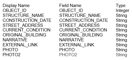
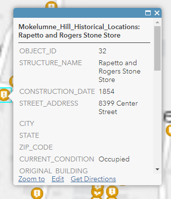
Methods After determining the focus of my project, I began with converting the 1855 Goddard Map PDF into a JPEG format that could be imported and georeferenced within ARC Pro. Using ARC Pro, and with quite a bit of difficulty and trial and error, I georeferenced the image. I then performed the same operation on the 4 individual sheets of the 1872 Townsite maps. When creating the layer file in ARC Pro, The next step in the process was to collect information about the historical sites located within Mokelumne Hill. I contacted Julia Costello, Ph.D., who is one of the heads of the Mokelumne Hill Historical Trust and the Calaveras County Historical Society. I requested a digital copy of the paper “Walking Tour of Mokelumne Hill” that the Historical Trust had produced for tourist coming into the community. Dr Costello provided me with a Word document that listed 45 different historical locations throughout town and provided a short narrative of each of the locations. That list became the basis of an excel spreadsheet that I created and imported into AGOL. I conferred with Dr. Costello to determine what data should be included in the Table. And it was determined that I should include the following fields: |
|
| After importing and formatting the appearance of the initial 45 locations, I began adding additional
historical locations that were not on the original list and document. I worked with Dr. Costello for additional narratives and
Imagery for the locations. The images of the locations were uploaded into AGOL and links added to the Data Table.
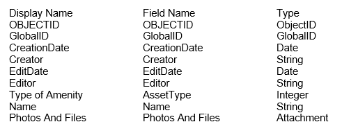
Locations and narratives are continuing to be added. Once I had completed the Initial upload and processing of the historical locations, I turned to the Amenities Layer. I wanted to provide tourist with information regarding the modern amenities found throughout Mokelumne Hill, including restrooms, parks, athletic fields, shopping, and restaurants. Using the Survey123 created during exercise 7 as the basis for the project, I went to the locations of many of the amenity’s locations and collected data on their locations, types and collected photos of the amenities. |
|
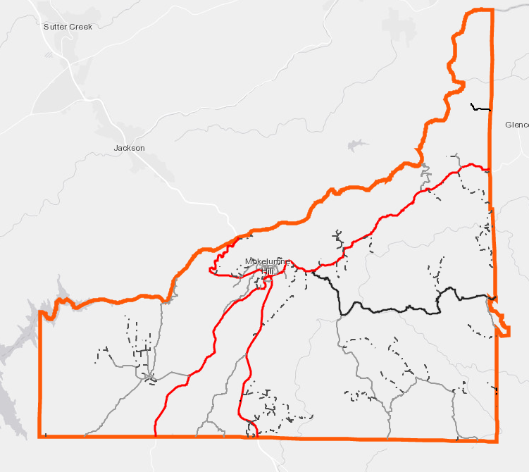
| After the data had been collected, I added and formatted the layer in the project. Following the creation of the original data, and to fulfill the requirements of the project, I choose feature layers that would help build a more complete picture of Mokelumne Hill and the area surrounding it. I chose to include the following features: Mines Rivers and Streams Lakes Roads 40 ft Contours I acquired the data from the Calaveras County GIS Department. However, the datasets available were either the entire county or the entire state. And I wanted to limit the scope of the layers to just Mokelumne Hill and the surrounding area. Therefore, I determined to limit the scope by using the boundaries of the Mokelumne Hill Veteran’s Memorial District (MHVMD), a special district that manages parks and facilities through out Mokelumne Hill and the surrounding area. I acquired the boundary of the MHVMD by contacting the GIS department directly. Once I had the boundary, I clipped all features to the geometry of the MHVMD boundary and formatted and uploaded them to AGOL. |
|
|
Results Overall, the project was successfully, as I have conferred with several of community members
and members of the local historical society. Most of the individuals I have polled, have found the information useful and
relatively easy to view. However, in this case I believe that too much data is actually distracting from the overall theme of the project. | |
|
Figures and Maps The following displays the layers created for the project. | |
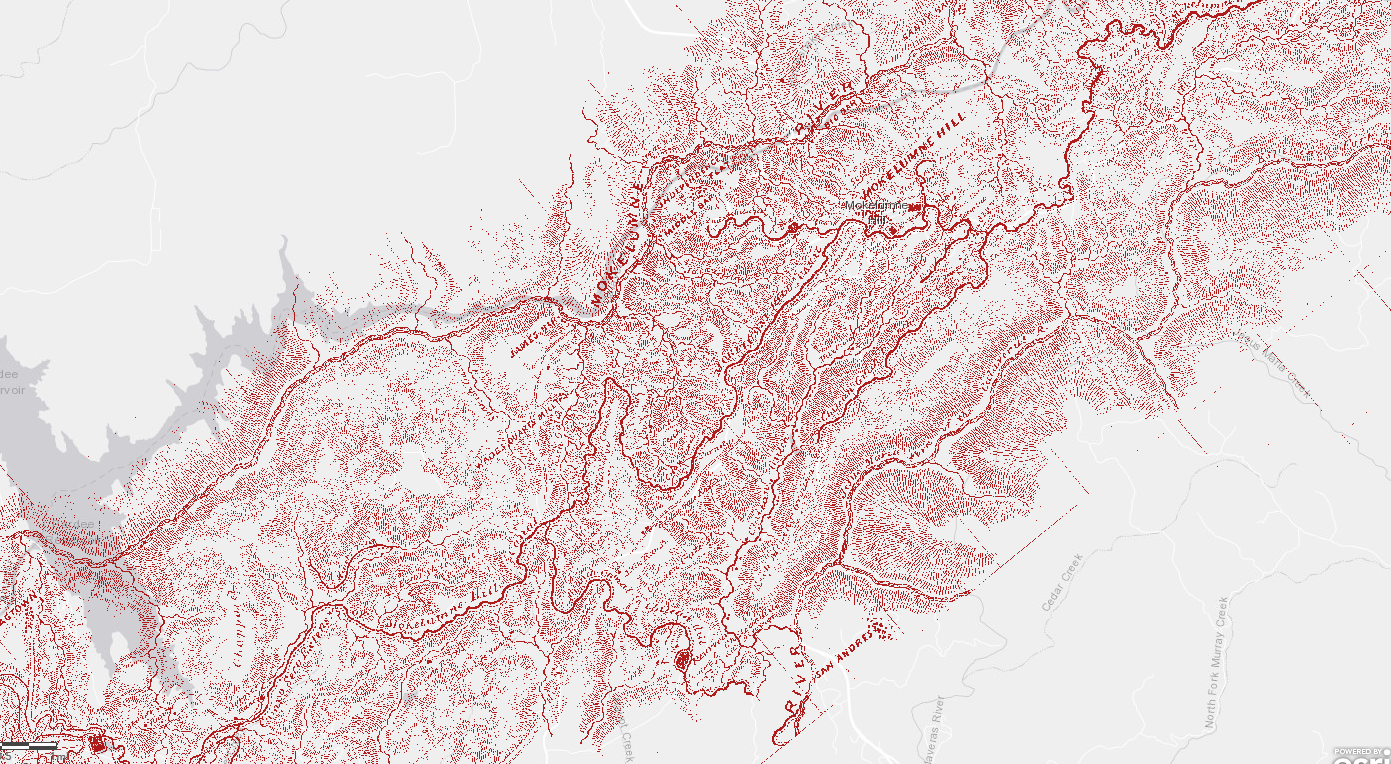
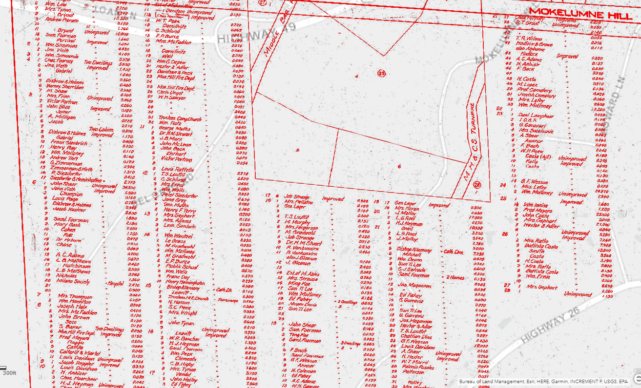
| This Tile Layer is a digitized and Georeferenced copy of the 1855 Goddard Map of Northern Calaveras County Ca.
As can be seen when the overlaid onto modern imagery and maps, the original map was limited in accuracy by the technology of the day.
As one of the earliest maps printed in California this map displays the workings of Northern Calaveras County's gold country including its mines, mining camps, ranches, stores, mills, roads and reservoirs. Interestingly the map also shows "Rich Mining Ground". The purpose of the original map was to display the 106.5 miles of flums and branches that made up the Mokelumne Seco canal. |
|
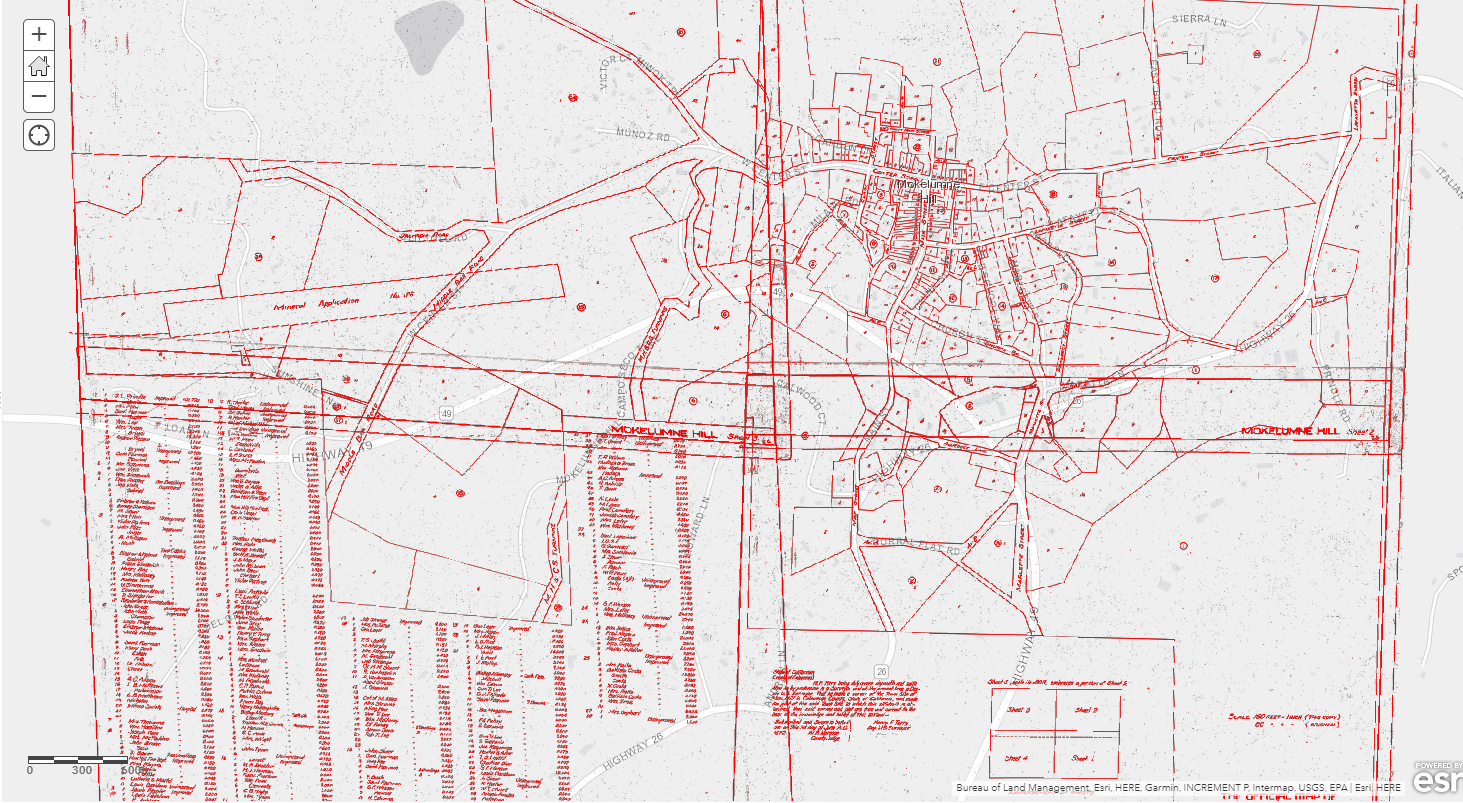
| This Tile Layer is a digitized and georeferenced version of the 1872 Mokelumne Hill CA Townsite Map (4 sheet series)
produced by Henry F. Terry, C.E. the first actual survey of the town. |
|
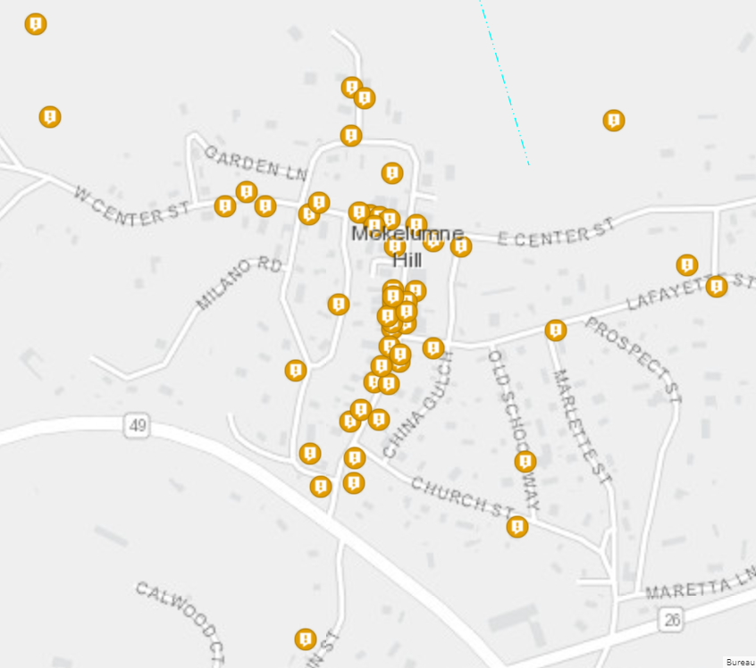
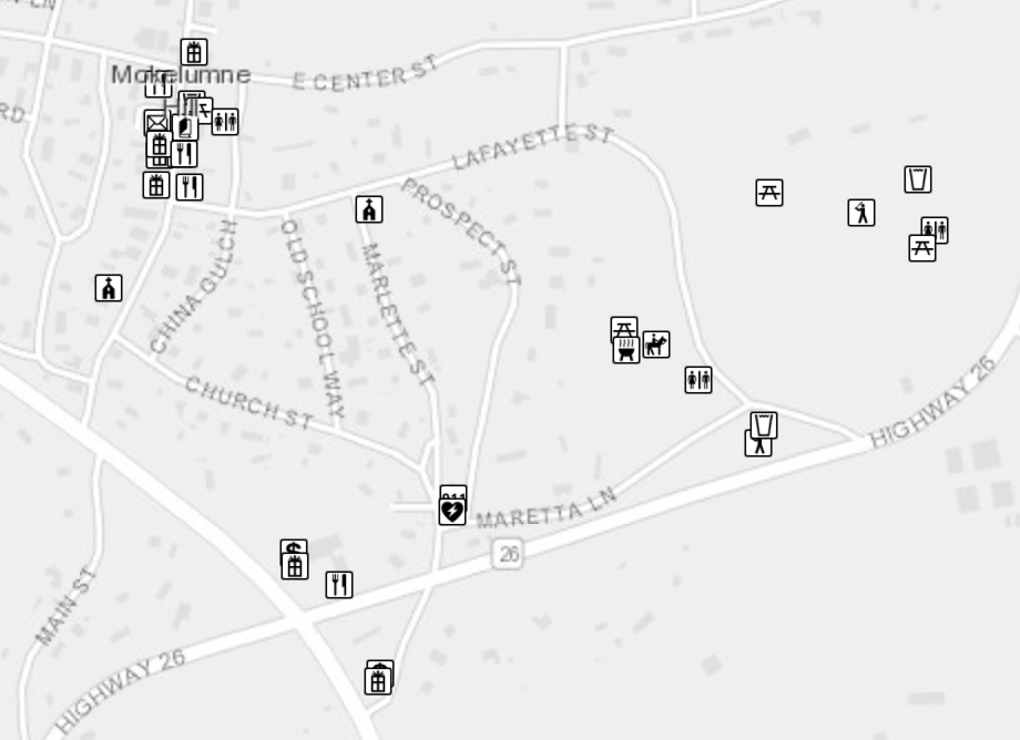
| The Mokelumne Hill Historicial Locations data set was developed to provide visitors to the community of Mokelumne Hill, CA with information regarding the historical
structures and location within Mokelumne Hill and the surrounding area. Data was collected from a variety of local resources including local archeologist and historian
Julia Costello. This data builds on a document produced by the Mokelumne Hill Community Trust. Images were collected from a variety of sources including but not limited
to the Library of Congress. Outside links are provided for additional resources. Addresses and physical locations were verified through aerial imagery and physical survey. |
|
| The Mokelumne Hill Amenities dataset is a collection of amenities including restaurants, shopping, public restrooms, parks and
sports facilities located within Mokelumne Hill, CA. Links to additional information is included within the data. |
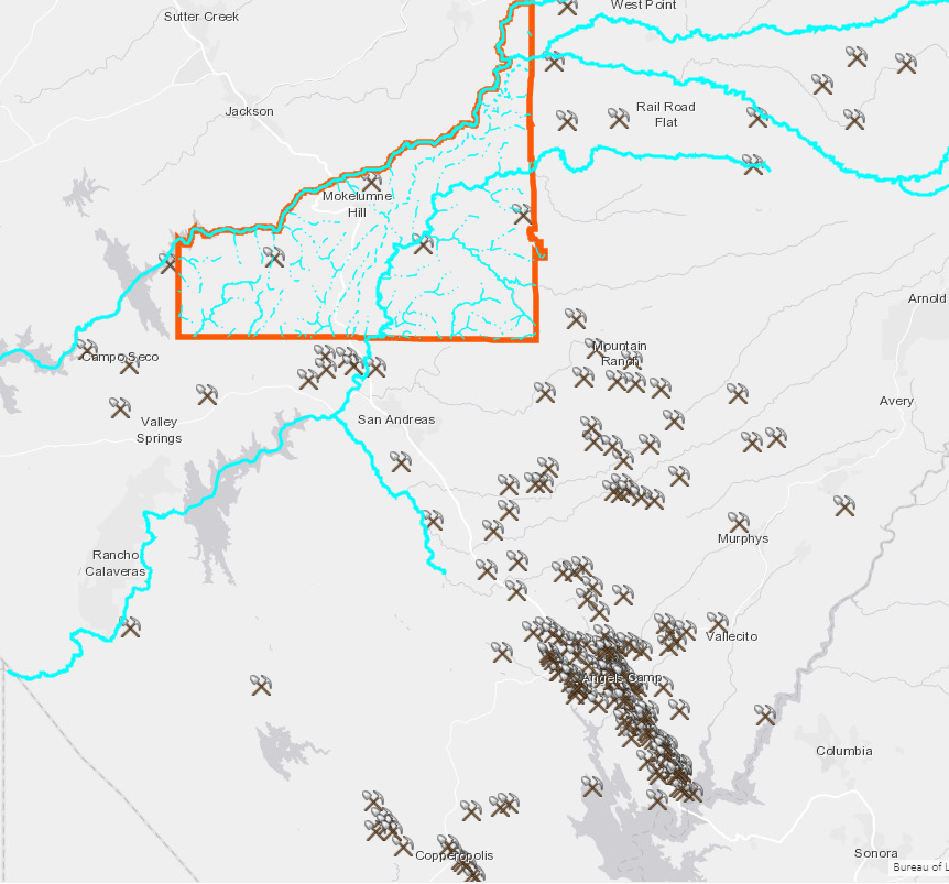
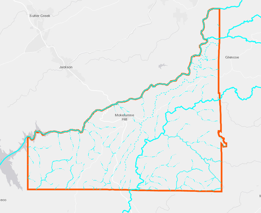
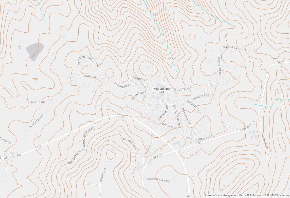
| As a way to provide additional historical context to the project, I provided the hydrology, mining,
roads, topographical and MHVMD layers. Acquired from the Calaveras County GIS Department. |
    |
|
Analysis I had to determine the most effective way to display the information located on the historical maps,
while allowing the viewer to see the modern base layers located below. I determined that the most effective solution to the problem was to
use a color ramp with the highest values colored red and the lowest values transparent. As raster files cannot be imported into AGOL, I created
Tile Layers for each of the historical map layers. These Tile Layers were then imported into AGOL. Additionally, while georeferencing the historical maps, I discovered the limits of the software and its ability to "stretch" an image. Once I loaded the mines layer into AGOL, I realized that the layer contained very few actual mines within the boundaries of the MHVMD. To provide the public with more information, I determined that I would not clip the layer and leave the layer intact. Additionally, I noted that upon clipping the rivers layer, a significant portion of the rivers of Northern Calaveras County were broken. Therefore, I chose to create a Major Rivers Layer of Northern Calaveras County, including only the major rivers located within the MHVMD boundaries. | |
|
Conclusions If I were to provide this project as a resource for the community, I would remove, the contextual layers, as the basemaps provided on AGOL
already display the majority of this data.
Additionally, contact information for businesses listed in the "Amenities Layer" should be included.Further collection of historical data and locations should continue in order to provide a more complete picture of the historical locations. | |
|
References Calaveras County GIS Department, www.gisdept.calaverasgov.us CalaverasHistory.org, Calaveras Heritage Council, 2021, www.calaverashistory.org Historic American Buildings Survey, Creator. Stone Ruins, Mokelumne Hill, Calaveras County, CA. Documentation Compiled After. Photograph. Retrieved from the Library of Congress, www.loc.gov/item/ca0096/ Historic American Buildings Survey, Creator. Frame Church, Mokelumne Hill, Calaveras County, CA. Documentation Compiled After. Photograph. Retrieved from the Library of Congress, www.loc.gov/item/ca0092/ Historic Mokelumne Hill Walking Tour, Mokelumne Hill Historical Society, Waldon and Lorraine, Mokelumne Hill Community Historical Trust, 2019 Irvine, Edith Irvine Collection, L. Tom Perry Special Collections, Harold B. Lee Library, Brigham Young University, Provo, UT, 84602 Marvin, Costello and Manna, Northern Calalveras County, Illustrated edition, Arcadia Publishing, August 27, 2007 Mokelumne Hill, CA, Mokelumne Hill Historical Community Trust, www.mokehill.org | |