Natomas Rural Development – A 10-year Comparison
Mohammad Shafi Saboory
GEOG 350 Data Acquisition
American River Collage
12/12/2021 (Fall 2021)
Abstract
Rural development of the Natomas area emphasizes home-building, city modernization, and population growth. Within these topics this paper will focus on roads, population density, and business improvement.
Introduction
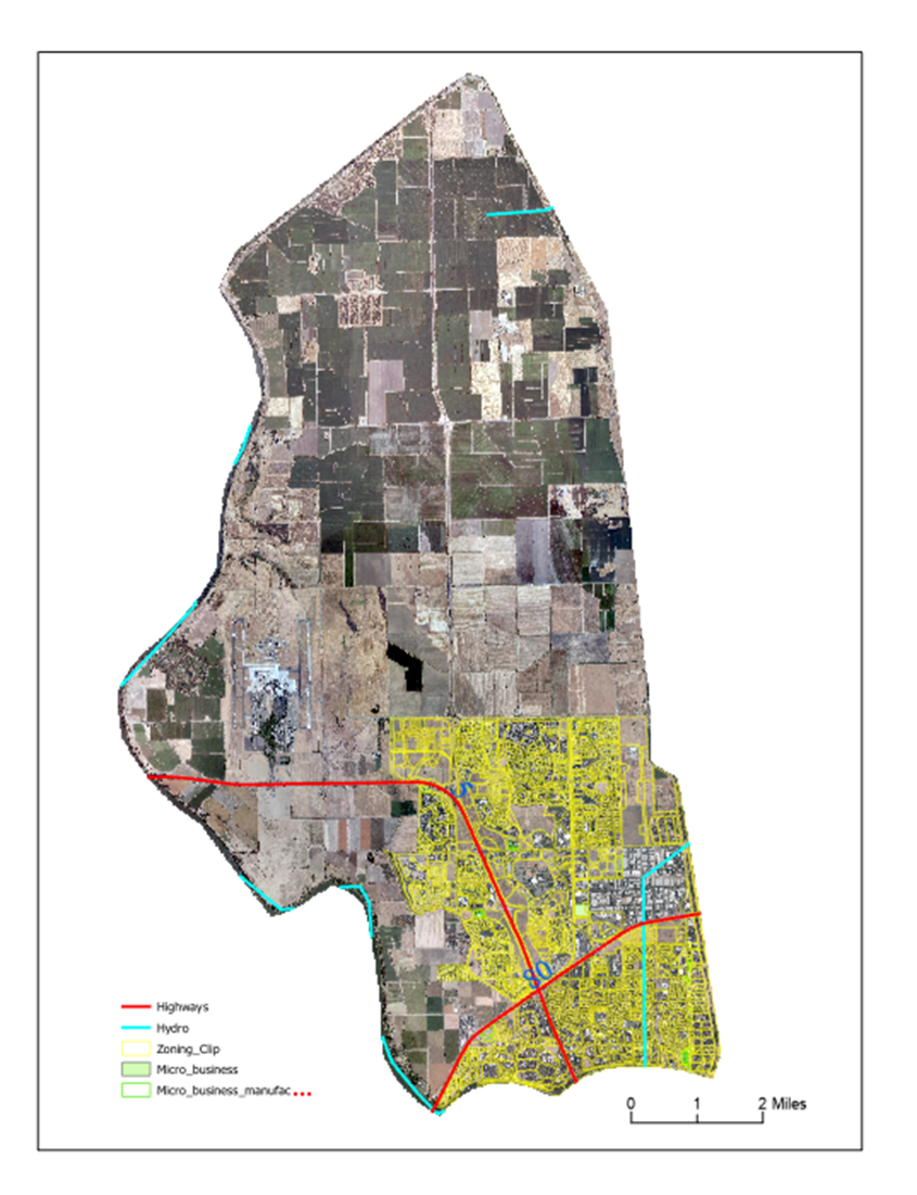
Natomas is generally defined as north of the Sacramento County line, north of the Garden Highway and the American River, west of the Natomas East Main Drain, and east of the Sacramento River.
Natomas is a community in northwestern Sacramento, California. North Natomas was historically an agricultural area on the floodplains of the Sacramento River, but population grew quickly starting in the mid-1990s with extensive residential and office park development and retail construction. South Natomas developed predominantly as residential subdivisions from 1950 to 1980, but in 1982, the area amended its community plan to permit 2.4 million square feet of new office parks along I-5. As a major center of employment, retail, and entertainment facilities, Natomas is recognized as one of greater Sacramento's most important edge cities.
This Project will compare Natomas development over a 10-year period (2010 to 2020), using two different high-resolution images, as well as other layers such as hydrology, roads, census tracts, zoning, and industrial and retail buildings. This comparison evaluates population growth and city modernization which have direct impact and effect on regional climate, traffic and water resources.
The specific features I interpreted were newly built houses, roads extension, landscaping, and land cover.
Visual comparison of images from the two years easily reveals large changes, but to collect accurate and precise results, focus on every entity in the area interest is required. So given the varying resolution of layers, I tried to find the least common resolution which was about 5 meters.
Acquiring consistent images with required bands and with a high-resolution was difficult. Processing large images (2+ GB per image) took hours for each process. Future projects must incorporate acquisition and post-processing the total time cost of data.
Background
As I started researching and reading regrading my area of interest, I found a lot of development and improvement had occurred in this area since 2010. This area has been growing quickly due to its central location and pleasant climate.
In additional of many big developments there are also some remarkable, small projects. The West Lake Project, which consists of more than 1000 single-family homes which have been constructed over the last 10 years.
The North Lake Project is probably the largest project in north Natomas.
This massive master-development was previously known as the Greenbriar site, managed by Integral Communities. But both the project name and the developers have changed names. The area is north of the city center, by the Sacramento International Airport. Construction will include 2,752 single-family homes with an estimated completion date to be announced. This project is an independent ‘city’ by itself--with schools, parks, malls, reginal transit routes, artificial lakes, pools, community rooms, and many small business facilities.
Another remarkable Project for which the plan has already been approved by the City of Sacramento, will be built on a vacant 30-acre lot at Rio Linda Boulevard and Main Avenue, just north of Futures High School. The plan is to construct 147 single-family detached homes that would be on sale in 2023.
The Sacramento City Board of Directors after long negotiations and discussion decided to either extend or relocate the Sacramento Zoo to north of Sacramento. This expansion will be located either in old Arena or Natomas regional park. This expansion has a direct economic and environmental impact on the area.
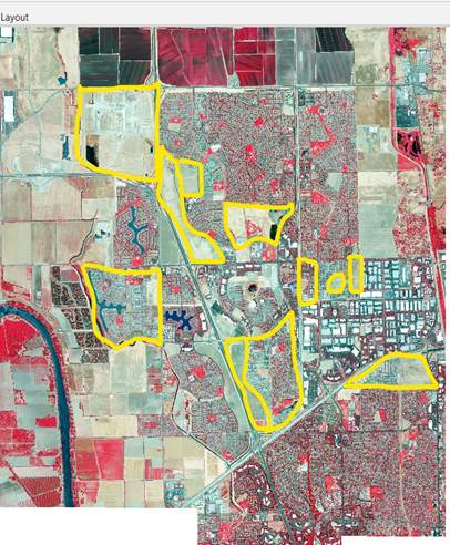
There are some projects that are closed due to some reasons location map is attached.
Estimate of Acres Covered by HCP Trough December 12/31/2019
|
Geographic Area |
Grading Permits Issued from HCP Inception to 12/31/2019 |
Undeveloped / Likely future Grading |
Undeveloped / Not Likely to Develop |
Catch up Fees Required |
|
North Natomas |
6039.15 |
615.52 |
153 |
69 |
|
South Natomas |
624.45 |
155 |
0 |
0 |
Comparison
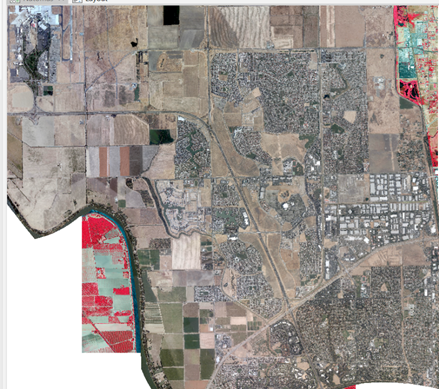
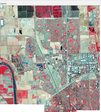
The number of actual developments, if tracked one by one, would exceed the scope of this paper. Only the major developed area will be mentioned. Visual detail in high resolution attached images reveals the complexity.
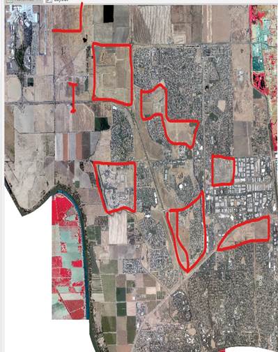
2010 undeveloped 2020 Developed area
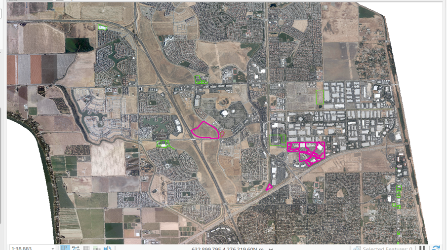
2010 Retail dispensers and micro business centers
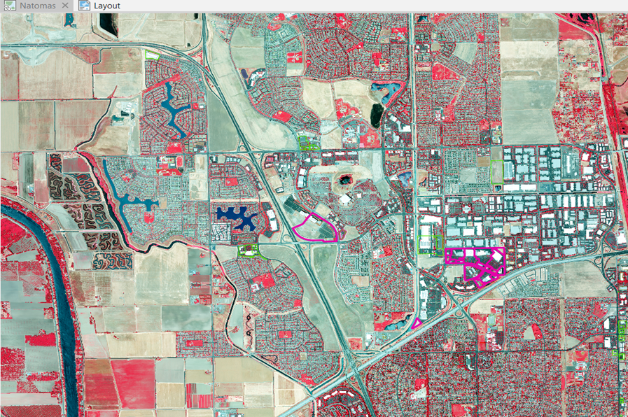
2020 Retail outlets and micro business centers or mini malls
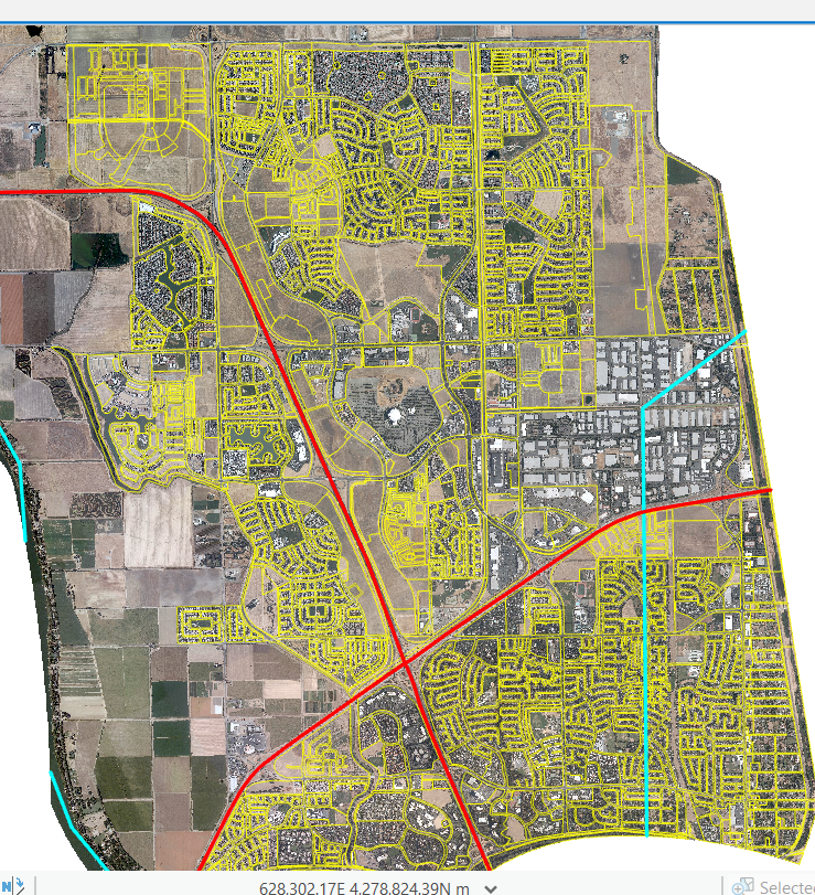
Yellow delineation is from 2020 zoning. This clarifies what land that was vacant in 2010 is now developed.
Conclusion
Like every other phenomenon, development has both positive and negative impacts on climate change, environment, society, and economics.
Destroying nature in the name of development is harmful for the environment and worsens climate change.
Construction has direct effects on insolation and reflection, evaporation, with related issues in water resources and land use, wildlife habitat, and ecosystem services.
Population growth and high demand for housing makes humans seek quality of live, not just survival.
Balance is a challenge while living and setting priorities within the environment, but we cannot ignore the environment when stiving to live better.
Quality, accuracy, and quantity rarely come together in a single Project.
Quantity represents speed of work and quality represents integrity and best practices of development as it should be. Fast-paced work is advanced to save money, but investors usually don’t care about quality and environment, so nature is the victim.
Comments
While thousands of houses have been built and populations have grown. Traffic issues have increased. This will impact all residents. This Project also noted that besides urban and residential development, some public facilities need to be developed such as roads, highways, ramps, exits, cemeteries, marketplaces, banks, clinics, and regional transit routes.
References
1- https://sacramento.granicus.com
2- https://www.cityofsacramento.org
3- https://en.wikipedia.org/wiki/Natomas,_Sacramento,_California
4- https://map.dfg.ca.gov/arcgis/services/Base_Remote_Sensing/NAIP_2020_CIR/ImageServer