Abstract
A great deal of geographical data can be found in genealogical research. GIS tools can be applied to this data to find new and useful relationships and insights for the family historian. I used some of the location data of one of my ancestors, Joshua Skinner, to show a few of the possibilities when it is mapped. I created several maps that show where Joshua was born, lived, and died. There were several challenges for this project; not the least of which was doing this as static print maps rather than a dynamic online application. However, this project still revealed useful insights and future paths of family history research. I imagine that someday, GIS will become a routine tool in a genealogist's tool box, once it is incorporated further into common genealogy tools and applications.
Introduction
Geographic Information can find uses in a wide range of interests and fields. One such interest that it can be applied to is genealogical family history research. When researching one's family through history one will use documents that often include geographic information. That geographic data can provide hints and paths to find other useful information. One can look for records from other organizations and people that have a geographic relationship to one's ancestors.
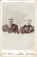
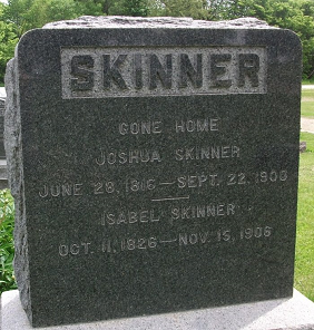
For this project, I will explore how to expand the use of geographic information and data to further family history research. I will use the example of my own paternal ancestor to analyze geographic data related to the places and data found in my family history. The furthest I have been able to research my Skinner lineage is to my great-great-great grandfather, Joshua Skinner, who lived from 1816 to 1900. After over thirty-five years of research, I have yet to be able to determine who were Joshua's parents.
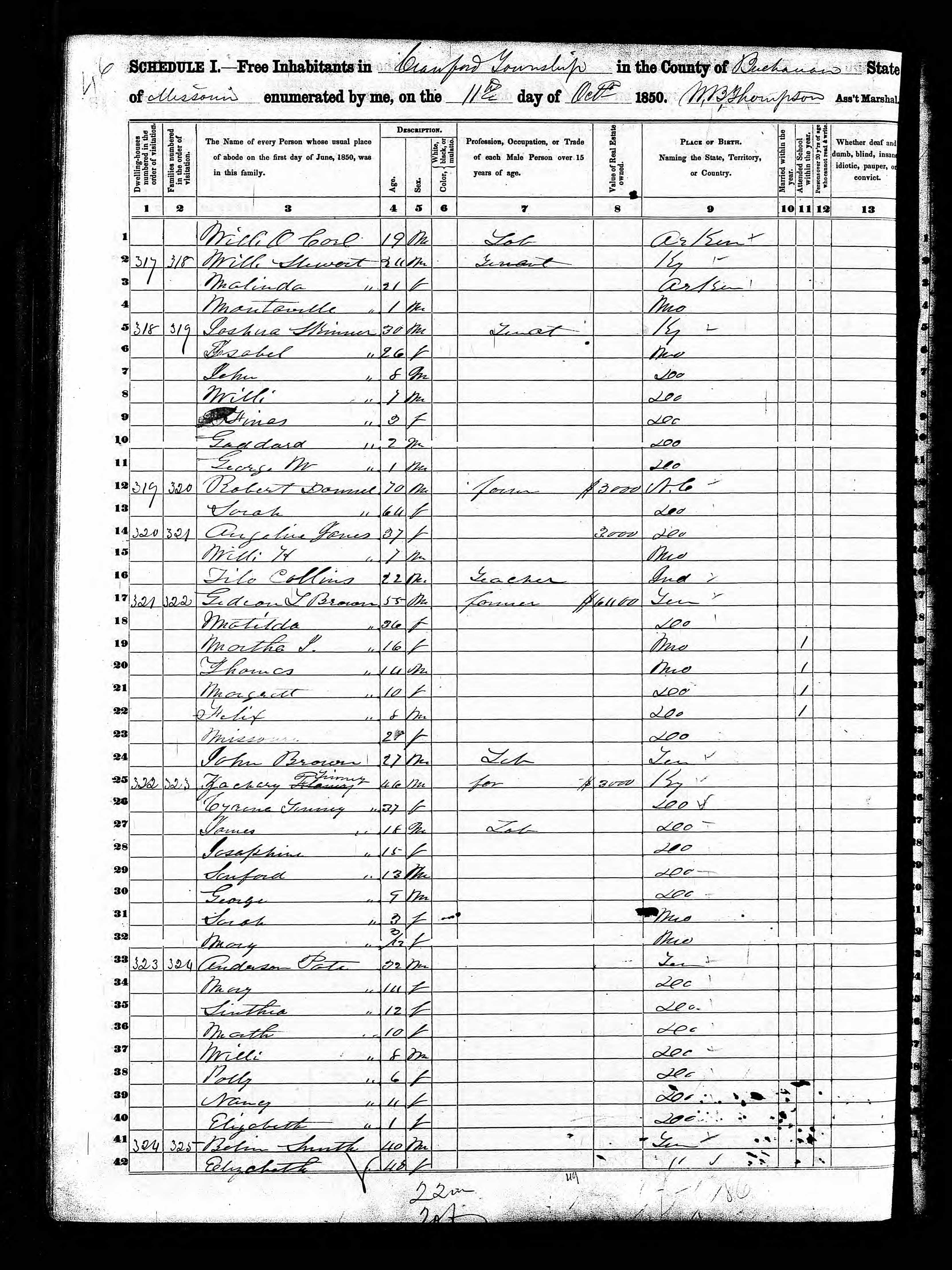
The earliest records I have of Joshua Skinner are as follows: his name on an 1840 Buchanan County Missouri tax roll, his two marriage certifications dated 15 July, 1841 and 19 February, 1846, and the 1850 United States Census for Crawford Township of Buchanan County Missouri that list Joshua Skinner, his second wife, and his five oldest children. After this, Joshua Skinner relocated to Lincoln Township in Page County, Iowa, in 1851 (as described on page 67 of the History of Page County, Iowa: Also Biographical Sketches of Some Prominent Citizens of the County, Volume 1, Kershaw, W.L. 1909.) Here he would live the rest of his life, as shown in United States and Iowa census records from 1855 through 1900, as well as death and burial records and images from Elmwood Cemetery in Coin, Page County, Iowa. Additionally, a scanned image a map titled: "Plat of Lincoln: Township 68 North, Range 38 West" from approximately 1900, and several United States General Land Office Land Grant documents show Joshua Skinner's land ownership in Page County Iowa.
Incorporating historical geographic data such as topographic maps, US Census track data, Public Land Survey System information, and other sources, I will explore a picture of where a branch of my ancestors were born, lived, grew, and were buried. I hope to see what insights I can find, and maybe find a hint to one of the longest enigmatic conundrums in my genealogical research. Who were Joshua Skinner's parents?
Background
The hobby and profession of genealogy, or family history research, is a popular activity with many people who are at least somewhat aware of their ancestry. According to the online magazine GenealogyInTime (2015 as cited in Ray, 2016), genealogy is on par with gardening in popularity as a hobby.
Until the end of the 20th century, the practitioners of genealogy tended to be people with generous free time, such as retires. Before widespread access to the internet and the World Wide Web, research of one's family history was a challenge and time consuming. It would require traveling to, or postal correspondence with, various libraries, court houses, churches, cemeteries, county, state, and national record repositories, and other genealogists to list a few examples.
This started to change in the last decade of the 20th century. First, with free, home-grown web sites and collections such as RootsWeb, The USGenWeb Project, and Cyndi's List, family historians were able to do some research from home through a personal computer. This has continued to grow through the first decades of the 21st century. Commercial products like Ancestry, FamilySearch, GenealogyBank, as well as specialty tools for different types of research like BillionGraves, Find a Grave, Fold3, and Newspapers.com, are a small sampling of available products. There are also ever improving standalone computer applications that can allow researchers to manage their own family history data, as well as tap into many of the online resources. Family Tree Maker 2019 is one such product used by this author.
While the tools and solutions available in Geographic Information Systems (GIS) could provide a new dimension to the research of a family historian involved in genealogy, little has been done in this domain to date by any of the previously listed examples. Even though a Google search for "family history mapping" yielded millions of results in 2014 and 2015, only three of them were relevant to mapping family history data, each of which contained a range of functionality and limitations. (Ray 2016). "While many services offer bits and pieces of this idea, no system has currently capitalized on the prospect of a woven together user experience portraying both ancestry information from genealogy enthusiasts with the personal aspect of individual geolocation sharing" (Harne 2017). This continues to be the experience of the author of this paper today.
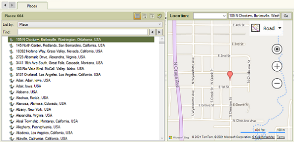
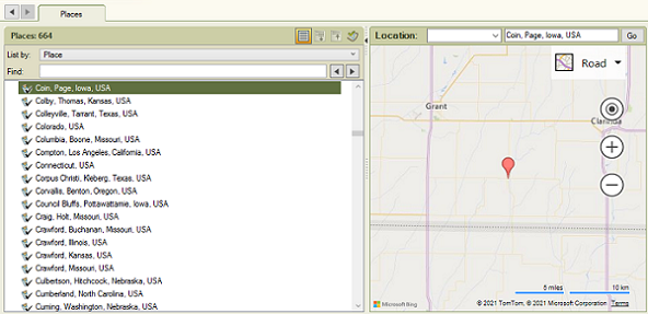
The limited GIS capability that exists currently tends to be simple geolocation encoding using resources like the USGS Geographic Names Information System (GNIS), or similar proprietary geographic place name data such as The Place resource maintained and utilized by FamilySearch (Ray 2016) combined with basic address location functionality. The following figures 2 through 5, show the geolocation feature in Family Tree Maker 2019 from street address resolution to state level resolution.
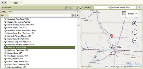
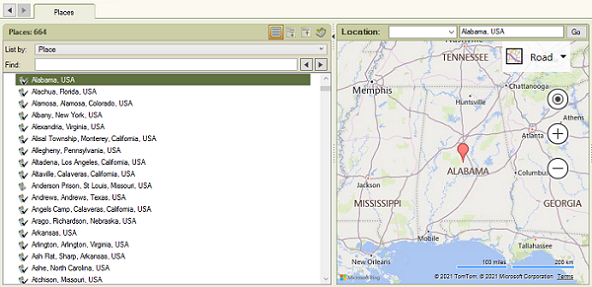
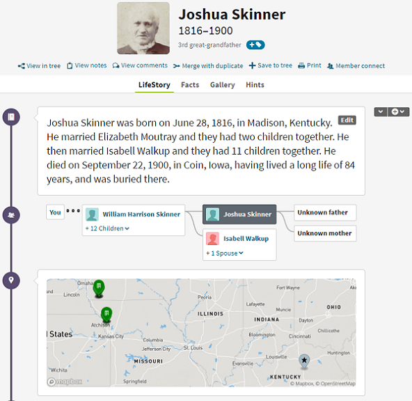
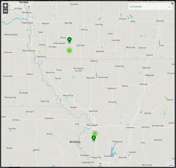
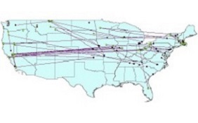
The best-known genealogy web tool today is probably Ancestry (ancestry.com). There is some rudimentary GIS functionality built into their product which is demonstrated in figures 6 and 7. As opposed to the above, Family Tree Maker examples, here all the geographic points relevant to an individual ancestor are shown on a single map, with the ability to pan and zoom to focus in on any geographic area of interest. However, the points are not ordered and are categorized only in a distinct marker for the birth location.
These figures show that GIS utilization in genealogy products is limited and simple. To demonstrate the relationship of points associated with an individual, both Murphy 2009 (figure 8) and Ray 2016 (figure 9) created GIS products that show a spatial relationship between where family members were born and, where they died and/or were buried. This is just the beginning of what could be shown about family members in GIS. As well as where family were born and died, genealogy data often includes locations were ancestors lived at different points in their lives. The ability to track ancestors' lives across a map showing both geographic and chronological relationships could be very interesting.
In addition to mapping the lives ancestors by geographically plotting their life events, another important segment of family history research is land ownership. It would be a very unusual family that, throughout the entirety of history, did not have some members who worked the land in agriculture. Land ownership records are an important resource in learning one's family history.
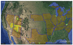
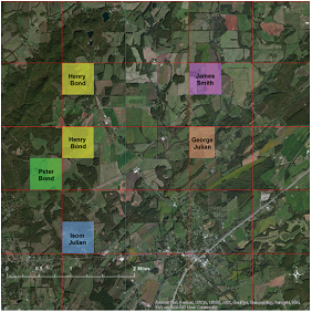
Just reading the dry descriptions of where an ancestor owned a piece of land leaves a lot to the imagination. Figure 10 shows where the lands of ancestors of Glenn Julian were located. Before they were mapped with GIS tools, he thought we knew aproxametly where they were, but his ideas were not always true (Abbit and Julian, 2014). Robbyn Abbit and students of Miami University GIS program used GIS tools to map the land grants of several of Julian's ancestors across three Tennessee counties (Abbit and Julian, 2014).
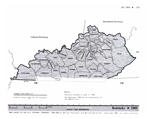
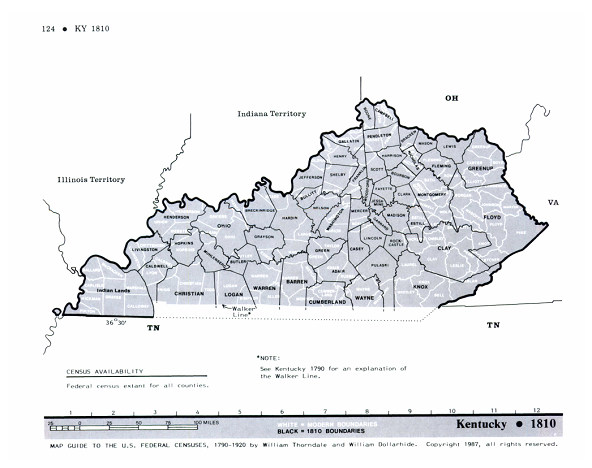
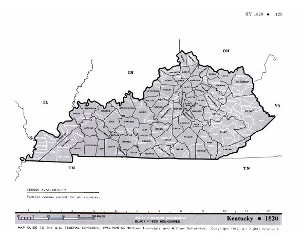
An important consideration of GIS in relation to genealogy is the mutability of geographic features through history. The most common geographic governmental unit in genealogy is the county or county equivalent. The geometries of counties are highly mutable over time. They can be altered through additions, splits, mergers, and occasional extinctions (Timothy, 2008 cited in Ray, 2016). Figures 11, 12, and 13, show the changes in county boundaries for the state of Kentucky in the 1800, 1810, and 1820 decimal U.S. Census years (Thorndale, 1987). One also has to be aware of changes in geographic mapping and surveying over time. When mapping the land grant of Julian's ancestor, Robert Paterson, the land description was for Township 6, Range 1 west. However, there was no Township 6 in the 1851 map they were referencing. Looking at an 1836 Tax Map for McMinn County, Tennessee showed that the numbering of townships was different in the older maps (Abbit and Julian, 2014).
By combining GIS with genealogical data, it should be possible to find new relationships and research possibilities in family history. It is also interesting to see one's family history visually represented on a map. In this paper, the author will use GIS to explore the geographical information in the genealogy data of his Great-Great-Great Grandfather, Joshua Skinner, who lived from 28 June, 1816 to 22 September, 1900.
Methods
The choice was made to focus on a single ancestor for the scope of this paper. Joshua Skinner (1816-1900) was picked as he is the oldest direct paternal ancestor I have yet to document in my family history. Also, over the years, I have been able to document his life to a greater extent than many of my other 19th century ancestors. Finally, after years of research, I have yet to document who were his parents.
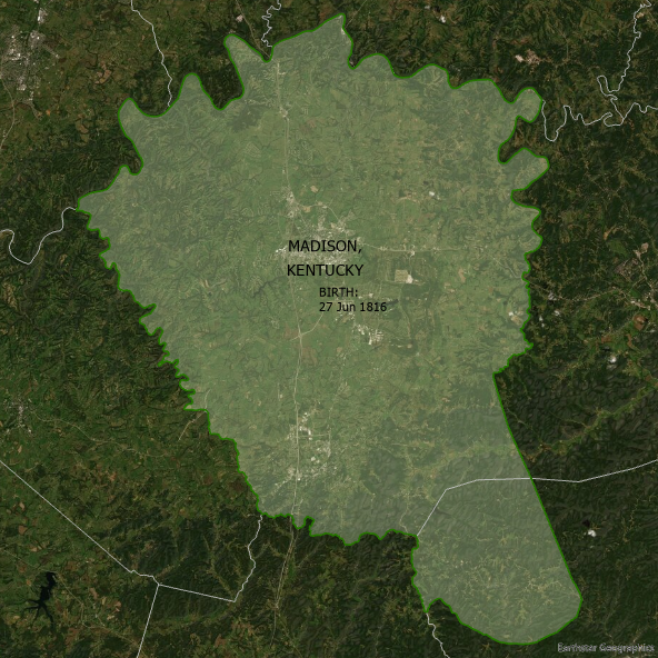
Joshua was born on the 28th of June, 1816 in Madison County, Kentucky, USA. In the table below from the Atlas of Historical Boundaries we can see there are twelve geometries for Madison County Kentucky (Scholl, 2012). The one relevant to the birth of Joshua Skinner is FID 6551, that shows the county as it existed from 1 March, 1812 to 20 December, 1821. This feature will be used to show the birth place of Joshua Skinner.
| FID | START DATE |
END DATE |
CHANGE (CITATION) |
AREA SQMI |
|---|---|---|---|---|
| 6542 | 6/1/1792 | 5/31/1797 | Jurisdiction changed from Virginia to Kentucky. (Hening, 11:85; U.S. Stat., vol. 1, ch. 4[1791]/p. 189) |
2082 |
| 6543 | 6/1/1797 | 12/31/1799 | MADISON lost to creation of GARRARD, lost small area to LINCOLN. (Ky. Acts 1796-1797, 5th assy., 1st sess., sec. 1/pp. 38-39) |
2003 |
| 6544 | 1/1/1800 | 5/31/1800 | MADISON lost to GARRARD. (Ky. Acts 1799, 8th assy., ch. 70, sec. 1/pp. 146-147) |
1990 |
| 6545 | 6/1/1800 | 12/18/1801 | MADISON gained from MONTGOMERY. (Ky. Acts 1799, 8th assy., ch. 73, sec. 1/pp. 150-152) |
2707 |
| 6546 | 12/19/1801 | 3/31/1805 | MADISON lost small area to GARRARD. (Ky. Acts 1801, 10th assy., ch. 64, sec. 1/pp. 64-65) |
2707 |
| 6547 | 4/1/1805 | 3/31/1807 | MADISON lost to KNOX. (Ky. Acts 1804, 13th assy., ch. 46, sec. 1/pp. 76-77) |
2587 |
| 6548 | 4/1/1807 | 3/31/1808 | MADISON lost to creation of CLAY, lost to FLOYD and KNOX. (Ky. Acts 1806, 15th assy., sec. 1/pp. 139-141) |
771 |
| 6549 | 4/1/1808 | 3/31/1810 | MADISON lost to creation of ESTILL. (Ky. Acts 1807-1808, 16th assy., ch. 38, sec. 1/pp. 64-66, and ch. 39, sec. 1/pp. 66-67) |
533 |
| 6550 | 4/1/1810 | 2/29/1812 | MADISON lost to creation of ROCKCASTLE. (Ky. Acts 1809-1810, 18th assy., ch. 102, sec. 1/pp. 16-19) |
476 |
| 6551 | 3/1/1812 | 12/20/1821 | MADISON gained from CLAY. (Ky. Acts 1811-1812, 20th assy., ch. 392, sec. 1/p. 218) |
499 |
| 6552 | 12/21/1821 | 4/24/1858 | MADISON lost to ROCKCASTLE. (Ky. Acts 1821, 30th assy., 1st sess., ch. 343, sec. 1/pp. 444-445) |
495 |
| 6553 | 4/25/1858 | 12/31/2000 | MADISON lost to creation of JACKSON. (Ky. Acts 1857-1858, vol. 1, ch. 167, sec. 1/pp. 18-22, and res. 13, p. 103) |
443 |
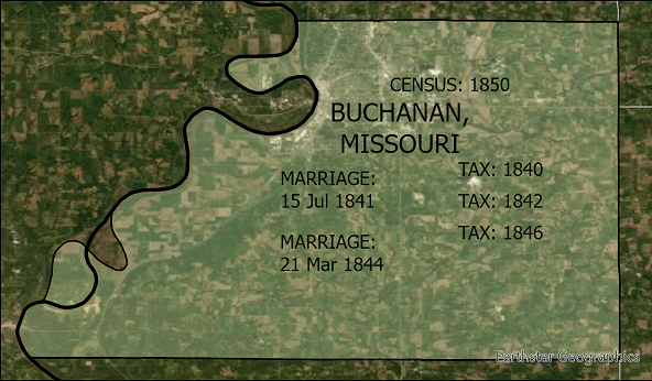
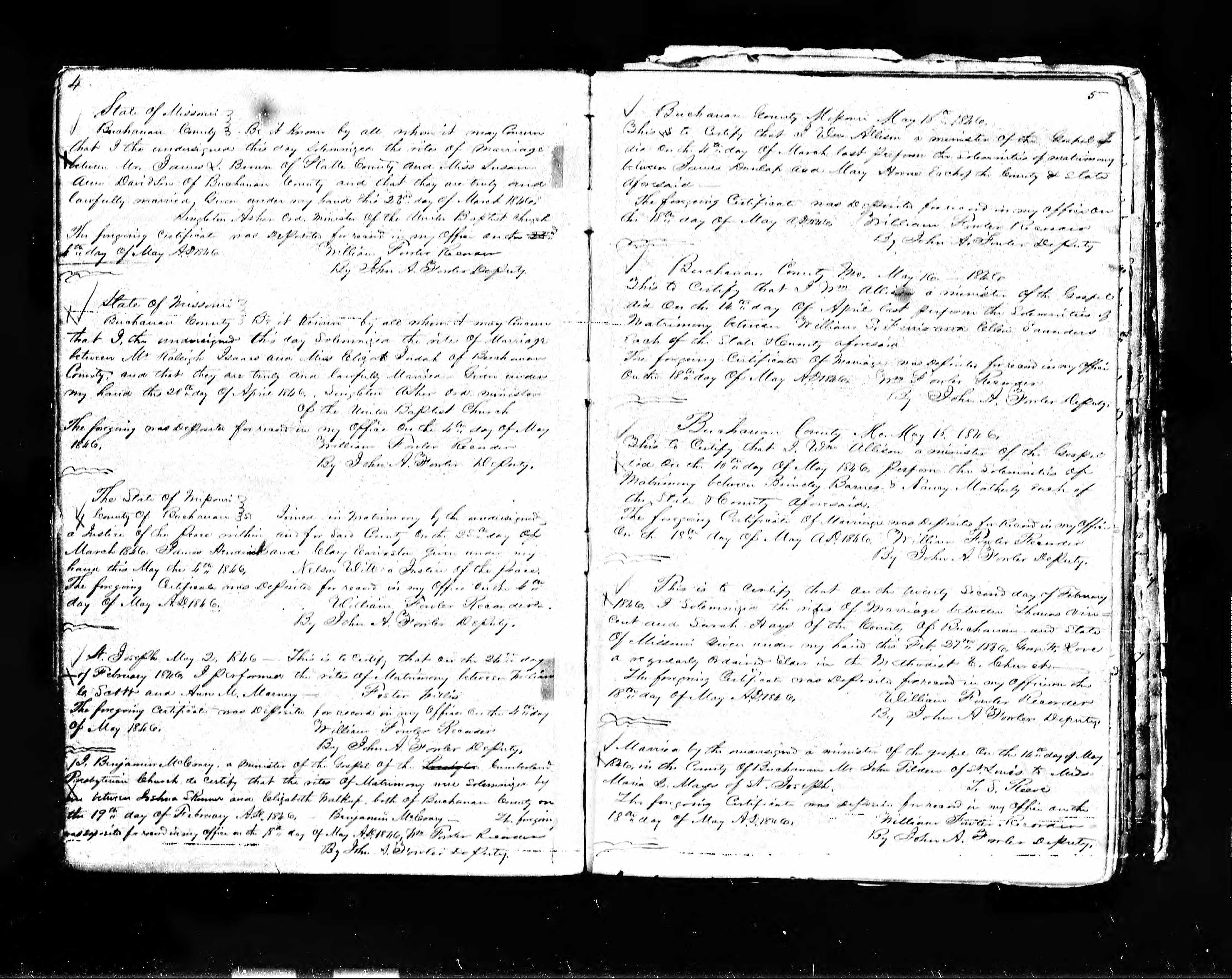
Chronologically, the next records of Joshua Skinner are his name listed on the 1840, 1842, and 1846 Tax Rolls for Buchanan County, Missouri. Also, in the 1840's, there is a record of his first marriage on 15 July, 1841, and a record of his second marriage on 21 March, 1844 in the same county. As well, he is listed as living in Crawford Township of Buchanan County, Missouri with his second wife and five oldest children in the 1850 United States census.
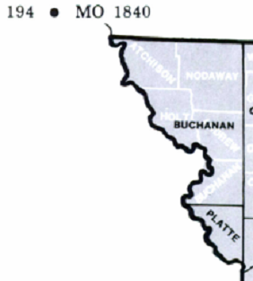
Buchanan is one of the six counties that were created out of the Platte Purchase land acquisition in 1836 (Platte Purchase, n.d.). According to the Map Guide to the U.S. Federal Census, 1790-1920 (Figure 14), in 1840, Buchanan County covered the extent of the modern counties of Buchanan, Andrew, Holt, Nodaway, and Atchison (Thorndale, 1987). However, the Atlas of Historical Boundaries indicates that Buchanan County, Missouri has existed in its current extent from its creation on 31 December, 1838 to now, other than a small change in August, 1950 when the western border was updated to the current center line of the Missouri River (Scholl, 2012). The Atlas of Historical Boundaries feature will be used to map Joshua's life in Buchanan County, Missouri, as it is the more modern and documented description of the county as it existed from 1840 through 1851 (Scholl, 2012).
| FID | START DATE |
END DATE |
CHANGE (CITATION) |
AREA SQMI |
|---|---|---|---|---|
| 8308 | 12/31/1838 | 8/2/1950 | BUCHANAN (Mo.) created by Missouri from non-county area. Due to shifting course of the Missouri River (esp. after the 1944 flood), BUCHANAN (Mo.), at its creation, included territory now in present Kansas. Such bdry changes are not generally mapped here. (Mo. Laws 1838-1839, pub., pp. 23-25) |
418 |
| 8309 | 8/3/1950 | 12/31/2000 | BUCHANAN created from Non-County Area 12. (Mo. Laws 1838-1839, pub., pp. 23-25) |
415 |
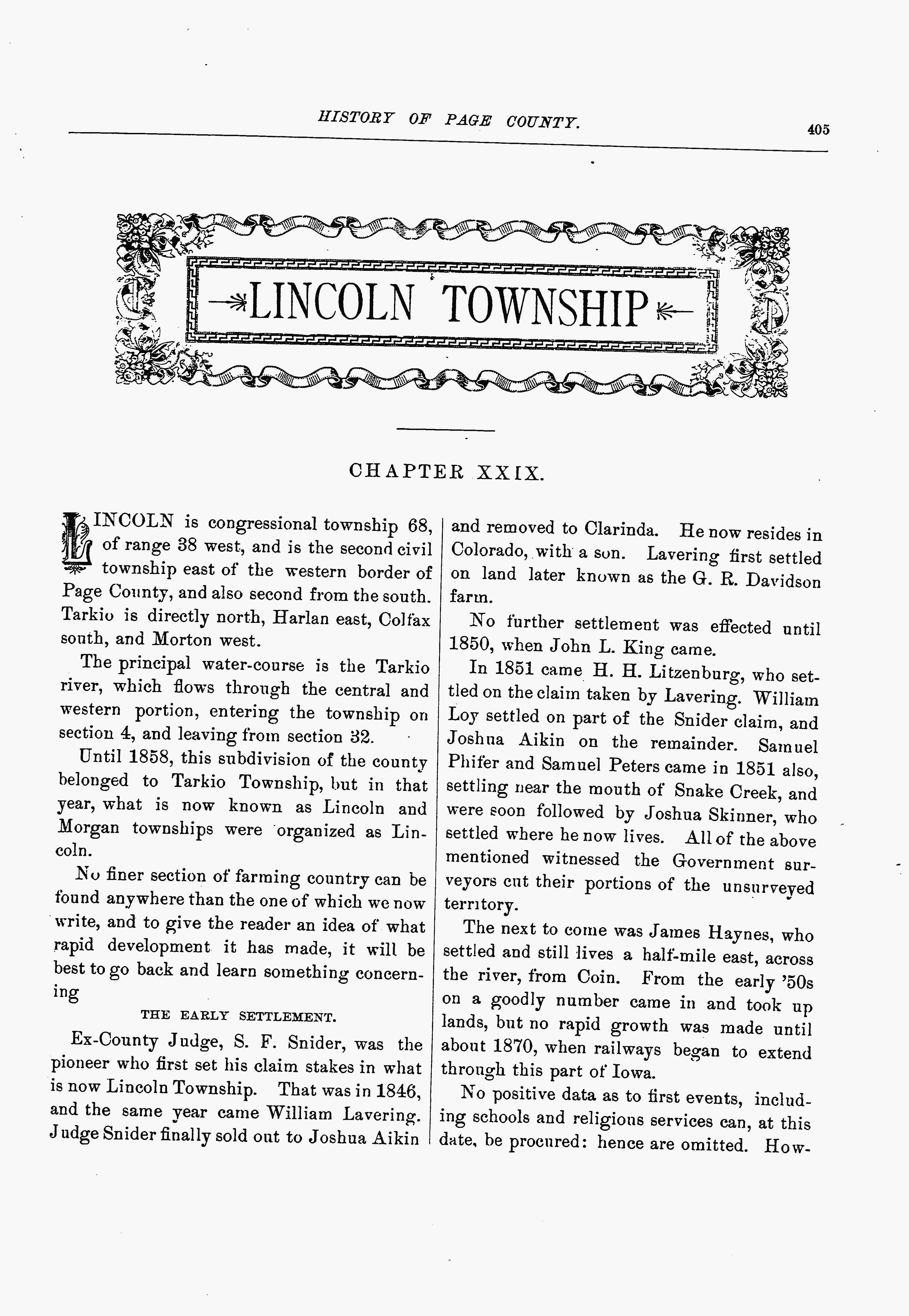
After living in Buchanan County for at least a decade -- Joshua moved to Page County, Iowa. From the "Lincoln Township" chapter of Biographical History of Page County, Iowa:
"In 1851 came H. H. Litzenburge, who settled on the claim taken by Lavering. William Loy settled on part of the Snider claim, and Joshua Aikin on the remainder. Samuel Phifer and Samuel Petes came in 1851 also, settling near the mouth of Snake Creek, and were soon followed by Joshua Skinner, who settled where he now lives. All of the above mentioned witnessed the Government surveyors cut their portions of the unsurveyed territory" (Biographical History of Page County, Iowa, 1890).
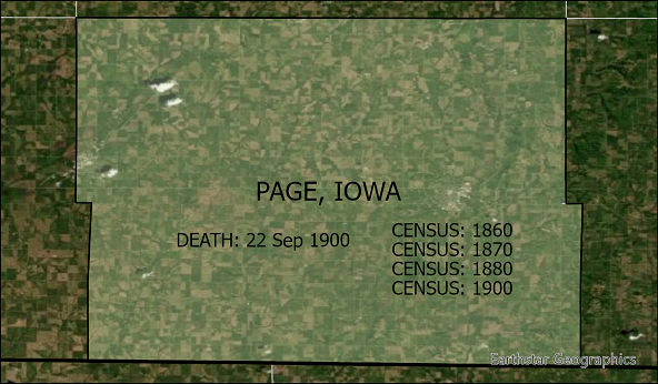
Joshua would spend the rest of his life in Page County, until his death on 22 September, 1900, as documented with state and federal censuses from 1855 through 1900, as well as newspaper, birth, marriage, death, and cemetery records. The single Page County Iowa feature from the Atlas of Historical Boundaries will be used to map Joshua's life here (Scholl, 2012).
| FID | START DATE |
END DATE |
CHANGE (CITATION) |
AREA SQMI |
|---|---|---|---|---|
| 4661 | 2/24/1847 | 12/31/2000 | PAGE created from Non-County Area 5 attached to APPANOOSE. (Iowa Acts 1846-1847, ch. 83, secs. 1-4/p. 100) |
535 |
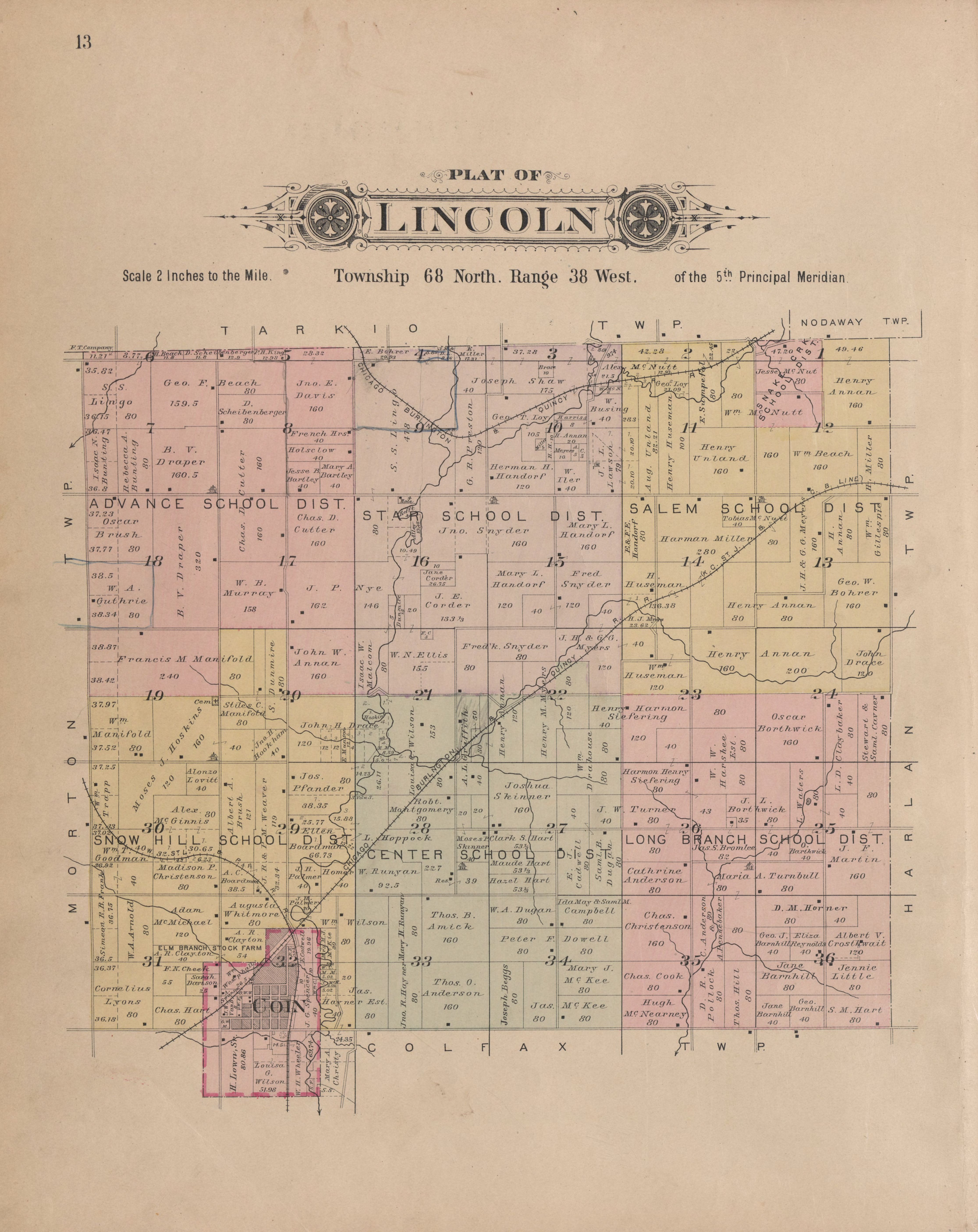
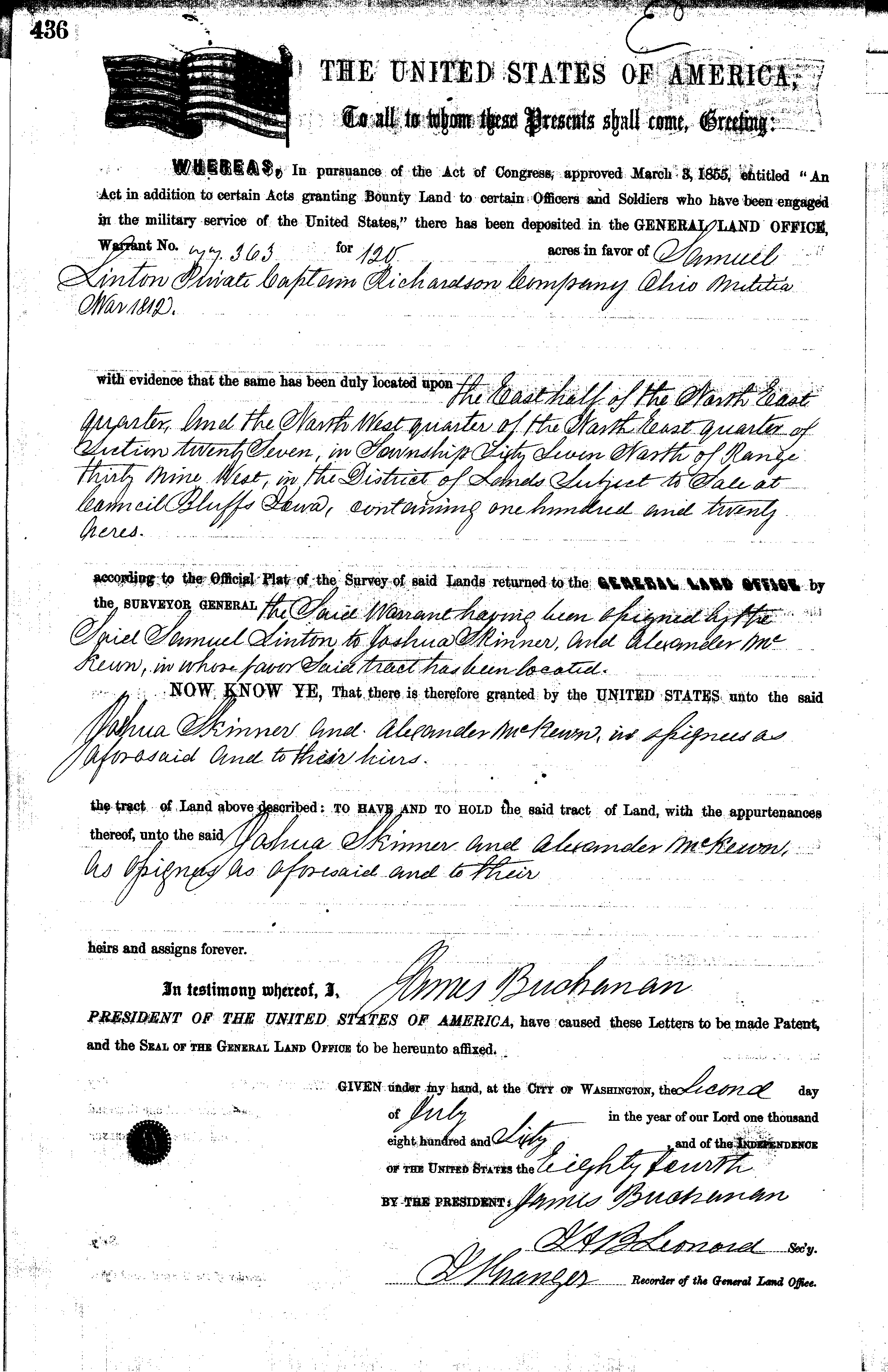
Joshua acquired several parcels of land in Page County, Iowa, through several land grants and a military warrant from the General Land Office of the United States of America. These documents described the parcels in terms of fractions of sections of townships and ranges of the Public Land Survey Systems (PLSS). Using a dataset of polygon features describing PLSS sections, new polygon features have been created from the descriptions to represent the parcels of land once owned by Joshua Skinner. Also, a Plat map of Lincoln Township, published in a 1902 atlas of Page County, shows land owned by Joshua Skinner about the time of his death. This was scanned into a digital image which was geolocated using reference points. These land-grant features and plat map raster will be combined with elevation, hydrological, and land imagery to create a sense of where Joshua lived and farmed in Page County, Iowa.
In addition to the above features and rasters, basic State and County border features and imagery from ERSI Living Atlas, and ArcGIS Online resources, will be used to provide context to the region that covers the life of Joshua Skinner from Kentucky, through western Missouri, to southwest Iowa.
First, the historical county geometries will be overlayed with center point features identifying a selection of life events to show the geographic relationship in order to give an overview of Joshua's life. Second, a more detailed view of where Joshua lived for almost 50 years in Page County, Iowa, will be shown.
Results
After I created a simple map with features for the three counties that Joshua Skinner was known to have lived, it immediately became apparent that a scale that showed all three counties at the same time was too small to include detailed points with life events in each county. I decided to start with this overview map showing the relationship of the three counties: Madison, Kentucky as it existed in 1812; Buchanan, Missouri as it existed from 1840-1851; and Page, Iowa as it has existed since 1847.
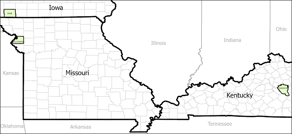
Madison, Kentucky; Buchanan, Missouri; and Page, Iowa.
From here, I created three maps zoomed into each county to show the life events recorded in each respective county. These maps were created by overlaying the selected Atlas of Historical County Boundaries county features over modern county outlines and the ERSI World Imagery background. Then, point features which identify select records of Joshua Skinner, were embedded into the maps based on center point features of the county polygons. The first map is of Madison County, Kentucky, which shows the birth record for Joshua Skinner.
The second map is Buchanan County, Missouri, with references to the three tax roll records, the two marriage records, and the one US Census record that document the decade Joshua lived in the county.
Here is the map of Page County, Iowa, with four US Census records, and the death record for Joshua Skinner. This is just a small set of available records that documents the half-century Joshua lived in Page County. The birth records of Joshua's eight children, born here, and several of their marriages, as well as numerous newspaper records were not included at this time.
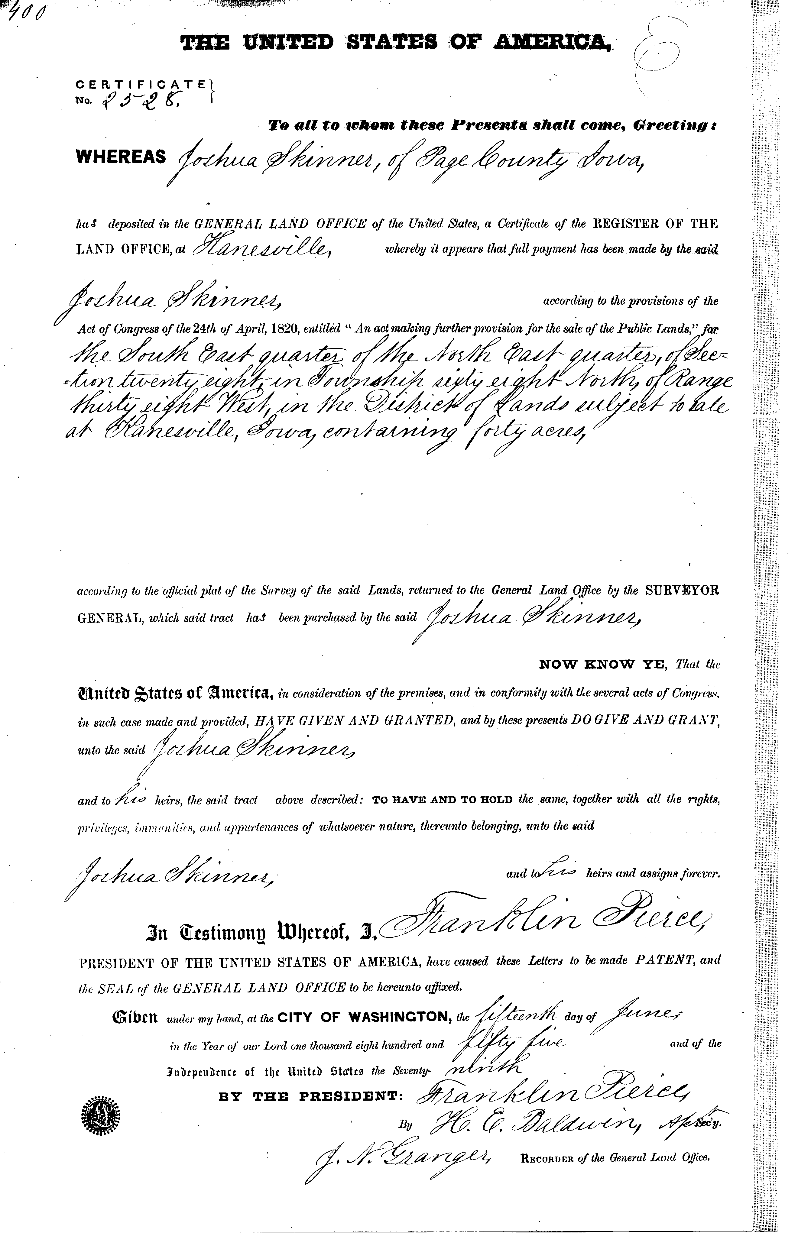
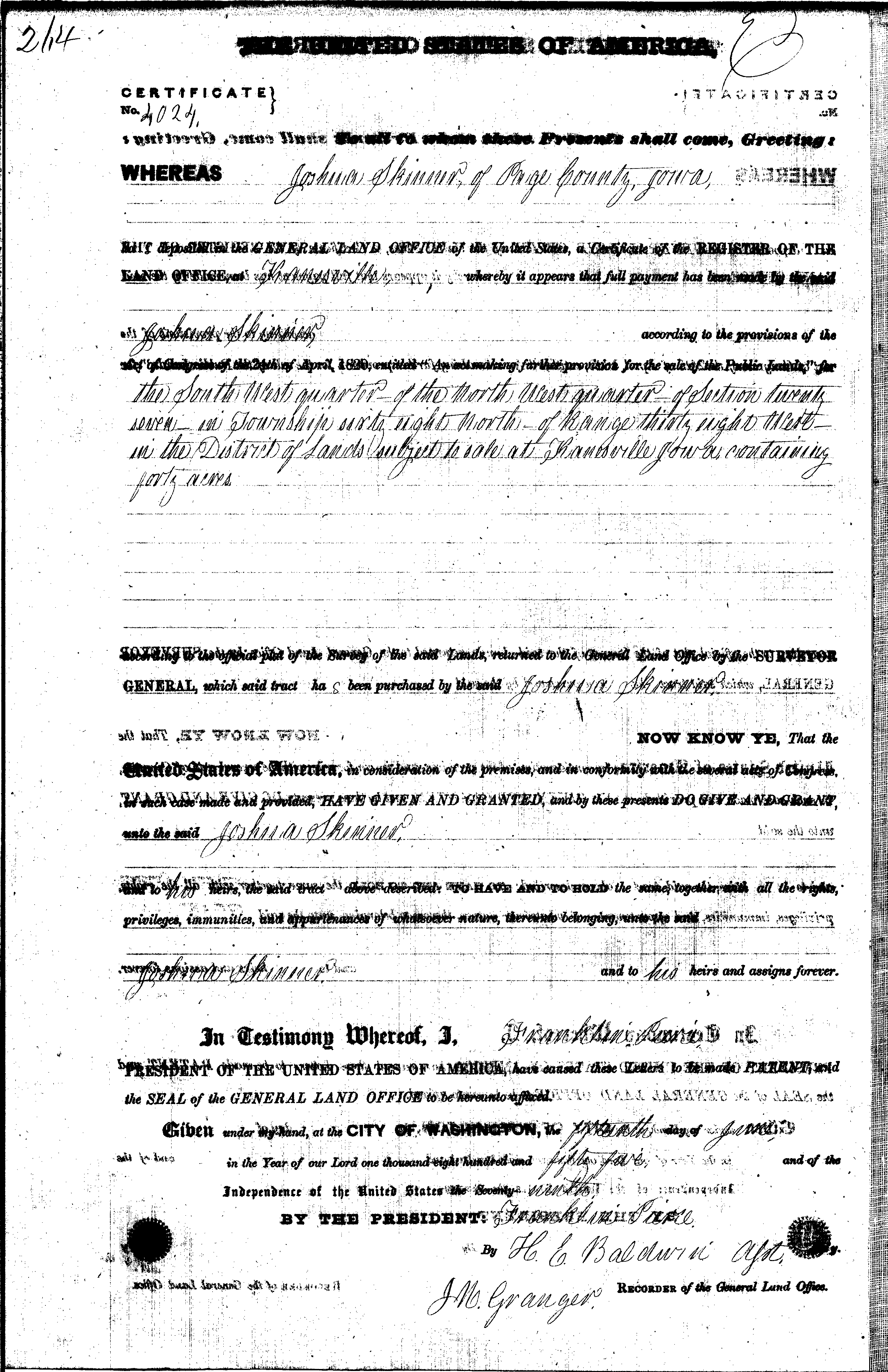
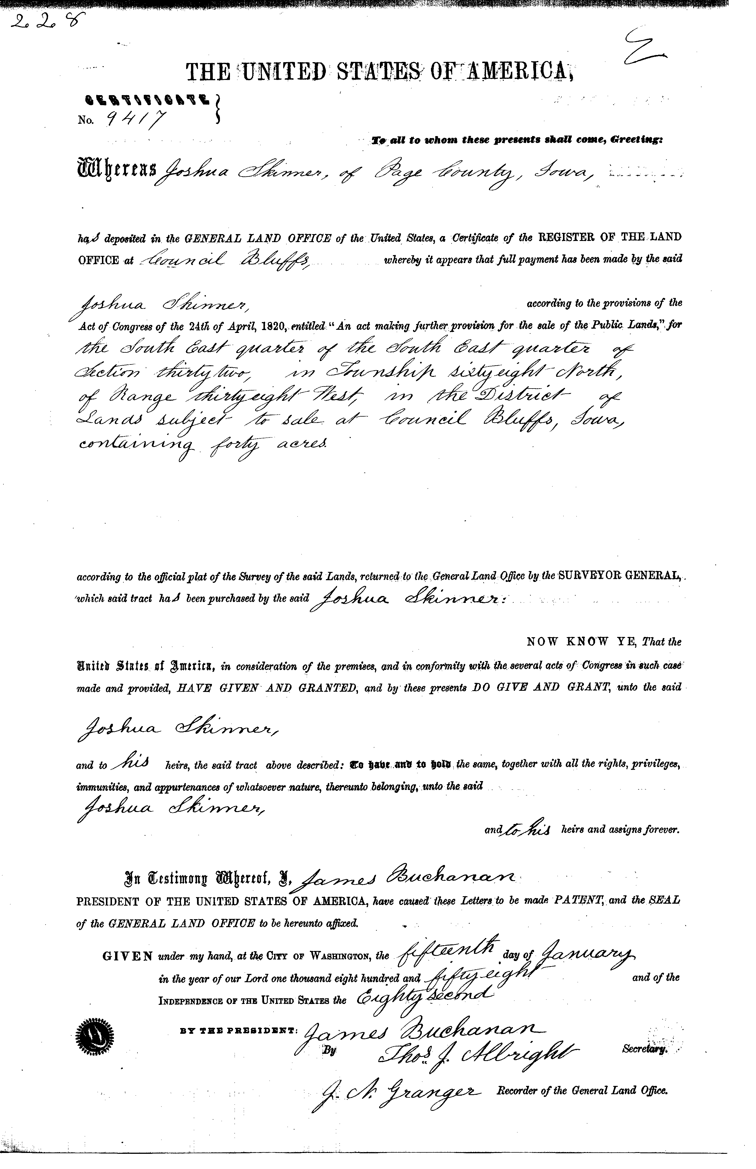
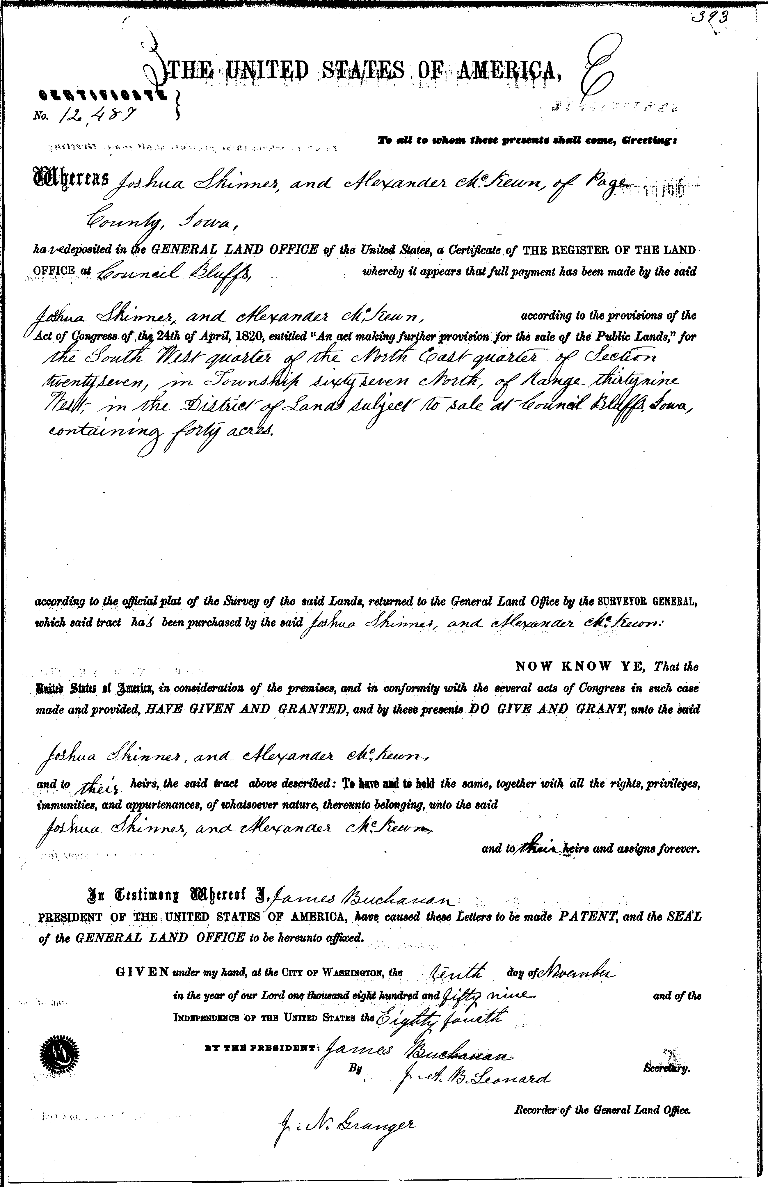
Following is a map that shows some of the land ownership of Joshua Skinner in Page County, Iowa. First, a polygon feature set was created that consists of five features that document the various parcels of lands described in the General Land Office of the United States grants and warrants. Using a feature set of PLSS sections, the descriptions of a grant was read, and the appropriate section feature was divided as described to create a new feature. Here is an example description from Certificate 2528 dated 15 June, 1855, and identified as parcel 1 on the map below.
Act of Congress of the 24th of April, 1820, entitled "An act making further provision for the sale of the Public lands," for the South East quarter of the North East quarter of Section twenty-eight in Township sixty-eight North of Range thirty-eight West in the District of Lands subject to sale at Hanesville, Iowa containing forty acres.
Next, a digital copy of the plat map of Lincoln Township, published in a 1902 Page County Iowa Atlas, was geolocated using reference points. Then these features and raster were combined with hydrological data from the USGS, a digital elevation model, and 1930s air photography rasters from the Iowa GIS portal, to give a sense of the landscape.
various Land Grants and a Military Warrant.
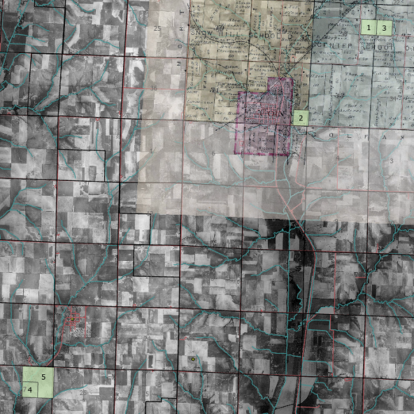
Below, I have zoomed in on an area of interest that shows the land owned by Joshua Skinner and his son Moses P. Skinner in the 1902 Plat Map of Lincoln Township, and the relationship of the land to the town of Coin. This image includes plots of lands described in three of Joshua's Land Grant documents. Two of these coorespond to portions of the lands owned by Joshua and his son in 1902.
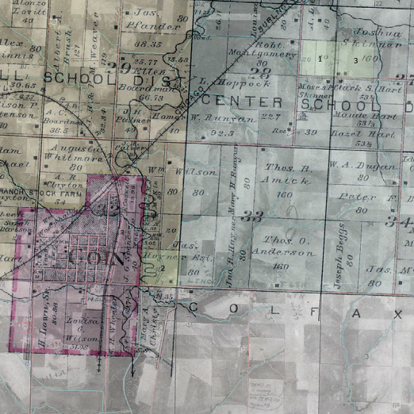
1902 Plat Map of Lincoln Township and its relationship to the town of Coin.
Analysis
I now have some new understandings on where my ancestor, Joshua Skinner, lived during his life as a result of this project. Unfortunately, I still do not know who his parents are, though that was always a long shot for GIS tools to uncover. However, I learned that the extent of Buchanan County was not what I had long held true that it included five modern counties in 1840. This will allow me to focus future research on just the extent of Buchanan County as it is now, and not have to include the other four counties in the north west corner of Missouri. I also learned that there is not a one-to-one relationship between any of the parcels of lands Joshua acquired with land grants, and the lands he owned in the 1902 Plat Map of Lincoln Township at this death, as I once imagined. Two of the parcels, 1 and 3, account for 1/3 of his and his son's land in 1902. In the future, I will research when and how he acquired the other 2/3s of the land owned in 1902, as well as how the other three parcels he got from grants were disposed.
Creating these maps as static products with ArcGIS Pro limited what I could do with them. Thus, I ended up creating six separate products to show some of what can be done when GIS and genealogy are combined. I also ran into limitations when I used the center points of the county polygons as the base of multiple point features for various life facts related to a given county. The labeling engine was not able to show data from multiple points at one set of coordinates well. I ended up arbitrarily moving individual point features to create room for the labels. Finally, I was not able to effectively import data from my genealogical sources into GIS sources. All the data I used had to be manually transcribed from one source to the other.
Conclusion
While this project and others cited within show the potential for using GIS with genealogical research, there is much that needs to be developed before it can be of practical use for the average genealogist. It is quite possible for users with GIS experience to utilize the location data found in genealogical data to create interesting and useful products such as I have here. However, it will be a tiny set of genealogical researchers who have such skills or access to those who do. To be useful to a larger group of researchers, GIS tools will need to be incorporated in common and populargenealogy tools, as well as having the ability to extract geographical information from genealogical data with GIS tools or other utilities. I have shown that there are the beginnings of GIS functionality in some current genealogy tools, but they do not currently do much. It will be interesting to see how this grows in the future.
To fully realize the potential of exploring the geographical relationships in genealogical data, I imagine dynamic, interactive applications would be highly useful, probably making use of being online or utilizing web services. The ability to scroll and pan both geographical and chronological as well as to filter and combine multiple family members would create a very dynamic system with a great deal of potential.
References
Abbit, R. J. F. and Julian, G. M. (2014). GIS and Genealogy ArcUser: The Magazine for Esri Software Users, Spring 2014 17(2), 58-61. https://www.esri.com/content/dam/esrisites/en-us/newsroom/arcuser/arcuser-spring-2014.pdf.
Abbitt, R. J. F. and Lawrie, J. F. (2014). Seven Best Practices For georeferencing historic maps and data. The Magazine for Esri Software Users, Spring 2014 17(2), 62-63. https://www.esri.com/content/dam/esrisites/en-us/newsroom/arcuser/arcuser-spring-2014.pdf.
Biographical History of Page County, Iowa. (1890) Lewis & Dunbar Publishers. Referenced online at https://www.ancestry.com/sharing/26699179?h=38ba63&utm_campaign=bandido-webparts&utm_source=post-share-modal&utm_medium=copy-url.
Family Tree Maker 2019 [Computer software]. (2019). Boston, MA: The Software MacKiev Company. https://www.mackiev.com/ftm/.
Harne O. (2017, May 1). Using Geolocation to Connect Geography with Genealogy. GIS LOUNGE. https://www.gislounge.com/using-geolocation-connect-geography-genealogy/.
Murphy, T. (2009). GIS and Geneology1 [Paper presentation]. Twenty-first International Conference on Spatial Data Acquisition for GIS, American River College, Sacramento, California, United States of America https://ic.arc.losrios.edu/~veiszep/21spr2009/MurphyT/G350_MurphyT_Project.htm.
Platte Purchase. (n.d.). In Wikipedia. Retrieved 8 December 2021, from https://en.wikipedia.org/wiki/Platte_Purchase.
Scholl, W. M. (2012). Atlas of Historical County Boundaries. US Historical Counties (1629-2000). Full file Not generalized. The Newbery Library. Center for American History and Culture. https://digital.newberry.org/ahcb/downloads/gis/US_AtlasHCB_Counties.zip.
Ray, J. T. (2016). A User Study of GIS Infused Genealogy with Dynamic Thematic Representation and Spatiotemporal Control. (Master Thesis University of Southern California, Los Angles, United States of America). https://spatial.usc.edu/wp-content/uploads/formidable/12/James-Ray.pdf.
Thorndale, W. and Dollarhide, W. (1987) Map Guide to the U.S. Federal Census, 1790-1920. Genealogical Publishing Company.
1 The published paper includes the typo.
Appendices
Individual Report for Joshua Skinner


Plat Book of Page County Iowa: 1902
Plat Map of Lincoln Township
Land Warrant and Grants of Joshua Skinner
Certificate 2528
Certificate 4024
Certificate 9417
Warrant 436
Certificate 12,487
Tax Rolls and Census Records
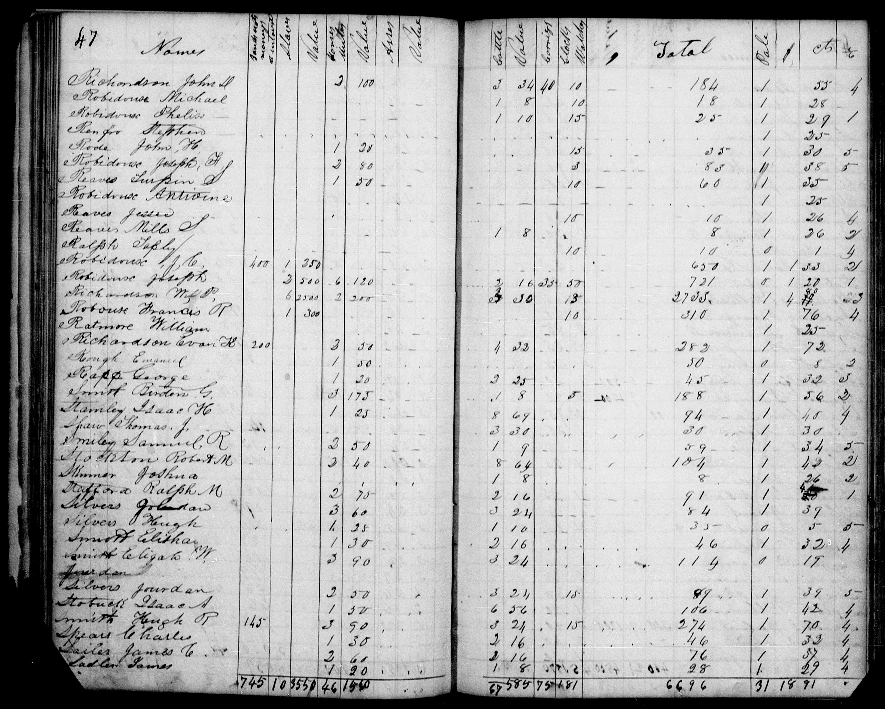
1840 Tax Roll for Buchanan County Missouri
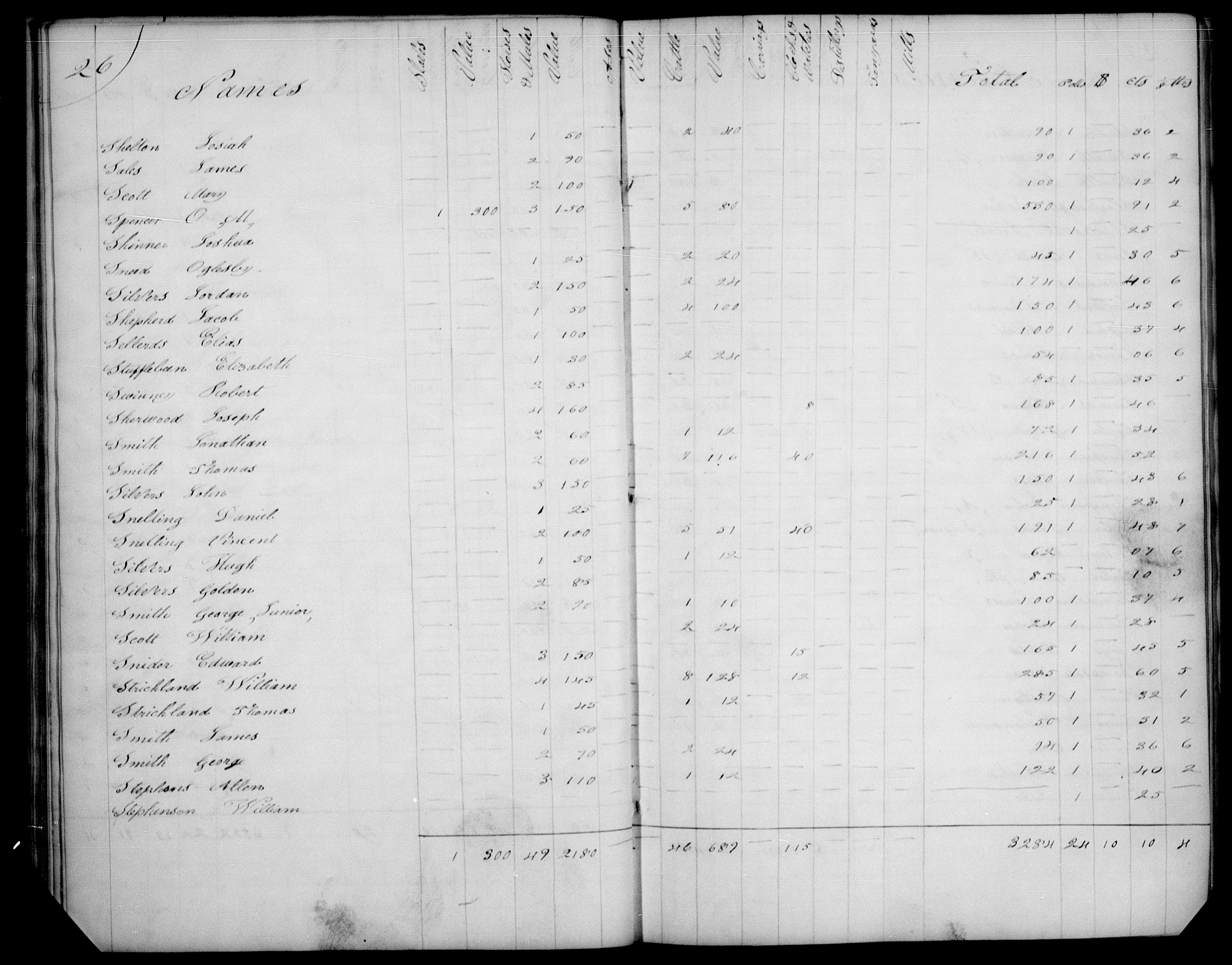
1842 Tax Roll for Buchanan County Missouri
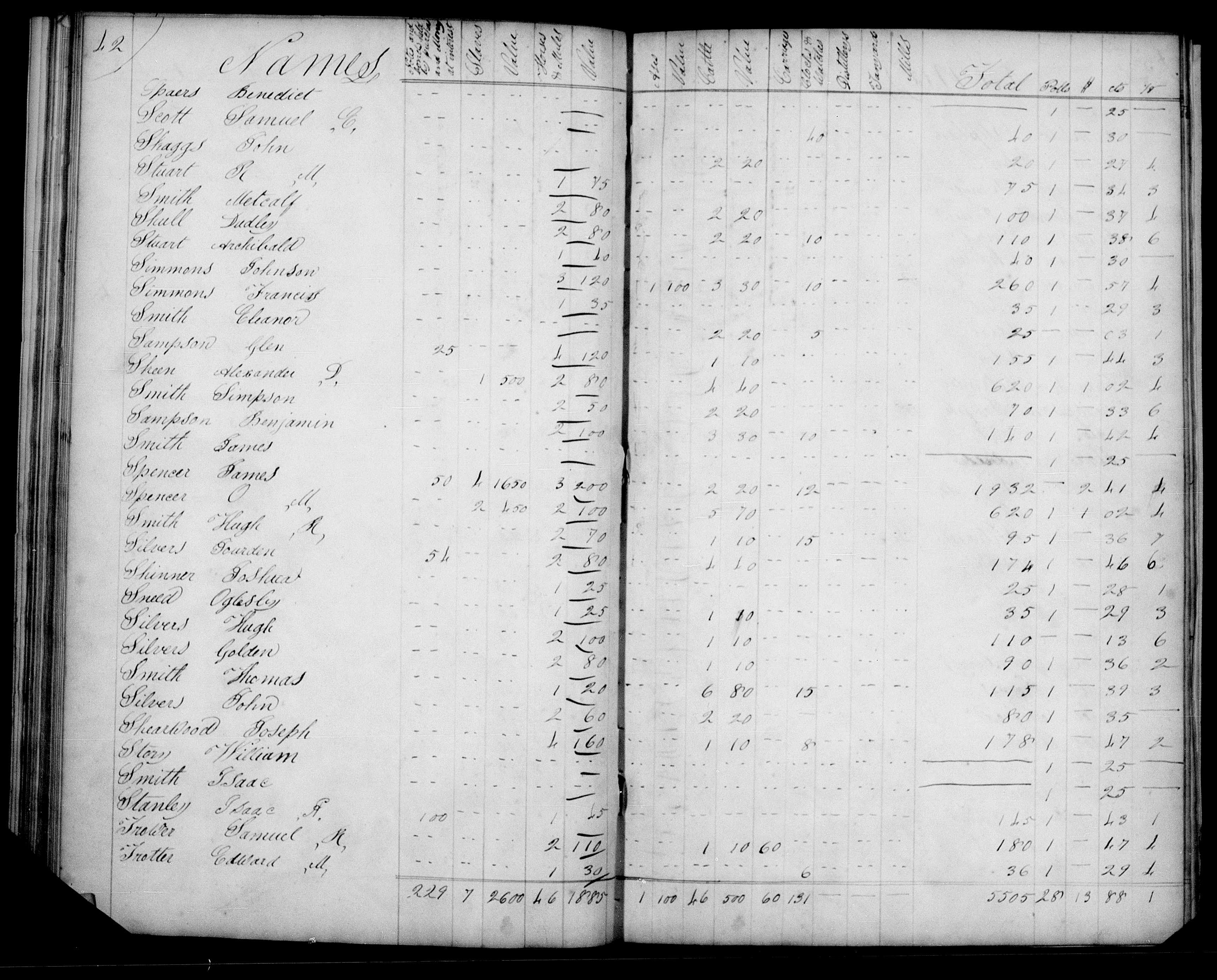
1846 Tax Roll for Buchanan County Missouri
1850 US Federal Census for Buchanan County Missouri
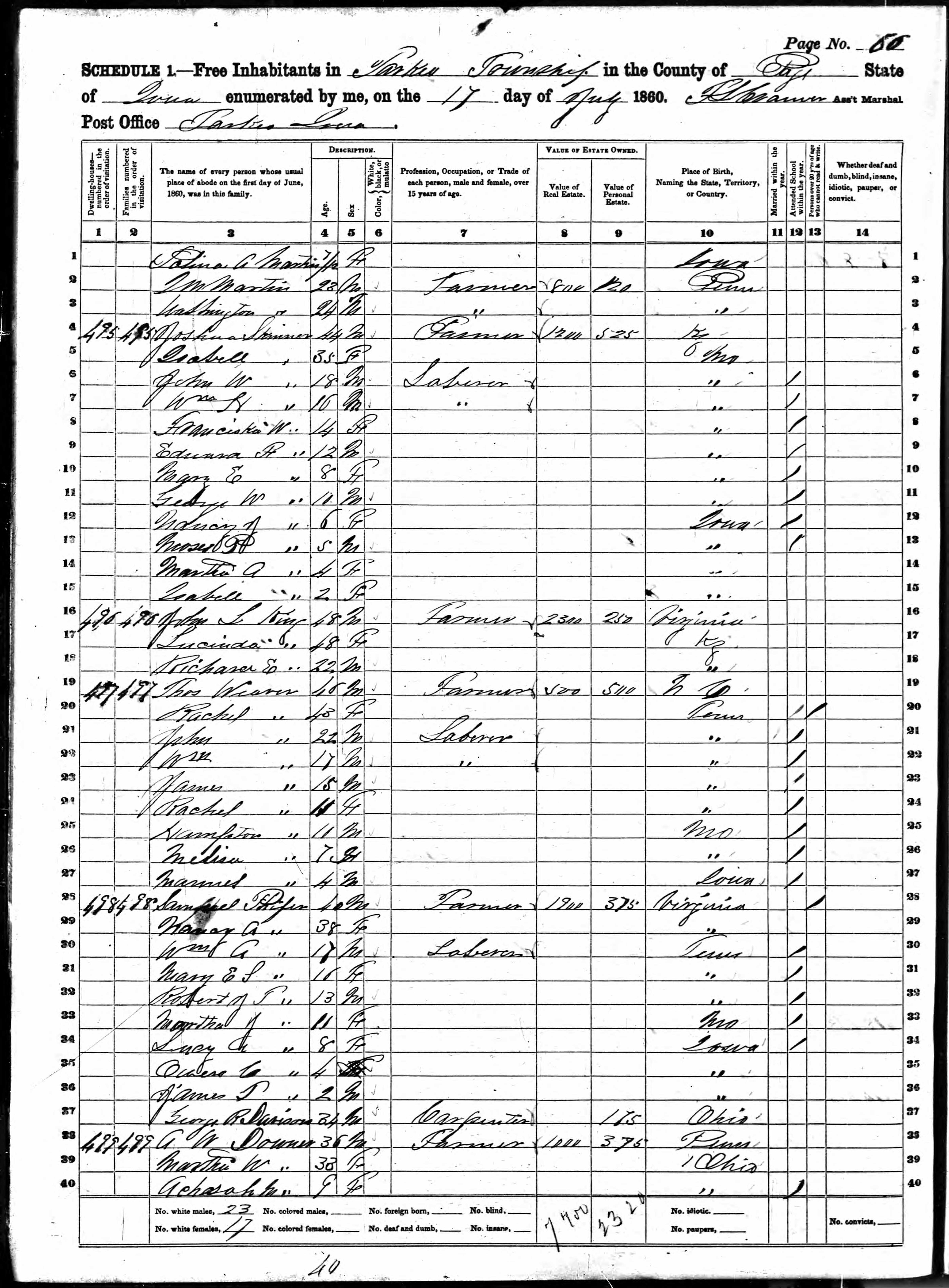
1860 US Federal Census for Page County Iowa
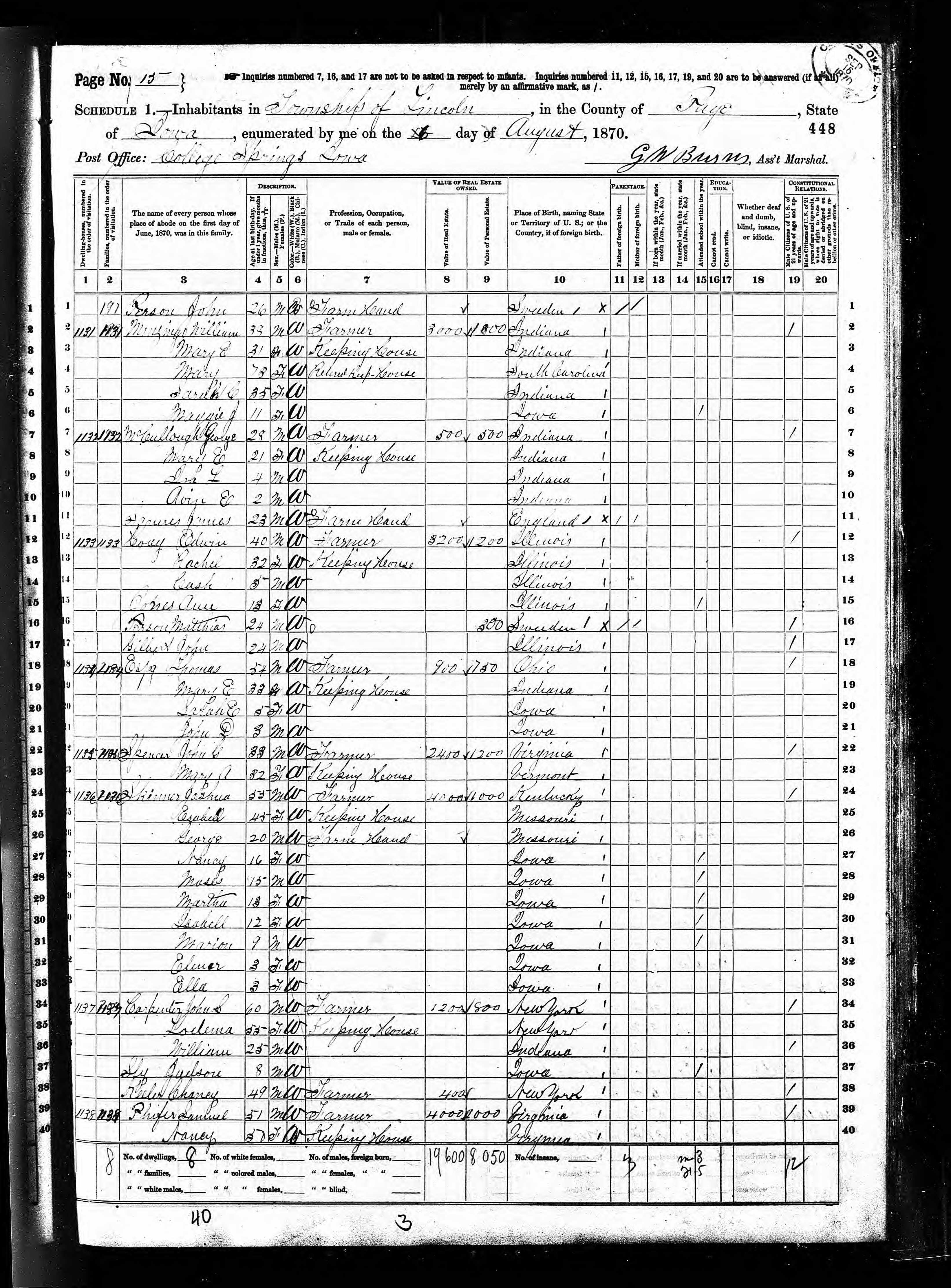
1870 US Federal Census for Page County Iowa
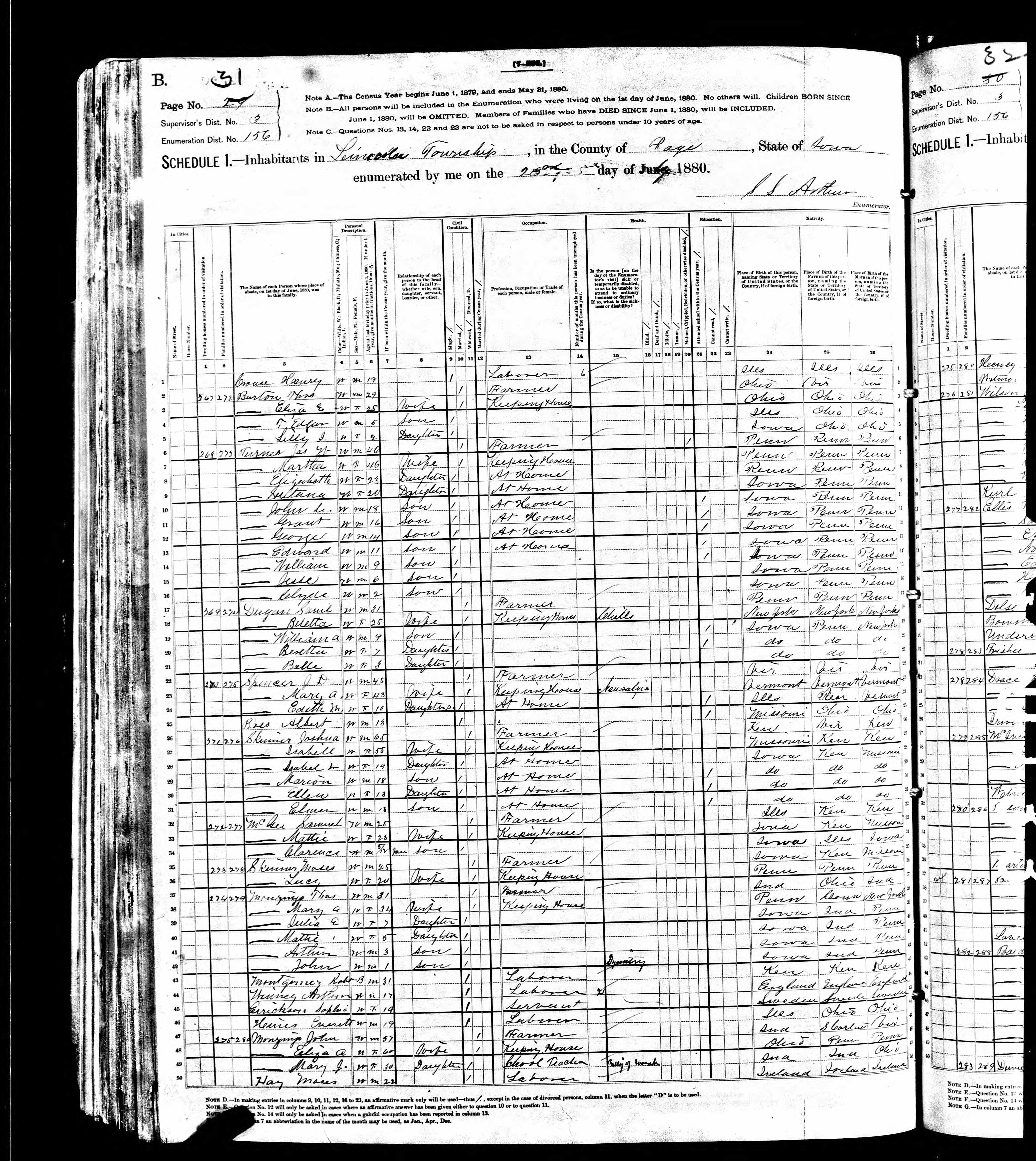
1880 US Federal Census for Page County Iowa
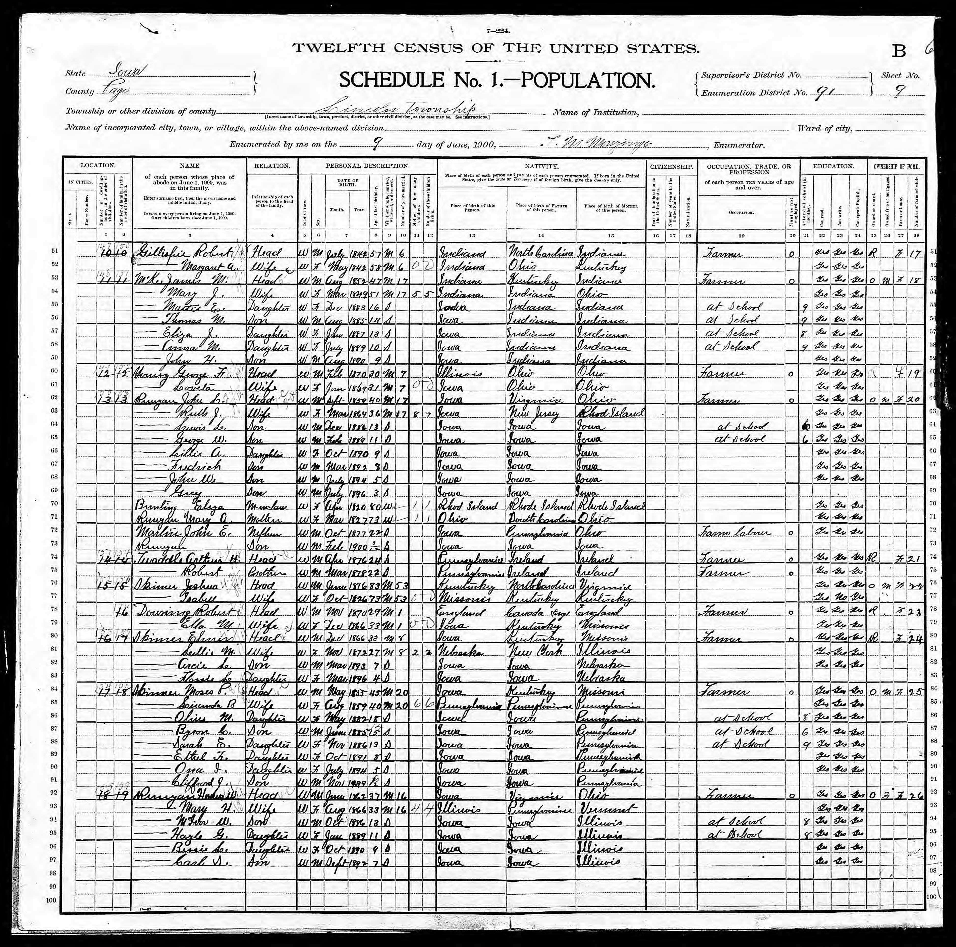
1900 US Federal Census for Page County Iowa
Marriage Certificates for
Buchanan County Missouri
1841 Marriage Between Joshua Skinner and Elizabeth Mootry
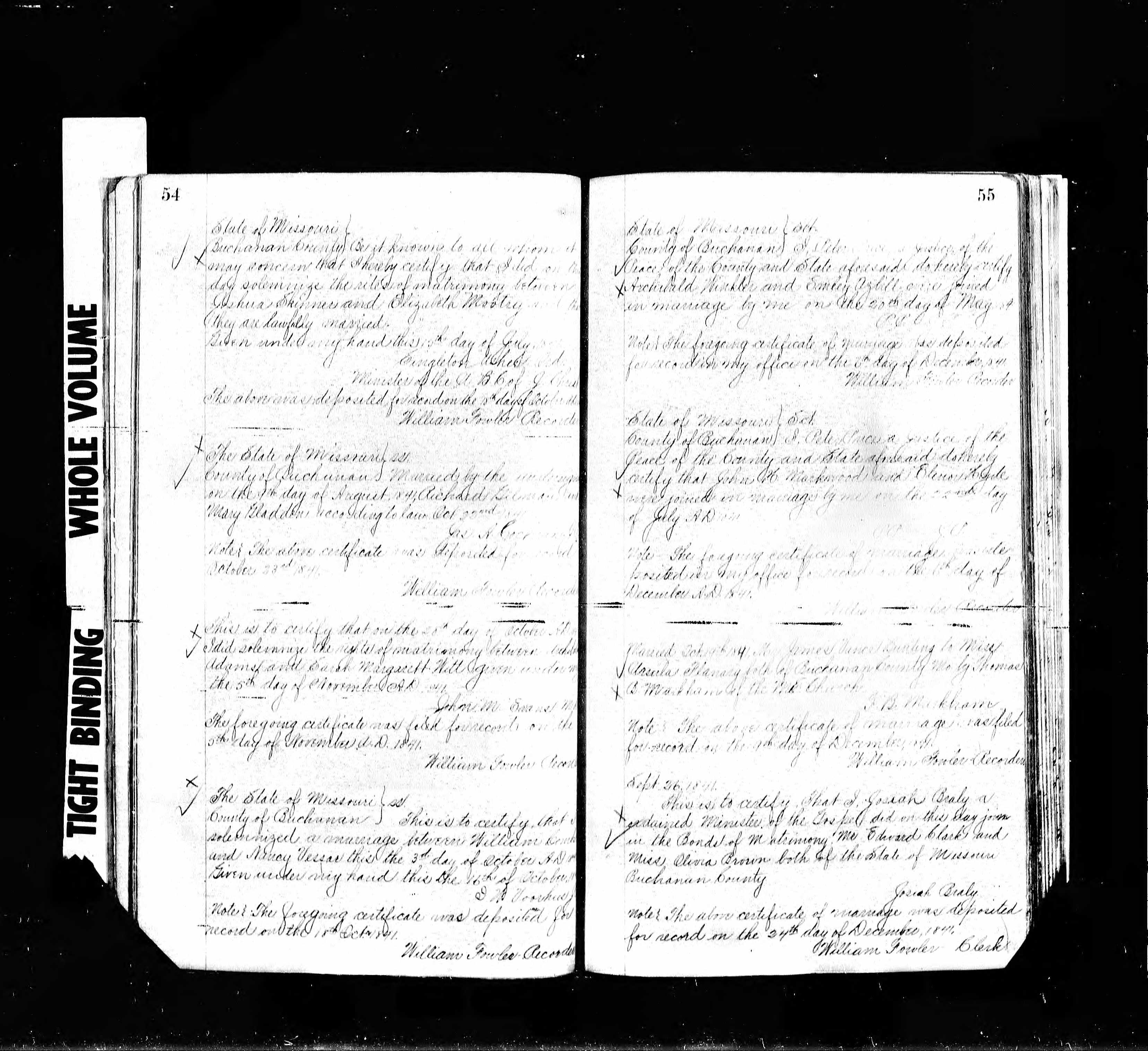
1846 Marriage Between Joshua Skinner and Elizabeth Walkup
Biographical History of Page County Iowa
"Lincoln Township"